Maesycrugiau

Settlement in Cardiganshire

Wales

Maesycrugiau

View to the coast from Plwmp
View to the coast from Plwmp Credit: Eirian Evans

The requested URL returned error: 429 Too Many Requests

If you have any feedback on the listing, please let us know in the comments section below.
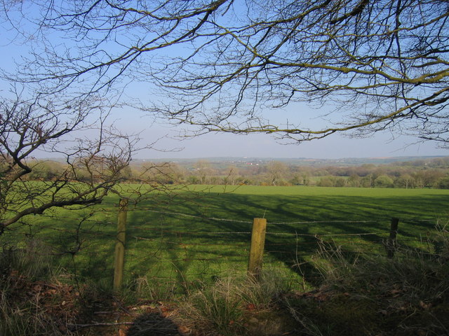
Maesycrugiau Images

Images are sourced within 2km of 52.14188/-4.3980116 or Grid Reference SN3652. Thanks to Geograph Open Source API. All images are credited.

View to the coast from Plwmp
Ordnance Survey Cut Mark This OS cut mark can be found on Bwlch Rhyd. It marks a point 196.108m above mean sea level.
Ordnance Survey Cut Mark
This OS cut mark can be found on Bwlch Rhyd. It marks a point 196.108m above mean sea level.
Ordnance Survey Cut Mark This OS cut mark can be found on the NW parapet of the bridge. It marks a point 186.734m above mean sea level.
Ordnance Survey Cut Mark
This OS cut mark can be found on the NW parapet of the bridge. It marks a point 186.734m above mean sea level.
Ordnance Survey Cut Mark This OS cut mark can be found on Rhyd Fach. It marks a point 210.601m above mean sea level.
Ordnance Survey Cut Mark
This OS cut mark can be found on Rhyd Fach. It marks a point 210.601m above mean sea level.
Ordnance Survey Cut Mark This OS cut mark can be found on the roadside barn at Ty-rhos Farm. It marks a point 230.302m above mean sea level.
Ordnance Survey Cut Mark
This OS cut mark can be found on the roadside barn at Ty-rhos Farm. It marks a point 230.302m above mean sea level.
Ordnance Survey Cut Mark This OS cut mark can be found on the SW parapet of Blaen Bedw Fawr Bridge. It marks a point 195.213m above mean sea level.
Ordnance Survey Cut Mark
This OS cut mark can be found on the SW parapet of Blaen Bedw Fawr Bridge. It marks a point 195.213m above mean sea level.
Ordnance Survey Cut Mark This OS cut mark can be found on the roadside barn at Blaenbedw Fawr Farm. It marks a point 199.244m above mean sea level.
Ordnance Survey Cut Mark
This OS cut mark can be found on the roadside barn at Blaenbedw Fawr Farm. It marks a point 199.244m above mean sea level.
Churn Stand There is an Ordnance Survey rivet on the top of the stand. <a title="https://www.geograph.org.uk/photo/7446195" href="https://www.geograph.org.uk/photo/7446195">Link</a>
Churn Stand
There is an Ordnance Survey rivet on the top of the stand. Link
Ordnance Survey Rivet This OS rivet can be found on the top of the churn stand. It marks a point 242.873m above mean sea level. <a title="https://www.geograph.org.uk/photo/7446194" href="https://www.geograph.org.uk/photo/7446194">Link</a>
Ordnance Survey Rivet
This OS rivet can be found on the top of the churn stand. It marks a point 242.873m above mean sea level. Link
A487 nearing Pentregat
A487 at Plwmp village boundary
Old Milestone by the A487, Plwmp, Llandysiliogogo Parish Cardigan low profile top by the A487, in parish of Llandysiliogogo (Ceredigion District), Plwmp, in village centre, on verge, South side of road. An earlier photograph can be found here <a title="https://www.geograph.org.uk/photo/6042986" href="https://www.geograph.org.uk/photo/6042986">Link</a>.

Inscription reads:-
TO
CARDIGAN
13 MILES
{arrow}

Grade II listed by Cadw. Reference Number: 16638 <span class="nowrap"><a title="https://cadwpublic-api.azurewebsites.net/reports/listedbuilding/FullReport?lang=&id=16638" rel="nofollow ugc noopener" href="https://cadwpublic-api.azurewebsites.net/reports/listedbuilding/FullReport?lang=&id=16638">Link</a><img style="margin-left:2px;" alt="External link" title="External link - shift click to open in new window" src="https://s1.geograph.org.uk/img/external.png" width="10" height="10"/></span>

Milestone Society National ID: CRD_CAAY13
Old Milestone by the A487, Plwmp, Llandysiliogogo Parish
Cardigan low profile top by the A487, in parish of Llandysiliogogo (Ceredigion District), Plwmp, in village centre, on verge, South side of road. An earlier photograph can be found here Link. Inscription reads:- TO CARDIGAN 13 MILES {arrow} Grade II listed by Cadw. Reference Number: 16638 LinkExternal link Milestone Society National ID: CRD_CAAY13
Milestone Old milestone on the A487 near Wervil Grange, Pentregat.
Milestone
Old milestone on the A487 near Wervil Grange, Pentregat.
Pantycrugiau Chapel Pantycrugiau Congregational Chapel at Plwmp.
Pantycrugiau Chapel
Pantycrugiau Congregational Chapel at Plwmp.
Tree in Lake View of Wervil Grange Farm with tree in lake
Tree in Lake
View of Wervil Grange Farm with tree in lake
B4321 ger Pentregat / The B4321 near Pentregat Ffordd B syn arwain i Langrannog / B road leading to Llangrannog
B4321 ger Pentregat / The B4321 near Pentregat
Ffordd B syn arwain i Langrannog / B road leading to Llangrannog
Tir Amaethyddol  ger Plwmp / Farmland near Plwmp Ffens Cae ar dir amaethyddol ger Plwmp / Field edge on farmland near Plwmp
Tir Amaethyddol ger Plwmp / Farmland near Plwmp
Ffens Cae ar dir amaethyddol ger Plwmp / Field edge on farmland near Plwmp
Defaid mewn cae ger Blaencelyn / Sheep in a field near Blaencelyn Defaid mewn cae ger Blaencelyn / Sheep in a field near Blaencelyn
Defaid mewn cae ger Blaencelyn / Sheep in a field near Blaencelyn
Show me another place!

Maesycrugiau is located at Grid Ref: SN3652 (Lat: 52.14188, Lng: -4.3980116)

Unitary Authority: Ceredigion

Police Authority: Dyfed Powys

What 3 Words

///torched.decking.steered. Near Llanllwchaiarn, Ceredigion

Nearby Locations

Plwmp Maesycrugiau

Related Wikis

Pentre-gat

Pentre-gat is a small village in the community of Llangrannog, Ceredigion, Wales, which is 69.6 miles (112 km) from Swansea and 381 miles (302.3 km) from...

Blaenbedw Fawr

Blaenbedw Fawr is a small village in the community of Llandysiliogogo, Ceredigion, Wales, which is 68.9 miles (110.8 km) from Cardiff and 187 miles (300...

Blaen Celyn

Blaen Celyn is a hamlet in the community of Llangrannog, Ceredigion, Wales, 2 miles (3.2 km) east of Llangrannog village. The local St. David's Church...

Penbontrhydyfoethau

Penbontrhydyfothau is a hamlet in the community of Llandysiliogogo, Ceredigion, Wales, which is 70.5 miles (113.4 km) from Cardiff and 187.9 miles (302...

Nearby Amenities

Located within 500m of 52.14188,-4.3980116
Power: pole
Lat/Long: 52.1386937/-4.3935362
Power: pole
Lat/Long: 52.1386591/-4.3950945
Power: pole
Lat/Long: 52.1386081/-4.3964356
Power: pole
Lat/Long: 52.138557/-4.3981683
Power: pole
Lat/Long: 52.1384879/-4.4004563
Power: pole
Lat/Long: 52.1384418/-4.4022238
The data included in this document is from www.openstreetmap.org. The data is made available under ODbL.

Have you been to Maesycrugiau?

Leave your review of Maesycrugiau below (or comments, questions and feedback).