Besford Wood

Settlement in Shropshire

England

Besford Wood

Field Near Preston Brockhurst
Field Near Preston Brockhurst Credit: Richard Cooke

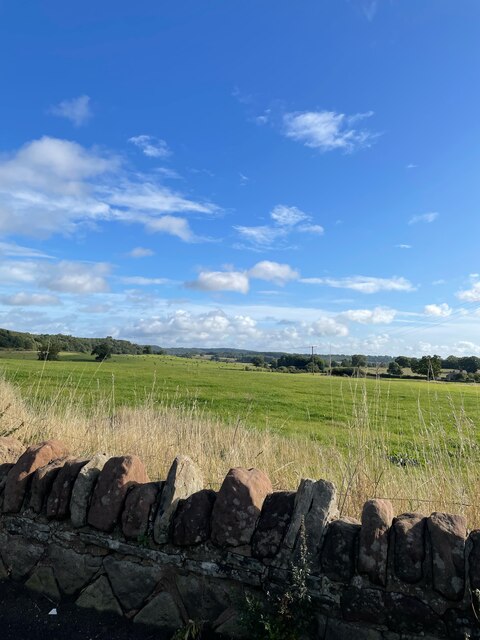
Besford Wood is a picturesque woodland located in the county of Shropshire, England. Situated near the village of Besford, this enchanting forest covers an area of approximately 50 acres. It is nestled within the rolling hills and meandering streams of the Worcestershire-Shropshire border, offering visitors a tranquil and idyllic retreat from the hustle and bustle of everyday life.

The wood is predominantly composed of broadleaf trees, including oak, ash, and birch, which create a rich and diverse ecosystem. The lush undergrowth is adorned with a vibrant carpet of wildflowers, providing a haven for an array of wildlife species. It is not uncommon to spot deer, badgers, and various bird species such as woodpeckers and owls in their natural habitat.

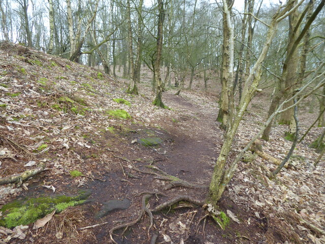
Besford Wood is a popular destination for nature enthusiasts and walkers alike. There are well-maintained footpaths that wind through the forest, offering visitors the opportunity to explore its beauty at their own pace. The wood is also home to a small picnic area, allowing visitors to relax and enjoy the peaceful surroundings.

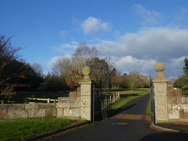
In addition to its natural beauty, Besford Wood holds historical significance. It is believed to have been part of a hunting ground in medieval times, and remnants of an ancient trackway can still be seen within its boundaries.

Overall, Besford Wood is a hidden gem in Shropshire, offering visitors a chance to reconnect with nature and experience the tranquility of a truly enchanting woodland setting.

If you have any feedback on the listing, please let us know in the comments section below.

Besford Wood Images

Images are sourced within 2km of 52.828344/-2.6826013 or Grid Reference SJ5425. Thanks to Geograph Open Source API. All images are credited.

Field Near Preston Brockhurst
Old A49, Lee Brockhurst An old bend, removed by a realignment.
Old A49, Lee Brockhurst
An old bend, removed by a realignment.
Village notice board, Lee Brockhurst Obnoxious and shouty, the sort of rubbish that often blights a walk in England. 
At least three signs telling me to go away -  for a while there were fears that you could catch the novel coronavirus from passing somebody in a wood, but that was disproved over a year before this was taken. Meanwhile folk were able to gather indoors in England without even a face covering.

I have since been told that local opinion is very much against these notices which are the work of one individual only. They are to be removed, only the cabinet seems to have been jammed shut by vandals.


On a positive note, the walk was lovely (despite the mild dog attack) and there is a well provisioned car park here. Well worth a stop by if travelling on the A49.
Village notice board, Lee Brockhurst
Obnoxious and shouty, the sort of rubbish that often blights a walk in England. At least three signs telling me to go away - for a while there were fears that you could catch the novel coronavirus from passing somebody in a wood, but that was disproved over a year before this was taken. Meanwhile folk were able to gather indoors in England without even a face covering. I have since been told that local opinion is very much against these notices which are the work of one individual only. They are to be removed, only the cabinet seems to have been jammed shut by vandals. On a positive note, the walk was lovely (despite the mild dog attack) and there is a well provisioned car park here. Well worth a stop by if travelling on the A49.
Working telephone box, Lee Brockhurst In a very handy car park serving a lovely woodland to walk in. The obelisk behind the utterly vile noticeboard is a war memorial.
Working telephone box, Lee Brockhurst
In a very handy car park serving a lovely woodland to walk in. The obelisk behind the utterly vile noticeboard is a war memorial.
The Roman Road, Lee Brockhurst Gives access to the paths in the woods to the west as well as several delightfully located houses.
The Roman Road, Lee Brockhurst
Gives access to the paths in the woods to the west as well as several delightfully located houses.
Path on Lee Hill A set of steps climb out of the Roman road's cutting giving access to this fine oak wood on thin sandstone soils.
Path on Lee Hill
A set of steps climb out of the Roman road's cutting giving access to this fine oak wood on thin sandstone soils.
Summit, Lee Hill Oak wood on sandstone.
Summit, Lee Hill
Oak wood on sandstone.
Entrance gateway to Preston Hall The hall <a href="https://www.geograph.org.uk/photo/351085">SJ5324 : Preston Hall</a> dates from 1652 with few later alterations; it is claimed that the stone for the hall came from quarries on the estate, which may apply to the gateway as well
Entrance gateway to Preston Hall
The hall SJ5324 : Preston Hall dates from 1652 with few later alterations; it is claimed that the stone for the hall came from quarries on the estate, which may apply to the gateway as well
Road to Palms Hill from A49 The A49 is a major road, which traverses the Welsh Marches region. It runs north from Ross-on-Wye in Herefordshire via Hereford, Leominster, Ludlow, Shrewsbury and Whitchurch, then continues to Warrington and Wigan before terminating at its junction with the A6 road just south of Bamber Bridge, near the junction of the M6, M65 and M61 motorways.
Road to Palms Hill from A49
The A49 is a major road, which traverses the Welsh Marches region. It runs north from Ross-on-Wye in Herefordshire via Hereford, Leominster, Ludlow, Shrewsbury and Whitchurch, then continues to Warrington and Wigan before terminating at its junction with the A6 road just south of Bamber Bridge, near the junction of the M6, M65 and M61 motorways.
Advance sign on A49 for crossroads at Lee Brockhurst The A49 is a major road that runs for 158 miles from Bamber Bridge, near Preston, to Ross-on-Wye.

The section north of Warrington is mostly a non-primary road for local traffic, having been largely superseded by the M6 motorway. South of Warrington, the route traverses the Welsh Marches region <span class="nowrap"><a title="https://en.wikipedia.org/wiki/Welsh_Marches" rel="nofollow ugc noopener" href="https://en.wikipedia.org/wiki/Welsh_Marches">Link</a><img style="margin-left:2px;" alt="External link" title="External link - shift click to open in new window" src="https://s1.geograph.org.uk/img/external.png" width="10" height="10"/></span>  , following the hills along the English/Welsh borders although it never actually enters Wales; usually running around ten miles away from the border as it winds its way through Cheshire, Shropshire and Herefordshire although it comes within a couple of miles near Whitchurch. The road is all primary but mainly single carriageway, which means that traffic queues sometimes build up behind tractors or slow-moving goods vehicles.  The stretch between the A5 at Shrewsbury and Ross-on-Wye is a trunk road, maintained by the national Highways England.
<span class="nowrap"><a title="http://www.sabre-roads.org.uk/wiki/index.php?title=A49" rel="nofollow ugc noopener" href="http://www.sabre-roads.org.uk/wiki/index.php?title=A49">Link</a><img style="margin-left:2px;" alt="External link" title="External link - shift click to open in new window" src="https://s1.geograph.org.uk/img/external.png" width="10" height="10"/></span>  SABRE
Advance sign on A49 for crossroads at Lee Brockhurst
The A49 is a major road that runs for 158 miles from Bamber Bridge, near Preston, to Ross-on-Wye. The section north of Warrington is mostly a non-primary road for local traffic, having been largely superseded by the M6 motorway. South of Warrington, the route traverses the Welsh Marches region LinkExternal link , following the hills along the English/Welsh borders although it never actually enters Wales; usually running around ten miles away from the border as it winds its way through Cheshire, Shropshire and Herefordshire although it comes within a couple of miles near Whitchurch. The road is all primary but mainly single carriageway, which means that traffic queues sometimes build up behind tractors or slow-moving goods vehicles. The stretch between the A5 at Shrewsbury and Ross-on-Wye is a trunk road, maintained by the national Highways England. LinkExternal link SABRE
Parish noticeboard on Lee Brockhurst village green I hadn't noticed the content last time I visited, a year or so ago. The display includes a poster for the now disgraced local Tory MP who had to resign after being embroiled in a 'cash for questions' or lobbying 'conflict of interest' crisis which showed him as a snout in the public and corporate trough. It also includes some duplicate notices asking walkers to be prepared to prove their local-ness or resident proximity to their intended walk route - with the implication that this is required by the local parish council -  which hopefully it is NOT! Rather unpleasant reading! This green is used by many walkers and is the start of a very popular Shrewsbury Ramblers walking book route - which I know has helped many, many people with their mental and physical health since the first Covid lockdown in March 2020. 

I see that other geographers have spotted the same content! And had a similar reaction. Someones paranoia is being paraded here maybe? Distasteful and unnecessary. I hope their mental health is OK after what has been a very difficult time for everyone! Maybe their faith in their fellow humans has been restored by the exemplary way in which 99.9% of ordinary people have responded to events. I hope so.
Parish noticeboard on Lee Brockhurst village green
I hadn't noticed the content last time I visited, a year or so ago. The display includes a poster for the now disgraced local Tory MP who had to resign after being embroiled in a 'cash for questions' or lobbying 'conflict of interest' crisis which showed him as a snout in the public and corporate trough. It also includes some duplicate notices asking walkers to be prepared to prove their local-ness or resident proximity to their intended walk route - with the implication that this is required by the local parish council - which hopefully it is NOT! Rather unpleasant reading! This green is used by many walkers and is the start of a very popular Shrewsbury Ramblers walking book route - which I know has helped many, many people with their mental and physical health since the first Covid lockdown in March 2020. I see that other geographers have spotted the same content! And had a similar reaction. Someones paranoia is being paraded here maybe? Distasteful and unnecessary. I hope their mental health is OK after what has been a very difficult time for everyone! Maybe their faith in their fellow humans has been restored by the exemplary way in which 99.9% of ordinary people have responded to events. I hope so.
Elegant house in Lee Brockhurst This village has great houses, and this is a prime example.
Elegant house in Lee Brockhurst
This village has great houses, and this is a prime example.
National Trust walk in the Lee Hills above Lee Brockhurst Very pleasant walk through oak woods interspersed with pines and firs. Heath meets woodland and very good to stroll.
National Trust walk in the Lee Hills above Lee Brockhurst
Very pleasant walk through oak woods interspersed with pines and firs. Heath meets woodland and very good to stroll.
Path beneath fir trees near Lee Brockhurst Nice woodland / heath land.
Path beneath fir trees near Lee Brockhurst
Nice woodland / heath land.
A walk in the woods Great walking on an early Spring morning.
A walk in the woods
Great walking on an early Spring morning.
Bracket fungi on a birch tree in the Lee Hills near Lee Brockhurst Nice.
Bracket fungi on a birch tree in the Lee Hills near Lee Brockhurst
Nice.
View from the woodland footpath near Lee Brockhurst Nice outlook over farms.
View from the woodland footpath near Lee Brockhurst
Nice outlook over farms.
Woodland path above Lee Brockhurst With a dramatic viewpoint.
Woodland path above Lee Brockhurst
With a dramatic viewpoint.
Show me another place!

Besford Wood is located at Grid Ref: SJ5425 (Lat: 52.828344, Lng: -2.6826013)

Unitary Authority: Shropshire

Police Authority: West Merica

What 3 Words

///processes.incisions.wrist. Near Clive, Shropshire

Related Wikis

RAF Bridleway Gate

Royal Air Force Bridleway Gate, or more simply RAF Bridleway Gate, is a former Royal Air Force satellite airfield located in Shropshire. The following...

Lee Brockhurst

Lee Brockhurst, sometimes known locally as just Brockhurst, is a village and former civil parish, now in the parish of Moreton Corbet and Lee Brockhurst...

Rutunium

Rutunium was a former Roman settlement at the site of Harcourt Park, Shropshire, in the United Kingdom. It appeared in the Antonine Itinerary. == References ==

Moston, Shropshire

Moston is a hamlet in North Shropshire, England, about 10 miles or 16 km north-east of Shrewsbury. In 1870–72, John Marius Wilson's Imperial Gazetteer...

Moreton Corbet and Lee Brockhurst

Moreton Corbet and Lee Brockhurst is a civil parish in Shropshire, England. It is the result of a merger of two older parishes - Moreton Corbet and Lee...

Barkers Green

Barkers Green is a hamlet near Wem in Shropshire, England. == External links == Media related to Barkers Green at Wikimedia Commons

Acton Reynald Hall

Acton Reynald Hall is a 19th-century country house at Acton Reynald, Moreton Corbet, Shropshire, England. It is a Grade II* listed building.The Corbet...

Corbet Wood and Grinshill

Corbet Wood Countryside Heritage Site and Grinshill Site is a mixture of a woodland and quarrying site in Shropshire. It has been designated a SSSI due...

Have you been to Besford Wood?

Leave your review of Besford Wood below (or comments, questions and feedback).