Berryfields

Settlement in Buckinghamshire

England

Berryfields

The Berryfields estate by the A41, Aylesbury
The Berryfields estate by the A41, Aylesbury Credit: David Howard

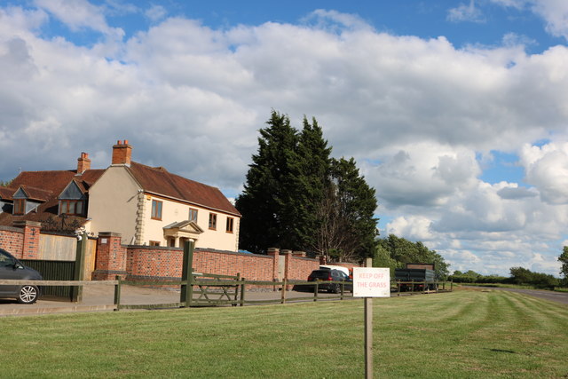
Berryfields is a residential area located in the Aylesbury Vale district of Buckinghamshire, England. It is situated approximately 2.5 miles northeast of the town of Aylesbury, the county town of Buckinghamshire. The development of Berryfields began in the early 2000s and has since become a thriving and vibrant community.

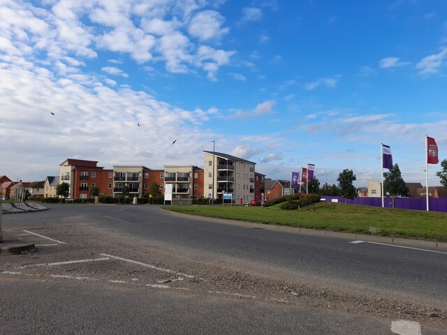
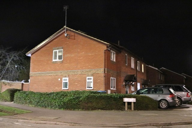
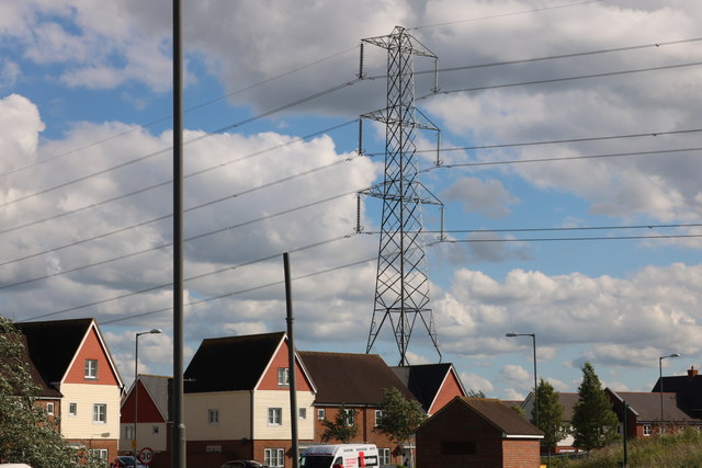
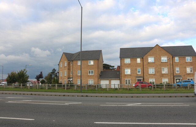
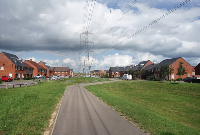
The area is known for its modern housing estates, offering a mix of detached, semi-detached, and terraced houses. The architecture is varied, with a blend of traditional and contemporary styles. The residential properties cater to a range of budgets and needs, making Berryfields an attractive option for families, professionals, and first-time buyers.

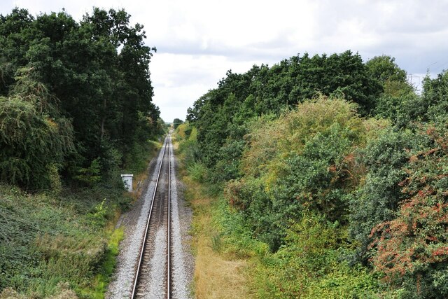
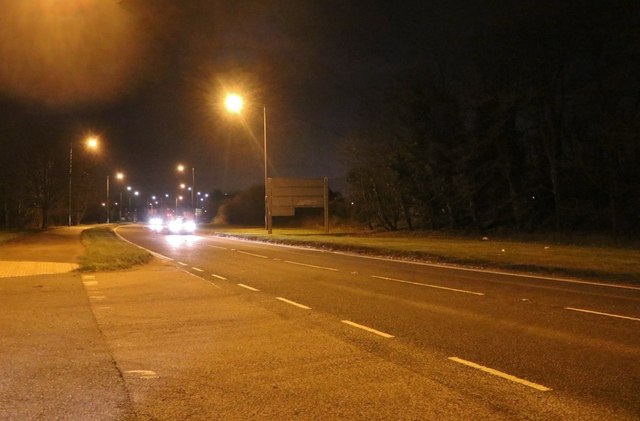
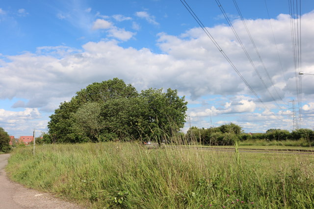
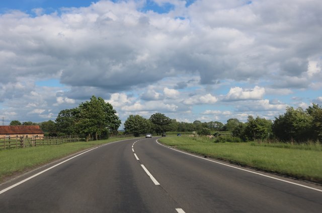
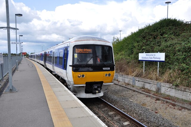
Berryfields boasts excellent transport links, with easy access to the A41 and Aylesbury Vale Parkway railway station. The station provides regular services to London Marylebone and Aylesbury town center, making it a popular choice for commuters. Additionally, the area benefits from good bus connections, ensuring convenient travel within the region.

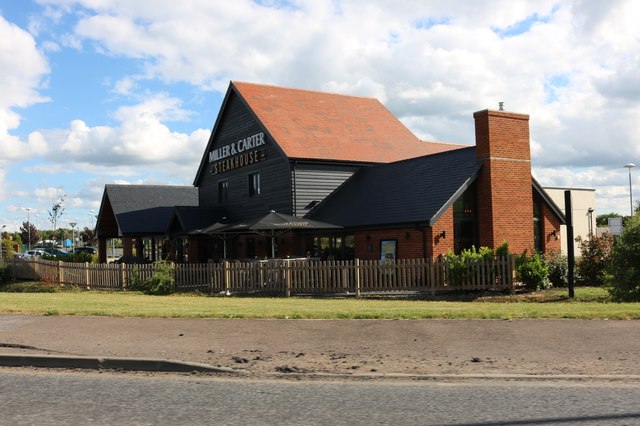
Residents of Berryfields can enjoy a range of amenities within the community itself. The area features a local center with a supermarket, shops, and a medical center, providing essential services within walking distance. There are also several parks and green spaces, providing opportunities for outdoor activities and recreation.

Overall, Berryfields offers a well-connected and desirable place to live, with a range of housing options, convenient amenities, and a strong sense of community.

If you have any feedback on the listing, please let us know in the comments section below.

Berryfields Images

Images are sourced within 2km of 51.840637/-0.85216285 or Grid Reference SP7916. Thanks to Geograph Open Source API. All images are credited.

The Berryfields estate by the A41, Aylesbury
Looking north west from Rabans Lane bridge This line to the north west of Aylesbury sees only passenger services to and from Aylesbury Vale Parkway Station, plus freight trains to Calvert waste management facility.  In the future, passenger services should be extended north to Milton Keynes Central via the rebuilt East West Railway.
Looking north west from Rabans Lane bridge
This line to the north west of Aylesbury sees only passenger services to and from Aylesbury Vale Parkway Station, plus freight trains to Calvert waste management facility. In the future, passenger services should be extended north to Milton Keynes Central via the rebuilt East West Railway.
The Cotton Wheel on Jackson Road
Bicester Road, Aylesbury The A41.
Bicester Road, Aylesbury
The A41.
Houses on Dicks Way, Quarrendon I expect the residents get fed up with telling people their address after a while.
Houses on Dicks Way, Quarrendon
I expect the residents get fed up with telling people their address after a while.
The A41, Quarrendon
The A41, Quarrendon
Miller & Carter Steakhouse, Aylesbury
The A41 entering Aylesbury
Pylon by the A41, Quarrendon
House on the A41 west of Aylesbury
The A41 west of Aylesbury
The A41 entering Aylesbury
Field by the A41 near Quarrendon
The A41, Heath Marston
New housing development by the A41, Quarrendon
Train departing from Aylesbury Parkway Station Units 165028/165038 about to depart for London Marylebone on 25th August 2018.  The station has been built to serve the new housing estates being built in the area, also to encourage people to leave their cars and take the train onwards towards Aylesbury and London.  The old Metropolitan/Great Central route onward to Calvert passes the station platform on the left.  This line is at present used for landfill and HS2 aggregate trains to Calvert, but in future will form part of the East West Railway route between Milton Keynes, Aylesbury and London.
Train departing from Aylesbury Parkway Station
Units 165028/165038 about to depart for London Marylebone on 25th August 2018. The station has been built to serve the new housing estates being built in the area, also to encourage people to leave their cars and take the train onwards towards Aylesbury and London. The old Metropolitan/Great Central route onward to Calvert passes the station platform on the left. This line is at present used for landfill and HS2 aggregate trains to Calvert, but in future will form part of the East West Railway route between Milton Keynes, Aylesbury and London.
Lucas Furniture Store A new furniture store in an edge of town location on Sir Henry Lee Crescent opposite Aylesbury Parkway station.
Lucas have been in the furniture business since 1898.
Lucas Furniture Store
A new furniture store in an edge of town location on Sir Henry Lee Crescent opposite Aylesbury Parkway station. Lucas have been in the furniture business since 1898.
Space for the Cables A recently built area of housing on the edge of Aylesbury. The pylons were here long before the builders and a wide space has had to be left in between the new housing developments. A cycleway with lawns fills the space.
Space for the Cables
A recently built area of housing on the edge of Aylesbury. The pylons were here long before the builders and a wide space has had to be left in between the new housing developments. A cycleway with lawns fills the space.
Show me another place!

Berryfields is located at Grid Ref: SP7916 (Lat: 51.840637, Lng: -0.85216285)

Unitary Authority: Buckinghamshire

Police Authority: Thames Valley

What 3 Words

///superhero.mouse.opera. Near Aylesbury, Buckinghamshire

Nearby Locations

Berryfields

Related Wikis

Berryfields

Berryfields is a Major Development Area (MDA) to the north-west of Aylesbury, Buckinghamshire, England. It is one of two new major housing projects in...

Aylesbury Vale Parkway railway station

Aylesbury Vale Parkway railway station is a railway station serving villages northwest of Aylesbury, England. It also serves the Berryfields and Weedon...

Aylesbury Vale Dynamos F.C.

Aylesbury Vale Dynamos Football Club is a football club based in Aylesbury, Buckinghamshire, England. They are currently members of the Spartan South Midlands...

St Mary's Church, Fleet Marston

St Mary's Church is the redundant Church of England parish church of the deserted medieval village of Fleet Marston, Buckinghamshire, England. It is recorded...

Nearby Amenities

Located within 500m of 51.840637,-0.85216285
Crossing
Crossing: unmarked
Crossing Island: no
Crossing Markings: no
Tactile Paving: yes
Lat/Long: 51.8422207/-0.8574793
Fixme: building
Source: npe
Lat/Long: 51.8399305/-0.8479257
Crossing
Crossing: uncontrolled
Crossing Island: no
Crossing Markings: zebra
Note: lowered curbs all across
Tactile Paving: yes
Lat/Long: 51.8362352/-0.8525636
Post Box
Brand: Royal Mail
Brand Wikidata: Q638098
Brand Wikipedia: en:Royal Mail
Collection Times: Mo-Fr 17:00; Sa 09:30
Operator: Royal Mail
Operator Wikidata: Q638098
Post Box Type: lamp
Ref: HP18 331
Royal Cypher: EIIR
Royal Cypher Wikidata: Q33102113
Source: survey
Survey Date: 2015-05-16
Lat/Long: 51.8389831/-0.8531496
Power: pole
Lat/Long: 51.8438789/-0.8561464
Power: pole
Lat/Long: 51.8435417/-0.8548978
Power: pole
Lat/Long: 51.8432152/-0.8537056
Power: pole
Lat/Long: 51.8428689/-0.8524355
Power: pole
Lat/Long: 51.8425209/-0.8512004
Power: pole
Lat/Long: 51.8421804/-0.8499317
Power: pole
Lat/Long: 51.8418199/-0.8486295
Power: pole
Lat/Long: 51.8414276/-0.8471791
Power: pole
Lat/Long: 51.8411115/-0.8459929
Power: pole
Lat/Long: 51.8408107/-0.8453102
Power: pole
Lat/Long: 51.8413046/-0.8471489
Power: pole
Lat/Long: 51.8417197/-0.8486925
Power: pole
Lat/Long: 51.8421804/-0.8503608
Power: pole
Lat/Long: 51.8425996/-0.8518682
Power: pole
Lat/Long: 51.8430702/-0.8536305
Power: pole
Lat/Long: 51.8435301/-0.855272
Crossing
Crossing: unmarked
Crossing Island: no
Crossing Markings: no
Tactile Paving: yes
Lat/Long: 51.8403532/-0.8554742
Crossing
Crossing Island: no
Tactile Paving: yes
Lat/Long: 51.841059/-0.8561297
Direction: 170
Generator Method: photovoltaic
Generator Output Electricity: yes
Generator Solar Modules: 38
Generator Source: solar
Generator Type: solar_photovoltaic_panel
Location: roof
Power: generator
Lat/Long: 51.8408054/-0.8586572
Direction: 170
Generator Method: photovoltaic
Generator Output Electricity: yes
Generator Solar Modules: 52
Generator Source: solar
Generator Type: solar_photovoltaic_panel
Location: roof
Power: generator
Lat/Long: 51.8409693/-0.8583691
Direction: 170
Generator Method: photovoltaic
Generator Output Electricity: yes
Generator Solar Modules: 40
Generator Source: solar
Generator Type: solar_photovoltaic_panel
Location: roof
Power: generator
Lat/Long: 51.8408879/-0.8586668
Turning Circle
Lat/Long: 51.8381645/-0.8477273
Turning Circle
Lat/Long: 51.8371449/-0.8481654
Crossing
Crossing: uncontrolled
Crossing Markings: yes
Lat/Long: 51.8406865/-0.8576889
Crossing
Crossing: unmarked
Crossing Island: no
Crossing Markings: no
Tactile Paving: yes
Lat/Long: 51.8375908/-0.8478227
Crossing
Crossing: unmarked
Crossing Island: no
Crossing Markings: no
Tactile Paving: yes
Lat/Long: 51.8369318/-0.8550143
Crossing
Crossing: unmarked
Crossing Island: no
Crossing Markings: no
Tactile Paving: yes
Lat/Long: 51.836416/-0.8525229
Crossing
Crossing: unmarked
Crossing Island: no
Crossing Markings: no
Tactile Paving: yes
Lat/Long: 51.8370474/-0.8526774
Crossing
Crossing: unmarked
Crossing Island: no
Crossing Markings: no
Tactile Paving: yes
Lat/Long: 51.837605/-0.8476513
Crossing
Crossing: unmarked
Crossing Markings: no
Lat/Long: 51.8389979/-0.847415
Crossing
Crossing: unmarked
Crossing Island: no
Crossing Markings: no
Tactile Paving: yes
Lat/Long: 51.8386856/-0.857517
Crossing
Crossing: unmarked
Crossing Markings: no
Lat/Long: 51.8391727/-0.8579108
Crossing
Crossing: unmarked
Crossing Island: no
Crossing Markings: no
Tactile Paving: yes
Lat/Long: 51.8389545/-0.8575479
Crossing
Crossing: unmarked
Crossing Markings: no
Lat/Long: 51.8389966/-0.8586659
Crossing
Crossing: unmarked
Crossing Island: no
Crossing Markings: no
Tactile Paving: yes
Lat/Long: 51.8395682/-0.8591983
Crossing
Crossing: unmarked
Crossing Island: no
Crossing Markings: no
Tactile Paving: yes
Lat/Long: 51.8397779/-0.8582695
Crossing
Crossing: unmarked
Crossing Island: no
Crossing Markings: no
Tactile Paving: yes
Lat/Long: 51.840741/-0.8570145
Crossing
Crossing: unmarked
Crossing Island: no
Crossing Markings: no
Tactile Paving: yes
Lat/Long: 51.8384517/-0.8581731
Crossing
Crossing: unmarked
Crossing Island: no
Crossing Markings: no
Tactile Paving: yes
Lat/Long: 51.8380951/-0.8570466
Crossing
Crossing: unmarked
Crossing Island: no
Crossing Markings: no
Tactile Paving: yes
Lat/Long: 51.8373721/-0.8567705
Crossing
Crossing: unmarked
Crossing Island: no
Crossing Markings: no
Tactile Paving: yes
Lat/Long: 51.8380516/-0.8470237
Crossing
Crossing: unmarked
Crossing Island: no
Crossing Markings: no
Tactile Paving: yes
Lat/Long: 51.8384731/-0.8469149
Crossing
Crossing: unmarked
Crossing Island: no
Crossing Markings: no
Tactile Paving: yes
Lat/Long: 51.8416898/-0.8551569
Crossing
Crossing: unmarked
Crossing Island: no
Crossing Markings: no
Tactile Paving: yes
Lat/Long: 51.8420551/-0.8541326
Crossing
Crossing: unmarked
Crossing Markings: no
Lat/Long: 51.8411088/-0.8566147
Crossing
Lat/Long: 51.8408959/-0.8569936
Crossing
Lat/Long: 51.8403984/-0.8584198
Crossing
Lat/Long: 51.8401854/-0.8592173
Crossing
Crossing: unmarked
Crossing Island: no
Crossing Markings: no
Tactile Paving: yes
Lat/Long: 51.8422908/-0.8513902
Crossing
Crossing: unmarked
Crossing Island: no
Crossing Markings: no
Tactile Paving: yes
Lat/Long: 51.8418837/-0.8510813
Crossing
Crossing: unmarked
Crossing Island: no
Crossing Markings: no
Tactile Paving: yes
Lat/Long: 51.8419932/-0.851618
Crossing
Crossing: unmarked
Crossing Island: no
Crossing Markings: no
Tactile Paving: yes
Lat/Long: 51.8372126/-0.8480904
Crossing
Crossing: unmarked
Crossing Island: no
Crossing Markings: no
Tactile Paving: yes
Lat/Long: 51.8400095/-0.8490173
Leisure: playground
Lat/Long: 51.8402841/-0.8490724
Crossing
Crossing: uncontrolled
Crossing Markings: yes
Lat/Long: 51.8404704/-0.8587301
Crossing
Crossing: uncontrolled
Crossing Island: no
Crossing Markings: zebra
Tactile Paving: yes
Lat/Long: 51.8405068/-0.8577433
Direction: 155
Generator Method: photovoltaic
Generator Output Electricity: yes
Generator Source: solar
Generator Type: solar_photovoltaic_panel
Location: roof
Power: generator
Lat/Long: 51.8373329/-0.849142
Crossing
Crossing: unmarked
Crossing Island: no
Crossing Markings: no
Tactile Paving: yes
Lat/Long: 51.8377623/-0.8481327
Crossing
Crossing: unmarked
Crossing Island: no
Crossing Markings: no
Tactile Paving: yes
Lat/Long: 51.8383035/-0.8486556
Direction: 225
Generator Method: photovoltaic
Generator Output Electricity: yes
Generator Source: solar
Generator Type: solar_photovoltaic_panel
Location: roof
Power: generator
Lat/Long: 51.8382378/-0.8480972
Direction: 225
Generator Method: photovoltaic
Generator Output Electricity: yes
Generator Source: solar
Generator Type: solar_photovoltaic_panel
Location: roof
Power: generator
Lat/Long: 51.8382597/-0.8480009
Crossing
Crossing: unmarked
Crossing Island: no
Crossing Markings: no
Tactile Paving: yes
Lat/Long: 51.8393267/-0.8478508
Crossing
Crossing: unmarked
Crossing Island: no
Crossing Markings: no
Tactile Paving: yes
Lat/Long: 51.839754/-0.8482104
Crossing
Crossing: unmarked
Crossing Island: no
Crossing Markings: no
Tactile Paving: yes
Lat/Long: 51.8396071/-0.8487258
Crossing
Crossing: unmarked
Crossing Island: no
Crossing Markings: no
Tactile Paving: yes
Lat/Long: 51.8387551/-0.8490136
Crossing
Crossing: unmarked
Crossing Island: no
Crossing Markings: no
Tactile Paving: yes
Lat/Long: 51.8403964/-0.8494944
Crossing
Crossing: unmarked
Crossing Island: no
Crossing Markings: no
Tactile Paving: yes
Lat/Long: 51.8401588/-0.8501468
Crossing
Crossing: unmarked
Crossing Island: no
Crossing Markings: no
Tactile Paving: yes
Lat/Long: 51.8415608/-0.8508611
Crossing
Crossing: unmarked
Crossing Island: no
Crossing Markings: no
Tactile Paving: yes
Lat/Long: 51.8409423/-0.8509244
Crossing
Crossing: unmarked
Crossing Island: no
Crossing Markings: no
Tactile Paving: yes
Lat/Long: 51.840878/-0.8504739
Crossing
Crossing: unmarked
Crossing Island: no
Crossing Markings: no
Tactile Paving: yes
Lat/Long: 51.8379497/-0.8506233
Crossing
Crossing: unmarked
Crossing Island: no
Crossing Markings: no
Tactile Paving: yes
Lat/Long: 51.8388464/-0.850728
Crossing
Crossing: unmarked
Crossing Island: no
Crossing Markings: no
Tactile Paving: yes
Lat/Long: 51.8392115/-0.8506561
Crossing
Crossing: unmarked
Crossing Island: no
Crossing Markings: no
Tactile Paving: yes
Lat/Long: 51.8395431/-0.8516796
Crossing
Crossing: unmarked
Crossing Island: no
Crossing Markings: no
Tactile Paving: yes
Lat/Long: 51.8406776/-0.8512108
Crossing
Crossing: unmarked
Crossing Island: no
Crossing Markings: no
Tactile Paving: yes
Lat/Long: 51.8412543/-0.8510204
Crossing
Crossing: unmarked
Crossing Island: no
Crossing Markings: no
Tactile Paving: yes
Lat/Long: 51.8415845/-0.8502314
Crossing
Crossing: unmarked
Crossing Island: no
Crossing Markings: no
Tactile Paving: yes
Lat/Long: 51.8395412/-0.8547943
Crossing
Crossing: unmarked
Crossing Island: no
Tactile Paving: yes
Lat/Long: 51.8401531/-0.8554587
Crossing
Crossing: unmarked
Crossing Island: no
Crossing Markings: no
Tactile Paving: yes
Lat/Long: 51.8407136/-0.8559669
Crossing
Crossing Island: no
Tactile Paving: yes
Lat/Long: 51.8419424/-0.8534958
Crossing
Crossing: unmarked
Crossing Island: no
Crossing Markings: no
Tactile Paving: yes
Lat/Long: 51.841757/-0.8510768
Crossing
Crossing: unmarked
Crossing Island: no
Crossing Markings: no
Tactile Paving: yes
Lat/Long: 51.8389705/-0.8530513
Crossing
Crossing: unmarked
Crossing Island: no
Crossing Markings: no
Tactile Paving: yes
Lat/Long: 51.8381064/-0.852554
Crossing
Crossing: unmarked
Crossing Island: no
Crossing Markings: no
Tactile Paving: yes
Lat/Long: 51.8377378/-0.8519827
Crossing
Crossing: unmarked
Crossing Island: no
Crossing Markings: no
Tactile Paving: yes
Lat/Long: 51.8385924/-0.8511983
Crossing
Crossing: unmarked
Crossing Island: no
Crossing Markings: no
Tactile Paving: yes
Lat/Long: 51.8370187/-0.8508191
Crossing
Crossing: unmarked
Crossing Island: no
Crossing Markings: no
Tactile Paving: yes
Lat/Long: 51.8422033/-0.8510273
Crossing
Crossing: unmarked
Crossing Island: no
Crossing Markings: no
Tactile Paving: yes
Lat/Long: 51.8425985/-0.8514746
Crossing
Crossing: unmarked
Crossing Island: no
Crossing Markings: no
Tactile Paving: yes
Lat/Long: 51.8428826/-0.8509151
Crossing
Crossing: unmarked
Crossing Island: no
Crossing Markings: no
Tactile Paving: yes
Lat/Long: 51.842301/-0.8504841
Crossing
Crossing: unmarked
Crossing Island: no
Crossing Markings: no
Tactile Paving: yes
Lat/Long: 51.8372631/-0.8559975
Crossing
Crossing: unmarked
Crossing Island: no
Crossing Markings: no
Tactile Paving: yes
Lat/Long: 51.8382653/-0.8569944
Crossing
Crossing: unmarked
Crossing Island: no
Crossing Markings: no
Tactile Paving: yes
Lat/Long: 51.8385942/-0.8519924
Crossing
Crossing: unmarked
Crossing Island: no
Crossing Markings: no
Tactile Paving: yes
Lat/Long: 51.8378922/-0.8531939
Crossing
Crossing: unmarked
Crossing Island: no
Crossing Markings: no
Tactile Paving: yes
Lat/Long: 51.8428225/-0.8496266
Crossing
Crossing: unmarked
Crossing Island: no
Crossing Markings: no
Tactile Paving: yes
Lat/Long: 51.8398958/-0.857592
Crossing
Crossing: unmarked
Crossing Island: no
Crossing Markings: no
Tactile Paving: yes
Lat/Long: 51.8427367/-0.8516926
Crossing
Crossing: unmarked
Crossing Island: no
Crossing Markings: no
Tactile Paving: yes
Lat/Long: 51.8432631/-0.8507833
Crossing
Crossing: unmarked
Crossing Island: no
Crossing Markings: no
Tactile Paving: yes
Lat/Long: 51.8434751/-0.8499598
Crossing
Crossing: unmarked
Crossing Island: no
Crossing Markings: no
Tactile Paving: yes
Lat/Long: 51.8402008/-0.8589143
Crossing
Crossing: unmarked
Crossing Island: no
Crossing Markings: no
Tactile Paving: yes
Lat/Long: 51.840291/-0.8585733
Direction: 175
Generator Method: photovoltaic
Generator Output Electricity: yes
Generator Source: solar
Generator Type: solar_photovoltaic_panel
Location: roof
Power: generator
Lat/Long: 51.839873/-0.8523101
The data included in this document is from www.openstreetmap.org. The data is made available under ODbL.

Have you been to Berryfields?

Leave your review of Berryfields below (or comments, questions and feedback).