Bepton Common

Settlement in Sussex Chichester

England

Bepton Common

Midhurst Fire Station Adjacent to the A286.
Midhurst Fire Station Credit: Chris Thomas-Atkin

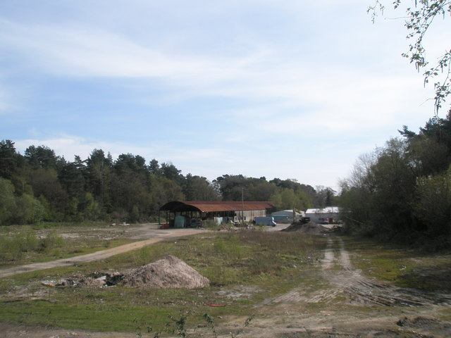
Bepton Common is a picturesque area located in the county of Sussex, England. Covering an area of approximately 80 acres, it is situated near the village of Bepton, nestled in the South Downs National Park. The common is characterized by its rolling hills, lush greenery, and diverse wildlife, making it a haven for nature enthusiasts and wildlife lovers.

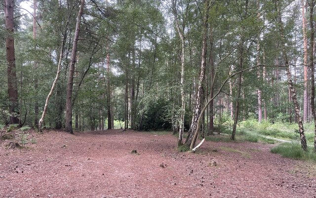
The landscape of Bepton Common is predominantly composed of heathland and woodland. The heathland is adorned with an array of colorful wildflowers during the summer months, creating a vibrant and captivating display. The woodland, mainly consisting of oak and beech trees, provides a serene atmosphere, with dappled sunlight filtering through the branches.

This area is home to a rich variety of flora and fauna. It is a habitat for several species of birds, such as woodpeckers, nightingales, and tawny owls. Additionally, various mammals, including badgers, foxes, and deer, can be spotted roaming the common.

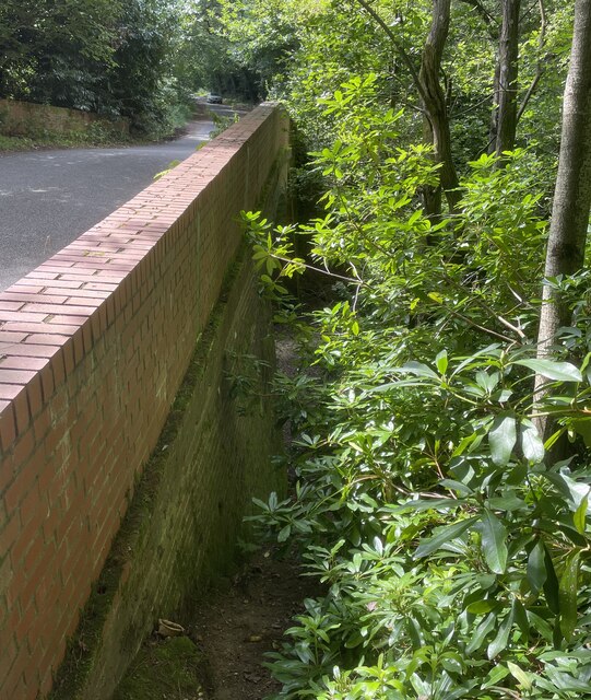
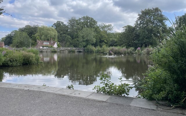
Bepton Common offers a tranquil environment, attracting visitors seeking solace in nature. The surrounding footpaths and bridleways provide opportunities for leisurely walks, hikes, and horseback riding, allowing visitors to explore the beauty of the countryside. The common also features a small pond, which serves as a watering hole for wildlife and adds to the charm of the area.

Overall, Bepton Common is a stunning natural landscape, offering a peaceful retreat amidst the hustle and bustle of modern life. Its diverse ecosystem and scenic beauty make it a cherished destination for locals and tourists alike, who appreciate the tranquility and natural splendor it has to offer.

If you have any feedback on the listing, please let us know in the comments section below.

Bepton Common Images

Images are sourced within 2km of 50.97773/-0.7598649 or Grid Reference SU8720. Thanks to Geograph Open Source API. All images are credited.

Midhurst Fire Station Adjacent to the A286.
Midhurst Fire Station
Adjacent to the A286.
New Road On New Road (A286) approaching the junction with the Bepton Road.
New Road
On New Road (A286) approaching the junction with the Bepton Road.
Midhurst Common Tall pines aside the path across Midhurst Common.
Midhurst Common
Tall pines aside the path across Midhurst Common.
Midhurst Common On one of the many paths crossing Midhurst Common.
Midhurst Common
On one of the many paths crossing Midhurst Common.
Footpath through The Warren On public footpath number 911 heading westwards from Severals Road. The path at this point was surfaced with rejects of the ‘Midhurst Whites’ bricks, remnants of which can be seen.
Footpath through The Warren
On public footpath number 911 heading westwards from Severals Road. The path at this point was surfaced with rejects of the ‘Midhurst Whites’ bricks, remnants of which can be seen.
Old Railway Beyond the gate lies the route of the former railway line from Midhurst to Petersfield.
Old Railway
Beyond the gate lies the route of the former railway line from Midhurst to Petersfield.
Old railway Looking down towards the disused track bed of the Midhurst to Pulborough railway line. Oaklands Lane, on the left, crosses the railway bridge.
To the right the railway line entered a cutting, now overgrown with trees, then presumably went through a tunnel to arrive at Midhurst.
Old railway
Looking down towards the disused track bed of the Midhurst to Pulborough railway line. Oaklands Lane, on the left, crosses the railway bridge. To the right the railway line entered a cutting, now overgrown with trees, then presumably went through a tunnel to arrive at Midhurst.
Church Road Not far from the parish church of St Mary Magdalene.
Church Road
Not far from the parish church of St Mary Magdalene.
Walking close to Closewalks Wood Heading towards Midhurst on public footpath number 1101.
Walking close to Closewalks Wood
Heading towards Midhurst on public footpath number 1101.
South Pond South Pond in Midhurst viewed from a convenient seat.
South Pond
South Pond in Midhurst viewed from a convenient seat.
Looking northwards in Church Hill
Church Hill: early April 2022
Spring flowers in the churchyard (1)
Spring flowers in the churchyard (2)
Spring flowers in the churchyard (3)
Spring flowers in the churchyard (4)
Spring flowers in the churchyard (5)
Memorial within St Mary Magdalene & St Denys, Midhurst (5) Chaning-Pearce was born in 1938. He studied for ordination at Rochester Theological College and was priested in 1965. After curacies in Bromley and Rustington he was Rector of Slinfold from 1973 to 1983; and the incumbent of Midhurst with Woolbeding from then until his death in 1993.
Memorial within St Mary Magdalene & St Denys, Midhurst (5)
Chaning-Pearce was born in 1938. He studied for ordination at Rochester Theological College and was priested in 1965. After curacies in Bromley and Rustington he was Rector of Slinfold from 1973 to 1983; and the incumbent of Midhurst with Woolbeding from then until his death in 1993.
Show me another place!

Bepton Common is located at Grid Ref: SU8720 (Lat: 50.97773, Lng: -0.7598649)

Administrative County: West Sussex

District: Chichester

Police Authority: Sussex

What 3 Words

///scrum.ruling.stunning. Near Midhurst, West Sussex

Related Wikis

Midhurst Brickworks

Midhurst Brickworks is a former brickworks situated to the south-west of Midhurst, West Sussex in England. The works were sited close to the (now closed...

Midhurst railway station (London and South Western Railway)

Midhurst (LSWR) railway station was opened on 1 September 1864 by the London and South Western Railway, the terminus of the line from Petersfield, serving...

Midhurst railway station

Midhurst railway station used to serve the market town of Midhurst in the English county of West Sussex. The first railway to reach the town was a branch...

Cocking Causeway

Cocking Causeway is a hamlet in the civil parish of Cocking, in the Chichester district, in the county of West Sussex, England. == References == ��2�...

Midhurst

Midhurst () is a market town, parish and civil parish in West Sussex, England. It lies on the River Rother 20 miles (32 km) inland from the English Channel...

St Margaret's Convent, Midhurst

St Margaret's Convent was a mixed primary and an all-girls secondary convent school in Midhurst, West Sussex. St Margaret's was founded by the Sisters...

Old Town Hall, Midhurst

The Old Town Hall is a municipal building in the Market Square in Midhurst, West Sussex, England. The building, which is managed by the Midhurst Town Trust...

Midhurst Cricket Ground

Midhurst Cricket Ground (exact name and location unknown) was a cricket ground in Midhurst, Sussex. The first recorded match on the ground was in 1830...

Nearby Amenities

Located within 500m of 50.97773,-0.7598649
Addr City: Midhurst
Addr Postcode: GU29 0LR
Addr Street: Severals Road
Addr Suburb: Bepton
Disused Amenity: pub
Old Name: The Country Inn
Lat/Long: 50.9775573/-0.7612116
Barrier: stile
Lat/Long: 50.977356/-0.7625287
Barrier: stile
Lat/Long: 50.9762489/-0.7570251
Barrier: stile
Lat/Long: 50.9754411/-0.756409
Barrier: stile
Lat/Long: 50.9752221/-0.7553548
Description: At this point a railway bridge used to pass over the bridleway. Some bricks can still be seen in the embankment on either side.
Lat/Long: 50.9801949/-0.7591863
Bus Stop
Severalls Lane
Bus: yes
Naptan AtcoCode: 4400MO0300
Naptan Bearing: NW
Naptan BusStopType: CUS
Naptan CommonName: Severalls Lane
Naptan Indicator: o/s pub
Naptan Landmark: The Country Inn
Naptan NaptanCode: wsxdjmdg
Naptan Street: Severalls Lane
Naptan Verified: no
Public Transport: platform
Source: naptan_import
Lat/Long: 50.9773144/-0.761274
Bus Stop
Frogmore
Bus: yes
Naptan AtcoCode: 4400MO0552
Naptan Bearing: NE
Naptan BusStopType: CUS
Naptan CommonName: Frogmore
Naptan Indicator: opp
Naptan Landmark: Hail & Ride
Naptan NaptanCode: wsxgdawg
Naptan Street: Bepton Road
Naptan Verified: no
Public Transport: platform
Source: naptan_import
Lat/Long: 50.9797759/-0.7551113
Bus Stop
Frogmore
Bus: yes
Naptan AtcoCode: 4400MO0553
Naptan Bearing: SW
Naptan BusStopType: CUS
Naptan CommonName: Frogmore
Naptan Indicator: adj
Naptan Landmark: Hail & Ride
Naptan NaptanCode: wsxgdawj
Naptan Street: Bepton Road
Naptan Verified: no
Public Transport: platform
Source: naptan_import
Lat/Long: 50.9797292/-0.7549559
Barrier: stile
Lat/Long: 50.977735/-0.7651897
Defibrillator
Booth: K6
Colour: red
Defibrillator Location: In a red phonebox.
Disused Amenity: telephone
Emergency: defibrillator
Lat/Long: 50.9775152/-0.7606595
Bepton Common
Place: hamlet
Lat/Long: 50.9777206/-0.7606944
Post Box
Collection Times: Mo-Fr 17:15; Sa 09:15
Operator: Royal Mail
Post Box Type: wall
Ref: GU29 55
Royal Cypher: EIIR
Royal Cypher Wikidata: Q33102113
Lat/Long: 50.9770114/-0.7615428
Waste Basket
Fixme: On Thursday 28.07.2022 I passed this location and I did not see a litter bin here. Perhaps it has been removed.
Lat/Long: 50.977327/-0.7612722
Bench
Backrest: yes
Colour: brown
Material: wood
Source: survey
Lat/Long: 50.9772903/-0.7613192
Material: wood
Power: pole
Lat/Long: 50.9815675/-0.760929
Material: wood
Power: pole
Lat/Long: 50.9807604/-0.761385
Material: wood
Power: pole
Lat/Long: 50.9800106/-0.7597006
Material: wood
Power: pole
Lat/Long: 50.9794043/-0.7584104
Material: wood
Power: pole
Lat/Long: 50.9788031/-0.7571096
Material: wood
Power: pole
Lat/Long: 50.9782744/-0.7560293
Material: wood
Power: pole
Lat/Long: 50.977945/-0.7552971
Material: wood
Power: pole
Lat/Long: 50.9773286/-0.7549001
Material: wood
Power: pole
Lat/Long: 50.9765807/-0.7540894
The data included in this document is from www.openstreetmap.org. The data is made available under ODbL.

Have you been to Bepton Common?

Leave your review of Bepton Common below (or comments, questions and feedback).