Belmont

Settlement in Herefordshire

England

Belmont

Hillside cereal crop near Haywood Lodge
Hillside cereal crop near Haywood Lodge Credit: JThomas

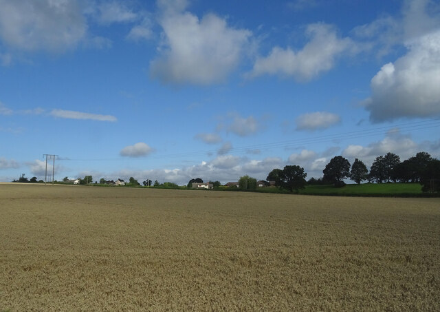
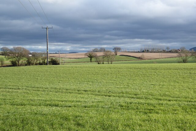
Belmont is a small village located in the county of Herefordshire, England. Situated approximately 5 miles southwest of the city of Hereford, it is nestled in the picturesque countryside of the Wye Valley. The village is surrounded by rolling hills, lush green fields, and meandering streams, offering residents and visitors a tranquil and scenic environment.

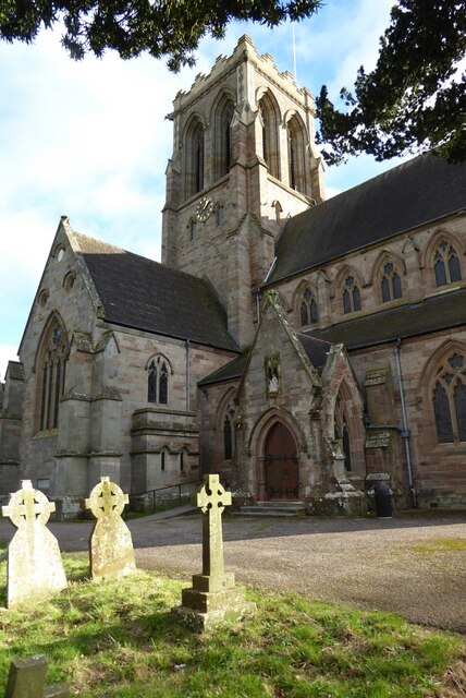
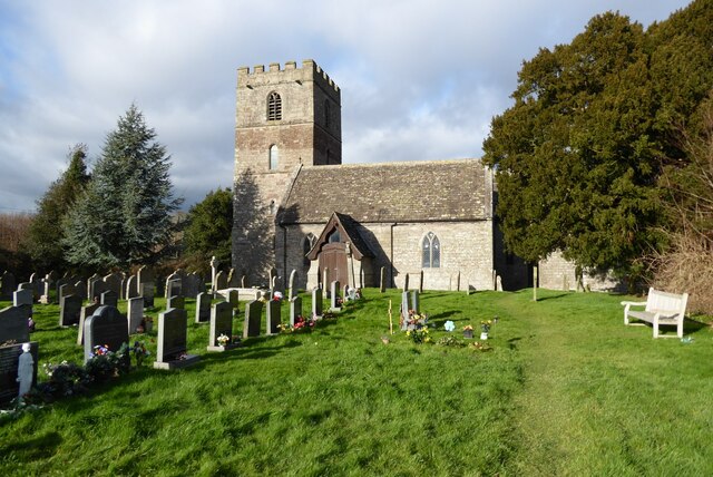
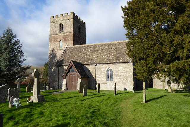
Belmont is known for its rich history, with evidence of human settlement dating back to the Iron Age. The village is home to several historic buildings, including a 12th-century church, St. Mary's, which serves as a reminder of the area's long-standing religious heritage. The architecture of the village blends traditional and modern styles, with quaint cottages and charming houses lining the streets.

Despite its small size, Belmont offers a range of amenities and services to its residents. These include a primary school, a village hall, a post office, and a local pub, where locals gather to socialize and enjoy a pint. The village also benefits from excellent transport links, with regular bus services connecting it to nearby towns and cities.

Nature lovers will find plenty to explore in Belmont and its surrounding areas. With the Wye Valley Area of Outstanding Natural Beauty just a stone's throw away, outdoor enthusiasts can enjoy activities such as hiking, cycling, and birdwatching. The village is also within easy reach of popular tourist attractions, including the historic town of Ross-on-Wye and the renowned Symonds Yat Rock viewpoint.

Overall, Belmont offers a peaceful and idyllic setting, making it a desirable place to live or visit for those seeking a rural retreat with access to both natural beauty and nearby amenities.

If you have any feedback on the listing, please let us know in the comments section below.

Belmont Images

Images are sourced within 2km of 52.036172/-2.7593051 or Grid Reference SO4837. Thanks to Geograph Open Source API. All images are credited.

Hillside cereal crop near Haywood Lodge
Cereal crop, Merry Hill
Grassland near Hereford The trees mark the course of an old railway.
Grassland near Hereford
The trees mark the course of an old railway.
Tesco Tesco superstore on Abbotsmead Road in the Belmont area of Hereford.
Tesco
Tesco superstore on Abbotsmead Road in the Belmont area of Hereford.
View to Hereford Cathedral View to Hereford Cathedral, with the spire of All Saints church to the left viewed from opposite Belmont Abbey.  In the field is a sheep rack which is used for feeding hay and nuts to sheep.
View to Hereford Cathedral
View to Hereford Cathedral, with the spire of All Saints church to the left viewed from opposite Belmont Abbey. In the field is a sheep rack which is used for feeding hay and nuts to sheep.
Road passing Belmont Abbey Country road to Bishop Eaton passing Belmont Abbey.
Road passing Belmont Abbey
Country road to Bishop Eaton passing Belmont Abbey.
Belmont Abbey Belmont Abbey is dedicated as the Abbey Church of St Michael is Roman Catholic Benedictine monastery.  The architect was Edward Welby Pugin, and his brother Peter Paul.  From 1859 until 1916 the abbey was also the cathedral for the diocese of Newport and Menevia.  Hence for just over half a century the city of Hereford had two cathedrals.  The abbey is Grade II* listed, see: <span class="nowrap"><a title="https://historicengland.org.uk/listing/the-list/list-entry/1099699?section=official-listing" rel="nofollow ugc noopener" href="https://historicengland.org.uk/listing/the-list/list-entry/1099699?section=official-listing">Link</a><img style="margin-left:2px;" alt="External link" title="External link - shift click to open in new window" src="https://s1.geograph.org.uk/img/external.png" width="10" height="10"/></span>
Belmont Abbey
Belmont Abbey is dedicated as the Abbey Church of St Michael is Roman Catholic Benedictine monastery. The architect was Edward Welby Pugin, and his brother Peter Paul. From 1859 until 1916 the abbey was also the cathedral for the diocese of Newport and Menevia. Hence for just over half a century the city of Hereford had two cathedrals. The abbey is Grade II* listed, see: LinkExternal link
Interior of Belmont Abbey
Farmland at Belmont Farmland to the west of Belmont Abbey.
Farmland at Belmont
Farmland to the west of Belmont Abbey.
Farmland opposite Belmont Abbey
Farmland at Clehonger View to the east towards Belmont across farmland at Clehonger.
Farmland at Clehonger
View to the east towards Belmont across farmland at Clehonger.
View to Belmont Hotel View across fields to Belmont Hotel.
View to Belmont Hotel
View across fields to Belmont Hotel.
Ruckhall Lane and Belmont Abbey View along Ruckhall Lane to Belmont Abbey.
Ruckhall Lane and Belmont Abbey
View along Ruckhall Lane to Belmont Abbey.
Belmont Abbey Belmont Abbey is dedicated as the Abbey Church of St Michael is Roman Catholic Benedictine monastery.  The architect was Edward Welby Pugin, and his brother Peter Paul.  From 1859 until 1916 the abbey was also the cathedral for the diocese of Newport and Menevia.  Hence for just over half a century the city of Hereford had two cathedrals.  The abbey is Grade II* listed, see: <span class="nowrap"><a title="https://historicengland.org.uk/listing/the-list/list-entry/1099699?section=official-listing" rel="nofollow ugc noopener" href="https://historicengland.org.uk/listing/the-list/list-entry/1099699?section=official-listing">Link</a><img style="margin-left:2px;" alt="External link" title="External link - shift click to open in new window" src="https://s1.geograph.org.uk/img/external.png" width="10" height="10"/></span>
Belmont Abbey
Belmont Abbey is dedicated as the Abbey Church of St Michael is Roman Catholic Benedictine monastery. The architect was Edward Welby Pugin, and his brother Peter Paul. From 1859 until 1916 the abbey was also the cathedral for the diocese of Newport and Menevia. Hence for just over half a century the city of Hereford had two cathedrals. The abbey is Grade II* listed, see: LinkExternal link
All Saints Church, Clehonger Clehonger church is dedicated to All Saints and dates back to the 12th century.  The church is Grade I listed, see: <span class="nowrap"><a title="https://historicengland.org.uk/listing/the-list/list-entry/1301135?section=official-listing" rel="nofollow ugc noopener" href="https://historicengland.org.uk/listing/the-list/list-entry/1301135?section=official-listing">Link</a><img style="margin-left:2px;" alt="External link" title="External link - shift click to open in new window" src="https://s1.geograph.org.uk/img/external.png" width="10" height="10"/></span>
All Saints Church, Clehonger
Clehonger church is dedicated to All Saints and dates back to the 12th century. The church is Grade I listed, see: LinkExternal link
All Saints church, Clehonger Clehonger church is dedicated to All Saints and dates back to the 12th century.  The church is Grade I listed, see: <span class="nowrap"><a title="https://historicengland.org.uk/listing/the-list/list-entry/1301135?section=official-listing" rel="nofollow ugc noopener" href="https://historicengland.org.uk/listing/the-list/list-entry/1301135?section=official-listing">Link</a><img style="margin-left:2px;" alt="External link" title="External link - shift click to open in new window" src="https://s1.geograph.org.uk/img/external.png" width="10" height="10"/></span>  A similar picture to the first picture uploaded in this grid square almost sixteen years ago <a href="https://www.geograph.org.uk/photo/149666">SO4637 : All Saints Church, Clehonger</a>.
All Saints church, Clehonger
Clehonger church is dedicated to All Saints and dates back to the 12th century. The church is Grade I listed, see: LinkExternal link A similar picture to the first picture uploaded in this grid square almost sixteen years ago SO4637 : All Saints Church, Clehonger.
Rolling Herefordshire farmland Rolling Herefordshire farmland near Allensmore.
Rolling Herefordshire farmland
Rolling Herefordshire farmland near Allensmore.
Show me another place!

Belmont is located at Grid Ref: SO4837 (Lat: 52.036172, Lng: -2.7593051)

Unitary Authority: County of Herefordshire

Police Authority: West Merica

What 3 Words

///estimates.quoted.strikers. Near Belmont, Herefordshire

Related Wikis

Belmont Abbey, Herefordshire

Belmont Abbey, in Herefordshire, England, is a Catholic Benedictine monastery that forms part of the English Benedictine Congregation. It stands on a small...

Belmont Rural

Belmont Rural is a civil parish in Herefordshire, England. The population of the Civil Parish taken at the 2011 Census was 3,769. It is south-west of...

Warham, Herefordshire

Warham is a place in the English county of Herefordshire. It is situated about 3 km west of the city of Hereford, close to the north bank of the River...

Grafton, Herefordshire

Grafton is a village and civil parish in Herefordshire, England. The population of this civil parish was 258 at the 2011 census. The parish includes the...

Nearby Amenities

Located within 500m of 52.036172,-2.7593051
Bus Stop
Abbey Cottages
Naptan AtcoCode: 2090A0106114
Naptan Bearing: NE
Naptan CommonName: Abbey Cottages
Naptan Indicator: adj
Naptan Landmark: Abbey Cottages
Naptan NaptanCode: heratgja
Naptan Street: B4349
Naptan Verified: no
Source: naptan_import
Lat/Long: 52.035936/-2.7608495
Bus Stop
Abbey Cottages
Naptan AtcoCode: 2090A0106116
Naptan Bearing: SW
Naptan BusStopType: CUS
Naptan CommonName: Abbey Cottages
Naptan Indicator: opp
Naptan Landmark: Abbey Cottages
Naptan NaptanCode: heratgjd
Naptan Street: B4349
Naptan Verified: no
Source: naptan_import
Lat/Long: 52.035834/-2.7608488
Bus Stop
Belmont Abbey
Bus: yes
Naptan AtcoCode: 2090A19634
Naptan Bearing: NE
Naptan BusStopType: CUS
Naptan CommonName: Belmont Abbey
Naptan Indicator: adj
Naptan Landmark: o/s Belmont Abbey
Naptan NaptanCode: heramgjp
Naptan Street: A465
Naptan Verified: no
Public Transport: platform
Source: naptan_import
Lat/Long: 52.0369292/-2.7560862
Barrier: bollard
Bicycle: yes
Foot: yes
Motor Vehicle: no
Lat/Long: 52.0374417/-2.7552801
Bus Stop
Belmont Abbey
Bus: yes
Naptan AtcoCode: 2090A19632
Naptan Bearing: SW
Naptan BusStopType: CUS
Naptan CommonName: Belmont Abbey
Naptan Indicator: opp
Naptan Landmark: o/s Belmont Abbey
Naptan NaptanCode: heramgjm
Naptan Street: A465
Naptan Verified: no
Public Transport: platform
Source: naptan_import
Lat/Long: 52.0367581/-2.7563163
Bicycle Rental
Capacity: 5
Name Signed: no
Network: Beryl - Hereford
Official Name: Belmont Park and Choose
Operator: Beryl
Operator Wikidata: Q106575369
Payment App: yes
Payment App Android: cc.beryl.basis
Payment App Ios: 1386768364
Payment Cash: no
Payment Credit Cards: no
Payment Cryptocurrencies: no
Payment Debit Cards: no
Payment Electronic Purses: no
Ref Gbfs: beryl_hereford:2258
Lat/Long: 52.0376167/-2.75618
The data included in this document is from www.openstreetmap.org. The data is made available under ODbL.

Have you been to Belmont?

Leave your review of Belmont below (or comments, questions and feedback).