Badersfield

Settlement in Norfolk North Norfolk

England

Badersfield

View across the Bure Valley The Bure Valley is seen from a Bure Valley Railway train between Buxton and Coltishall.
View across the Bure Valley Credit: Glen Denny

Badersfield is a small village located in the county of Norfolk, England. Situated approximately 10 miles north of the city of Norwich, it falls within the district of Broadland. The village is part of the civil parish of Horsham St Faith and Newton St Faith.

Badersfield is a predominantly rural area, characterized by its charming countryside and agricultural landscapes. The village is surrounded by open fields, meadows, and farmlands, creating a tranquil and peaceful atmosphere. It is home to a small population, with a tight-knit community that fosters a strong sense of belonging.

The village offers limited amenities, including a local church, St. Andrew's, which dates back to the Norman era and is known for its beautiful architecture. Badersfield also has a primary school, providing education to the younger residents of the village.

The nearby city of Norwich provides additional amenities and services for the residents of Badersfield. Norwich offers a wide range of shopping facilities, entertainment venues, and cultural attractions, making it easily accessible for those seeking a more urban lifestyle.

The area surrounding Badersfield is known for its picturesque countryside, offering opportunities for outdoor activities such as hiking, cycling, and horse riding. The village is well-connected by road, with easy access to the A140 and A1270, providing convenient links to nearby towns and cities.

Overall, Badersfield is a peaceful and idyllic village, offering a rural lifestyle while still being within close proximity to larger urban areas.

If you have any feedback on the listing, please let us know in the comments section below.
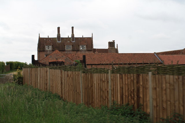
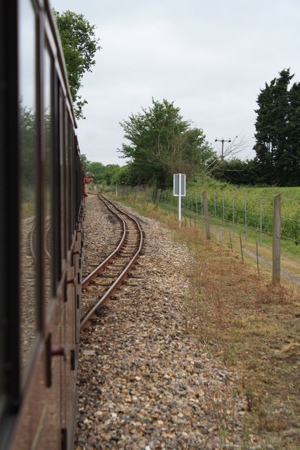
Badersfield Images

Images are sourced within 2km of 52.761779/1.3429931 or Grid Reference TG2523. Thanks to Geograph Open Source API. All images are credited.

View across the Bure Valley The Bure Valley is seen from a Bure Valley Railway train between Buxton and Coltishall.
View across the Bure Valley
The Bure Valley is seen from a Bure Valley Railway train between Buxton and Coltishall.
Bure Valley Railway warning sign This warning sign is at the beginning of a passing loop and is close to a level crossing connecting Fendyke Nursery with the marshes.
Bure Valley Railway warning sign
This warning sign is at the beginning of a passing loop and is close to a level crossing connecting Fendyke Nursery with the marshes.
Level Crossing near Fendyke Nursery This level crossing allows access across the Bure Valley Railway between Fendyke Nursery and the marshes. This is the view from a BVR train.
Level Crossing near Fendyke Nursery
This level crossing allows access across the Bure Valley Railway between Fendyke Nursery and the marshes. This is the view from a BVR train.
Bure Valley Railway passing loop This passing loop is close to Little Hautbois Hall.
Bure Valley Railway passing loop
This passing loop is close to Little Hautbois Hall.
Bure Valley Railway near Little Hautbois Hall The train from where this image was taken is on one of the tracks of a passing loop.
Bure Valley Railway near Little Hautbois Hall
The train from where this image was taken is on one of the tracks of a passing loop.
Bure Valley Railway near Little Hautbois Hall The train from which this image is taken is leaving the passing loop and entering the single-track section to Coltishall station. Some of the farm buildings at Little Hautbois Hall can be glimpsed beside the tree on the left.
Bure Valley Railway near Little Hautbois Hall
The train from which this image is taken is leaving the passing loop and entering the single-track section to Coltishall station. Some of the farm buildings at Little Hautbois Hall can be glimpsed beside the tree on the left.
Bure Valley Railway near Little Hautbois Hall The train from which this image is taken is leaving the passing loop and entering the single-track section to Coltishall station.
Bure Valley Railway near Little Hautbois Hall
The train from which this image is taken is leaving the passing loop and entering the single-track section to Coltishall station.
Little Hautbois Hall This is the view from a Bure Valley Railway train as it approaches the level crossing near Little Hautbois Hall.
Little Hautbois Hall
This is the view from a Bure Valley Railway train as it approaches the level crossing near Little Hautbois Hall.
Little Hautbois Hall This is a view from a Bure Valley Railway train as it passes over the level crossing adjacent to Little Hautbois Hall. At this point the Bure Valley Path crosses over the railway to parallel it from the south side.
Little Hautbois Hall
This is a view from a Bure Valley Railway train as it passes over the level crossing adjacent to Little Hautbois Hall. At this point the Bure Valley Path crosses over the railway to parallel it from the south side.
Little Hautbois Hall This is a view of Little Hautbois Hall from a passing Bure Valley Railway train.
Little Hautbois Hall
This is a view of Little Hautbois Hall from a passing Bure Valley Railway train.
Bure Valley Railway view This view from a Bure Valley Railway train shows a field between the railway and the boundary of the former RAF Coltishall. The low structure on the horizon just left of centre, is the remains of a concrete aircraft shelter.
Bure Valley Railway view
This view from a Bure Valley Railway train shows a field between the railway and the boundary of the former RAF Coltishall. The low structure on the horizon just left of centre, is the remains of a concrete aircraft shelter.
Former RAF Coltishall The concrete structures on the horizon belong to the former RAF Coltishall and are seen from a passing Bure Valley Railway train. The airfield perimeter fence can also be seen.
Former RAF Coltishall
The concrete structures on the horizon belong to the former RAF Coltishall and are seen from a passing Bure Valley Railway train. The airfield perimeter fence can also be seen.
Approach Little Hautbois Hall level crossing These warning signs indicate to the driver the speed at which the level crossing can be negotiated and also that the whistle/horn is to be used.
Approach Little Hautbois Hall level crossing
These warning signs indicate to the driver the speed at which the level crossing can be negotiated and also that the whistle/horn is to be used.
Bure Valley Path The Bure Valley Path is seen near to Little Hautbois Hall from a Bure Valley Railway train.
Bure Valley Path
The Bure Valley Path is seen near to Little Hautbois Hall from a Bure Valley Railway train.
Bure Valley Railway and Bure Valley Path This is the passing loop close to Little Hautbois Hall, with the Bure Valley Path on the right.
Bure Valley Railway and Bure Valley Path
This is the passing loop close to Little Hautbois Hall, with the Bure Valley Path on the right.
Bure Valley Railway and Bure Valley Path This BVR train is on one track of the passing loop close to Little Hautbois Hall, with the Bure Valley Path on the right.
Bure Valley Railway and Bure Valley Path
This BVR train is on one track of the passing loop close to Little Hautbois Hall, with the Bure Valley Path on the right.
Bure Valley Railway and Bure Valley Path This train is leaving the passing loop and is running over the level crossing near Fendyke Nursery. On the right is the Bure Valley Path.
Bure Valley Railway and Bure Valley Path
This train is leaving the passing loop and is running over the level crossing near Fendyke Nursery. On the right is the Bure Valley Path.
River Bure - Little Hautbois - Norfolk River Bure at dawn on 14 Dec 11 0730
River Bure - Little Hautbois - Norfolk
River Bure at dawn on 14 Dec 11 0730
Show me another place!

Badersfield is located at Grid Ref: TG2523 (Lat: 52.761779, Lng: 1.3429931)

Administrative County: Norfolk

District: North Norfolk

Police Authority: Norfolk

What 3 Words

///rollover.tangling.bidder. Near Buxton, Norfolk

Nearby Locations

Badersfield

Related Wikis

HM Prison Bure

His Majesty's Prison Bure, more commonly known as HM Prison Bure, and often abbreviated to HMP Bure, is a Category C men's prison, located in the parish...

Swift Aircraft

Swift Aircraft Limited is a British aerospace manufacturer that designs the Swift II aerobatic training aircraft. == Swift II == The Swift II is a side...

Buxton with Lamas

Buxton with Lamas is a civil parish in Broadland in the English county of Norfolk. It comprises the villages of Buxton lying to the west of the River Bure...
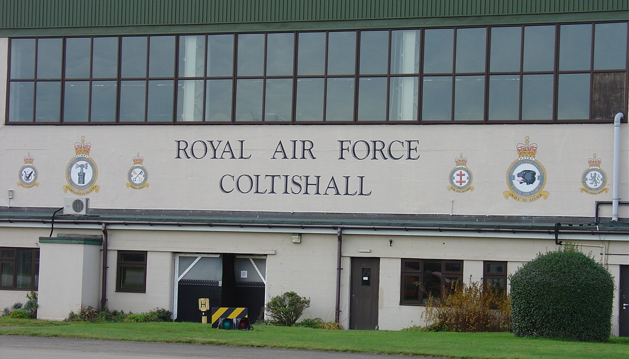
RAF Coltishall

Royal Air Force Coltishall, more commonly known as RAF Coltishall (IATA: CLF, ICAO: EGYC), is a former Royal Air Force station located 10 miles (16 kilometres...

Nearby Amenities

Located within 500m of 52.761779,1.3429931
Barton Road, opp
Naptan AtcoCode: 2900S092
Naptan Bearing: E
Naptan BusStopType: CUS
Naptan CommonName: Barton Road
Naptan Indicator: opp
Naptan Landmark: Barton Road
Naptan Locality: Coltishall RAF
Naptan NaptanCode: nfodtdgm
Naptan Street: Tunstead Road
Naptan Verified: no
Shelter: yes
Source: naptan_import
Lat/Long: 52.7620743/1.3420999
Barton Road, adj
Alt Name: Coltishall NAAFI;Coltishall NAAFI;RAF Coltishall NAAFI
Naptan AltCommonName: Coltishall NAAFI
Naptan AtcoCode: 2900S094
Naptan Bearing: W
Naptan BusStopType: CUS
Naptan CommonName: Barton Road
Naptan Indicator: adj
Naptan Landmark: Barton Road
Naptan Locality: Coltishall RAF
Naptan NaptanCode: nfodtdgt
Naptan Street: Tunstead Road
Naptan Verified: no
Source: naptan_import
Lat/Long: 52.7619985/1.3420097
Priority: equal
Lat/Long: 52.7590733/1.3406612
Give Way
Lat/Long: 52.7623917/1.3409853
Traffic Calming: bump
Lat/Long: 52.7650625/1.3429391
Traffic Calming: bump
Lat/Long: 52.7646648/1.3420459
Traffic Calming: bump
Lat/Long: 52.7642358/1.3436397
Traffic Calming: bump
Lat/Long: 52.7634298/1.3438846
Traffic Calming: bump
Lat/Long: 52.7640627/1.3407585
Traffic Calming: bump
Lat/Long: 52.7637751/1.3408313
Traffic Calming: bump
Lat/Long: 52.7632398/1.3408416
Post Box
Operator: Royal Mail
Post Box Type: pillar
Lat/Long: 52.7619423/1.3422847
Give Way
Lat/Long: 52.7636448/1.3392891
Traffic Calming: bump
Lat/Long: 52.7629692/1.3403138
Traffic Calming: bump
Lat/Long: 52.7622696/1.3436759
Barrier: lift_gate
Lat/Long: 52.7576436/1.3434701
Traffic Calming: bump
Lat/Long: 52.7646391/1.3436536
Access: no
Barrier: block
Lat/Long: 52.7573483/1.3421195
Grit Bin
Lat/Long: 52.7618673/1.3406775
Priority: equal
Lat/Long: 52.7594098/1.3405895
Traffic Calming: hump
Lat/Long: 52.7608889/1.340218
Traffic Calming: hump
Lat/Long: 52.7602427/1.3403737
Traffic Calming: hump
Lat/Long: 52.7595344/1.3405596
Traffic Calming: hump
Lat/Long: 52.7588664/1.340714
Give Way
Lat/Long: 52.7627309/1.3500273
Give Way
Lat/Long: 52.762869/1.3501449
Power: pole
Lat/Long: 52.7661815/1.3436955
Scottow
Colour: black
Inscription: 2012
Man Made: village_sign
Material: metal
Start Date: 2012
Lat/Long: 52.7620185/1.3461283
Barrier: bollard
Foot: yes
Lat/Long: 52.7633902/1.3421389
Give Way
Lat/Long: 52.763436/1.3412187
Give Way
Lat/Long: 52.7636407/1.3409384
Give Way
Lat/Long: 52.7640374/1.3406287
Give Way
Lat/Long: 52.7640993/1.339341
Give Way
Lat/Long: 52.7639662/1.3405654
Give Way
Lat/Long: 52.7637783/1.338981
Crossing
Crossing: unmarked
Lat/Long: 52.764204/1.3404323
Crossing
Crossing: unmarked
Lat/Long: 52.7642157/1.3410808
Crossing
Crossing: unmarked
Lat/Long: 52.7654429/1.3436994
Waste Basket
Waste: dog_excrement
Lat/Long: 52.7621025/1.3420346
Give Way
Lat/Long: 52.7647786/1.343599
Give Way
Lat/Long: 52.7643574/1.3436915
Give Way
Lat/Long: 52.764011/1.3435827
Give Way
Lat/Long: 52.7629184/1.3395405
Give Way
Lat/Long: 52.7629636/1.3398526
Give Way
Lat/Long: 52.7619982/1.3422314
Give Way
Lat/Long: 52.7620323/1.3411917
Give Way
Lat/Long: 52.7624817/1.3437594
Give Way
Lat/Long: 52.76295/1.3438124
Give Way
Lat/Long: 52.7650935/1.3433577
Crossing
Crossing: unmarked
Lat/Long: 52.7650615/1.3423048
Crossing
Crossing: unmarked
Lat/Long: 52.7646307/1.3413624
Give Way
Lat/Long: 52.7620096/1.3435322
Give Way
Lat/Long: 52.761952/1.3440891
Badersfield
Place: village
Lat/Long: 52.7626049/1.3450521
Colour: grey
Communication Mobile Phone: yes
Fixme: Who is the operator?
Man Made: mast
Material: metal
Tower Construction: freestanding
Tower Type: communication
Lat/Long: 52.761982/1.342459
Colour: white
Communication Mobile Phone: yes
Man Made: mast
Material: metal
Operator: O2-UK;Vodafone UK
Tower Construction: freestanding
Tower Type: communication
Lat/Long: 52.7619025/1.3434058
Colour: white
Communication Mobile Phone: yes
Man Made: mast
Material: metal
Operator: Three UK;EE
Tower Construction: freestanding
Tower Type: communication
Lat/Long: 52.7619739/1.342736
The data included in this document is from www.openstreetmap.org. The data is made available under ODbL.

Have you been to Badersfield?

Leave your review of Badersfield below (or comments, questions and feedback).