Maes Pennant

Settlement in Flintshire

Wales

Maes Pennant

Drybridge Lodge, Rhewl Mostyn The carriage drive for Mostyn Hall has the public road dive under in the tunnel
Drybridge Lodge, Rhewl Mostyn Credit: Kevin Waterhouse

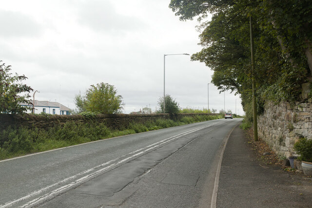
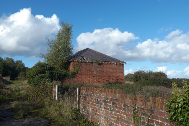
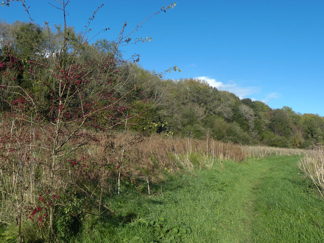
Maes Pennant is a small village located in Flintshire, Wales. It is situated near the town of Whitford and is surrounded by picturesque countryside. The village is known for its charming rural setting and peaceful atmosphere.

Maes Pennant is home to a mix of traditional Welsh cottages and modern houses, giving it a quaint and welcoming feel. The community is tight-knit, with residents often coming together for events and activities.

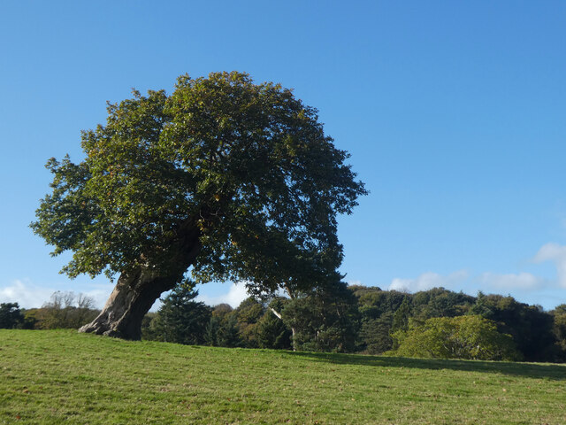
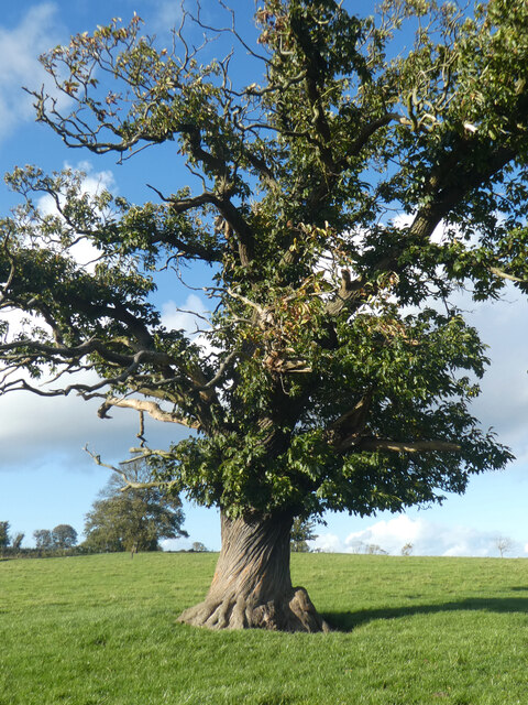
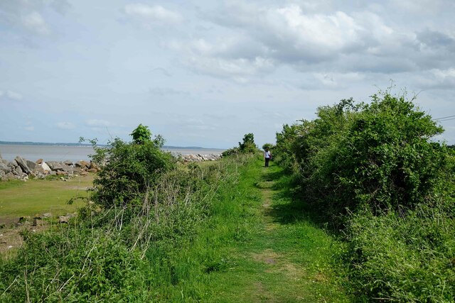
The village is also conveniently located near a number of amenities, including shops, schools, and recreational facilities. The nearby countryside offers ample opportunities for outdoor activities such as walking, cycling, and birdwatching.

Overall, Maes Pennant is a lovely village that provides a peaceful and idyllic setting for those looking to escape the hustle and bustle of city life. Its friendly community, beautiful surroundings, and convenient location make it a desirable place to live for both locals and visitors alike.

If you have any feedback on the listing, please let us know in the comments section below.
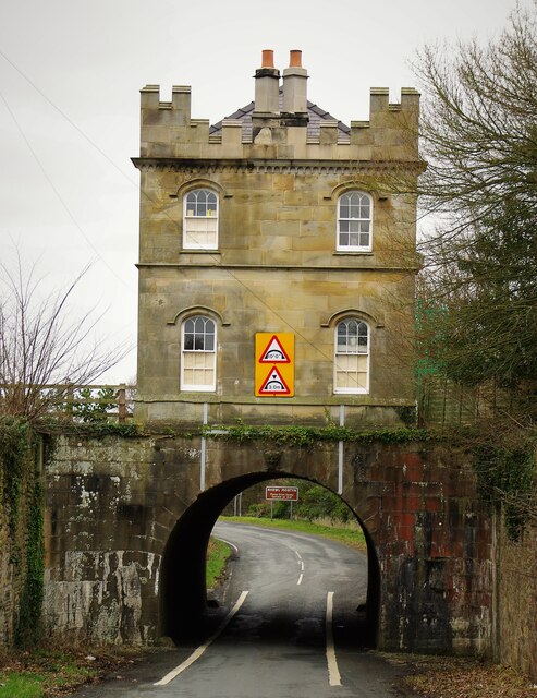
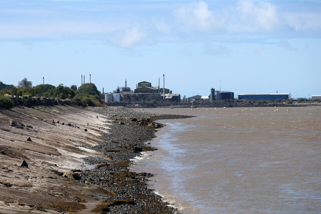
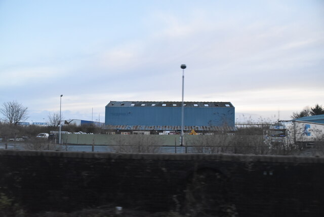
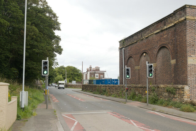
Maes Pennant Images

Images are sourced within 2km of 53.307427/-3.25629 or Grid Reference SJ1679. Thanks to Geograph Open Source API. All images are credited.

Drybridge Lodge, Rhewl Mostyn The carriage drive for Mostyn Hall has the public road dive under in the tunnel
Drybridge Lodge, Rhewl Mostyn
The carriage drive for Mostyn Hall has the public road dive under in the tunnel
Industry at Mostyn Seen from Llanerch-y-mor by the beached Duke of Lancaster.
Industry at Mostyn
Seen from Llanerch-y-mor by the beached Duke of Lancaster.
Mostyn Industrial Estate
Pedestrian crossing on the A548
A548, Mostyn Mostyn Docks on the left and Mostyn Park on the right.
A548, Mostyn
Mostyn Docks on the left and Mostyn Park on the right.
Derwen ar ogwydd / A leaning oak
Gwaith brics addurniadol / Decorative brickwork
Rhisgl troellog castanwydden / A chestnut's twisted bark
"Hardd yw brigau coedydd Mostyn" The title of this image is from an old Welsh folk song, and simply means "pretty are the branches of Mostyn".  Although the lyrics treat Conwy, Nefyn and Mostyn as being of equivalent beauty, they reserve superlative praise for the beauty of Dyffryn Meifod.
"Hardd yw brigau coedydd Mostyn"
The title of this image is from an old Welsh folk song, and simply means "pretty are the branches of Mostyn". Although the lyrics treat Conwy, Nefyn and Mostyn as being of equivalent beauty, they reserve superlative praise for the beauty of Dyffryn Meifod.
TSS Duke of Lancaster A former Irish Sea ferry and cruise ship, beached to be a fun ship on a retail park but unloved in this view
TSS Duke of Lancaster
A former Irish Sea ferry and cruise ship, beached to be a fun ship on a retail park but unloved in this view
TSS Duke of Lancaster The port side of the former ferry and cruise ship
TSS Duke of Lancaster
The port side of the former ferry and cruise ship
TSS Duke of Lancaster at Llannerch-y-Mor The former railway steamer passenger ship TSS Duke of Lancaster was launched on 1 December 1955 and was in operation from 1956 to 1979 when she started her new life as "the Fun Ship" here at Llannerch-y-Mor. She has had various owners over the years, all seemingly having legal battles with the local councils. For her full story see the Wikipedia link below.

Wikipedia <span class="nowrap"><a title="https://en.wikipedia.org/wiki/TSS_Duke_of_Lancaster_(1955)" rel="nofollow ugc noopener" href="https://en.wikipedia.org/wiki/TSS_Duke_of_Lancaster_(1955)">Link</a><img style="margin-left:2px;" alt="External link" title="External link - shift click to open in new window" src="https://s1.geograph.org.uk/img/external.png" width="10" height="10"/></span>
TSS Duke of Lancaster at Llannerch-y-Mor
The former railway steamer passenger ship TSS Duke of Lancaster was launched on 1 December 1955 and was in operation from 1956 to 1979 when she started her new life as "the Fun Ship" here at Llannerch-y-Mor. She has had various owners over the years, all seemingly having legal battles with the local councils. For her full story see the Wikipedia link below. Wikipedia LinkExternal link
The Wales Coast Path at Llannerch-y-Mor The Wales Coast Path continues here up the steps on the right and passes the TSS Duke of Lancaster along the dyke towards Greenfield Docks.

The former railway steamer passenger ship TSS Duke of Lancaster was launched on 1 December 1955 and was in operation from 1956 to 1979 when she started her new life as "the Fun Ship" here at Llanerch-y-Mor. She has had various owners over the years, all seemingly having legal battles with the local councils. For her full story see the Wikipedia link below.

Wikipedia <span class="nowrap"><a title="https://en.wikipedia.org/wiki/TSS_Duke_of_Lancaster_(1955)" rel="nofollow ugc noopener" href="https://en.wikipedia.org/wiki/TSS_Duke_of_Lancaster_(1955)">Link</a><img style="margin-left:2px;" alt="External link" title="External link - shift click to open in new window" src="https://s1.geograph.org.uk/img/external.png" width="10" height="10"/></span>
The Wales Coast Path at Llannerch-y-Mor
The Wales Coast Path continues here up the steps on the right and passes the TSS Duke of Lancaster along the dyke towards Greenfield Docks. The former railway steamer passenger ship TSS Duke of Lancaster was launched on 1 December 1955 and was in operation from 1956 to 1979 when she started her new life as "the Fun Ship" here at Llanerch-y-Mor. She has had various owners over the years, all seemingly having legal battles with the local councils. For her full story see the Wikipedia link below. Wikipedia LinkExternal link
The Wales Coast Path approaching the Duke of Lancaster The Wales Coast Path heading northwest the TSS Duke of Lancaster at Llannerch-y-Mor.

The former railway steamer passenger ship TSS Duke of Lancaster was launched on 1 December 1955 and was in operation from 1956 to 1979 when she started her new life as "the Fun Ship" here at Llanerch-y-Mor. She has had various owners over the years, all seemingly having legal battles with the local councils. For her full story see the Wikipedia link below.

Wikipedia <span class="nowrap"><a title="https://en.wikipedia.org/wiki/TSS_Duke_of_Lancaster_(1955)" rel="nofollow ugc noopener" href="https://en.wikipedia.org/wiki/TSS_Duke_of_Lancaster_(1955)">Link</a><img style="margin-left:2px;" alt="External link" title="External link - shift click to open in new window" src="https://s1.geograph.org.uk/img/external.png" width="10" height="10"/></span>
The Wales Coast Path approaching the Duke of Lancaster
The Wales Coast Path heading northwest the TSS Duke of Lancaster at Llannerch-y-Mor. The former railway steamer passenger ship TSS Duke of Lancaster was launched on 1 December 1955 and was in operation from 1956 to 1979 when she started her new life as "the Fun Ship" here at Llanerch-y-Mor. She has had various owners over the years, all seemingly having legal battles with the local councils. For her full story see the Wikipedia link below. Wikipedia LinkExternal link
The Wales Coast Path at Llanerch-y-mor Heading southeast along the Wales Coast Path at Llannerch-y-mor.
The Wales Coast Path at Llanerch-y-mor
Heading southeast along the Wales Coast Path at Llannerch-y-mor.
The Wales Coast Path at Llannerch-y-mor Heading towards the TSS Duke of Lancaster moored at Llannerch-y-mor.
The Wales Coast Path at Llannerch-y-mor
Heading towards the TSS Duke of Lancaster moored at Llannerch-y-mor.
Show me another place!

Maes Pennant is located at Grid Ref: SJ1679 (Lat: 53.307427, Lng: -3.25629)

Unitary Authority: Flintshire

Police Authority: North Wales

What 3 Words

///dwarves.peroxide.political. Near Mostyn, Flintshire

Related Wikis

Mostyn

Mostyn is a village and community in Flintshire, Wales, and electoral ward lying on the estuary of the River Dee, located near the town of Holywell. It...

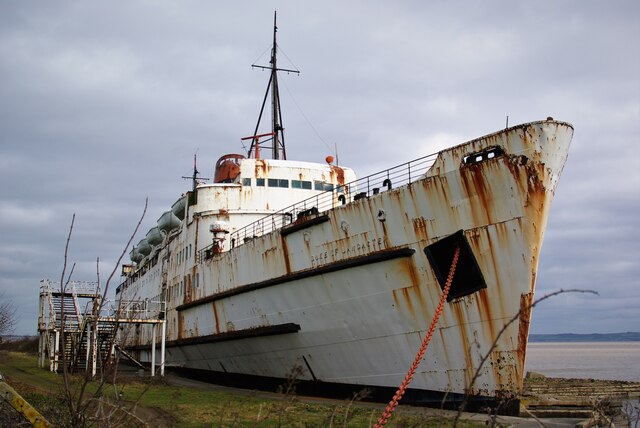
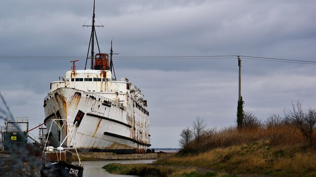
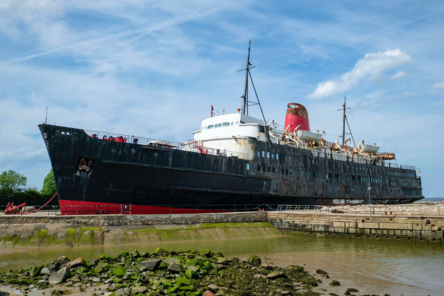
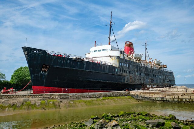
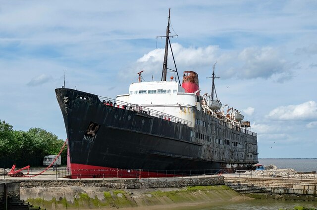
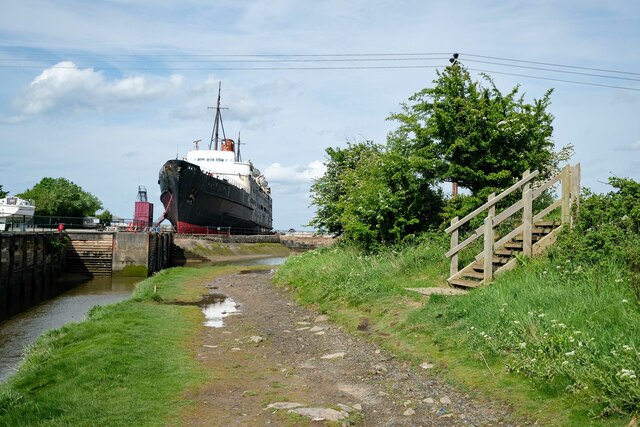
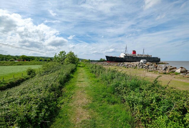
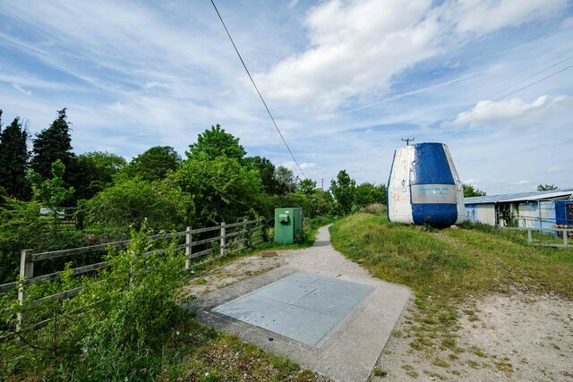
TSS Duke of Lancaster (1955)

TSS Duke of Lancaster is a former railway steamer passenger ship that operated in Europe from 1956 to 1979, and is beached near Mostyn Docks, on the River...
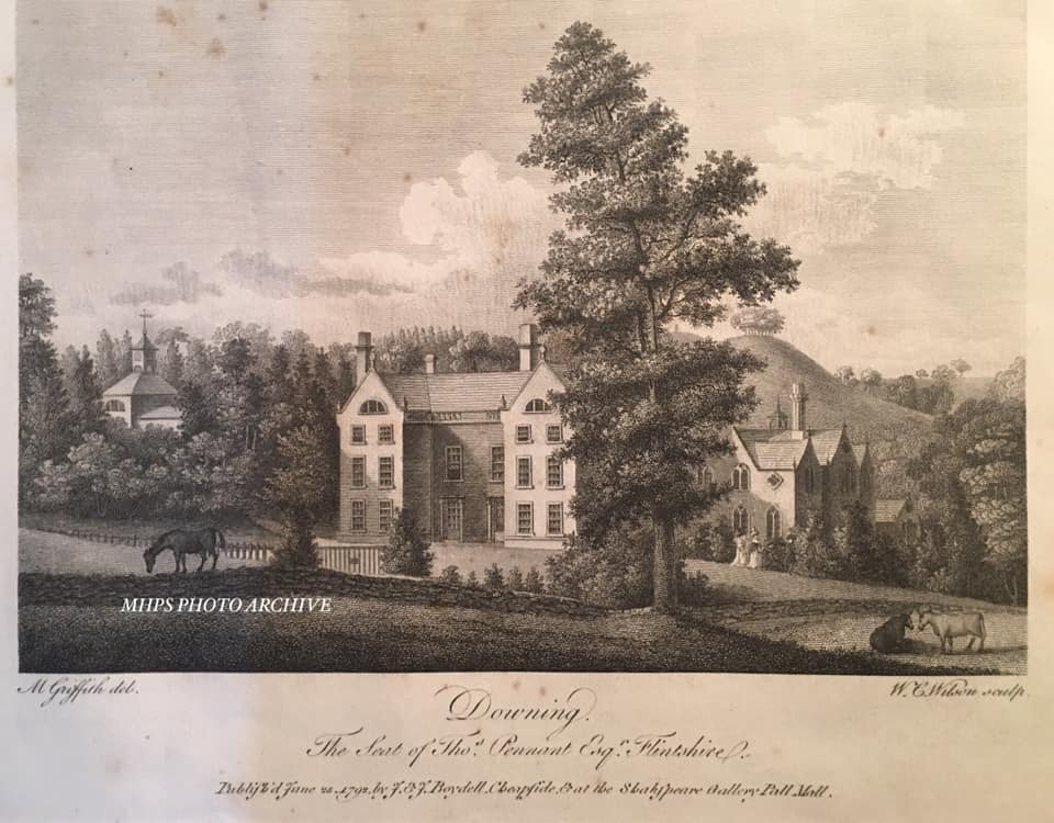
Downing Hall

Downing Hall was built in 1627 by the Pennant family near Whitford, Flintshire. It was later the home of Thomas Pennant, the naturalist, traveller and...

Mostyn Colliery

Mostyn Colliery was a coal mine in Flintshire, North Wales, that was owned in the later part of its operating life by the influential Mostyn family. The...

Related Videos

The Duke. WelshBloke walking. (With Outtakes)

WelshBloke walking. (With Outtakes) The Duke. Today we are in Mostyn, a former industrialised part of the North Wales coast.

Bagillt to Duke of Lancaster Walking Wales Coastal Path for Conqueror Virtual Challenge Episode 6

Join me as I start a new challenge the Florida Keys. Using the Wales Costal path to help me get my miles in.

The end of a long WALK Charlie

Charlie needs a rest after a good walk #doglover #dogwalking #dogwalk #cutedog #cutepet #yorkshireterrier #charlie #panting ...

Jaguar E-Type Convertible And Porsche 911 GT3 #JaguarEType #ClassicCars #Porsche911GT3

Can you feel the class of this Jaguar E-Type Convertible? Yeah. Same here - We filmed this Primrose Yellow E-Type Convertible ...

Nearby Amenities

Located within 500m of 53.307427,-3.25629
Place Of Worship
Religion: christian
Lat/Long: 53.3063566/-3.2506324
Disused Amenity: post_office
Lat/Long: 53.3077173/-3.2499644
Bus Stop
Mostyn, A548 / Marsh Farm
Bench: yes
Bus: yes
Kerb: raised
Naptan AtcoCode: 5120AWF80829
Naptan Bearing: SE
Naptan CommonName: Marsh Farm
Naptan Indicator: o/s
Naptan Landmark: Marsh Farm Pumping Station
Naptan LocalityName: Mostyn
Naptan NaptanCode: flidgjm
Naptan Street: A548
Public Transport: platform
Shelter: yes
Source: naptan_import
Timetable: yes
Lat/Long: 53.3099078/-3.2541689
Street Lamp
Lat/Long: 53.3053863/-3.2518184
Street Lamp
Lat/Long: 53.3063979/-3.2511704
Post Office
Mostyn Post Office
Addr City: Maes Pennant
Addr Housenumber: 65
Addr Postcode: CH8 9NX
Addr Street: Ffordd Pennant
Brand: Post Office
Brand Wikidata: Q1783168
Check Date: 2023-09-27
Opening Hours: Mo-Tu 09:00-18:00; We 09:00-12:00,14:00-18:00; Th-Fr 09:00-18:00; Sa 09:00-17:00; Su 11:00-15:00
Operator: Premier Stores
Ref Pol Id: 123622
Source: survey
Website: https://www.postoffice.co.uk/branch-finder/3594580/mostyn
Lat/Long: 53.3071037/-3.2581173
Waste Basket
Source: survey
Waste: trash
Lat/Long: 53.310133/-3.2599992
Waste Basket
Source: survey
Waste: trash
Lat/Long: 53.3101991/-3.2610877
Grit Bin
Access: permissive
Source: survey
Lat/Long: 53.3103775/-3.2606343
Waste Basket
Source: survey
Waste: trash
Lat/Long: 53.3073328/-3.2581683
Waste Basket
Source: survey
Waste: trash
Lat/Long: 53.3071565/-3.2577123
Fast Food
Mayflower
Addr City: Maes Pennant
Addr Housenumber: 69
Addr Postcode: CH8 9NX
Addr Street: Ffordd Pennant
Cuisine: chinese
Phone: +44 1745 561558
Source: survey
Takeaway: only
Lat/Long: 53.3069867/-3.2578625
Access: customers
Entrance: main
Source: survey
Lat/Long: 53.3069861/-3.2577799
Access: customers
Entrance: main
Source: survey
Lat/Long: 53.3070864/-3.2580276
D&G Hair Salon
Addr City: Maes Pennant
Addr Housenumber: 67
Addr Postcode: CH8 9NX
Addr Street: Ffordd Pennant
Contact Facebook: https://www.facebook.com/pages/D-G-Hair-Salon/347537848747270
Contact Phone: +44 1745 797471
Opening Hours: Tu-Sa 09:00-17:00
Shop: hairdresser
Source: survey
Lat/Long: 53.3070427/-3.2580098
Access: customers
Entrance: main
Source: survey
Lat/Long: 53.3072056/-3.2583224
Access: customers
Entrance: main
Source: survey
Lat/Long: 53.3071063/-3.2580769
Pennant Stores
Addr City: Maes Pennant
Addr Housenumber: 65
Addr Postcode: CH8 9NX
Addr Street: Ffordd Pennant
Fhrs Id: 1039005
Operator: Premier Express
Shop: convenience
Source: survey
Lat/Long: 53.3070859/-3.2581384
Post Box
Collection Times: Mo-Fr 16:30; Sa 10:00
Operator: Royal Mail
Post Box Type: pillar
Ref: CH8 16
Lat/Long: 53.3071715/-3.257897
Telephone
Booth: KX100
Covered: booth
Currency GBP: yes
Operator: BT
Payment Coins: yes
Payment Credit Cards: no
Payment Debit Cards: no
Payment Notes: no
Source: survey
Lat/Long: 53.3069992/-3.2572542
Waste Basket
Waste: dog_excrement
Lat/Long: 53.3070106/-3.2572942
Grit Bin
Source: survey
Lat/Long: 53.3071422/-3.2580358
Post Box
Collection Times: Mo-Sa 11:00
Operator: Royal Mail
Post Box Type: lamp
Ref: CH8 61
Lat/Long: 53.308147/-3.2605824
Post Box
Collection Times: Mo-Fr 16:15; Sa 10:45
Operator: Royal Mail
Post Box Type: wall
Ref: CH8 48
Royal Cypher: GVIR
Royal Cypher Wikidata: Q33102169
Source: survey
Survey Date: 2014-03-24
Lat/Long: 53.3077337/-3.2499097
Street Lamp
Lat/Long: 53.3059192/-3.2504758
Street Lamp
Lat/Long: 53.3056097/-3.2496551
Street Lamp
Lat/Long: 53.3060464/-3.2516153
Street Lamp
Lat/Long: 53.3047894/-3.2508471
Street Lamp
Lat/Long: 53.3059642/-3.251089
Street Lamp
Lat/Long: 53.306134/-3.2508882
Street Lamp
Lat/Long: 53.3058005/-3.2501319
Street Lamp
Lat/Long: 53.3067519/-3.2512505
Street Lamp
Lat/Long: 53.3100873/-3.2556557
Street Lamp
Lat/Long: 53.3098637/-3.2559078
Street Lamp
Lat/Long: 53.3095259/-3.2559637
Street Lamp
Lat/Long: 53.3092557/-3.2562336
Street Lamp
Lat/Long: 53.309938/-3.2577089
Street Lamp
Lat/Long: 53.309962/-3.2579892
Street Lamp
Lat/Long: 53.3102919/-3.2606577
Street Lamp
Lat/Long: 53.3111124/-3.2599286
Street Lamp
Lat/Long: 53.3107571/-3.2602118
Street Lamp
Lat/Long: 53.3099848/-3.2613305
Street Lamp
Lat/Long: 53.3096977/-3.261822
Street Lamp
Lat/Long: 53.3091397/-3.2625874
Street Lamp
Lat/Long: 53.3076479/-3.2511863
Direction: SW
Generator Method: photovoltaic
Generator Output Electricity: yes
Generator Solar Modules: 10
Generator Source: solar
Generator Type: solar_photovoltaic_panel
Location: roof
Power: generator
Lat/Long: 53.3091775/-3.2540882
Direction: SW
Generator Method: photovoltaic
Generator Output Electricity: yes
Generator Solar Modules: 16
Generator Source: solar
Generator Type: solar_photovoltaic_panel
Location: roof
Power: generator
Lat/Long: 53.3091407/-3.2533291
Direction: 195
Generator Method: photovoltaic
Generator Output Electricity: yes
Generator Solar Modules: 10
Generator Source: solar
Generator Type: solar_photovoltaic_panel
Location: roof
Power: generator
Lat/Long: 53.3081086/-3.2624352
Direction: 195
Generator Method: photovoltaic
Generator Output Electricity: yes
Generator Solar Modules: 10
Generator Source: solar
Generator Type: solar_photovoltaic_panel
Location: roof
Power: generator
Lat/Long: 53.3081919/-3.2629287
Direction: 195
Generator Method: photovoltaic
Generator Output Electricity: yes
Generator Solar Modules: 10
Generator Source: solar
Generator Type: solar_photovoltaic_panel
Location: roof
Power: generator
Lat/Long: 53.3082224/-3.2631755
Direction: 190
Generator Method: photovoltaic
Generator Output Electricity: yes
Generator Solar Modules: 14
Generator Source: solar
Generator Type: solar_photovoltaic_panel
Location: roof
Power: generator
Lat/Long: 53.3050506/-3.2500166
Direction: SSW
Generator Method: photovoltaic
Generator Output Electricity: yes
Generator Solar Modules: 10
Generator Source: solar
Generator Type: solar_photovoltaic_panel
Location: roof
Power: generator
Lat/Long: 53.306219/-3.2530287
Direction: SW
Generator Method: photovoltaic
Generator Output Electricity: yes
Generator Solar Modules: 9
Generator Source: solar
Generator Type: solar_photovoltaic_panel
Location: roof
Power: generator
Lat/Long: 53.3067271/-3.2531816
Direction: SW
Generator Method: photovoltaic
Generator Output Electricity: yes
Generator Solar Modules: 8
Generator Source: solar
Generator Type: solar_photovoltaic_panel
Location: roof
Power: generator
Lat/Long: 53.3069146/-3.2535383
Direction: SW
Generator Method: photovoltaic
Generator Output Electricity: yes
Generator Solar Modules: 10
Generator Source: solar
Generator Type: solar_photovoltaic_panel
Location: roof
Power: generator
Lat/Long: 53.3070059/-3.2537395
Direction: 195
Generator Method: photovoltaic
Generator Output Electricity: yes
Generator Solar Modules: 10
Generator Source: solar
Generator Type: solar_photovoltaic_panel
Location: roof
Power: generator
Lat/Long: 53.3065572/-3.254402
Direction: 195
Generator Method: photovoltaic
Generator Output Electricity: yes
Generator Solar Modules: 10
Generator Source: solar
Generator Type: solar_photovoltaic_panel
Location: roof
Power: generator
Lat/Long: 53.3066838/-3.2551101
Direction: SSW
Generator Method: photovoltaic
Generator Output Electricity: yes
Generator Solar Modules: 12
Generator Source: solar
Generator Type: solar_photovoltaic_panel
Location: roof
Power: generator
Lat/Long: 53.3068505/-3.2560006
Direction: ESE
Generator Method: photovoltaic
Generator Output Electricity: yes
Generator Solar Modules: 9
Generator Source: solar
Generator Type: solar_photovoltaic_panel
Location: roof
Power: generator
Lat/Long: 53.3071566/-3.2561401
Direction: ESE
Generator Method: photovoltaic
Generator Output Electricity: yes
Generator Solar Modules: 9
Generator Source: solar
Generator Type: solar_photovoltaic_panel
Location: roof
Power: generator
Lat/Long: 53.3073409/-3.2559764
Direction: 145
Generator Method: photovoltaic
Generator Output Electricity: yes
Generator Solar Modules: 14
Generator Source: solar
Generator Type: solar_photovoltaic_panel
Location: roof
Power: generator
Lat/Long: 53.3079083/-3.2559121
Direction: 215
Generator Method: photovoltaic
Generator Output Electricity: yes
Generator Solar Modules: 7
Generator Source: solar
Generator Type: solar_photovoltaic_panel
Location: roof
Power: generator
Lat/Long: 53.3079387/-3.2571244
Direction: 215
Generator Method: photovoltaic
Generator Output Electricity: yes
Generator Solar Modules: 7
Generator Source: solar
Generator Type: solar_photovoltaic_panel
Location: roof
Power: generator
Lat/Long: 53.307756/-3.2567194
Direction: SSW
Generator Method: photovoltaic
Generator Output Electricity: yes
Generator Solar Modules: 7
Generator Source: solar
Generator Type: solar_photovoltaic_panel
Location: roof
Power: generator
Lat/Long: 53.3076342/-3.2564083
Direction: SW
Generator Method: photovoltaic
Generator Output Electricity: yes
Generator Solar Modules: 10
Generator Source: solar
Generator Type: solar_photovoltaic_panel
Location: roof
Power: generator
Lat/Long: 53.3075605/-3.2547641
Direction: 235
Generator Method: photovoltaic
Generator Output Electricity: yes
Generator Solar Modules: 10
Generator Source: solar
Generator Type: solar_photovoltaic_panel
Location: roof
Power: generator
Lat/Long: 53.3086359/-3.2561186
Direction: 260
Generator Method: photovoltaic
Generator Output Electricity: yes
Generator Solar Modules: 10
Generator Source: solar
Generator Type: solar_photovoltaic_panel
Location: roof
Power: generator
Lat/Long: 53.3084403/-3.2590234
Direction: 175
Generator Method: photovoltaic
Generator Output Electricity: yes
Generator Solar Modules: 12
Generator Source: solar
Generator Type: solar_photovoltaic_panel
Location: roof
Power: generator
Lat/Long: 53.3083089/-3.2592487
Direction: 175
Generator Method: photovoltaic
Generator Output Electricity: yes
Generator Solar Modules: 12
Generator Source: solar
Generator Type: solar_photovoltaic_panel
Location: roof
Power: generator
Lat/Long: 53.3082961/-3.2593507
Direction: 215
Generator Method: photovoltaic
Generator Output Electricity: yes
Generator Solar Modules: 12
Generator Source: solar
Generator Type: solar_photovoltaic_panel
Location: roof
Power: generator
Lat/Long: 53.3083522/-3.2595652
Direction: 215
Generator Method: photovoltaic
Generator Output Electricity: yes
Generator Solar Modules: 11
Generator Source: solar
Generator Type: solar_photovoltaic_panel
Location: roof
Power: generator
Lat/Long: 53.3083907/-3.2596564
Direction: 215
Generator Method: photovoltaic
Generator Output Electricity: yes
Generator Solar Modules: 12
Generator Source: solar
Generator Type: solar_photovoltaic_panel
Location: roof
Power: generator
Lat/Long: 53.3085109/-3.259863
Direction: SW
Generator Method: photovoltaic
Generator Output Electricity: yes
Generator Solar Modules: 4
Generator Source: solar
Generator Type: solar_photovoltaic_panel
Location: roof
Power: generator
Lat/Long: 53.3084035/-3.261373
Direction: SW
Generator Method: photovoltaic
Generator Output Electricity: yes
Generator Solar Modules: 4
Generator Source: solar
Generator Type: solar_photovoltaic_panel
Location: roof
Power: generator
Lat/Long: 53.3084339/-3.2614294
Direction: 125
Generator Method: photovoltaic
Generator Output Electricity: yes
Generator Solar Modules: 8
Generator Source: solar
Generator Type: solar_photovoltaic_panel
Location: roof
Power: generator
Lat/Long: 53.3089644/-3.2625639
Direction: 215
Generator Method: photovoltaic
Generator Output Electricity: yes
Generator Solar Modules: 5
Generator Source: solar
Generator Type: solar_photovoltaic_panel
Location: roof
Power: generator
Lat/Long: 53.3099039/-3.2620724
Direction: 215
Generator Method: photovoltaic
Generator Output Electricity: yes
Generator Solar Modules: 10
Generator Source: solar
Generator Type: solar_photovoltaic_panel
Location: roof
Power: generator
Lat/Long: 53.3092208/-3.2604772
Direction: 175
Generator Method: photovoltaic
Generator Output Electricity: yes
Generator Solar Modules: 10
Generator Source: solar
Generator Type: solar_photovoltaic_panel
Location: roof
Power: generator
Lat/Long: 53.3093009/-3.2581276
Direction: SSE
Generator Method: photovoltaic
Generator Output Electricity: yes
Generator Solar Modules: 7
Generator Source: solar
Generator Type: solar_photovoltaic_panel
Location: roof
Power: generator
Lat/Long: 53.3093618/-3.2594848
Direction: 175
Generator Method: photovoltaic
Generator Output Electricity: yes
Generator Solar Modules: 10
Generator Source: solar
Generator Type: solar_photovoltaic_panel
Location: roof
Power: generator
Lat/Long: 53.3096343/-3.2583287
Direction: 165
Generator Method: photovoltaic
Generator Output Electricity: yes
Generator Solar Modules: 10
Generator Source: solar
Generator Type: solar_photovoltaic_panel
Location: roof
Power: generator
Lat/Long: 53.3096391/-3.2574758
Direction: W
Generator Method: photovoltaic
Generator Output Electricity: yes
Generator Solar Modules: 7
Generator Source: solar
Generator Type: solar_photovoltaic_panel
Location: roof
Power: generator
Lat/Long: 53.3096832/-3.2578741
Bus Stop
Glan-y-don, Ffordd Penant / Ffordd Penant Lower
Bus: yes
Naptan AtcoCode: 5120AWF80824
Naptan Bearing: NW
Naptan CommonName: Ffordd Penant Lower
Naptan Indicator: opp 216
Naptan LocalityName: Glan-y-don
Naptan NaptanCode: fliataw
Naptan Street: Ffordd Penant
Public Transport: platform
Source: naptan_import
Lat/Long: 53.3051722/-3.2512232
Bus Stop
Mostyn, A548 / Marsh Farm
Bus: yes
Naptan AtcoCode: 5120WDB46579
Naptan Bearing: NW
Naptan CommonName: Marsh Farm
Naptan Indicator: opp
Naptan Landmark: Marsh Farm Pumping Station
Naptan LocalityName: Mostyn
Naptan NaptanCode: flijgtg
Naptan Street: A548
Public Transport: platform
Source: naptan_import
Lat/Long: 53.3098231/-3.2543161
Bus Stop
Glan-y-don, Ffordd Ddyfrdwy / Y Gerddi East
Bus: yes
Naptan AtcoCode: 5120WDB22286
Naptan Bearing: NW
Naptan CommonName: Y Gerddi East
Naptan Crossing: Y Gerddi
Naptan Indicator: before
Naptan LocalityName: Glan-y-don
Naptan NaptanCode: flimdwa
Naptan Street: Ffordd Ddyfrdwy
Public Transport: platform
Source: naptan_import
Lat/Long: 53.3077813/-3.2554839
Bus Stop
Glan-y-don, Ffordd Ddyfrdwy / Y Gerddi East
Bus: yes
Naptan AtcoCode: 5120FLX17099
Naptan Bearing: SE
Naptan CommonName: Y Gerddi East
Naptan Crossing: Y Gerddi
Naptan Indicator: opp junction
Naptan LocalityName: Glan-y-don
Naptan NaptanCode: fliatdj
Naptan Street: Ffordd Ddyfrdwy
Public Transport: platform
Source: naptan_import
Lat/Long: 53.3079318/-3.2554443
Bus Stop
Glan-y-don, Ffordd Penant / Ffordd Penant Lower
Bus: yes
Naptan AtcoCode: 5120WDB22418
Naptan Bearing: SE
Naptan CommonName: Ffordd Penant Lower
Naptan Indicator: o/s 216
Naptan LocalityName: Glan-y-don
Naptan NaptanCode: flimjgp
Naptan Street: Ffordd Penant
Public Transport: platform
Source: naptan_import
Lat/Long: 53.3052551/-3.2510283
Bus Stop
Maes Pennant, Ffordd Pennant / Maes Pennant Shops
Bus: yes
Naptan AtcoCode: 5120AWF80825
Naptan Bearing: SE
Naptan CommonName: Maes Pennant Shops
Naptan Crossing: Y Gerddi
Naptan Indicator: opp
Naptan Landmark: Maes Pennant Shops
Naptan LocalityName: Maes Pennant
Naptan NaptanCode: fliatdm
Naptan ShortCommonName: Sops
Naptan Street: Ffordd Pennant
Public Transport: platform
Source: naptan_import
Lat/Long: 53.307285/-3.2576514
Bus Stop
Glan-y-don, Ffordd Pennant / Bryn Pennant School
Bus: yes
Naptan AtcoCode: 5120WDB22419
Naptan Bearing: NW
Naptan CommonName: Bryn Pennant School
Naptan Indicator: before
Naptan Landmark: Bryn Pennant School
Naptan LocalityName: Glan-y-don
Naptan NaptanCode: flimjgt
Naptan Street: Ffordd Pennant
Public Transport: platform
Source: naptan_import
Lat/Long: 53.3082987/-3.262481
Bus Stop
Glan-y-don, A548 / Glan-y-don Inn
Bus: yes
Naptan AtcoCode: 5120WDB46568
Naptan Bearing: NW
Naptan CommonName: Glan-y-don Inn
Naptan Indicator: o/s former
Naptan Landmark: Glan-y-don Inn
Naptan LocalityName: Glan-y-don
Naptan NaptanCode: flijgta
Naptan ShortCommonName: Glan-y-don Post Office
Naptan Street: A548
Public Transport: platform
Source: naptan_import
Lat/Long: 53.3079765/-3.2504048
Bus Stop
Glan-y-don, A458 / Glan-y-don Inn
Bus: yes
Naptan AtcoCode: 5120AWF80828
Naptan Bearing: SE
Naptan CommonName: Glan-y-don Inn
Naptan Indicator: opp former
Naptan Landmark: Glan-y-don Inn PH
Naptan LocalityName: Glan-y-don
Naptan NaptanCode: fliatda
Naptan ShortCommonName: Glan-y-don Post Office
Naptan Street: A458
Public Transport: platform
Source: naptan_import
Lat/Long: 53.308015/-3.2501619
Bus Stop
Maes Pennant, Ffordd Pennant / Shops
Bus: yes
Naptan AtcoCode: 5120WDB22050
Naptan Bearing: NW
Naptan BusStopType: CUS
Naptan CommonName: Shops
Naptan Crossing: Y Gerddi
Naptan Indicator: o/s
Naptan Landmark: Maes Pennant Shops
Naptan LocalityName: Maes Pennant
Naptan NaptanCode: flijpjw
Naptan Street: Ffordd Pennant
Public Transport: platform
Source: naptan_import
Lat/Long: 53.307377/-3.258268
Bus Stop
Glan-y-don, Ffordd Pennant / Bryn Pennant School
Bus: yes
Naptan AtcoCode: 5120AWF80826
Naptan Bearing: SE
Naptan CommonName: Bryn Pennant School
Naptan Indicator: after
Naptan Landmark: Bryn Pennant School
Naptan LocalityName: Glan-y-don
Naptan NaptanCode: fliatat
Naptan Street: Ffordd Pennant
Public Transport: platform
Source: naptan_import
Lat/Long: 53.3083856/-3.2624515
The data included in this document is from www.openstreetmap.org. The data is made available under ODbL.

Have you been to Maes Pennant?

Leave your review of Maes Pennant below (or comments, questions and feedback).