Ardchattan

Settlement in Argyllshire

Scotland

Ardchattan

Ruins of St Baodan’s Church
Ruins of St Baodan’s Church Credit: Steven Brown

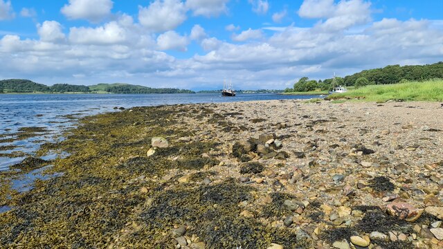
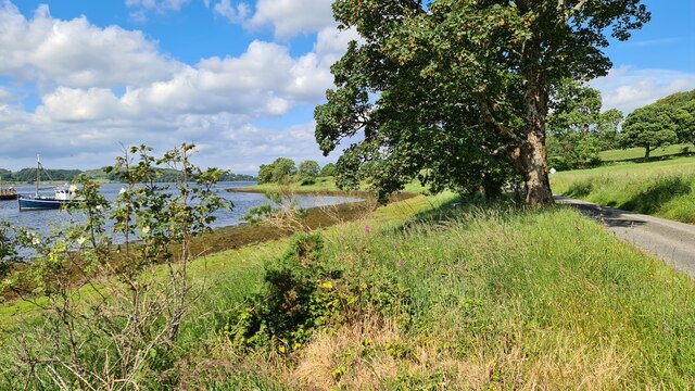
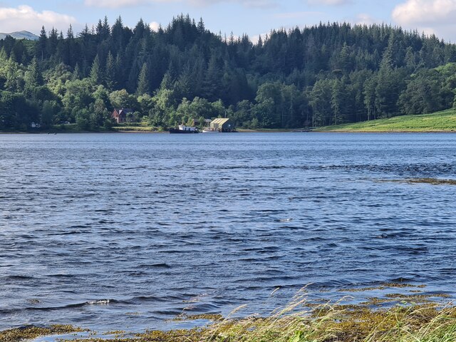
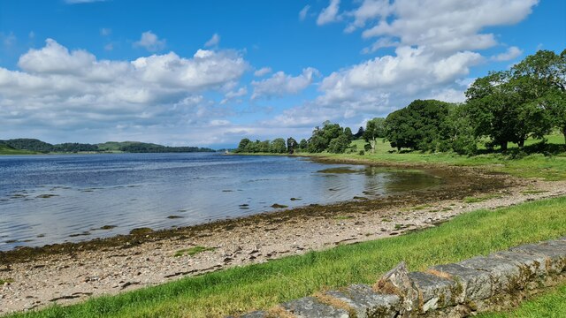
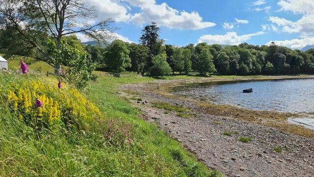
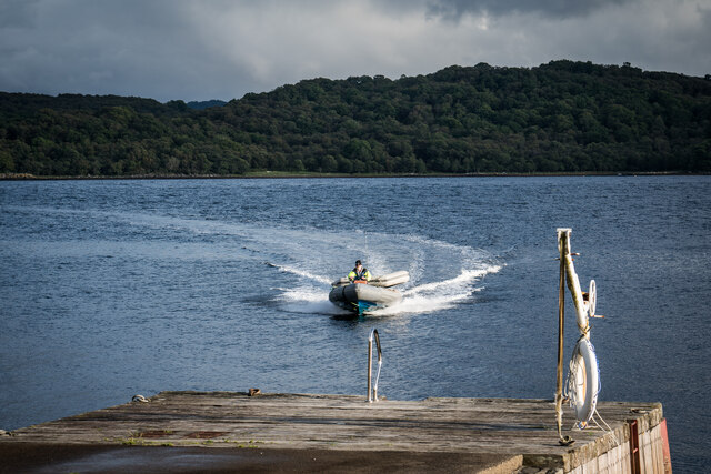
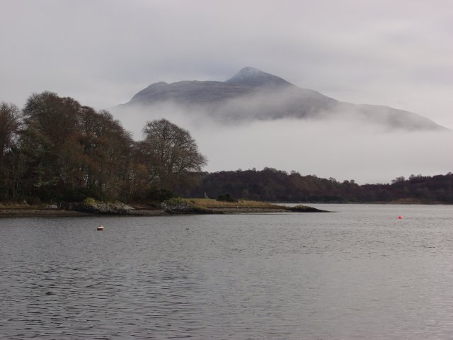
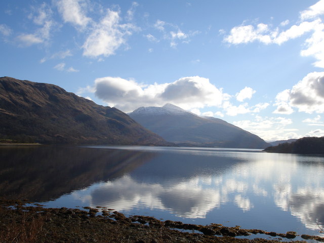
Ardchattan is a small rural village located in the historic county of Argyllshire, Scotland. Situated on the western coast of Scotland, Ardchattan is nestled between the stunning Loch Etive and the picturesque hills of Glen Creran. The village is part of the wider Ardchattan Parish, which encompasses a diverse range of landscapes including forests, lochs, and mountains.

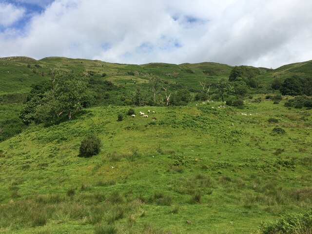
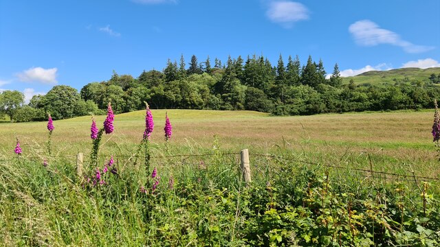
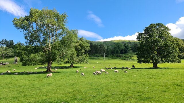
Known for its natural beauty, Ardchattan attracts visitors who enjoy outdoor activities such as hiking, fishing, and birdwatching. The village is surrounded by lush greenery, with several walking trails leading to breathtaking viewpoints and tranquil spots along the loch. Wildlife enthusiasts will find a rich variety of bird species, and may even catch a glimpse of red deer or otters.

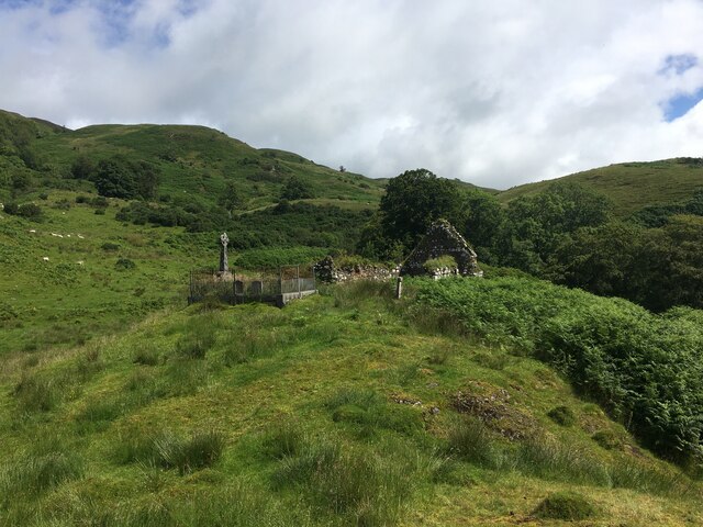
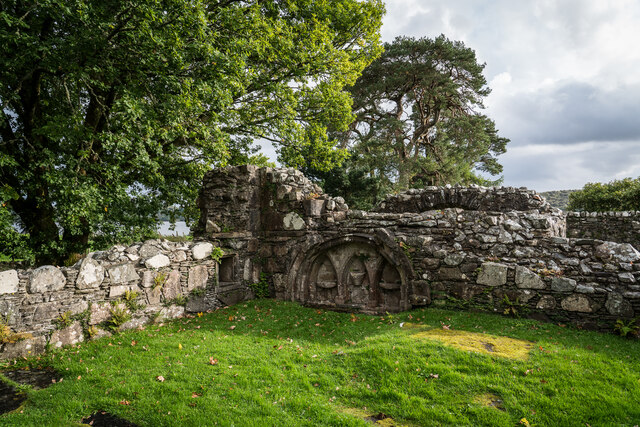
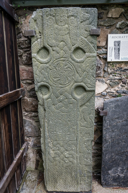
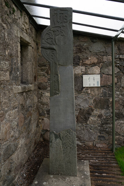
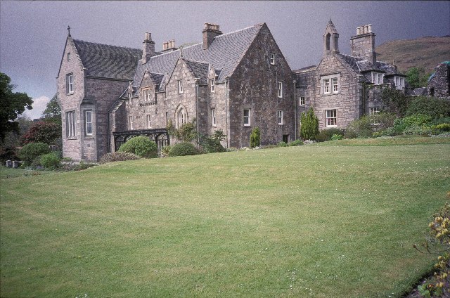
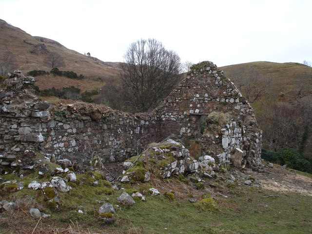
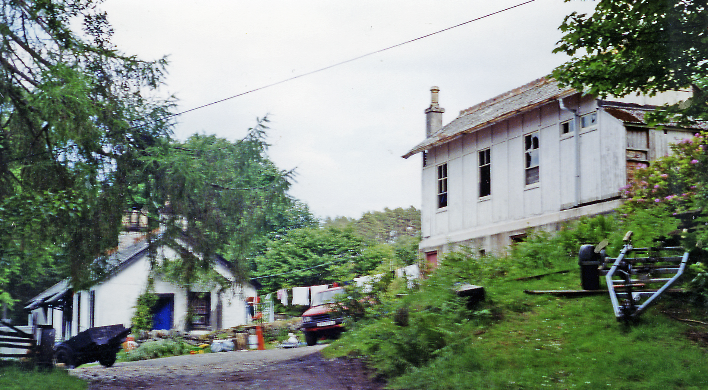
The heart of Ardchattan is dominated by the historic Ardchattan Priory, a well-preserved medieval building that dates back to the 13th century. The priory is a popular attraction, offering visitors a glimpse into Scotland's religious past and its stunning architectural heritage. The village also has a small church, a local pub, and a handful of charming cottages.

Despite its small size, Ardchattan has a strong sense of community, with regular events and gatherings that bring residents and visitors together. The village hosts an annual Highland Games, showcasing traditional Scottish sports and music. The local community center is a hub for various activities and clubs, providing a space for people to come together and socialize.

Ardchattan offers a peaceful and scenic retreat for those seeking a rural getaway in the breathtaking Scottish countryside.

If you have any feedback on the listing, please let us know in the comments section below.

Ardchattan Images

Images are sourced within 2km of 56.46229/-5.295813 or Grid Reference NM9734. Thanks to Geograph Open Source API. All images are credited.

Ruins of St Baodan’s Church
Sheep grazing, Baile Mhaodain
Minor road near Achnacloich
Loch Etive at Rubha Charsalich
Shored of Loch Etive by Rubha Charsalich
Foxgloves beside Loch Etive
Looking across Loch Etive from Rubha Charsalich
Hillside by Baile Mhaodain
Loch Etive shore towards Rubha Charsalich
Loch Etive at Ardchattan
Ardchattan Priory Piscina C15th Ardchattan Priory was established in 1230 or 1231 probably by Duncan MacDougall. Their monastic life came to an end here with the reformation of 1560.

From 1545 the priory was administered by a commendator, John Campbell, who passed it on to his son, Alexander, in 1580, and they have remained with Clan Campbell since.

<span class="nowrap"><a title="https://www.historicenvironment.scot/visit-a-place/places/ardchattan-priory/" rel="nofollow ugc noopener" href="https://www.historicenvironment.scot/visit-a-place/places/ardchattan-priory/">Link</a><img style="margin-left:2px;" alt="External link" title="External link - shift click to open in new window" src="https://s1.geograph.org.uk/img/external.png" width="10" height="10"/></span>

<span class="nowrap"><a title="https://en.wikipedia.org/wiki/Ardchattan_Priory" rel="nofollow ugc noopener" href="https://en.wikipedia.org/wiki/Ardchattan_Priory">Link</a><img style="margin-left:2px;" alt="External link" title="External link - shift click to open in new window" src="https://s1.geograph.org.uk/img/external.png" width="10" height="10"/></span>
Ardchattan Priory Piscina C15th
Ardchattan Priory was established in 1230 or 1231 probably by Duncan MacDougall. Their monastic life came to an end here with the reformation of 1560. From 1545 the priory was administered by a commendator, John Campbell, who passed it on to his son, Alexander, in 1580, and they have remained with Clan Campbell since. LinkExternal link LinkExternal link
Ardchattan Carved Grave Slabs C10th
Loch Etive and Speed Boat
The MacDougall Cross C16th The MacDougall Cross is among the grave markers and carved stones on display. It was commissioned by Prior Eugenius MacDougall in 1500, and carved by John Ó Brolchán, one of an Irish stone-carving family who also carried out work at Iona Abbey. It is one of the few examples of West Highland carving recording the sculptor’s name. The cross depicts:

A crucifixion scene
The Virgin and Child

<span class="nowrap"><a title="https://www.historicenvironment.scot/visit-a-place/places/ardchattan-priory/history/" rel="nofollow ugc noopener" href="https://www.historicenvironment.scot/visit-a-place/places/ardchattan-priory/history/">Link</a><img style="margin-left:2px;" alt="External link" title="External link - shift click to open in new window" src="https://s1.geograph.org.uk/img/external.png" width="10" height="10"/></span>
The MacDougall Cross C16th
The MacDougall Cross is among the grave markers and carved stones on display. It was commissioned by Prior Eugenius MacDougall in 1500, and carved by John Ó Brolchán, one of an Irish stone-carving family who also carried out work at Iona Abbey. It is one of the few examples of West Highland carving recording the sculptor’s name. The cross depicts: A crucifixion scene The Virgin and Child LinkExternal link
Ardchattan Priory
Ardchattan Priory
View of Ben Cruachan from Ardchattan The photograph was taken from a boat on Loch Etive.
View of Ben Cruachan from Ardchattan
The photograph was taken from a boat on Loch Etive.
Loch Etive Loch Etive looking east towards Ben Duirinish and Ben Cruachan
Loch Etive
Loch Etive looking east towards Ben Duirinish and Ben Cruachan
Baile Mhaodain Church, Ardchattan Ruins of old church on hill behind Ardchattan Priory on the shore of Loch Etive
Baile Mhaodain Church, Ardchattan
Ruins of old church on hill behind Ardchattan Priory on the shore of Loch Etive
Show me another place!

Ardchattan is located at Grid Ref: NM9734 (Lat: 56.46229, Lng: -5.295813)

Unitary Authority: Argyll and Bute

Police Authority: Argyll and West Dunbartonshire

What 3 Words

///entire.downcast.generally. Near Oban, Argyll & Bute

Related Wikis

Ardchattan and Muckairn

Ardchattan and Muckairn is a civil parish within Argyll and Bute in Scotland. It lies north of Oban, bordering Loch Etive and includes Glen Ure, Glen Creran...

Ach-na-Cloich railway station

Ach-na-Cloich is a closed railway station located on the south shore of Loch Etive, in Argyll and Bute. Its site is located on the Oban route of the scenic...

Fearnoch

Fearnoch is a small village in Argyll and Bute, Scotland. It is located just off the A85 road, about 2 miles (3 km) west of the village of Taynuilt....

Bonawe

Bonawe (Scots pronunciation: [boˈnɔː]; Scottish Gaelic: Bun Abha [puˈna.ə]) is a village in Ardchattan Parish Argyll and Bute, Scotland opposite Taynuilt...

River Awe

The River Awe (Scottish Gaelic: Uisge Abha) is a short river in the Southwest Highlands of Scotland by which the freshwater Loch Awe empties into Loch...

Taynuilt railway station

Taynuilt railway station is a railway station serving the village of Taynuilt in western Scotland. This station is on the Oban branch of the West Highland...
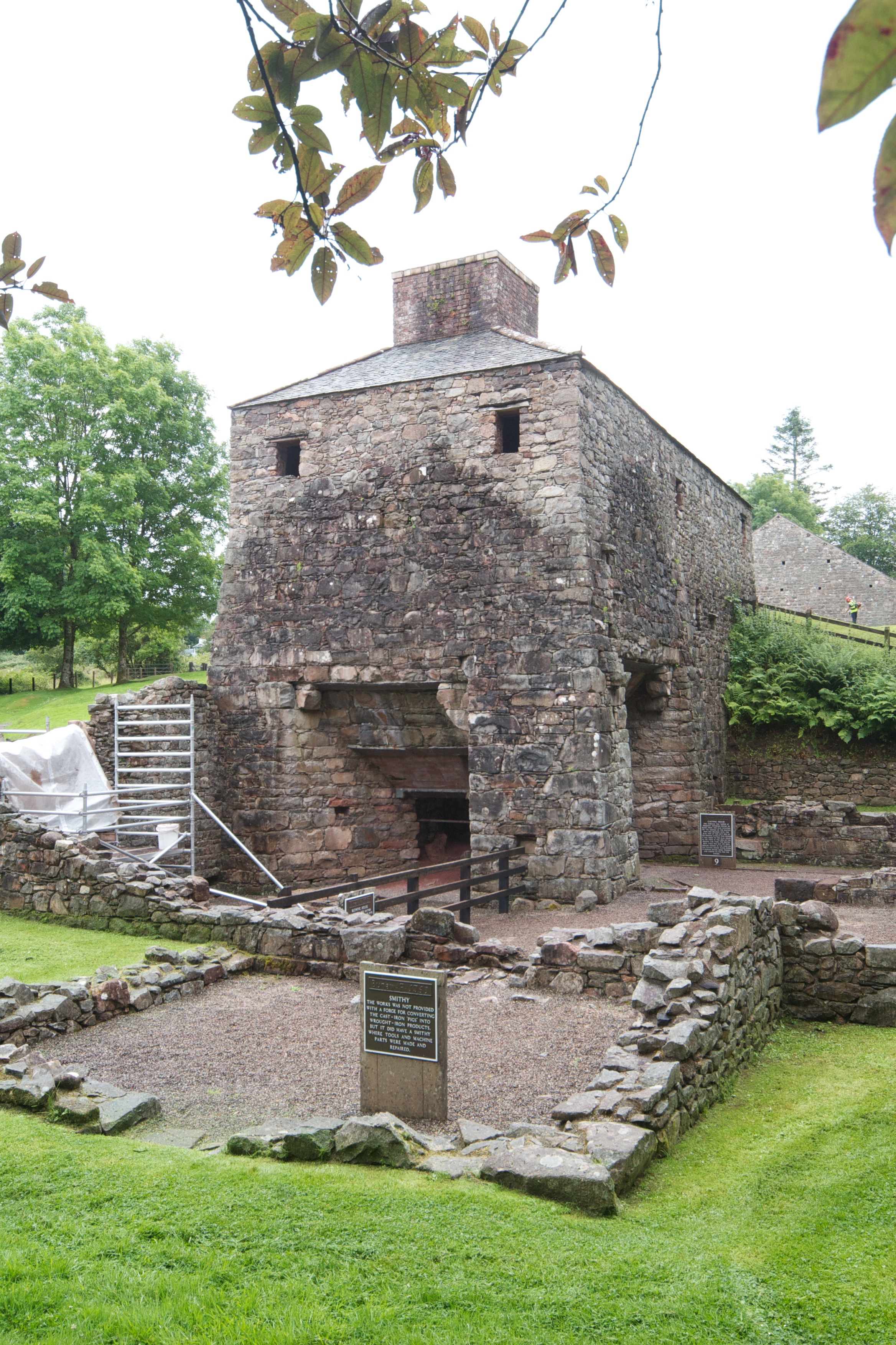
Bonawe Iron Furnace

The Bonawe Iron Furnace (also called the Lorn Furnace), was an industrial complex located in Bonawe, Lorn District, Scotland. It operated in the middle...

Taynuilt

Taynuilt (Scots: [ˈtɛinəlt]; Scottish Gaelic: Taigh an Uillt [t̪ʰɤj ən̪ˠ ˈɯiʎtʲ], meaning 'the house by the stream') is a large village in Argyll and Bute...

Nearby Amenities

Located within 500m of 56.46229,-5.295813
Power: pole
Lat/Long: 56.4647997/-5.3016182
Power: pole
Lat/Long: 56.4646766/-5.3003687
Power: pole
Lat/Long: 56.4646039/-5.2991425
Power: pole
Lat/Long: 56.46455/-5.2976829
Power: pole
Lat/Long: 56.4645008/-5.2966391
Power: pole
Lat/Long: 56.4644469/-5.295502
Power: pole
Lat/Long: 56.4642008/-5.294034
Power: pole
Lat/Long: 56.4640367/-5.2929393
Power: pole
Lat/Long: 56.4638034/-5.2916409
Power: pole
Lat/Long: 56.4636253/-5.2905505
Power: pole
Lat/Long: 56.4634471/-5.2895195
Power: pole
Lat/Long: 56.4632901/-5.2885181
Post Box
Lat/Long: 56.4622501/-5.2912938
The data included in this document is from www.openstreetmap.org. The data is made available under ODbL.

Have you been to Ardchattan?

Leave your review of Ardchattan below (or comments, questions and feedback).