Appietown

Settlement in Orkney

Scotland

Appietown

Sports field and car park at Harray
Sports field and car park at Harray Credit: David Medcalf

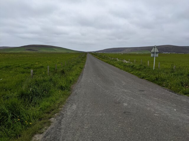
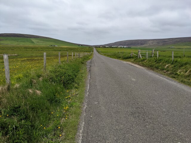
Appietown is a small settlement located in the Orkney Islands, an archipelago situated off the northeastern coast of Scotland. It is situated on the Mainland, the largest island in the Orkney group.

With a population of around 200 residents, Appietown is a peaceful and tight-knit community. The settlement is predominantly residential, with houses scattered across the picturesque landscape. The area is surrounded by rolling hills, green pastures, and stunning coastal views, offering residents a tranquil and idyllic living environment.

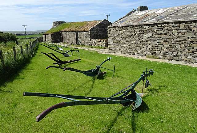
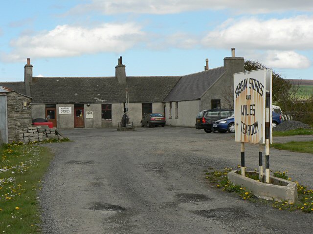
Despite its small size, Appietown benefits from a few amenities that cater to the needs of its residents. The settlement has a small convenience store where locals can purchase essential groceries and household items. There is also a community center that serves as a gathering place for social events, meetings, and various activities.

Appietown is well-connected to other parts of the island. The nearby town of Kirkwall, situated about 8 miles southwest, serves as the main hub for transportation, commerce, and services. Residents of Appietown can easily access Kirkwall by road, which provides them with access to a wider range of facilities, such as schools, healthcare centers, and a broader selection of shops and restaurants.

With its stunning natural beauty, close-knit community, and convenient location, Appietown offers a peaceful and charming place to call home in the enchanting Orkney Islands.

If you have any feedback on the listing, please let us know in the comments section below.

Appietown Images

Images are sourced within 2km of 59.041522/-3.1924598 or Grid Reference HY3117. Thanks to Geograph Open Source API. All images are credited.

Sports field and car park at Harray
Cattle grazing near the minor road Cyclists are rare enough for the cow to be curious.
Cattle grazing near the minor road
Cyclists are rare enough for the cow to be curious.
A power distribution pole in the rough field
A bungalow near Overhouse
Housing near Jubadie
A green tunnel at Harray Trees aren't common on Orkney, so this sight is especially unusual.
A green tunnel at Harray
Trees aren't common on Orkney, so this sight is especially unusual.
The road junction at Bimbister
A straight section of road at Harray
The road near Eastaquoy
Harray Church
Harray Church
Approaching Harray Kirk The plain grey kirk at Harray stands on a hill, making it a prominent landmark.
Approaching Harray Kirk
The plain grey kirk at Harray stands on a hill, making it a prominent landmark.
Extended Cottage at Appletown A row of old cottages benefits from a modern extension with a fine view.
Extended Cottage at Appletown
A row of old cottages benefits from a modern extension with a fine view.
Harray Kirk The severely plain kirk is hardly enhanced by the modern extension.
Harray Kirk
The severely plain kirk is hardly enhanced by the modern extension.
Corrigall Farm Museum Some of the traditional buildings making up the museum at Corrigall.
Corrigall Farm Museum
Some of the traditional buildings making up the museum at Corrigall.
Corrigall Farm Museum A display of old agricultural implements outside the main buildings at Corrigall Farm Museum.
Corrigall Farm Museum
A display of old agricultural implements outside the main buildings at Corrigall Farm Museum.
Drying Kiln The circular building at the end of the buildings at Corrigall Farm Museum was used for drying grain.
Drying Kiln
The circular building at the end of the buildings at Corrigall Farm Museum was used for drying grain.
Modern Stone Circle The garden of a new house at Harray contains a small circle of five standing stones.
Modern Stone Circle
The garden of a new house at Harray contains a small circle of five standing stones.
Ruined farm buildings near Bimbister Overlooking grazing land.
Ruined farm buildings near Bimbister
Overlooking grazing land.
Show me another place!

Appietown is located at Grid Ref: HY3117 (Lat: 59.041522, Lng: -3.1924598)

Unitary Authority: Orkney Islands

Police Authority: Highlands and Islands

What 3 Words

///cackling.finders.orbit. Near Harray, Orkney Islands

Nearby Locations

Appietown

Related Wikis

Harray

Harray (pronounced ) (Old Norse: Herað; Norn: Herrað) is a parish on Mainland, Orkney, Scotland. It has the unique distinction of being the only parish...

Loch of Bosquoy

The Loch of Bosquoy is a small, shallow, rhomboid shaped loch on Mainland, Orkney, Scotland situated just off the north east corner of the Loch of Harray...

Bimbister

Bimbister is a village on the Orkney Islands, Scotland. The A986 is the main road through the village. The Bronze Age cemetery, the Knowes of Trotty, which...

Knowes of Trotty

The Knowes of Trotty is a Bronze Age cemetery located in Mainland, Orkney in Scotland. The ancient site consists of a group of twelve surviving burial...

Nearby Amenities

Located within 500m of 59.041522,-3.1924598
Harray Parish War Memorial
Historic: memorial
Lat/Long: 59.0426161/-3.197877
Place Of Worship
Harray Parish Church
Religion: christian
Lat/Long: 59.0425611/-3.1972484
Harray
Name En: Harray
Name Non: Herað
Name Nrn: Herrað
Place: village
Wikidata: Q5663885
Wikipedia: en:Harray
Lat/Long: 59.0393189/-3.1898874
Power: pole
Lat/Long: 59.039918/-3.1848095
Power: pole
Lat/Long: 59.0406341/-3.1854602
Power: pole
Lat/Long: 59.0413329/-3.1860902
Power: pole
Lat/Long: 59.0418824/-3.1865516
Power: pole
Lat/Long: 59.0424865/-3.1870831
Power: pole
Lat/Long: 59.0431626/-3.1876456
Power: pole
Lat/Long: 59.0438214/-3.1882108
Power: pole
Lat/Long: 59.0445068/-3.1887656
Power: pole
Lat/Long: 59.0451695/-3.1893203
Power: pole
Lat/Long: 59.0457669/-3.1898466
Power: pole
Lat/Long: 59.038691/-3.1878498
Power: pole
Lat/Long: 59.0384669/-3.1862554
Power: pole
Lat/Long: 59.0413343/-3.1884934
Power: pole
Lat/Long: 59.041437/-3.187446
Power: pole
Lat/Long: 59.0422625/-3.185792
Power: pole
Lat/Long: 59.0426158/-3.1850428
Power: pole
Lat/Long: 59.0429572/-3.1843377
Power: pole
Lat/Long: 59.0404674/-3.2002753
Power: pole
Lat/Long: 59.0405675/-3.1993343
Power: pole
Lat/Long: 59.0405995/-3.1979447
Power: pole
Lat/Long: 59.0406248/-3.1968896
Power: pole
Lat/Long: 59.0406435/-3.1957697
Power: pole
Lat/Long: 59.0407128/-3.1949893
Power: pole
Lat/Long: 59.0407848/-3.1941442
Power: pole
Lat/Long: 59.0408862/-3.1929335
Power: pole
Lat/Long: 59.0409929/-3.1917384
Power: pole
Lat/Long: 59.0411582/-3.1907896
Power: pole
Lat/Long: 59.0410196/-3.1945694
Power: pole
Lat/Long: 59.041525/-3.1954327
Power: pole
Lat/Long: 59.0420491/-3.1963296
Defibrillator
Defibrillator Location: Harray Community Centre. External wall. Right hand side of entrance.
Emergency: defibrillator
Indoor: no
Lat/Long: 59.0390027/-3.1879243
The data included in this document is from www.openstreetmap.org. The data is made available under ODbL.

Have you been to Appietown?

Leave your review of Appietown below (or comments, questions and feedback).