Alltan an t-Salainn

Settlement in Ross-shire

Scotland

Alltan an t-Salainn

Sleeping trees by the A9
Sleeping trees by the A9 Credit: Peter Moore

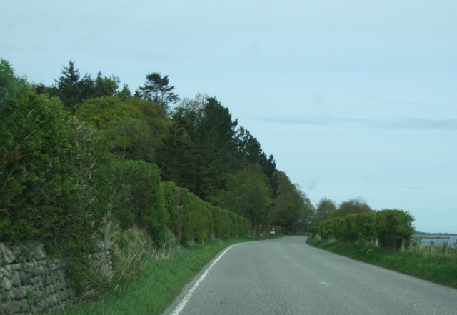
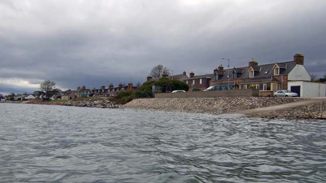
Alltan an t-Salainn is a small village located in the county of Ross-shire in the Highlands of Scotland. Situated near the eastern coastline, the village is nestled between the towns of Tain and Invergordon. With a population of around 200 residents, it offers a tranquil and picturesque setting for those seeking a peaceful retreat.

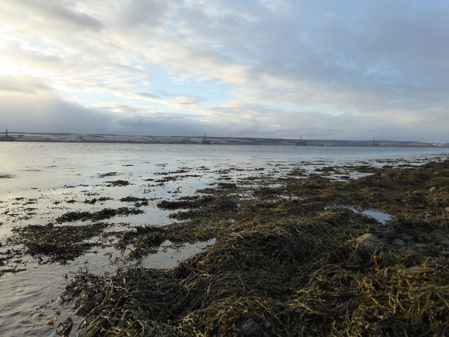
The name Alltan an t-Salainn derives from Scottish Gaelic, meaning "the saltwater burn." This is in reference to the nearby stream that flows into the neighboring Cromarty Firth, offering stunning views of the water and surrounding landscapes.

The village itself is made up of a cluster of traditional stone houses, some of which date back to the 19th century. Many of these houses have been lovingly restored, retaining their original charm and character. The local community takes great pride in maintaining the village's heritage and preserving its unique atmosphere.

Despite its small size, Alltan an t-Salainn has a strong sense of community spirit. The village boasts a community center, which serves as a hub for social gatherings and events throughout the year. Residents can also enjoy the nearby recreational facilities, including walking trails, cycling routes, and fishing spots.

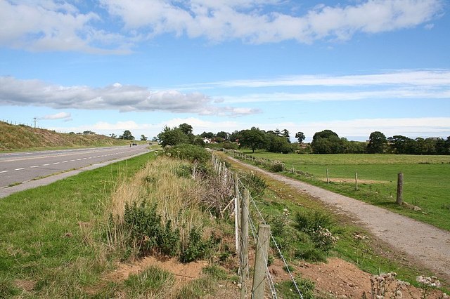
For amenities and services, residents typically rely on the neighboring towns of Tain and Invergordon, where they can find a range of shops, supermarkets, and healthcare facilities. Additionally, Alltan an t-Salainn is conveniently located near the A9 road, providing easy access to other parts of the region.

Overall, Alltan an t-Salainn offers a tranquil and close-knit community, surrounded by breathtaking natural beauty, making it an ideal place for those seeking a peaceful and picturesque lifestyle in the Scottish Highlands.

If you have any feedback on the listing, please let us know in the comments section below.

Alltan an t-Salainn Images

Images are sourced within 2km of 57.699584/-4.1411208 or Grid Reference NH7269. Thanks to Geograph Open Source API. All images are credited.

Sleeping trees by the A9
A9 near Broomhill
A9 near Broomhill
Coastal road (B817) Heading north east towards Balintraid.
Coastal road (B817)
Heading north east towards Balintraid.
Nearing Balintraid Heading north east on the B817.
Nearing Balintraid
Heading north east on the B817.
Cattle, Broomhill
Cattle, Broomhill
Seaweed covered rocks on the foreshore at Balintraid Pier
Sea defences near Balintraid Pier
View over fields at Broomhill A cruise ship is at the Invergordon pier.
View over fields at Broomhill
A cruise ship is at the Invergordon pier.
Fields beside the A9 Seen from the lay-by near Broomhill.
Fields beside the A9
Seen from the lay-by near Broomhill.
Fields beside the A9 Seen from the lay-by near Broomhill.
Fields beside the A9
Seen from the lay-by near Broomhill.
Lay-by on the A9 Near Broomhill.
Lay-by on the A9
Near Broomhill.
Stacked timber An entire forest-worth of timber is stacked on a disused car park at the entrance to Cromarty Firth Industrial Park.
Stacked timber
An entire forest-worth of timber is stacked on a disused car park at the entrance to Cromarty Firth Industrial Park.
Cromarty Firth Business Park A large area of apparently un-used grassland lies between the several vast warehouse-style buildings that form this business park.
Cromarty Firth Business Park
A large area of apparently un-used grassland lies between the several vast warehouse-style buildings that form this business park.
Industrial building, Cromarty Firth Industrial Park
Arable land at Ord
Arable land at Ord
Boundary wall northwest of Balintraid
Arable land north of Balintraid
Broomhill Farm along the A9. Evidence of the old road still remains.
Broomhill Farm along the A9.
Evidence of the old road still remains.
Show me another place!

Alltan an t-Salainn is located at Grid Ref: NH7269 (Lat: 57.699584, Lng: -4.1411208)

Unitary Authority: Highland

Police Authority: Highlands and Islands

Also known as: Saltburn

What 3 Words

///evenings.indicate.putts. Near Invergordon, Highland

Related Wikis

Saltburn, Ross and Cromarty

Saltburn (Scottish Gaelic: Allt an t-Salainn) is a long linear coastal village, which is situated on the northern shore of the Cromarty Firth, in Ross...

County Community Hospital, Invergordon

County Community Hospital is a health facility in Saltburn Road, Invergordon, Scotland. It is managed by NHS Highland. == History == The facility has its...

Invergordon distillery

Invergordon distillery is a grain whisky distillery located at Invergordon in Easter Ross, in Ross and Cromarty, Highland, Scotland. The distillery is...

Ben Wyvis distillery

Ben Wyvis distillery was a producer of single malt Scotch whisky that operated between 1965 and 1977. == History == The first distillery to use the name...

Balintraid

Balintraid (Scottish Gaelic: Baile na Tràghad) is an industrial settlement, which was built largely in the 1970s with the growth of the North Sea oil...

Invergordon

Invergordon (; Scottish Gaelic: Inbhir Ghòrdain or An Rubha) is a town and port in Easter Ross, in Ross and Cromarty, Highland, Scotland. It lies in the...

Invergordon F.C.

Invergordon Football Club are a senior football club from Invergordon in the Scottish Highlands. They compete in the North Caledonian Football League and...

Invergordon Town Hall

Invergordon Town Hall is a municipal building in the High Street in Invergordon in the Highland area of Scotland. The structure, which is used as a community...

Nearby Amenities

Located within 500m of 57.699584,-4.1411208
Source: PGS
Lat/Long: 57.6962169/-4.1460923
Source: PGS
Lat/Long: 57.6964279/-4.1458608
Source: PGS
Lat/Long: 57.6967796/-4.1453306
Source: PGS
Lat/Long: 57.6970799/-4.1446868
Source: PGS
Lat/Long: 57.6972089/-4.1444508
Source: PGS
Lat/Long: 57.6973399/-4.1442168
Source: PGS
Lat/Long: 57.6974689/-4.1439808
Source: PGS
Lat/Long: 57.6976453/-4.1438484
Source: PGS
Lat/Long: 57.697936/-4.1434434
Source: PGS
Lat/Long: 57.6983887/-4.1426446
Source: PGS
Lat/Long: 57.6986369/-4.1423448
Source: PGS
Lat/Long: 57.6987659/-4.1421088
Source: PGS
Lat/Long: 57.6988969/-4.1418748
Source: PGS
Lat/Long: 57.6990269/-4.1416388
Source: PGS
Lat/Long: 57.6991569/-4.1414048
Source: PGS
Lat/Long: 57.6992869/-4.1411688
Source: PGS
Lat/Long: 57.6994179/-4.1409348
Source: PGS
Lat/Long: 57.6995469/-4.1406988
Source: PGS
Lat/Long: 57.6996779/-4.1404648
Source: PGS
Lat/Long: 57.6998069/-4.1402288
Source: PGS
Lat/Long: 57.6999379/-4.1399948
Source: PGS
Lat/Long: 57.7000679/-4.1397588
Source: PGS
Lat/Long: 57.7001979/-4.1395248
Source: PGS
Lat/Long: 57.7003279/-4.1392888
Source: PGS
Lat/Long: 57.7004589/-4.1390548
Source: PGS
Lat/Long: 57.7005879/-4.1388188
Source: PGS
Lat/Long: 57.7007189/-4.1385848
Source: PGS
Lat/Long: 57.7008479/-4.1383488
Source: PGS
Lat/Long: 57.7009789/-4.1381148
Source: PGS
Lat/Long: 57.7011089/-4.1378788
Source: PGS
Lat/Long: 57.7012389/-4.1376448
Source: PGS
Lat/Long: 57.7013689/-4.1374088
Source: PGS
Lat/Long: 57.7014999/-4.1371748
Source: PGS
Lat/Long: 57.7016289/-4.1369388
Source: PGS
Lat/Long: 57.7017599/-4.1367048
Source: PGS
Lat/Long: 57.7020898/-4.1361325
Source: PGS
Lat/Long: 57.7024099/-4.1355288
Source: PGS
Lat/Long: 57.7025409/-4.1352938
Bus Stop
Saltburn
Bus: yes
Naptan AtcoCode: 6700713092A
Naptan Bearing: SW
Naptan CommonName: Saltburn
Naptan Indicator: beside Smelter Jetty
Naptan Landmark: Smelter Jetty
Naptan NaptanCode: 45323632
Naptan Street: Saltburn Road
Naptan Verified: no
Public Transport: platform
Source: naptan_import
Lat/Long: 57.6975654/-4.1442812
Bus Stop
Saltburn
Bus: yes
Naptan AtcoCode: 6700713092B
Naptan Bearing: NE
Naptan CommonName: Saltburn
Naptan Indicator: opp Smelter Jetty
Naptan Landmark: Smelter Jetty
Naptan NaptanCode: 45323629
Naptan Street: Saltburn Road
Naptan Verified: no
Public Transport: platform
Source: naptan_import
Lat/Long: 57.6976964/-4.1445071
Bus Stop
Saltburn
Bus: yes
Naptan AtcoCode: 6700713092C
Naptan Bearing: NE
Naptan CommonName: Saltburn
Naptan Indicator: o/s Post Office
Naptan Landmark: Post Office
Naptan NaptanCode: 45323628
Naptan Street: B817
Naptan Verified: no
Public Transport: platform
Source: naptan_import
Lat/Long: 57.6999344/-4.1407458
Bus Stop
Saltburn
Bench: yes
Bin: yes
Bus: yes
Lit: yes
Naptan AtcoCode: 6700713092D
Naptan Bearing: SW
Naptan CommonName: Saltburn
Naptan Indicator: opp Post Office
Naptan Landmark: Post Office
Naptan NaptanCode: 45323627
Naptan Street: B817
Naptan Verified: no
Public Transport: platform
Shelter: yes
Source: naptan_import
Tactile Paving: no
Lat/Long: 57.6997768/-4.1405016
Bus Stop
Saltburn
Bench: yes
Bin: yes
Bus: yes
Lit: yes
Naptan AtcoCode: 6700713092E
Naptan Bearing: SW
Naptan CommonName: Saltburn
Naptan Indicator: Bus Shelter opp No 77
Naptan Landmark: No 77 Saltburn Road
Naptan NaptanCode: 45323685
Naptan Street: B817
Naptan Verified: no
Public Transport: platform
Shelter: yes
Source: naptan_import
Tactile Paving: no
Lat/Long: 57.7019826/-4.1365197
Bus Stop
Saltburn
Bus: yes
Naptan AtcoCode: 6700713092F
Naptan Bearing: NE
Naptan CommonName: Saltburn
Naptan Indicator: o/s No 77
Naptan Landmark: No 77 Saltburn Road
Naptan NaptanCode: 45323639
Naptan Street: B817
Naptan Verified: no
Public Transport: platform
Source: naptan_import
Lat/Long: 57.7022721/-4.1364025
Telephone
Booth: KX100
Check Date: 2021-07-10
Covered: booth
Source: survey
Lat/Long: 57.6998875/-4.1407567
Post Box
Post Box Type: lamp
Source: survey
Lat/Long: 57.6998133/-4.1409016
Saltburn
Place: suburb
Lat/Long: 57.6996333/-4.1421824
Railway: level_crossing
Lat/Long: 57.7032559/-4.1458557
Bench
Lat/Long: 57.6979781/-4.1480932
Bench
Lat/Long: 57.6978248/-4.1485873
Power: pole
Lat/Long: 57.7022862/-4.1382129
Power: pole
Lat/Long: 57.703172/-4.1456949
Power: pole
Lat/Long: 57.7031437/-4.1457416
Power: pole
Lat/Long: 57.7024798/-4.1468827
Power: pole
Lat/Long: 57.7018452/-4.1479872
Power: pole
Lat/Long: 57.7013168/-4.1488806
The data included in this document is from www.openstreetmap.org. The data is made available under ODbL.

Have you been to Alltan an t-Salainn?

Leave your review of Alltan an t-Salainn below (or comments, questions and feedback).