Aigburth Vale

Settlement in Lancashire

England

Aigburth Vale

Mather Avenue at Greenhill Road, Liverpool
Mather Avenue at Greenhill Road, Liverpool Credit: Ian S

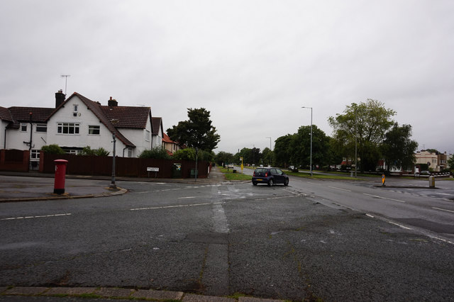
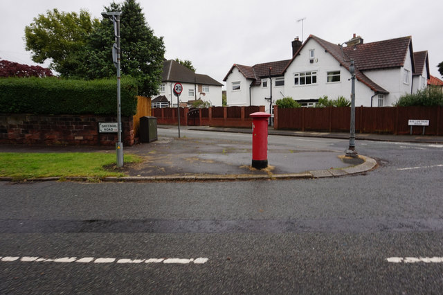
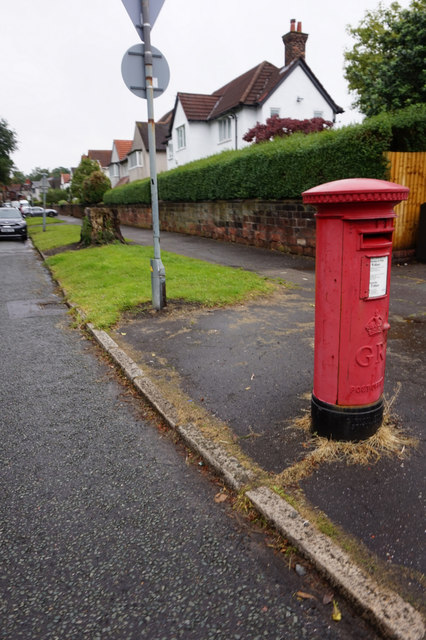
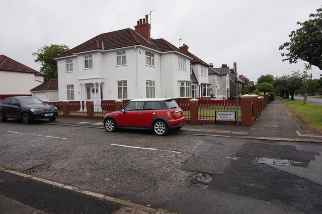
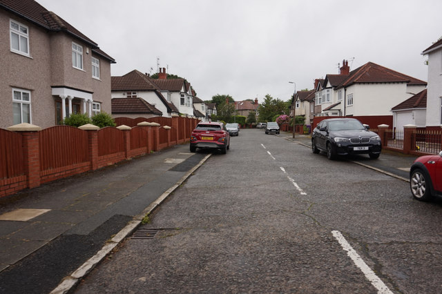
Aigburth Vale is a small village located in Lancashire, England. Situated in the southern part of the county, it is nestled in the picturesque countryside, offering residents and visitors a tranquil and idyllic setting. The village is part of the larger borough of Sefton, within the metropolitan county of Merseyside.

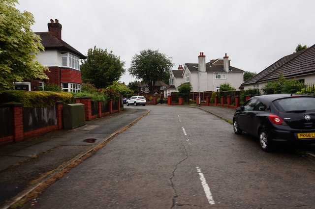
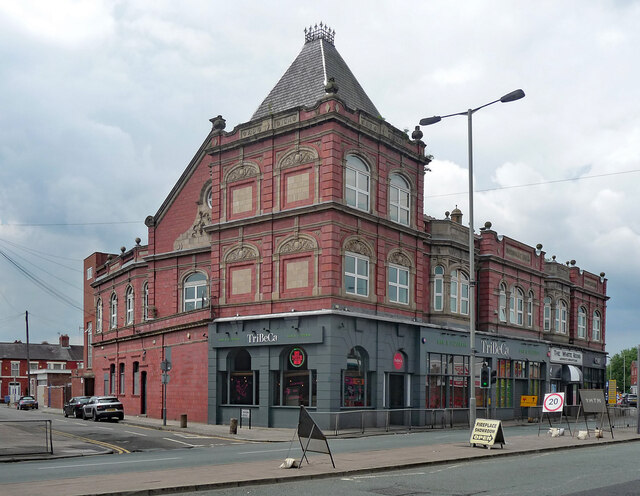
One of the defining features of Aigburth Vale is its charming architecture. The village is known for its well-preserved historic buildings, with many dating back to the Victorian era. These architectural gems add character and beauty to the village's streets and create a sense of heritage.

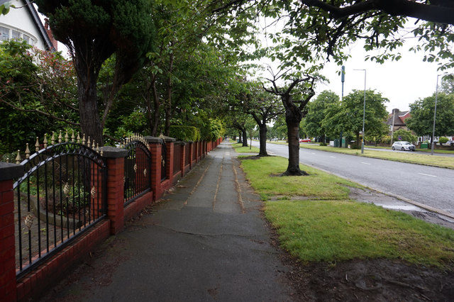
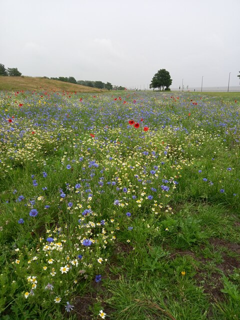
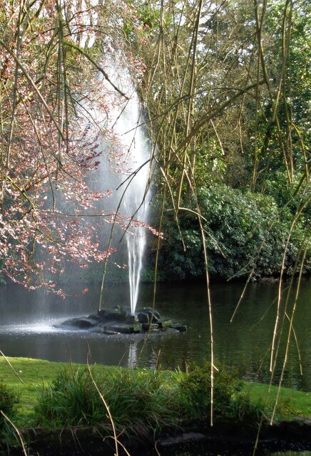
Nature lovers will find plenty to enjoy in Aigburth Vale. The village is surrounded by lush green fields and woodlands, providing ample opportunities for outdoor activities such as walking, hiking, and birdwatching. The nearby River Mersey also offers a scenic backdrop and is a popular spot for boating and fishing enthusiasts.

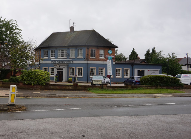
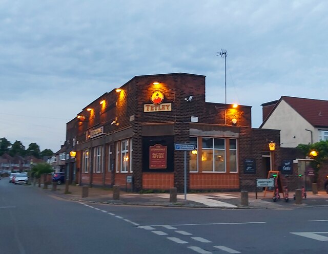
Aigburth Vale boasts a close-knit community, with a range of amenities to cater to residents' needs. The village has a local pub, a small convenience store, and a primary school, ensuring that daily essentials are easily accessible. For more extensive shopping and entertainment options, the bustling city of Liverpool is just a short drive away.

Overall, Aigburth Vale offers a peaceful and picturesque escape from the hustle and bustle of city life. With its charming architecture, natural beauty, and strong sense of community, it is a place that appeals to those seeking a laid-back and traditional English village experience.

If you have any feedback on the listing, please let us know in the comments section below.

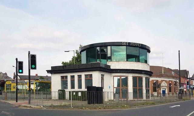
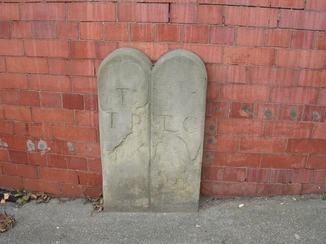
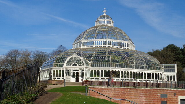
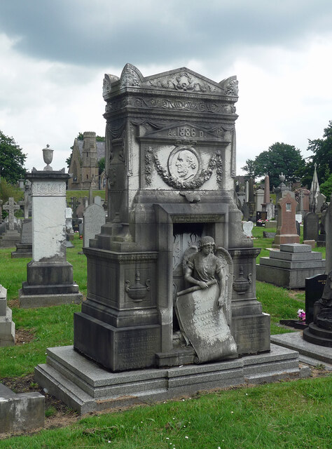
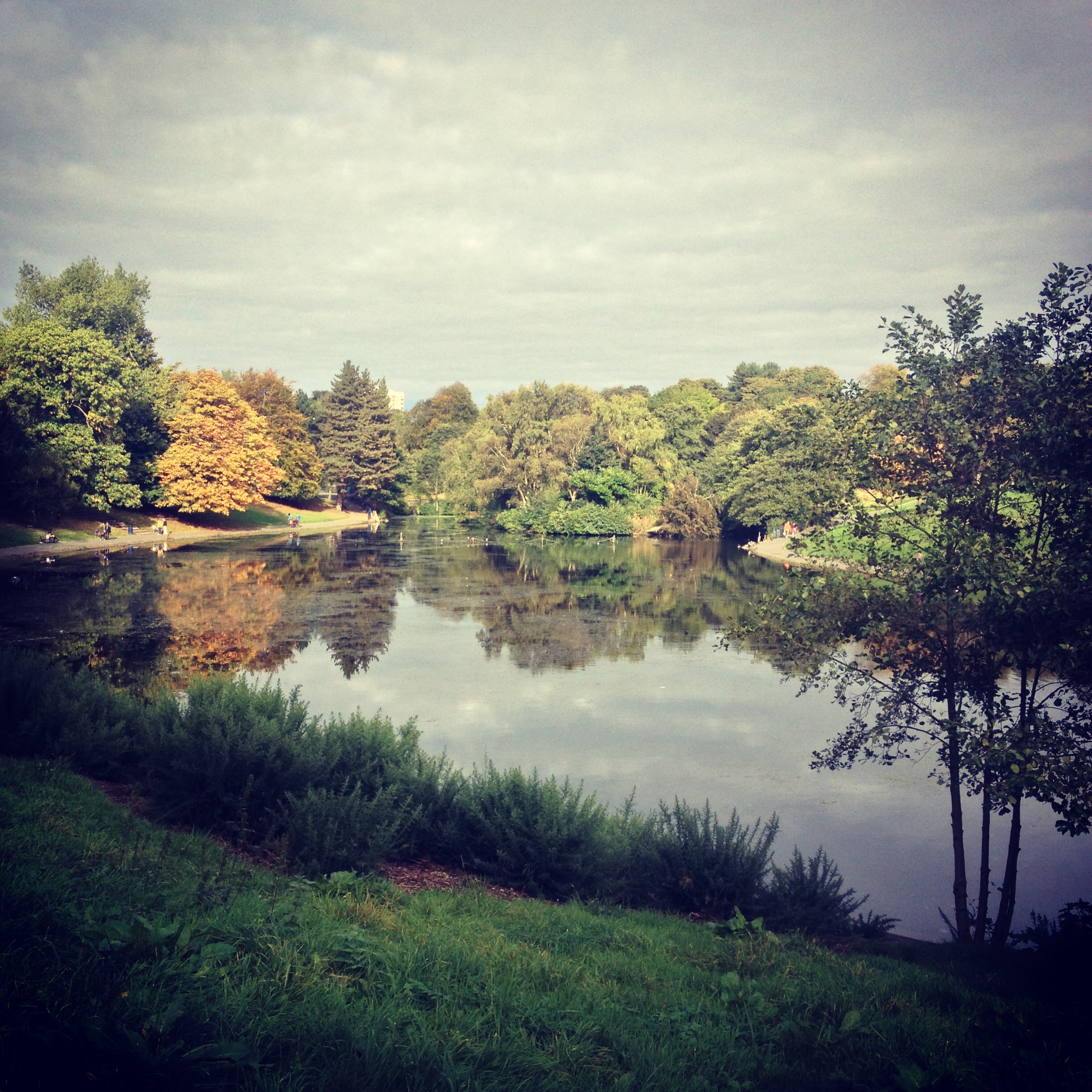
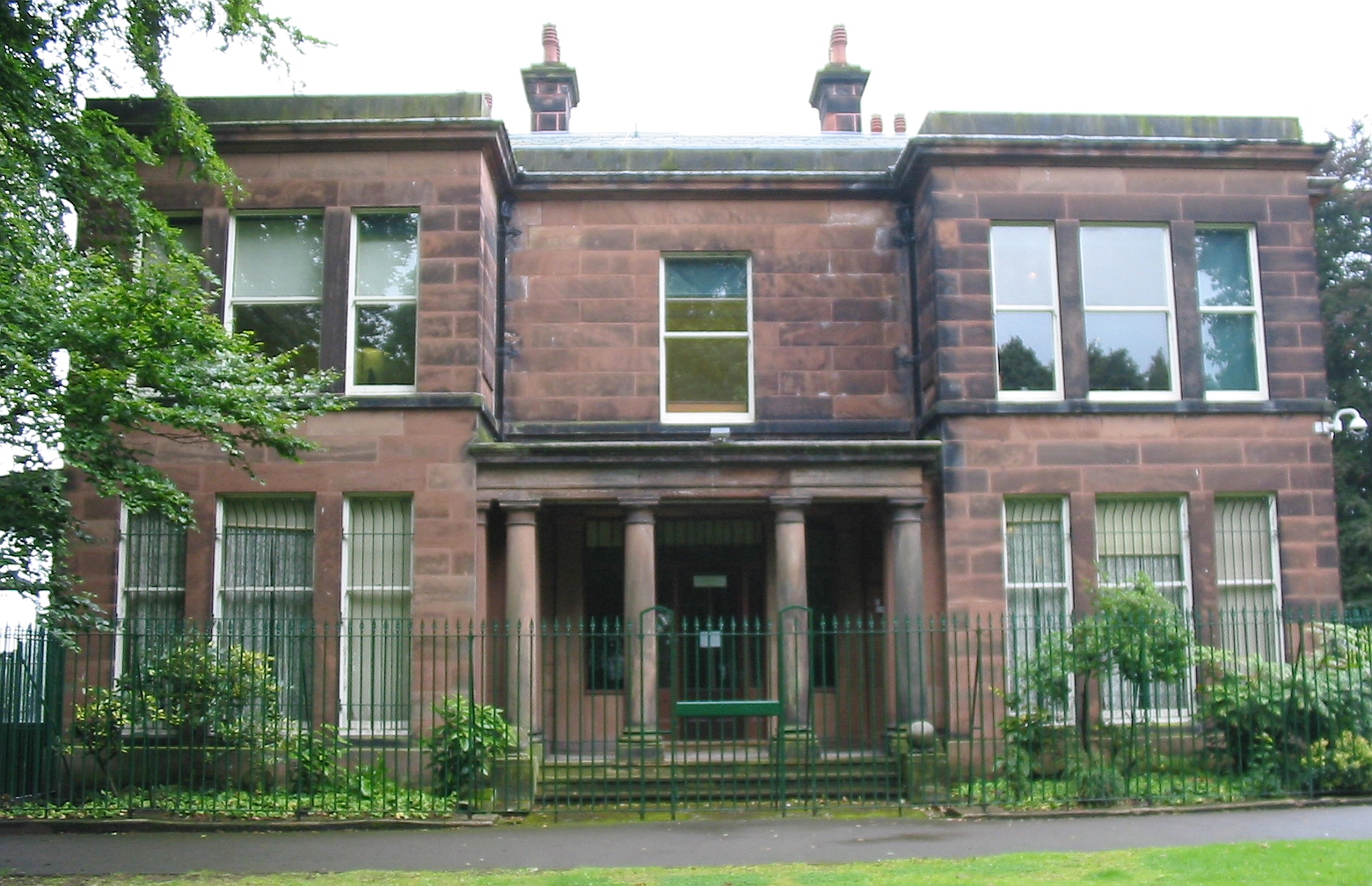
Aigburth Vale Images

Images are sourced within 2km of 53.377283/-2.930603 or Grid Reference SJ3887. Thanks to Geograph Open Source API. All images are credited.

Mather Avenue at Greenhill Road, Liverpool
Postbox on Greenhill Road, Liverpool
Greenhill Road, Liverpool
Mather Avenue at Burnham Road, Liverpool
Burnham Road off Mather Avenue, Liverpool
Mather Avenue, Liverpool
Gressingham Road off Mather Avenue, Liverpool
The Greenhills A public house on Greenhill Road, Liverpool.
The Greenhills
A public house on Greenhill Road, Liverpool.
Bus at Penny Lane bus terminus - 1968 Route 99 was one of the first in Liverpool to be converted to one-person-operation, using Leyland Panthers with MCW bodywork. 1023 is one of these and was brand new at the time.

It is standing on Church Road outside the impressive Welsh Methodist Church. This was demolished around 2010, leaving just the entrance steps as a reminder. See <span class="nowrap"><a title="https://goo.gl/maps/J1GuBwzyKwiJbPNA8" rel="nofollow ugc noopener" href="https://goo.gl/maps/J1GuBwzyKwiJbPNA8">Link</a><img style="margin-left:2px;" alt="External link" title="External link - shift click to open in new window" src="https://s1.geograph.org.uk/img/external.png" width="10" height="10"/></span> and <span class="nowrap"><a title="https://goo.gl/maps/Jj5rmVC4NgXHgsGo8" rel="nofollow ugc noopener" href="https://goo.gl/maps/Jj5rmVC4NgXHgsGo8">Link</a><img style="margin-left:2px;" alt="External link" title="External link - shift click to open in new window" src="https://s1.geograph.org.uk/img/external.png" width="10" height="10"/></span>

This is one of a series of views featuring buses in the 60s, 70s, and 80s. <a title="https://www.geograph.org.uk/search.php?i=137652761" href="https://www.geograph.org.uk/search.php?i=137652761">Link</a>
Bus at Penny Lane bus terminus - 1968
Route 99 was one of the first in Liverpool to be converted to one-person-operation, using Leyland Panthers with MCW bodywork. 1023 is one of these and was brand new at the time. It is standing on Church Road outside the impressive Welsh Methodist Church. This was demolished around 2010, leaving just the entrance steps as a reminder. See LinkExternal link and LinkExternal link This is one of a series of views featuring buses in the 60s, 70s, and 80s. Link
Wavertree: 'The shelter in the middle of a roundabout' Behind which a pretty nurse is selling poppies from a tray....

Anyway this structure was once the bus shelter and public conveniences in Smithdown Place at the north-eastern end of Penny Lane. It has since been converted into Sgt Pepper's Bistro, but was closed at the time of the photograph. 

Comparing this image with Sue Adair's from August 2005 <a href="https://www.geograph.org.uk/photo/44596">SJ3988 : Penny Lane</a> it is evident that the circular glass fronted first floor room has been added since.

A review of Street View images shows that it was not present in October 2012 but largely complete by July 2015.
Wavertree: 'The shelter in the middle of a roundabout'
Behind which a pretty nurse is selling poppies from a tray.... Anyway this structure was once the bus shelter and public conveniences in Smithdown Place at the north-eastern end of Penny Lane. It has since been converted into Sgt Pepper's Bistro, but was closed at the time of the photograph. Comparing this image with Sue Adair's from August 2005 SJ3988 : Penny Lane it is evident that the circular glass fronted first floor room has been added since. A review of Street View images shows that it was not present in October 2012 but largely complete by July 2015.
Old Boundary Marker on Ashfield Road, Aigburth Vale Parish Boundary Marker against the brick wall of Boots on the north side of the crossroads of the A561 Aigburth Road and the A5058 Ashfield Road, Liverpool 17. Inscribed T / T P │ T G (Township of Toxteth Park and Township of Garston) and possibly dates from 1866 when Garston was made a parish.

Milestone Society National ID: LA_LCTPGA01pb
Old Boundary Marker on Ashfield Road, Aigburth Vale
Parish Boundary Marker against the brick wall of Boots on the north side of the crossroads of the A561 Aigburth Road and the A5058 Ashfield Road, Liverpool 17. Inscribed T / T P │ T G (Township of Toxteth Park and Township of Garston) and possibly dates from 1866 when Garston was made a parish. Milestone Society National ID: LA_LCTPGA01pb
Wild flower meadow at Otterspool Promenade In the spring of 2021 some of the grass adjacent to the promenade was raked and seeded with wild flowers. This is the result-very pretty.
Wild flower meadow at Otterspool Promenade
In the spring of 2021 some of the grass adjacent to the promenade was raked and seeded with wild flowers. This is the result-very pretty.
The Palm House In Sefton Park
The Palm House
In Sefton Park
Fountain in Lake In Sefton Park near the 'Eros' drinking fountain
Fountain in Lake
In Sefton Park near the 'Eros' drinking fountain
The Storrsdale Public House
The Palm House The Palm House, Sefton Park, Liverpool
The Palm House
The Palm House, Sefton Park, Liverpool
334-338 Smithdown Road, Liverpool Aka Holyoake Hall. Built for the Co-operative Society in 1914 and featuring lots of terracotta and fussy stone detail.
Mostly occupied by TriBeCa, a bar and pizzeria, which has failed to weather the various storms since this photo.
334-338 Smithdown Road, Liverpool
Aka Holyoake Hall. Built for the Co-operative Society in 1914 and featuring lots of terracotta and fussy stone detail. Mostly occupied by TriBeCa, a bar and pizzeria, which has failed to weather the various storms since this photo.
Pennington monument, Toxteth Park Cemetery, Liverpool Thomas Pennington (d.1886) was a doctor. Marble and granite. The listing comments: "This is an exceptional monument, rich in symbolic ornament, little of it Christian, and highly idiosyncratic." Grade II listed.
Pennington monument, Toxteth Park Cemetery, Liverpool
Thomas Pennington (d.1886) was a doctor. Marble and granite. The listing comments: "This is an exceptional monument, rich in symbolic ornament, little of it Christian, and highly idiosyncratic." Grade II listed.
Show me another place!

Aigburth Vale is located at Grid Ref: SJ3887 (Lat: 53.377283, Lng: -2.930603)

Unitary Authority: Liverpool

Police Authority: Merseyside

What 3 Words

///stacks.eating.invest. Near New Ferry, Merseyside

Nearby Locations

Aigburth Vale

Related Wikis

Carnatic Hall

Carnatic Hall was an 18th-century mansion that was located in Mossley Hill, Liverpool, England.The house was built in 1779 for slave trader Peter Baker...

Mossley Hill (Liverpool ward)

Mossley Hill is an electoral division of Liverpool City Council in the Liverpool Riverside Parliamentary constituency. == Background == The ward was...

Church of St Matthew and St James, Mossley Hill

The Church of St Matthew and St James stands on the top of a hill in Rose Lane, Mossley Hill, Liverpool, England. It is an active Anglican parish church...

Sefton Park

Sefton Park is a public park in south Liverpool, England. The park is in a district of the same name, located roughly within the historic bounds of the...

Sudley House

Sudley House is a historic house in Aigburth, Liverpool, England. Built in 1824 and much modified in the 1880s, it is now a museum and art gallery which...

Sefton Park (district)

Sefton Park is a district within the city of Liverpool, Merseyside, United Kingdom. The area is part of the Liverpool City Council Ward of Mossley Hill...

Liverpool College

Liverpool College is a school in Mossley Hill, Liverpool, England. It was one of the thirteen founding members of the Headmasters' Conference. == History... ==

2008 Women's European Union Amateur Boxing Championships

The 2008 Women's European Union Amateur Boxing Championships were held in the Greenbank Sports Academy in Liverpool, England from August 4 to 8. This was...

Nearby Amenities

Located within 500m of 53.377283,-2.930603
Barrier: bollard
Bicycle: yes
Foot: yes
Lat/Long: 53.3809646/-2.9315649
Bus Stop
Bus: yes
Public Transport: platform
Lat/Long: 53.3798109/-2.9295633
Bus Stop
Bus: yes
Public Transport: platform
Lat/Long: 53.3799444/-2.9295601
Carnatic Halls of Residence
Landuse: residential
Operator: University of Liverpool
Postal Code: L18 8DG
Residential: apartments
Lat/Long: 53.3760152/-2.9253439
Post Box
Ref: L17 879
Lat/Long: 53.3755442/-2.9252237
Post Box
Ref: L17 731
Lat/Long: 53.3768902/-2.9278192
Post Box
Ref: L17 729
Lat/Long: 53.3778176/-2.9298413
Post Box
Collection Times: Mo-Fr 16:30; Sa 07:00
Ref: L17 375
Royal Cypher: GR
Royal Cypher Wikidata: Q33102273
Lat/Long: 53.3757045/-2.9306921
Kindergarten
Kelton Nursery
Lat/Long: 53.3799308/-2.9246187
Parking
Lat/Long: 53.3802326/-2.9255757
Nursing Home
Broughton House
Lat/Long: 53.375521/-2.9321644
Crossing
Button Operated: yes
Crossing: traffic_signals
Crossing Island: no
Crossing Ref: puffin
Kerb: lowered
Tactile Paving: yes
Traffic Signals Sound: no
Traffic Signals Vibration: yes
Lat/Long: 53.373412/-2.9342504
Bus Stop
AIGBURTH VALE/BUS LAYBY
Bus: yes
Naptan AtcoCode: 2800S43003A
Naptan Bearing: SW
Naptan CommonName: AIGBURTH VALE/BUS LAYBY
Naptan Indicator: AIGBURTH VALE
Naptan Landmark: 2ND STOP OF 2
Naptan NaptanCode: merdjdtp
Naptan Notes: No Notes
Naptan PlusbusZoneRef: LVRPLCH
Naptan ShortCommonName: Aigburth Vale/Dip
Naptan Street: AIGBURTH VALE
Naptan Verified: no
Public Transport: platform
Source: naptan_import
Lat/Long: 53.3739464/-2.9345492
Bus Stop
AIGBURTH VALE/(TERMINUS)
Bench: yes
Bin: yes
Bus: yes
Covered: no
Lit: yes
Naptan AtcoCode: 2800S43003B
Naptan Bearing: SE
Naptan CommonName: AIGBURTH VALE/(TERMINUS)
Naptan Indicator: AIGBURTH ROAD/(TERMINUS)
Naptan Landmark: AIGBURTH VALE/(TERMINUS)
Naptan NaptanCode: merdjdtw
Naptan Notes: No Notes
Naptan PlusbusZoneRef: LVRPLCH
Naptan ShortCommonName: Aigburth Vale/(End)
Naptan Street: AIGBURTH ROAD
Naptan Verified: no
Public Transport: platform
Shelter: yes
Source: naptan_import
Lat/Long: 53.3740843/-2.9352437
Bus Stop
Aigburth Road / Aigburth Vale
Bench: no
Bin: no
Bus: yes
Covered: no
Lit: yes
Naptan AtcoCode: 2800S43003C
Naptan Bearing: N
Naptan CommonName: AIGBURTH ROAD/AIGBURTH VALE
Naptan Indicator: AIGBURTH ROAD/AIGBURTH VALE
Naptan Landmark: AIGBURTH ROAD/AIGBURTH VALE
Naptan NaptanCode: mergmjda
Naptan Notes: No Notes
Naptan PlusbusZoneRef: LVRPLCH
Naptan ShortCommonName: Aigburth Vale
Naptan Street: AIGBURTH ROAD
Naptan Verified: yes
Public Transport: platform
Shelter: no
Source: naptan_import
Lat/Long: 53.3742538/-2.9354728
Bus Stop
AIGBURTH VALE/SMART STOP
Bus: yes
Naptan AtcoCode: 2800S43003F
Naptan Bearing: SW
Naptan CommonName: AIGBURTH VALE/SMART STOP
Naptan Indicator: AIGBURTH VALE/SMART STOP
Naptan Landmark: 1ST STOP OF 2
Naptan NaptanCode: merdjdwg
Naptan Notes: No Notes
Naptan PlusbusZoneRef: LVRPLCH
Naptan ShortCommonName: Aigburth Vale
Naptan Street: AIGBURTH VALE
Naptan Verified: no
Public Transport: platform
Source: naptan_import
Lat/Long: 53.3740821/-2.9344319
Bus Stop
AIGBURTH VALE/BUS LAYBY
Bench: no
Bin: no
Bus: yes
Lit: yes
Naptan AtcoCode: 2800S43003G
Naptan Bearing: N
Naptan CommonName: AIGBURTH VALE/BUS LAYBY
Naptan Indicator: AIGBURTH VALE
Naptan Landmark: NEAR 3 AND FULWOOD MOTOR COMPANY GARAGE
Naptan NaptanCode: mergmjdg
Naptan Notes: No Notes
Naptan PlusbusZoneRef: LVRPLCH
Naptan ShortCommonName: Aigburth Vale
Naptan Street: AIGBURTH VALE
Naptan Verified: no
Public Transport: platform
Shelter: no
Source: naptan_import
Lat/Long: 53.3744984/-2.9340802
Bus Stop
ELMSWOOD ROAD/ROSEMONT RD
Bus: yes
Naptan AtcoCode: 2800S43049A
Naptan Bearing: E
Naptan CommonName: ELMSWOOD ROAD/ROSEMONT RD
Naptan Indicator: ELMSWOOD ROAD/AIGBURTH VALE
Naptan Landmark: CORNER WOODLANDS ROAD O/S 72
Naptan NaptanCode: merdjpdj
Naptan Notes: No Notes
Naptan PlusbusZoneRef: LVRPLCH
Naptan ShortCommonName: Rosemont Rd
Naptan Street: ELMSWOOD ROAD
Naptan Verified: no
Public Transport: platform
Source: naptan_import
Lat/Long: 53.3754969/-2.9259096
Bus Stop
ELMSWOOD ROAD/GLADEVILLE RD
Bus: yes
Naptan AtcoCode: 2800S43049B
Naptan Bearing: E
Naptan CommonName: ELMSWOOD ROAD/GLADEVILLE RD
Naptan Indicator: ELMSWOOD ROAD/AIGBURTH VALE
Naptan Landmark: O/S 67 NR CORNER GLADEVILLE ROAD
Naptan NaptanCode: merdjpdm
Naptan Notes: No Notes
Naptan PlusbusZoneRef: LVRPLCH
Naptan ShortCommonName: Gladeville Rd
Naptan Street: ELMSWOOD ROAD
Naptan Verified: no
Public Transport: platform
Source: naptan_import
Lat/Long: 53.3755435/-2.9268576
Bus Stop
Ashfield Road / Elmswood Road
Bench: no
Bin: no
Bus: yes
Lit: yes
Naptan AtcoCode: 2800S43050A
Naptan Bearing: SW
Naptan CommonName: ASHFIELD ROAD/ELMSWOOD ROAD
Naptan Indicator: ASHFIELD ROAD/ELMSWOOD ROAD
Naptan Landmark: OPP 52
Naptan NaptanCode: merdjpdp
Naptan Notes: No Notes
Naptan PlusbusZoneRef: LVRPLCH
Naptan ShortCommonName: Elmswood Rd
Naptan Street: ASHFIELD ROAD
Naptan Verified: yes
Public Transport: platform
Shelter: no
Source: naptan_import
Lat/Long: 53.3751055/-2.9323047
Bus Stop
ELMSWOOD ROAD/ASHFIELD RD
Bench: no
Bin: no
Bus: yes
Lit: yes
Naptan AtcoCode: 2800S43050B
Naptan Bearing: W
Naptan CommonName: ELMSWOOD ROAD/ASHFIELD RD
Naptan Indicator: ELMSWOOD ROAD/VICTORIA ROAD
Naptan Landmark: O/S 14
Naptan NaptanCode: merdjpdt
Naptan Notes: No Notes
Naptan PlusbusZoneRef: LVRPLCH
Naptan ShortCommonName: Ashfield Rd
Naptan Street: ELMSWOOD ROAD
Naptan Verified: no
Public Transport: platform
Shelter: no
Source: naptan_import
Lat/Long: 53.3755687/-2.9305561
Bus Stop
AIGBURTH VALE
Bench: no
Bin: no
Bus: yes
Lit: yes
Naptan AtcoCode: 2800S43050C
Naptan Bearing: SW
Naptan CommonName: AIGBURTH VALE
Naptan Indicator: AIGBURTH VALE/ELMSWOOD ROAD
Naptan Landmark: O/S 10
Naptan NaptanCode: merdjpdw
Naptan Notes: No Notes
Naptan PlusbusZoneRef: LVRPLCH
Naptan ShortCommonName: Aigburth Vale
Naptan Street: AIGBURTH VALE
Naptan Verified: no
Public Transport: platform
Shelter: no
Source: naptan_import
Lat/Long: 53.3754846/-2.93326
Bus Stop
Mossley Hill Drive
Bus: yes
Naptan AtcoCode: 2800S43200A
Naptan Bearing: N
Naptan CommonName: Mossley Hill Drive
Naptan Indicator: Mossley Hill Drive
Naptan Landmark: Carnatic Road
Naptan NaptanCode: mertwgpg
Naptan PlusbusZoneRef: LVRPLCH
Naptan ShortCommonName: Mossley Hill Drive
Naptan Street: Mossley Hill Drive
Naptan Verified: no
Public Transport: platform
Source: naptan_import
Lat/Long: 53.3800742/-2.9314511
Bus Stop
VICTORIA ROAD/ELMSWOOD ROAD
Bus: yes
Naptan AtcoCode: 2800S43073A
Naptan Bearing: SW
Naptan CommonName: VICTORIA ROAD/ELMSWOOD ROAD
Naptan Indicator: VICTORIA ROAD/ELMSWOOD ROAD
Naptan Landmark: OPP VICTORIA CLOSE
Naptan NaptanCode: merdjtgj
Naptan Notes: No Notes
Naptan PlusbusZoneRef: LVRPLCH
Naptan ShortCommonName: Elmswood Rd
Naptan Street: VICTORIA ROAD
Naptan Verified: no
Public Transport: platform
Source: naptan_import
Lat/Long: 53.3766102/-2.9307141
Bus Stop
VICTORIA ROAD
Bus: yes
Naptan AtcoCode: 2800S43073B
Naptan Bearing: N
Naptan CommonName: VICTORIA ROAD
Naptan Indicator: VICTORIA ROAD
Naptan Landmark: OPP BRIARWOOD ROAD
Naptan NaptanCode: merdjtgm
Naptan Notes: No Notes
Naptan PlusbusZoneRef: LVRPLCH
Naptan ShortCommonName: Victoria Rd
Naptan Street: VICTORIA ROAD
Naptan Verified: no
Public Transport: platform
Source: naptan_import
Lat/Long: 53.3780288/-2.9297679
Bus Stop
AIGBURTH VALE/PARK AVENUE
Bus: yes
Naptan AtcoCode: 2800S43074A
Naptan Bearing: SW
Naptan CommonName: AIGBURTH VALE/PARK AVENUE
Naptan Indicator: AIGBURTH VALE/PARK AVENUE
Naptan Landmark: AIGBURTH VALE/PARK AVENUE
Naptan NaptanCode: merdjtgp
Naptan Notes: No Notes
Naptan PlusbusZoneRef: LVRPLCH
Naptan ShortCommonName: Aigburth Vale/Pk Av
Naptan Street: AIGBURTH VALE
Naptan Verified: no
Public Transport: platform
Source: naptan_import
Lat/Long: 53.3797387/-2.9295195
Bus Stop
AIGBURTH VALE/PARK AVE
Bus: yes
Naptan AtcoCode: 2800S43074B
Naptan Bearing: NE
Naptan CommonName: AIGBURTH VALE/PARK AVE
Naptan Indicator: AIGBURTH VALE/PARK AVENUE
Naptan Landmark: AIGBURTH VALE/PARK AVE
Naptan NaptanCode: merdjtgt
Naptan Notes: No Notes
Naptan PlusbusZoneRef: LVRPLCH
Naptan ShortCommonName: Aigburth Vale/Pk Av
Naptan Street: AIGBURTH VALE
Naptan Verified: no
Public Transport: platform
Source: naptan_import
Lat/Long: 53.3800806/-2.9294818
Bus Stop
MOSSLEY HILL HOSPITAL/PARK AVENUE
Bus: yes
Naptan AtcoCode: 2800S43184A
Naptan Bearing: E
Naptan CommonName: MOSSLEY HILL HOSPITAL/PARK AVENUE
Naptan Indicator: PARK AVENUE/MOSSLEY HILL HOSPITAL
Naptan Landmark: OPP MAYCROFT
Naptan NaptanCode: mergmjmj
Naptan Notes: No Notes
Naptan PlusbusZoneRef: LVRPLCH
Naptan ShortCommonName: Mossley Hill Hosp
Naptan Street: PARK AVENUE
Naptan Verified: no
Public Transport: platform
Source: naptan_import
Lat/Long: 53.3800141/-2.9264736
Bus Stop
Bus: yes
Public Transport: platform
Route Ref: 669
Lat/Long: 53.3761638/-2.9233337
Barrier: kerb
Kerb: lowered
Tactile Paving: yes
Lat/Long: 53.3736464/-2.9347883
Barrier: bollard
Bicycle: yes
Foot: yes
Lat/Long: 53.3813599/-2.931621
Mini Roundabout
Direction: clockwise
Lat/Long: 53.380452/-2.931389
Aigburth Vale
Place: locality
Lat/Long: 53.3761653/-2.9312914
Crossing
Crossing: zebra
Crossing Island: no
Kerb: lowered
Tactile Paving: yes
Lat/Long: 53.3760614/-2.9341207
Crossing
Crossing: unmarked
Crossing Island: no
Tactile Paving: yes
Lat/Long: 53.3736826/-2.9347257
Generator Method: photovoltaic
Generator Output Electricity: yes
Generator Source: solar
Generator Type: solar_photovoltaic_panel
Location: roof
Power: generator
Source: imagery
Lat/Long: 53.3734754/-2.9312723
Generator Method: photovoltaic
Generator Output Electricity: yes
Generator Source: solar
Generator Type: solar_photovoltaic_panel
Location: roof
Power: generator
Source: imagery
Lat/Long: 53.3746323/-2.935309
Generator Method: photovoltaic
Generator Output Electricity: yes
Generator Source: solar
Generator Type: solar_photovoltaic_panel
Location: roof
Power: generator
Source: imagery
Lat/Long: 53.3743859/-2.9349576
Generator Method: photovoltaic
Generator Output Electricity: yes
Generator Source: solar
Generator Type: solar_photovoltaic_panel
Location: roof
Power: generator
Lat/Long: 53.3751525/-2.9247139
Traffic Signals
Traffic Signals: signal
Traffic Signals Direction: forward
Lat/Long: 53.3756911/-2.9319097
Crossing
Crossing: uncontrolled
Crossing Island: no
Tactile Paving: yes
Lat/Long: 53.3754539/-2.9314687
Crossing
Button Operated: yes
Crossing: traffic_signals
Crossing Island: no
Crossing Ref: pelican
Kerb: lowered
Tactile Paving: yes
Traffic Signals Sound: yes
Traffic Signals Vibration: no
Lat/Long: 53.3756144/-2.9313371
Tourism: picnic_site
Lat/Long: 53.381052/-2.9342929
Ford: yes
Lat/Long: 53.3808134/-2.9330215
Cycleway: asl
Direction: backward
Lat/Long: 53.3734609/-2.933899
Traffic Signals
Traffic Signals: signal
Lat/Long: 53.3734361/-2.9343193
Crossing
Crossing: unmarked
Tactile Paving: yes
Lat/Long: 53.3738984/-2.9348887
Traffic Signals
Traffic Signals: signal
Traffic Signals Direction: backward
Lat/Long: 53.3734977/-2.9338612
Crossing
Button Operated: yes
Crossing: traffic_signals
Crossing Island: no
Crossing Ref: puffin
Kerb: lowered
Tactile Paving: yes
Traffic Signals Sound: no
Traffic Signals Vibration: yes
Lat/Long: 53.3734361/-2.9339303
Traffic Signals
Traffic Signals: signal
Traffic Signals Direction: backward
Lat/Long: 53.3758169/-2.9315226
Crossing
Button Operated: yes
Crossing: traffic_signals
Crossing Island: no
Crossing Ref: pelican
Kerb: lowered
Tactile Paving: yes
Traffic Signals Sound: yes
Traffic Signals Vibration: no
Lat/Long: 53.3757891/-2.9315426
Traffic Signals
Traffic Signals: signal
Traffic Signals Direction: backward
Lat/Long: 53.3756164/-2.93129
Traffic Signals
Traffic Signals: signal
Traffic Signals Direction: forward
Lat/Long: 53.3754705/-2.9318029
Crossing
Button Operated: yes
Crossing: traffic_signals
Crossing Island: yes
Crossing Ref: pelican
Kerb: lowered
Tactile Paving: yes
Traffic Signals Vibration: no
Lat/Long: 53.3754965/-2.9317788
Crossing
Button Operated: yes
Crossing: traffic_signals
Crossing Island: no
Crossing Ref: pelican
Kerb: lowered
Tactile Paving: yes
Traffic Signals Sound: yes
Traffic Signals Vibration: no
Lat/Long: 53.3756818/-2.9318638
Barrier: bollard
Bollard: fixed
Lat/Long: 53.3757133/-2.931819
Barrier: bollard
Bollard: fixed
Lat/Long: 53.3757103/-2.9317997
Barrier: bollard
Bollard: fixed
Lat/Long: 53.3757089/-2.9317784
Barrier: bollard
Bollard: fixed
Lat/Long: 53.3757104/-2.931754
Give Way
Direction: backward
Lat/Long: 53.3786344/-2.929481
Addr Housenumber: 1
Addr Street: Lugard Road
Lat/Long: 53.3729555/-2.9295877
Addr Housenumber: 50
Addr Street: Woodlands Road
Lat/Long: 53.3729589/-2.9299729
Addr Housenumber: 2
Addr Street: Lugard Road
Lat/Long: 53.3728307/-2.929774
Addr Housenumber: 57
Addr Street: Woodlands Road
Lat/Long: 53.3729142/-2.930423
Pub
The Old Bank
Lat/Long: 53.3732753/-2.9338679
Addr Housenumber: 50
Addr Street: Ashfield Road
Lat/Long: 53.3749698/-2.9320983
Addr Housenumber: 52
Addr Street: Ashfield Road
Lat/Long: 53.3750284/-2.9320296
Addr Housenumber: 14
Addr Street: Bessbrook Road
Lat/Long: 53.3732059/-2.9330304
Addr Housenumber: 1
Addr Street: Bundoran Road
Lat/Long: 53.372923/-2.9315187
Addr Housenumber: 60
Addr Street: Lucan Road
Lat/Long: 53.3728091/-2.9312667
Addr Housenumber: 2
Addr Street: Bundoran Road
Lat/Long: 53.3728951/-2.9309824
Addr Housenumber: 1
Addr Street: Bessbrook Road
Lat/Long: 53.3735943/-2.9332514
Addr Housenumber: 17
Addr Street: Bessbrook Road
Lat/Long: 53.3733447/-2.9328233
Addr Housenumber: 2
Addr Street: Bessbrook Road
Lat/Long: 53.3733789/-2.9333422
Crossing
Crossing: unmarked
Tactile Paving: yes
Lat/Long: 53.3738197/-2.9347657
Addr Housenumber: 72
Addr Street: North Sudley Road
Lat/Long: 53.3730368/-2.9282347
Addr Housenumber: 70
Addr Street: Woodlands Road
Lat/Long: 53.3735354/-2.9290549
Addr Housenumber: 62
Addr Street: Woodlands Road
Lat/Long: 53.3733457/-2.9293504
Addr Housenumber: 2
Addr Street: Rimmington Road
Lat/Long: 53.3731017/-2.9293572
Addr Housenumber: 70
Addr Street: North Sudley Road
Lat/Long: 53.373089/-2.9283344
Addr Housenumber: 52
Addr Street: North Sudley Road
Lat/Long: 53.3733918/-2.9289073
Addr Housenumber: 1
Addr Street: Rimmington Road
Lat/Long: 53.3732433/-2.9291227
Addr Housenumber: 60
Addr Street: Woodlands Road
Lat/Long: 53.3732546/-2.9295196
Addr Housenumber: 52
Addr Street: Woodlands Road
Lat/Long: 53.3730678/-2.9298151
Barrier: cycle_barrier
Lat/Long: 53.3737856/-2.9287333
Addr Housenumber: 13
Addr Street: Bundoran Road
Lat/Long: 53.3731273/-2.9318584
Addr Housenumber: 25
Addr Street: Bundoran Road
Lat/Long: 53.3734174/-2.9324022
Addr Housenumber: 60
Addr Street: Bundoran Road
Lat/Long: 53.373958/-2.9328712
Addr Housenumber: 34
Addr Street: Ashfield Road
Lat/Long: 53.3742462/-2.9329155
Addr Housenumber: 32
Addr Street: Bundoran Road
Lat/Long: 53.3734662/-2.9319799
Addr Housenumber: 32
Addr Street: Ashfield Road
Lat/Long: 53.3741589/-2.9330091
Addr Housenumber: 30
Addr Street: Bundoran Road
Lat/Long: 53.3733985/-2.9318586
Addr Housenumber: 15
Addr Street: Bundoran Road
Lat/Long: 53.3732146/-2.9320295
Addr Housenumber: 45
Addr Street: Bundoran Road
Lat/Long: 53.3737806/-2.9330081
Addr Housenumber: 36
Addr Street: Ashfield Road
Lat/Long: 53.3742945/-2.9328457
Addr Housenumber: 27
Addr Street: Bundoran Road
Lat/Long: 53.3735352/-2.9325697
Addr Housenumber: 28
Addr Street: Kildonan Road
Lat/Long: 53.3732815/-2.9325062
Addr Housenumber: 50
Addr Street: North Sudley Road
Lat/Long: 53.3736837/-2.9293647
Addr Housenumber: 3
Addr Street: North Sudley Road
Lat/Long: 53.3752779/-2.9308664
Addr Housenumber: 7a
Addr Street: Elmswood Road
Lat/Long: 53.3757662/-2.9312296
Addr Housenumber: 40
Addr Street: North Sudley Road
Lat/Long: 53.3739074/-2.9297085
Addr Housenumber: 36
Addr Street: North Sudley Road
Lat/Long: 53.3740074/-2.9298965
Addr Housenumber: 28
Addr Street: North Sudley Road
Lat/Long: 53.3744201/-2.9304351
Addr Housenumber: 9
Addr Street: Elmswood Road
Lat/Long: 53.3757528/-2.9311219
Addr Housenumber: 30
Addr Street: North Sudley Road
Lat/Long: 53.3743671/-2.9303667
Addr Housenumber: 38
Addr Street: North Sudley Road
Lat/Long: 53.3739574/-2.9298289
Addr Housenumber: 21
Addr Street: North Sudley Road
Lat/Long: 53.3746854/-2.9301137
Addr Housenumber: 19
Addr Street: North Sudley Road
Lat/Long: 53.3748528/-2.9303013
Addr Housenumber: 17
Addr Street: North Sudley Road
Lat/Long: 53.3749179/-2.9303714
Addr Housenumber: 5
Addr Street: North Sudley Road
Lat/Long: 53.3752229/-2.9308009
Addr Housenumber: 9
Addr Street: North Sudley Road
Lat/Long: 53.3750977/-2.9306274
Addr Housenumber: 11
Addr Street: North Sudley Road
Lat/Long: 53.37504/-2.9305323
Addr Housenumber: 1
Addr Street: North Sudley Road
Lat/Long: 53.3753843/-2.93097
Addr Housenumber: 7
Addr Street: North Sudley Road
Lat/Long: 53.3751668/-2.9307021
Addr Housenumber: 15
Addr Street: North Sudley Road
Lat/Long: 53.3749694/-2.9304706
Fast Food
Otto's
Opening Hours: Mo-Su 16:00-23:00
Lat/Long: 53.373329/-2.9338125
Capa Law Solicitors
Addr Housenumber: 10
Addr Street: Ashfield Road
Office: lawyer
Lat/Long: 53.3734618/-2.9336783
Avazia
Beauty: skin_care
Shop: beauty
Lat/Long: 53.3735174/-2.9336382
Fast Food
Steve's
Cuisine: fish_and_chips
Lat/Long: 53.3733983/-2.9337466
Pharmacy
Boots
Brand: Boots
Brand Wikidata: Q6123139
Healthcare: pharmacy
Opening Hours: Mo-Fr 09:00-18:00; Sa 09:00-13:00
Lat/Long: 53.3735155/-2.9341233
Post Office
Otterspool Post Office
Addr City: Liverpool
Addr Place: Aigburth Vale
Addr Postcode: L17 0DE
Brand: Post Office
Brand Wikidata: Q1783168
Check Date: 2023-09-27
Check Date Opening Hours: 2023-09-27
Opening Hours: Mo-Fr 09:30-17:30; Sa 09:30-14:00
Ref Pol Id: 119821
Website: https://www.postoffice.co.uk/branch-finder/2384582/otterspool
Lat/Long: 53.3757517/-2.9328078
Best-one
Brand: Best-one
Brand Wikidata: Q4896532
Opening Hours: Mo-Su 07:00-22:00
Shop: convenience
Lat/Long: 53.3757122/-2.9325519
The data included in this document is from www.openstreetmap.org. The data is made available under ODbL.

Have you been to Aigburth Vale?

Leave your review of Aigburth Vale below (or comments, questions and feedback).