Achranich
Settlement in Argyllshire
Scotland
Achranich

Achranich is a small village located in the county of Argyllshire, Scotland. Situated in the picturesque Highlands region, it is nestled in a valley alongside the Awe River, surrounded by stunning mountainous landscapes. The village is part of the wider municipality of Kilchrenan and Dalavich, and is approximately 15 miles northwest of the town of Oban.
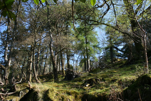
Despite its small size, Achranich boasts a rich history and offers an idyllic rural setting. The village is known for its traditional Scottish charm, with many of its buildings retaining their original stone architecture. The surrounding area is abundant in natural beauty, with lush green fields and rolling hills as far as the eye can see.
Achranich is a popular destination for outdoor enthusiasts, offering numerous opportunities for activities such as hiking, fishing, and wildlife spotting. The nearby Loch Awe, one of Scotland's largest freshwater lochs, offers excellent fishing opportunities for anglers, as well as breathtaking views for visitors.
In terms of amenities, Achranich is relatively limited, with a small number of local businesses providing essential services to the community. However, the village's close proximity to Oban ensures that residents have access to a wider range of amenities, including shops, restaurants, and healthcare facilities.
Overall, Achranich is a tranquil and picturesque village in the heart of the Scottish Highlands, offering a peaceful retreat for those seeking to immerse themselves in the natural beauty and rich history of the region.
If you have any feedback on the listing, please let us know in the comments section below.
Achranich Images
Images are sourced within 2km of 56.562009/-5.7411661 or Grid Reference NM7047. Thanks to Geograph Open Source API. All images are credited.


Achranich is located at Grid Ref: NM7047 (Lat: 56.562009, Lng: -5.7411661)
Unitary Authority: Highland
Police Authority: Highlands and Islands
What 3 Words
///incline.downsize.handfuls. Near Lochaline, Highland
Nearby Locations
Related Wikis
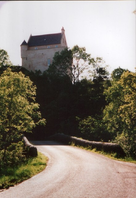
Kinlochaline Castle
Kinlochaline Castle is a 15th-century Scottish tower house on the Ardtornish estate in Morvern in the Highland council area. It is also known as Caisteal...

Ardtornish
Ardtornish (Scottish Gaelic: Àird Tòirinis) is a Highland estate in Scotland located in Morvern, Lochaber. Ardtornish House is famous for its gardens...

Loch Aline
Loch Aline (Scottish Gaelic: Loch Àlainn) is a small salt water loch home to fish, birds and game, located in Morvern, Lochaber, Scotland. Key features...

Lochaline Mine
Lochaline Mine is a mine on the Morvern peninsula of the Highland area of Scotland. The mine works a white cretaceous sandstone to produce high grade silica...

Lochaline
Lochaline (Scottish Gaelic: Loch Àlainn) is the main village in the Morvern area of Highland, Scotland. The coastal village is situated at the mouth of...

Morvern
Morvern (Scottish Gaelic: A' Mhorbhairne [ə ˈvɔɾɔ.əɾɲə]; "the sea-gap"), historically also spelt Morven, is a peninsula and traditional district in the...

Ardtornish Bay
Ardtornish Bay is coastal embayment, on a chord of 0.89 miles, on a 161° orientation, in the Morvern peninsula in Lochaber, in the western coast of Scotland...

Ardtornish Castle
Ardtornish Castle is situated in the grounds of the Ardtornish estate in Morvern, on the west coast of Scotland. It stands at the seaward end of a promontory...
Nearby Amenities
Located within 500m of 56.562009,-5.7411661Have you been to Achranich?
Leave your review of Achranich below (or comments, questions and feedback).