Achilty

Settlement in Ross-shire

Scotland

Achilty

Upstream from Rogie Falls View across Black Water just a few metres upstream from Rogie Falls.
Upstream from Rogie Falls Credit: Ajay Tegala

Achilty is a small hamlet located in Ross-shire, within the Highland region of Scotland. Situated approximately 4 miles southwest of the town of Dingwall, Achilty is nestled amidst picturesque countryside and offers a tranquil and rural setting.

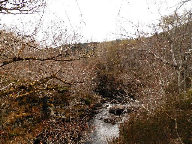
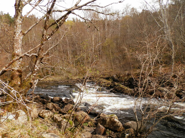
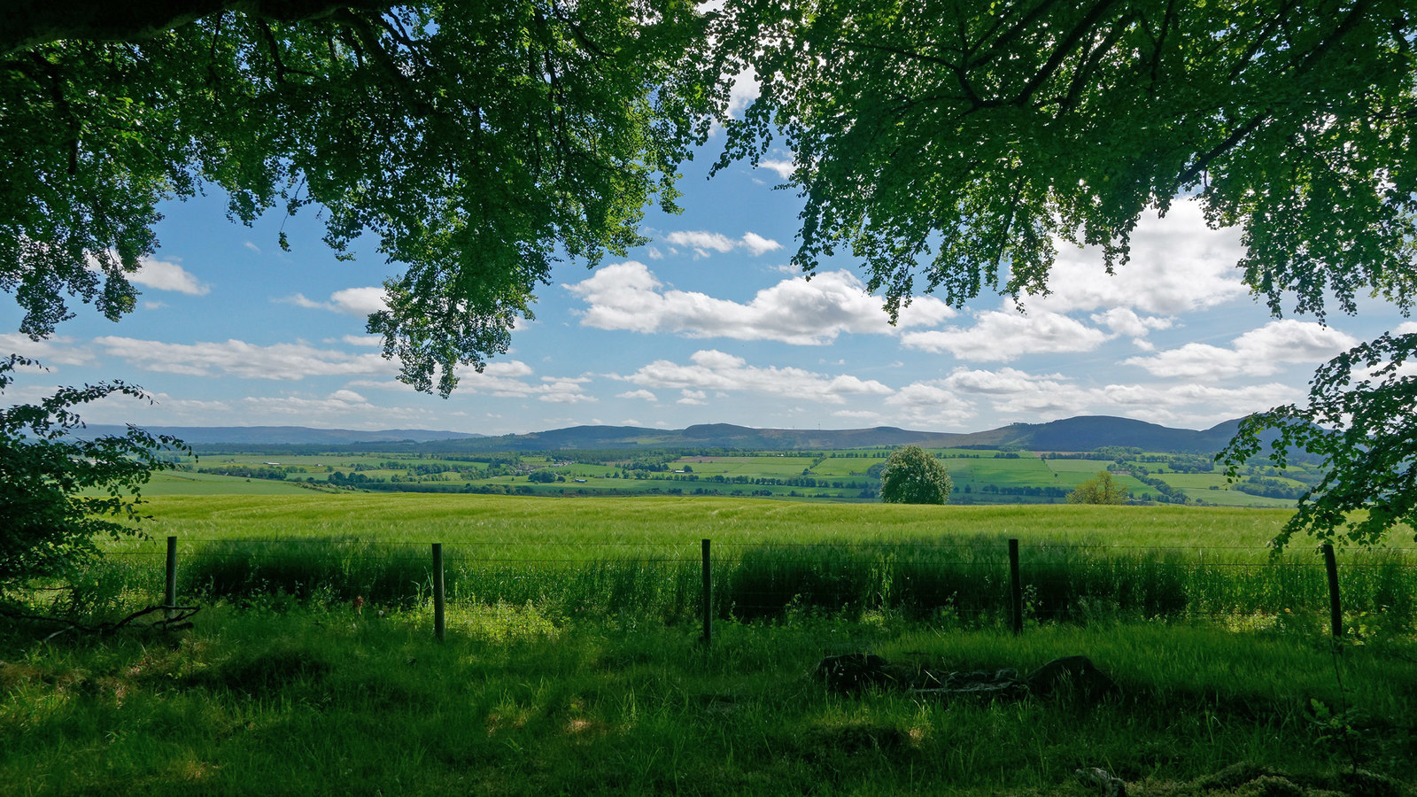
The hamlet is home to a limited number of residents and primarily consists of a cluster of traditional cottages and farmhouses. Surrounded by lush green fields and rolling hills, Achilty provides breathtaking views of the Scottish Highlands. The area is known for its natural beauty, with nearby forests and rivers offering opportunities for outdoor activities such as hiking, fishing, and birdwatching.

Despite its small size, Achilty benefits from its proximity to the market town of Dingwall, where residents can find amenities such as shops, schools, and healthcare facilities. The hamlet also benefits from good transport links, with easy access to the A9 road, connecting it to Inverness and other major cities in the region.

Achilty is rich in history, with evidence of ancient settlements in the area dating back to prehistoric times. Nearby, visitors can explore the ruins of Castle Leod, a historic seat of the Clan Mackenzie, which offers a glimpse into Scotland's feudal past.

In summary, Achilty is a charming and idyllic hamlet in Ross-shire, offering a peaceful countryside retreat with stunning natural landscapes and a rich historical heritage.

If you have any feedback on the listing, please let us know in the comments section below.

Achilty Images

Images are sourced within 2km of 57.574974/-4.6073189 or Grid Reference NH4456. Thanks to Geograph Open Source API. All images are credited.

Upstream from Rogie Falls View across Black Water just a few metres upstream from Rogie Falls.
Upstream from Rogie Falls
View across Black Water just a few metres upstream from Rogie Falls.
Path at Rogie Falls
Path at Rogie Falls
Road on Contin Island A singletrack road, leading to Contin Church and burial ground. 
One arm of the Black Water river is to the right,  amongst the trees over the wall.
Road on Contin Island
A singletrack road, leading to Contin Church and burial ground. One arm of the Black Water river is to the right, amongst the trees over the wall.
Contin Burial Ground The burial ground is next to Contin Church, on Contin Island.
Contin Burial Ground
The burial ground is next to Contin Church, on Contin Island.
Rogie Falls. April 2022
Downstream from Rogie Falls
Rogie Falls. April 2022
Upstream from Rogie Falls
The A835 approaching Contin
The A835 north of Contin
Loch Achilty Forestry Commission Car Park
A835 at Rogie Falls Car Park The A835 is a primary road in the Scottish Highlands linking Inverness to Ullapool and the Far North of Scotland. It runs for just over 66 miles, between Tore Roundabout and Ledmore (north of Ullapool)/ The road can be particularly busy before and after ferry crossings arrive at and depart from Ullapool, and sees a great deal of goods traffic travelling to and from the Western Isles (<span class="nowrap"><a title="https://www.sabre-roads.org.uk/wiki/index.php?title=A835" rel="nofollow ugc noopener" href="https://www.sabre-roads.org.uk/wiki/index.php?title=A835">Link</a><img style="margin-left:2px;" alt="External link" title="External link - shift click to open in new window" src="https://s1.geograph.org.uk/img/external.png" width="10" height="10"/></span> SABRE).
A835 at Rogie Falls Car Park
The A835 is a primary road in the Scottish Highlands linking Inverness to Ullapool and the Far North of Scotland. It runs for just over 66 miles, between Tore Roundabout and Ledmore (north of Ullapool)/ The road can be particularly busy before and after ferry crossings arrive at and depart from Ullapool, and sees a great deal of goods traffic travelling to and from the Western Isles (LinkExternal link SABRE).
A835 towards Contin The A835 is a primary road in the Scottish Highlands linking Inverness to Ullapool and the Far North of Scotland. It runs for just over 66 miles, between Tore Roundabout and Ledmore (north of Ullapool)/ The road can be particularly busy before and after ferry crossings arrive at and depart from Ullapool, and sees a great deal of goods traffic travelling to and from the Western Isles (<span class="nowrap"><a title="https://www.sabre-roads.org.uk/wiki/index.php?title=A835" rel="nofollow ugc noopener" href="https://www.sabre-roads.org.uk/wiki/index.php?title=A835">Link</a><img style="margin-left:2px;" alt="External link" title="External link - shift click to open in new window" src="https://s1.geograph.org.uk/img/external.png" width="10" height="10"/></span> SABRE).
A835 towards Contin
The A835 is a primary road in the Scottish Highlands linking Inverness to Ullapool and the Far North of Scotland. It runs for just over 66 miles, between Tore Roundabout and Ledmore (north of Ullapool)/ The road can be particularly busy before and after ferry crossings arrive at and depart from Ullapool, and sees a great deal of goods traffic travelling to and from the Western Isles (LinkExternal link SABRE).
A835 approaching Contin
Fàilte Gu Cunndainn Bilingulal welcome sign at the entrance to the village of Contin (Gaelic: Cunndain).
Fàilte Gu Cunndainn
Bilingulal welcome sign at the entrance to the village of Contin (Gaelic: Cunndain).
Path in forestry near Contin
Forestry path near Contin
Show me another place!

Achilty is located at Grid Ref: NH4456 (Lat: 57.574974, Lng: -4.6073189)

Unitary Authority: Highland

Police Authority: Highlands and Islands

What 3 Words

///diner.opts.drilled. Near Strathpeffer, Highland

Nearby Locations

Achilty

Related Wikis

Loch Achilty

Loch Achilty is a large picturesque lowland freshwater loch set within a sloping birch and oakwood forest, and located near to Contin in Ross-shire, Scottish...
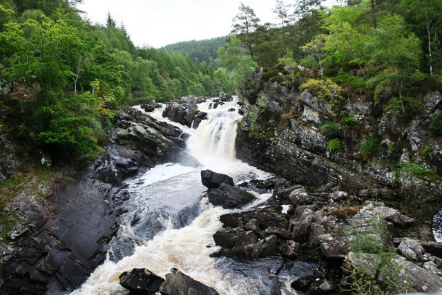
Rogie Falls

Rogie Falls (Gaelic: Eas Rothagaidh) are a series of waterfalls on the Black Water, a river in Ross-shire in the Highlands of Scotland. The falls are about...

Contin

Contin (Gaelic: Cunndainn) is a Ross-shire village, and a civil parish and community council area between Strathpeffer and Garve in the Highland council...

Contin Island

Contin Island is an inhabited riverine islet in Ross and Cromarty within the Highland council area of Scotland. Located in the Black Water, a tributary...

Battle of Blar Na Pairce

The Battle of Blar na Pairce (Scottish Gaelic: Blàr na Pàirce "Battle of the Park") was a Scottish clan battle that took place just outside Strathpeffer...

Jamestown, Easter Ross

Jamestown (Scottish Gaelic: Baile Sheumais) is a village in Strathpeffer (and formerly of 'Ross-shire'), Scottish Highlands and is in the Scottish council...

Strathpeffer

Strathpeffer (Scottish Gaelic: Srath Pheofhair) is a village and spa town in Ross and Cromarty, Highland, Scotland, with a population of 1,469. == Geography... ==

Black Water (Conon)

The Black Water (Scottish Gaelic: An t-Alltan Dubh) is a river in the Highlands of Scotland. It begins at the confluence of the Glascarnoch River with...

Nearby Amenities

Located within 500m of 57.574974,-4.6073189
Power: pole
Lat/Long: 57.5730349/-4.6009069
Power: pole
Lat/Long: 57.5735931/-4.6015339
Power: pole
Lat/Long: 57.5741872/-4.6022116
Power: pole
Lat/Long: 57.5748955/-4.6030172
Power: pole
Lat/Long: 57.5752916/-4.6034718
Power: pole
Lat/Long: 57.5757148/-4.6039446
Power: pole
Lat/Long: 57.576434/-4.6047644
Power: pole
Lat/Long: 57.5769835/-4.6053792
Power: pole
Lat/Long: 57.5774959/-4.6059758
Power: pole
Lat/Long: 57.5780203/-4.6065541
Power: pole
Lat/Long: 57.5772141/-4.6139546
Power: pole
Lat/Long: 57.5773501/-4.6127452
Power: pole
Lat/Long: 57.577485/-4.6114912
Power: pole
Lat/Long: 57.5776232/-4.6102513
Power: pole
Lat/Long: 57.5777603/-4.6088796
Power: pole
Lat/Long: 57.5778821/-4.6077595
Power: pole
Lat/Long: 57.5780225/-4.6050708
Power: pole
Lat/Long: 57.5761745/-4.6000931
Power: pole
Lat/Long: 57.5758264/-4.6012599
Power: pole
Lat/Long: 57.5755043/-4.6025495
The data included in this document is from www.openstreetmap.org. The data is made available under ODbL.

Have you been to Achilty?

Leave your review of Achilty below (or comments, questions and feedback).