Blackhalls Rocks

Island in Durham

England

Blackhalls Rocks

Crimdon Terrace
Crimdon Terrace Credit: David Robinson

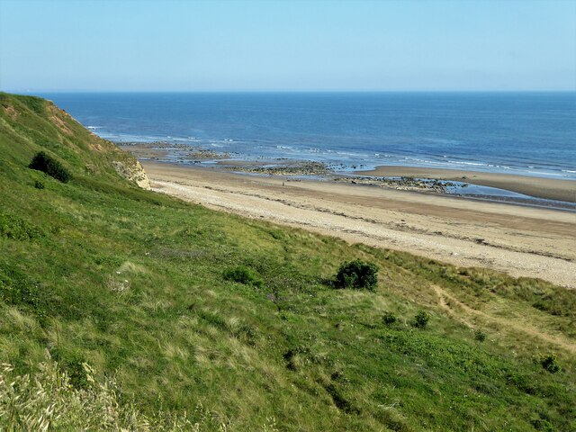
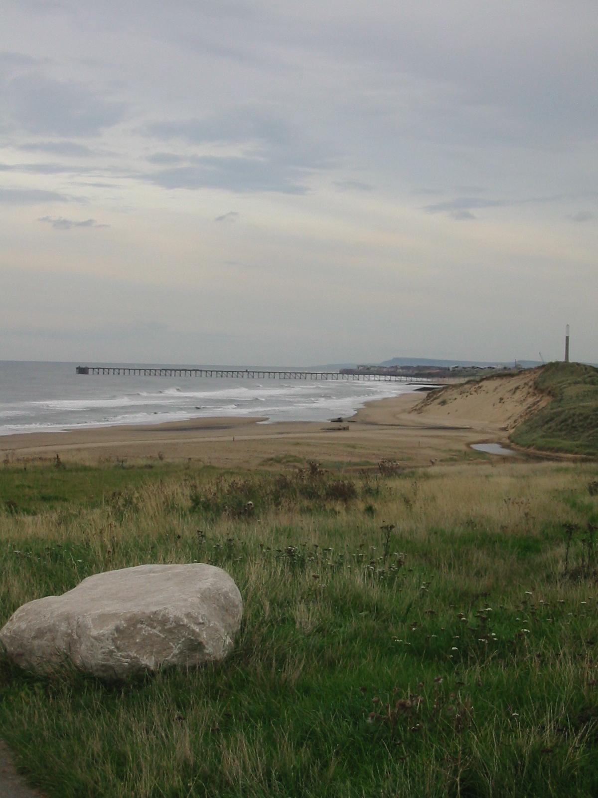
Blackhalls Rocks, located in County Durham, England, is a small island situated off the coast of Blackhall Colliery. Also known as "The Island," it is a prominent landmark in the area and holds historical significance. The island is accessible only by boat and is approximately 200 meters off the shoreline.

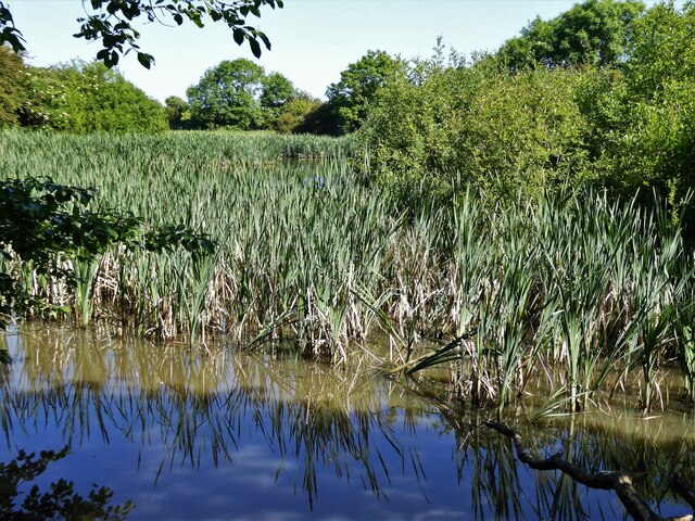
Blackhalls Rocks is characterized by its distinctive rock formations, which have been sculpted by the relentless action of the North Sea. The rocks are composed of sedimentary layers, prominently displaying sandstone and shale. Over time, erosion has created unique arches, caves, and stacks, adding to the island's allure.

The island is a popular spot for local wildlife, serving as a nesting site for various seabirds, such as kittiwakes and fulmars. The surrounding waters are also home to a diverse range of marine life, including seals and various species of fish.

Blackhalls Rocks has a rich history, with evidence of human activity dating back centuries. It was once used as a fishing outpost and provided a vital source of food for the local community. Today, it stands as a reminder of the area's maritime heritage.

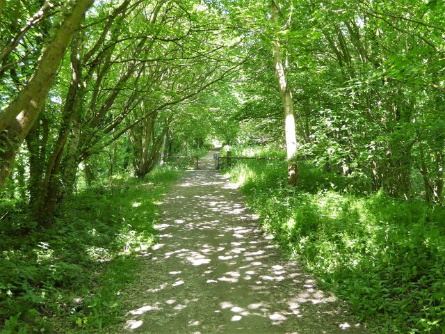
Visitors to Blackhalls Rocks can enjoy scenic views of the rugged coastline, explore the rock formations, and observe the abundant birdlife. However, caution must be exercised when visiting due to the unpredictable nature of the tides, which can leave the island inaccessible during high water.

Overall, Blackhalls Rocks offers a unique and picturesque destination for nature lovers, history enthusiasts, and those seeking tranquility amidst the stunning coastal landscape of County Durham.

If you have any feedback on the listing, please let us know in the comments section below.

Blackhalls Rocks Images

Images are sourced within 2km of 54.74092/-1.2647401 or Grid Reference NZ4738. Thanks to Geograph Open Source API. All images are credited.

Crimdon Terrace
Crimdon Terrace
North Sands at Crimdon Park Part of the Durham Coast National Nature Reserve, the beach is also a popular venue for dog walkers, accessed by a fenced path down the dunes from Crimdon Park where there is plenty of parking. For both uses, it is fortunate that there is little evidence here of the large number of dead crustaceans which have recently been washed up on a large stretch of the coast north and south of Teesmouth, the causes of which had not been established by the time of our visit. There seems little chance that the cause will not prove to be anthropogenic.
North Sands at Crimdon Park
Part of the Durham Coast National Nature Reserve, the beach is also a popular venue for dog walkers, accessed by a fenced path down the dunes from Crimdon Park where there is plenty of parking. For both uses, it is fortunate that there is little evidence here of the large number of dead crustaceans which have recently been washed up on a large stretch of the coast north and south of Teesmouth, the causes of which had not been established by the time of our visit. There seems little chance that the cause will not prove to be anthropogenic.
Mickle Hill Road The urban developments along the Coast Road are soon left behind as the road heads out into the country.
Mickle Hill Road
The urban developments along the Coast Road are soon left behind as the road heads out into the country.
On the beach in the mist Starting as a dark line on the horizon, within minutes a sea mist came billowing in turning a bright sunny morning into hazy gloom.
On the beach in the mist
Starting as a dark line on the horizon, within minutes a sea mist came billowing in turning a bright sunny morning into hazy gloom.
Mine Wheel Memorial, Blackhall Colliery One of several similar monuments in this area commemorating the former mining industry.
A sea mist has blown in making colour photography rather unrewarding, but this looks ok in B&W.
Mine Wheel Memorial, Blackhall Colliery
One of several similar monuments in this area commemorating the former mining industry. A sea mist has blown in making colour photography rather unrewarding, but this looks ok in B&W.
Middle Street, Blackhall Colliery A town with very logical street naming. This is Middle Street, the main road, with East and West Streets running parallel. In between are First to Eleventh Streets. Easy.
Further along, it's poets.
Middle Street, Blackhall Colliery
A town with very logical street naming. This is Middle Street, the main road, with East and West Streets running parallel. In between are First to Eleventh Streets. Easy. Further along, it's poets.
Durham Coast National Nature Reserve The fenced off area is restricted in the hope of encouraging Little terns and Ring Plover to breed and any other bird that wants to raise a family in relative safety.
Durham Coast National Nature Reserve
The fenced off area is restricted in the hope of encouraging Little terns and Ring Plover to breed and any other bird that wants to raise a family in relative safety.
Sand Dunes at  Crimdon Beach
Sand Dunes at Crimdon Beach
View towards Durham Coast National Nature Reserve The hut is used by Nature Wardens during the breeding season.
View towards Durham Coast National Nature Reserve
The hut is used by Nature Wardens during the breeding season.
Railway Bridge Over Station Road
Railway Bridge
Over Station Road
Sea Caves In an unnamed headland viewed from near the coastal path
Sea Caves
In an unnamed headland viewed from near the coastal path
Path to the beach View from the Coastal Path north of Blackhall Rocks
Path to the beach
View from the Coastal Path north of Blackhall Rocks
Rocks off the beach View from a path off the viewing platform on the Coastal Path
Rocks off the beach
View from a path off the viewing platform on the Coastal Path
Former reservoir By the side of the Hart to Haswell Walkway
Former reservoir
By the side of the Hart to Haswell Walkway
Cycle path following route of former railway Approaching the municipal boundary between Hartlepool & Easington districts at the embankment across Crimdon Beck on the Hart to Haswell route
Cycle path following route of former railway
Approaching the municipal boundary between Hartlepool & Easington districts at the embankment across Crimdon Beck on the Hart to Haswell route
Railway Bridge Across the access road from Crimdon Dene beach car park (Crimdon Park)
Railway Bridge
Across the access road from Crimdon Dene beach car park (Crimdon Park)
Beach at Crimdon Park North of the access steps from the car park for the beach
Beach at Crimdon Park
North of the access steps from the car park for the beach
Inaccessible Beach View across the unsafe and fenced off steps to the beach for the guests at Crimdon Dene Holiday Park. It is a distance south to the access steps at the public car park.
Inaccessible Beach
View across the unsafe and fenced off steps to the beach for the guests at Crimdon Dene Holiday Park. It is a distance south to the access steps at the public car park.
Show me another place!

Blackhalls Rocks is located at Grid Ref: NZ4738 (Lat: 54.74092, Lng: -1.2647401)

Unitary Authority: County Durham

Police Authority: Durham

What 3 Words

///portfolio.proposes.pushy. Near Peterlee, Co. Durham

Nearby Locations

Blackhalls Rocks

Related Wikis

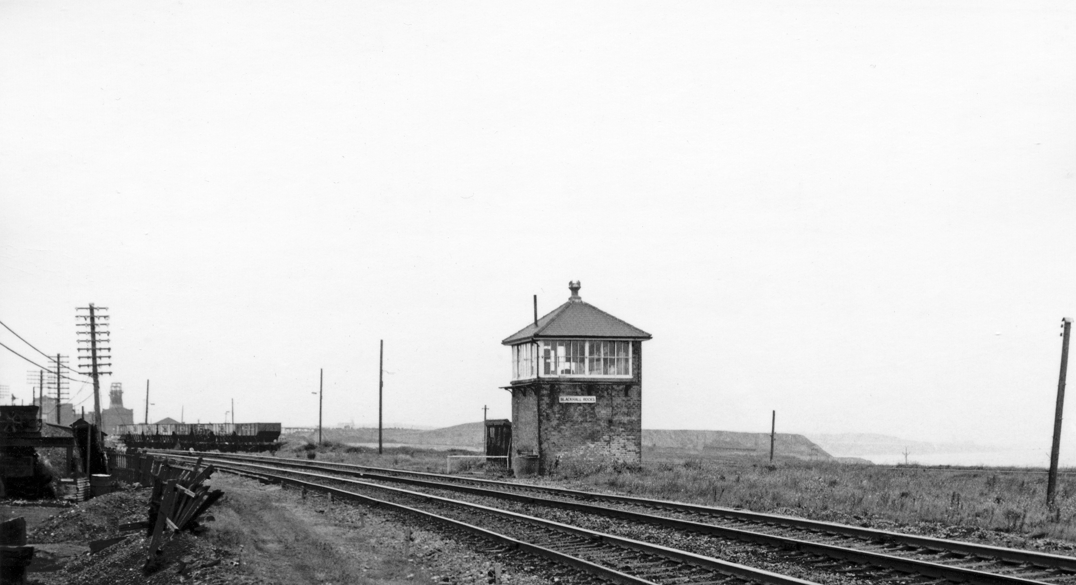
Blackhall Rocks railway station

Blackhall Rocks was one of two railway stations to have served the Blackhalls in County Durham, North East England, and was a stop on the Durham Coast...

Blackhall Rocks

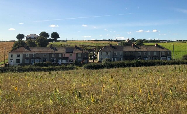
Blackhall Rocks is a village on the North Sea coast of County Durham, North East England. It is situated on the A1086 between Horden and Hartlepool, and...

Crimdon

Crimdon is a coastal village in County Durham, England. It is situated on the North Sea coast, between Blackhall Rocks and Hartlepool on the A1086 road...

Blackhall Colliery

Blackhall Colliery is a village on the North Sea coast of County Durham, in England. It is situated on the A1086 between Horden and Hartlepool. To the...

High Hesleden

High Hesleden is a village in Monk Hesleden parish, County Durham, in England. It is situated a few miles north of Hartlepool, between Blackhall Rocks...

Blackhall Colliery railway station

Blackhall Colliery railway station served the village of Blackhall Colliery in County Durham, North East England. It was located on the Durham Coast Line...

Monk Hesleden

Monk Hesleden is a village and civil parish in County Durham, England. The population of the parish at the 2011 Census was 5,722. The parish is situated...

Hart railway station

Hart railway station was a station that served the villages of Hart and Crimdon in County Durham, England. The station was built by the Hartlepool Dock...

Nearby Amenities

Located within 500m of 54.74092,-1.2647401
Source: PGS
Lat/Long: 54.7375969/-1.2622424
Tourism: viewpoint
Lat/Long: 54.7427516/-1.2669723
Tourism: viewpoint
Lat/Long: 54.7434498/-1.2668945
Gin Cave
Natural: cave_entrance
Lat/Long: 54.7435737/-1.2667792
Power: pole
Lat/Long: 54.7419513/-1.2716487
Power: pole
Lat/Long: 54.7414233/-1.2709138
Power: pole
Lat/Long: 54.7408272/-1.2700461
Power: pole
Lat/Long: 54.7420544/-1.2718
Power: pole
Lat/Long: 54.7391139/-1.2692951
Power: pole
Lat/Long: 54.740005/-1.2696867
Leisure: picnic_table
Lat/Long: 54.7415859/-1.2696826
Mapillary: 733946888641944
Power: pole
Switch: mechanical
Transformer: distribution
Lat/Long: 54.73792/-1.2702754
Power: pole
Lat/Long: 54.7385417/-1.2697577
The data included in this document is from www.openstreetmap.org. The data is made available under ODbL.

Have you been to Blackhalls Rocks?

Leave your review of Blackhalls Rocks below (or comments, questions and feedback).