Roan Heads

Island in Aberdeenshire

Scotland

Roan Heads

Trawlers in Peterhead's South Harbour Peterhead is the UK's premier white and pelagic fish port.
Trawlers in Peterhead's South Harbour Credit: Bob Jones

Roan Heads is an island located off the coast of Aberdeenshire, Scotland. Situated in the North Sea, it is part of an archipelago known as the Roan Heads Islands. The island covers an area of approximately 2 square kilometers and is known for its rugged and picturesque landscape.

The terrain of Roan Heads is characterized by steep cliffs, rocky shores, and rolling hills. The island is predominantly uninhabited, with no permanent population residing there. However, it attracts visitors who are drawn to its natural beauty and tranquility. The island is accessible by boat from the mainland, making it a popular destination for day trips or camping.

Roan Heads is home to a diverse range of wildlife, including various species of seabirds, such as puffins and gannets. The surrounding waters are also teeming with marine life, making it a great spot for fishing and birdwatching.

The island's history can be traced back several centuries, with evidence of human activity dating back to prehistoric times. Ruins of ancient structures and burial sites have been discovered, providing insights into the island's past.

In recent years, efforts have been made to preserve and protect the natural environment of Roan Heads. Conservation projects have been implemented to ensure the preservation of the island's unique ecosystem and to promote sustainable tourism.

Overall, Roan Heads offers a captivating and unspoiled natural environment for those seeking a peaceful retreat or an opportunity to explore the rich history and wildlife of Aberdeenshire.

If you have any feedback on the listing, please let us know in the comments section below.
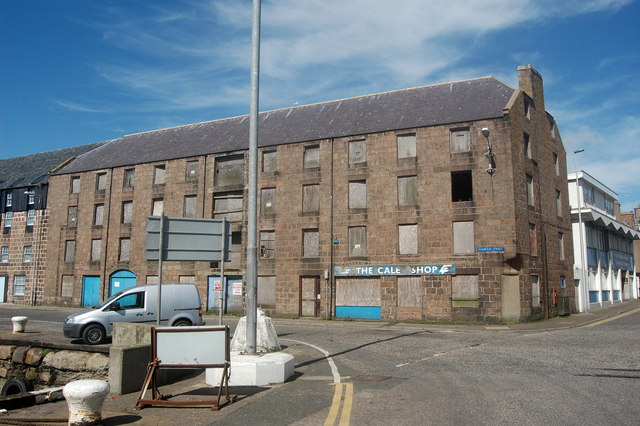
Roan Heads Images

Images are sourced within 2km of 57.509234/-1.7723721 or Grid Reference NK1346. Thanks to Geograph Open Source API. All images are credited.

Trawlers in Peterhead's South Harbour Peterhead is the UK's premier white and pelagic fish port.
Trawlers in Peterhead's South Harbour
Peterhead is the UK's premier white and pelagic fish port.
Buchanhaven Harbour In 1850 work started on a new pier, to replace an earlier small one to the west. This was to be the first stage in the building of a proper harbour basin for large herring boats. This plan was never completed. Buchanhaven Pier, as it stands today, did allow the fishermen to operate small-line boats. By the mid 1860s there were 27 boats working from the harbour.

The proximity of Peterhead and other larger fishing harbours eventually led to the demise of the harbour and nowadays only a few small boats use it.
Buchanhaven Harbour
In 1850 work started on a new pier, to replace an earlier small one to the west. This was to be the first stage in the building of a proper harbour basin for large herring boats. This plan was never completed. Buchanhaven Pier, as it stands today, did allow the fishermen to operate small-line boats. By the mid 1860s there were 27 boats working from the harbour. The proximity of Peterhead and other larger fishing harbours eventually led to the demise of the harbour and nowadays only a few small boats use it.
Peterhead marina
Peterhead marina
Peterhead Bay Sands and grass by the shore with an industrial offshore skyline due to oil rig work.
<span class="nowrap"><a title="http://en.wikipedia.org/wiki/Peterhead" rel="nofollow ugc noopener" href="http://en.wikipedia.org/wiki/Peterhead">Link</a><img style="margin-left:2px;" alt="External link" title="External link - shift click to open in new window" src="https://s1.geograph.org.uk/img/external.png" width="10" height="10"/></span>
Peterhead Bay
Sands and grass by the shore with an industrial offshore skyline due to oil rig work. LinkExternal link
Peterhead Bay East-facing bay at the Lido, south of the town centre.
Peterhead Bay
East-facing bay at the Lido, south of the town centre.
Caley Building, Peterhead The Caley building, at 26 Harbour Street, after undergoing renovations thanks to the CARS scheme.

The Peterhead CARS project (Conservation Area Regeneration Scheme) identified historical buildings at risk within the Peterhead Conservation Area, and grants were awarded to benefit various buildings such as the one in the photo.

More information can be found here... <span class="nowrap"><a title="http://www.aberdeenshire.gov.uk/built_heritage/PeterheadCARSsummaryatcompletion.pdf" rel="nofollow ugc noopener" href="http://www.aberdeenshire.gov.uk/built_heritage/PeterheadCARSsummaryatcompletion.pdf">Link</a><img style="margin-left:2px;" alt="External link" title="External link - shift click to open in new window" src="https://s1.geograph.org.uk/img/external.png" width="10" height="10"/></span>
Caley Building, Peterhead
The Caley building, at 26 Harbour Street, after undergoing renovations thanks to the CARS scheme. The Peterhead CARS project (Conservation Area Regeneration Scheme) identified historical buildings at risk within the Peterhead Conservation Area, and grants were awarded to benefit various buildings such as the one in the photo. More information can be found here... LinkExternal link
Peterhead harbour from the air Aerial photo taken from a plane flying between Aberdeen and Sumburgh.
Peterhead harbour from the air
Aerial photo taken from a plane flying between Aberdeen and Sumburgh.
At The Quayside A quiet Sunday morning in Peterhead.
At The Quayside
A quiet Sunday morning in Peterhead.
The Queenie Brig Replacing an 1850 swing bridge, this bascule bridge dates from 1954.
The Queenie Brig
Replacing an 1850 swing bridge, this bascule bridge dates from 1954.
Peterhead tolbooth
Peterhead tolbooth
Peterhead Lifeboat In dock at a quiet time ready to answer any call.
Peterhead Lifeboat
In dock at a quiet time ready to answer any call.
South Harbour, Peterhead
Ship repair yard, Scott's Pier, Peterhead
Peterhead lifeboat station
Icehouse, Peterhead South Harbour Peterhead is said to be Europe's most important white-fish port (see: <span class="nowrap"><a title="http://www.peterheadport.co.uk/fish_market.htm" rel="nofollow ugc noopener" href="http://www.peterheadport.co.uk/fish_market.htm">Link</a><img style="margin-left:2px;" alt="External link" title="External link - shift click to open in new window" src="https://s1.geograph.org.uk/img/external.png" width="10" height="10"/></span> ) and a ready supply of ice is vital...
Icehouse, Peterhead South Harbour
Peterhead is said to be Europe's most important white-fish port (see: LinkExternal link ) and a ready supply of ice is vital...
Harbour Street, Peterhead According to a plaque beside it, the cannon once protected the harbour from attacks by pirates...
Harbour Street, Peterhead
According to a plaque beside it, the cannon once protected the harbour from attacks by pirates...
Trawler, Peterhead South Harbour The Helenus (formerly the Heatherbelle V) registered to Fraserburgh as FR121.  She fairly bristles with radar and communication equipment.  She can be tracked here: <span class="nowrap"><a title="http://www.marinetraffic.com/ais/details/ships/shipid:185003/mmsi:233353000/imo:0/vessel:HELENUS_FR121" rel="nofollow ugc noopener" href="http://www.marinetraffic.com/ais/details/ships/shipid:185003/mmsi:233353000/imo:0/vessel:HELENUS_FR121">Link</a><img style="margin-left:2px;" alt="External link" title="External link - shift click to open in new window" src="https://s1.geograph.org.uk/img/external.png" width="10" height="10"/></span> .
Trawler, Peterhead South Harbour
The Helenus (formerly the Heatherbelle V) registered to Fraserburgh as FR121. She fairly bristles with radar and communication equipment. She can be tracked here: LinkExternal link .
Derelict warehouse, Harbour Street, Peterhead According to the new Pevsner guide to Aberdeenshire (North) and Moray, this building dates from about 1800 and is an "outstanding example" of the genre...
Derelict warehouse, Harbour Street, Peterhead
According to the new Pevsner guide to Aberdeenshire (North) and Moray, this building dates from about 1800 and is an "outstanding example" of the genre...
Show me another place!

Roan Heads is located at Grid Ref: NK1346 (Lat: 57.509234, Lng: -1.7723721)

Unitary Authority: Aberdeenshire

Police Authority: North East

What 3 Words

///maybe.simulates.koala. Near Peterhead, Aberdeenshire

Related Wikis

Peterhead Docks railway station

Peterhead Docks railway station was a goods railway station in Peterhead, Aberdeenshire. It opened in 1865 (1865) and closed in 1946 (1946). == References ==

75 Broad Street, Peterhead

75 Broad Street is a Category B listed building in Peterhead, Aberdeenshire, Scotland. It dates to 1835, and was originally a Clydesdale Bank. It is believed...

59 Broad Street, Peterhead

59 Broad Street is a Category B listed building in Peterhead, Aberdeenshire, Scotland. Dating to the mid 18th century, the residential building stands...

4 Union Street, Peterhead

4 Union Street is a Category C listed building in Peterhead, Aberdeenshire, Scotland. Dating to the late 18th century, the residential building stands...

32 Broad Street, Peterhead

32 Broad Street is a Category B listed building at 32 Broad Street in Peterhead, Aberdeenshire, Scotland. It was built in 1858. Originally a Union Bank...

Peterhead Town House

Peterhead Town House is a municipal structure in Broad Street, Peterhead, Aberdeenshire, Scotland. The building, which was the headquarters of Peterhead...

16 Prince Street, Peterhead

16 Prince Street is a Category B listed building in Peterhead, Aberdeenshire, Scotland. It dates from 1838. It was formerly Peterhead's infant school,...

10 Merchant Street, Peterhead

10 Merchant Street is a Category B listed building in Peterhead, Aberdeenshire, Scotland. Dating to around 1800, the building, which stands at the corner...

Nearby Amenities

Located within 500m of 57.509234,-1.7723721
Source: OS7
Lat/Long: 57.5117651/-1.778943
Source: OS7
Lat/Long: 57.5114521/-1.7778503
Source: OS7
Lat/Long: 57.5114478/-1.7761213
Source: OS7
Lat/Long: 57.5112761/-1.775925
Source: OS7
Lat/Long: 57.5111981/-1.7755618
Source: OS7
Lat/Long: 57.5106515/-1.7747545
Source: OS7
Lat/Long: 57.5104669/-1.7744606
Source: OS7
Lat/Long: 57.5098053/-1.7736515
Source: OS7
Lat/Long: 57.5091392/-1.7739625
Source: OS7
Lat/Long: 57.508325/-1.772254
Source: OS7
Lat/Long: 57.5080009/-1.7715294
Source: OS7
Lat/Long: 57.5075833/-1.7704859
Noexit: yes
Lat/Long: 57.5096637/-1.7783215
Traffic Calming: hump
Lat/Long: 57.5112119/-1.7777931
Noexit: yes
Lat/Long: 57.5102934/-1.7785764
Traffic Calming: table
Lat/Long: 57.5083273/-1.7772706
Roanheads
Is In: Aberdeenshire
Place: suburb
Lat/Long: 57.509551/-1.7778068
Roan Heads
Natural: rock
Lat/Long: 57.5092751/-1.7717526
North Harbour
Harbour: yes
Lat/Long: 57.5055934/-1.7715571
Port Henry Basin
Harbour: yes
Lat/Long: 57.5066354/-1.7734406
Noexit: yes
Lat/Long: 57.5078312/-1.7779378
Post Box
Post Box Type: wall
Ref: AB42 4
Royal Cypher: GVIR
Royal Cypher Wikidata: Q33102169
Lat/Long: 57.5067506/-1.7770745
Traffic Calming: cushion
Lat/Long: 57.5057988/-1.7697191
Platform
Stance 4
Bench: yes
Passenger Information Display: yes
Public Transport: platform
Shelter: yes
Lat/Long: 57.5074039/-1.779955
Platform
Stance 3
Bench: yes
Passenger Information Display: yes
Public Transport: platform
Shelter: yes
Lat/Long: 57.5073462/-1.7799454
Bus Stop
Park Lane
Bus: yes
Naptan AtcoCode: 630024331
Naptan Bearing: NW
Naptan CommonName: Park Lane
Naptan Indicator: opp
Naptan Landmark: Park Lane
Naptan LocalityName: Peterhead
Naptan NaptanCode: 23629643
Naptan NptgLocalityCode: ES003011
Naptan Street: Longate
Public Transport: platform
Ref: 23629643
Shelter: yes
Lat/Long: 57.5057511/-1.7766349
Crossing
Crossing: unmarked
Crossing Island: no
Crossing Markings: no
Kerb: lowered
Tactile Paving: yes
Lat/Long: 57.5093349/-1.7774235
Crossing
Crossing: unmarked
Crossing Island: no
Crossing Markings: no
Tactile Paving: yes
Lat/Long: 57.5093442/-1.7778003
Generator Method: photovoltaic
Generator Output Electricity: small_installation
Generator Source: solar
Generator Type: solar_photovoltaic_panel
Location: roof
Power: generator
Lat/Long: 57.5096/-1.7744905
Traffic Calming: hump
Lat/Long: 57.5082435/-1.7795464
Peterhead Docks
Historic Railway: station
Railway: site
Wikidata: Q7178054
Wikipedia: en:Peterhead Docks railway station
Lat/Long: 57.5095703/-1.774531
Post Box
Collection Times: Mo-Fr 09:00; Sa 07:00
Ref: AB42 17D
Royal Cypher: GR
Lat/Long: 57.5091728/-1.7778221
Traffic Calming: cushion
Lat/Long: 57.5078547/-1.7718206
Traffic Calming: cushion
Lat/Long: 57.5064061/-1.7695346
Traffic Calming: cushion
Lat/Long: 57.5068857/-1.7696608
Traffic Calming: cushion
Lat/Long: 57.5075081/-1.7710633
Traffic Calming: cushion
Lat/Long: 57.5082447/-1.7726773
Traffic Calming: cushion
Lat/Long: 57.508737/-1.7737697
Addr City: Peterhead
Addr Country: GB
Addr Housenumber: 40
Addr Postcode: AB42 1JY
Addr Street: North Street
Lat/Long: 57.5102536/-1.7773755
Addr City: Peterhead
Addr Country: GB
Addr Housenumber: 42
Addr Postcode: AB42 1JY
Addr Street: North Street
Lat/Long: 57.5104025/-1.7773112
Telephone
Addr City: Peterhead
Addr Country: GB
Addr Postcode: AB42 1LB
Addr Street: Gladstone Road
Booth: KX100
Covered: booth
Lat/Long: 57.5096742/-1.7774341
Addr City: Peterhead
Addr Country: GB
Addr Housenumber: 32
Addr Postcode: AB42 1JY
Addr Street: North Street
Lat/Long: 57.5094905/-1.7775104
Addr City: Peterhead
Addr Country: GB
Addr Housenumber: 34
Addr Postcode: AB42 1JY
Addr Street: North Street
Lat/Long: 57.5098106/-1.7775683
Noexit: yes
Lat/Long: 57.5106214/-1.7759383
Addr City: Peterhead
Addr Country: GB
Addr Housenumber: 36
Addr Postcode: AB42 1JY
Addr Street: North Street
Lat/Long: 57.5099615/-1.7775046
Addr City: Peterhead
Addr Country: GB
Addr Housenumber: 38
Addr Postcode: AB42 1JY
Addr Street: North Street
Lat/Long: 57.5101007/-1.7774413
Pub
Harbour Lights
Addr City: Peterhead
Addr Country: GB
Addr Housenumber: 122
Addr Postcode: AB42 1JU
Addr Street: Longate
Fhrs Authority: Aberdeenshire
Fhrs Id: 119517
Fhrs Local Authority Id: 4869
Lat/Long: 57.5067376/-1.7769048
Noexit: yes
Lat/Long: 57.5087931/-1.7777467
Addr City: Peterhead
Addr Country: GB
Addr Housenumber: 2
Addr Postcode: AB42 1LA
Addr Street: Port Henry Road
Lat/Long: 57.5092731/-1.7773229
Noexit: yes
Lat/Long: 57.5099407/-1.7803672
Alexandra Basin
Harbour: yes
Lat/Long: 57.5064901/-1.7707558
The data included in this document is from www.openstreetmap.org. The data is made available under ODbL.

Have you been to Roan Heads?

Leave your review of Roan Heads below (or comments, questions and feedback).