Girdle and Bakebread
Island in Aberdeenshire
Scotland
Girdle and Bakebread

Girdle and Bakebread is a small island located off the coast of Aberdeenshire, Scotland. Situated in the North Sea, this picturesque island offers visitors a unique and tranquil escape from the mainland.
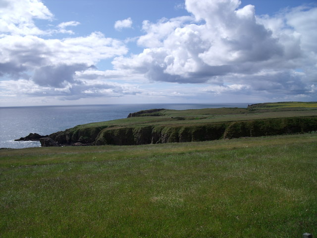
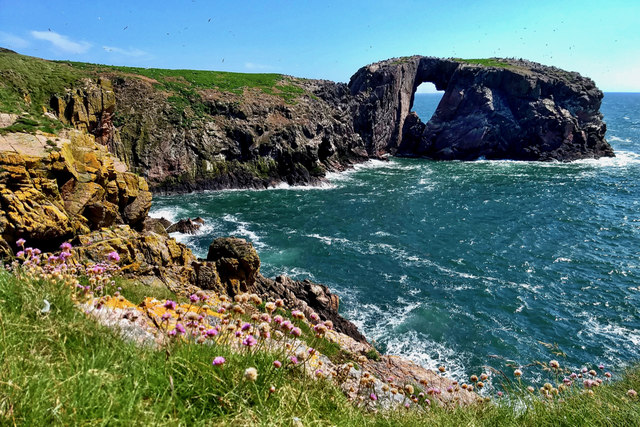
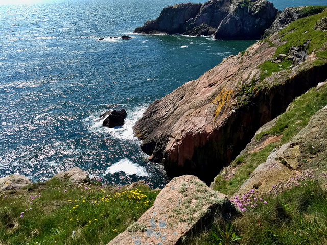
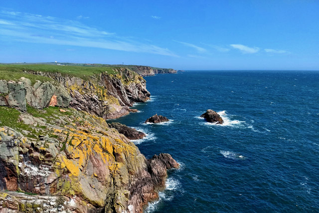
Covering an area of approximately 1 square kilometer, Girdle and Bakebread is characterized by its untouched natural beauty. The island boasts a diverse landscape, comprising rocky cliffs, sandy beaches, and lush green fields. Its remote setting and limited accessibility make it an ideal destination for those seeking solitude and a chance to reconnect with nature.
The island is home to a variety of wildlife, including seabirds, seals, and occasionally otters. Ornithologists will find the island particularly fascinating, as it serves as a nesting ground for several bird species, including puffins and guillemots.
Girdle and Bakebread has a rich history dating back centuries. Ruins of ancient stone structures can still be found, offering a glimpse into the island's past. The island was once inhabited by monks, who sought solace in its peaceful surroundings. Today, visitors can explore the ruins and learn about the island's intriguing history.
Access to Girdle and Bakebread is mainly by boat, with a small jetty available for docking. There are no permanent residents on the island, and facilities such as accommodations and restaurants are not available. Visitors are advised to bring their own supplies and be mindful of the fragile ecosystem.
Overall, Girdle and Bakebread offers a secluded and idyllic retreat for nature enthusiasts and history lovers alike. Its untouched landscapes, diverse wildlife, and rich history make it a truly captivating destination.
If you have any feedback on the listing, please let us know in the comments section below.
Girdle and Bakebread Images
Images are sourced within 2km of 57.437796/-1.8110434 or Grid Reference NK1138. Thanks to Geograph Open Source API. All images are credited.


Girdle and Bakebread is located at Grid Ref: NK1138 (Lat: 57.437796, Lng: -1.8110434)
Unitary Authority: Aberdeenshire
Police Authority: North East
What 3 Words
///forwarded.belonged.scales. Near Cruden Bay, Aberdeenshire
Nearby Locations
Related Wikis

Bullers of Buchan
The name Bullers of Buchan refers both to a collapsed sea cave and to the adjacent village, situated about 6 miles (9.7 km) south of Peterhead in Buchan...

Bullers O'Buchan Platform railway station
Bullers O'Buchan Platform railway station also known as Bullers O'Buchan Halt railway station was a railway station serving visitors to the Bullers of...

Longhaven railway station
Longhaven railway station was a railway station in Longhaven, Aberdeen, serving passengers and goods on the line to Boddam. It opened with the branch in...

Longhaven
Longhaven is a village in Aberdeenshire, Scotland, located two miles southwest of Boddam.Longhaven railway station closed in 1948. The village had a primary...

RAF Buchan
Royal Air Force Buchan or more simply RAF Buchan is a former Royal Air Force station near Peterhead in Aberdeenshire, Scotland. Buchan opened in 1952 as...
RRH Buchan
Remote Radar Head Buchan or RRH Buchan is an air defence radar station operated by the Royal Air Force. It is located at Stirling Hill, 3.2 kilometres...

New Slains Castle
Slains Castle, also known as New Slains Castle to distinguish it from the nearby Old Slains Castle, is a ruined castle in Aberdeenshire, Scotland. It overlooks...

A90 road
The A90 road is a major north to south road in eastern Scotland, running from Edinburgh to Fraserburgh, through Dundee and Aberdeen. Along with the A9...
Nearby Amenities
Located within 500m of 57.437796,-1.8110434Have you been to Girdle and Bakebread?
Leave your review of Girdle and Bakebread below (or comments, questions and feedback).