Dirten Craig
Island in Kincardineshire
Scotland
Dirten Craig

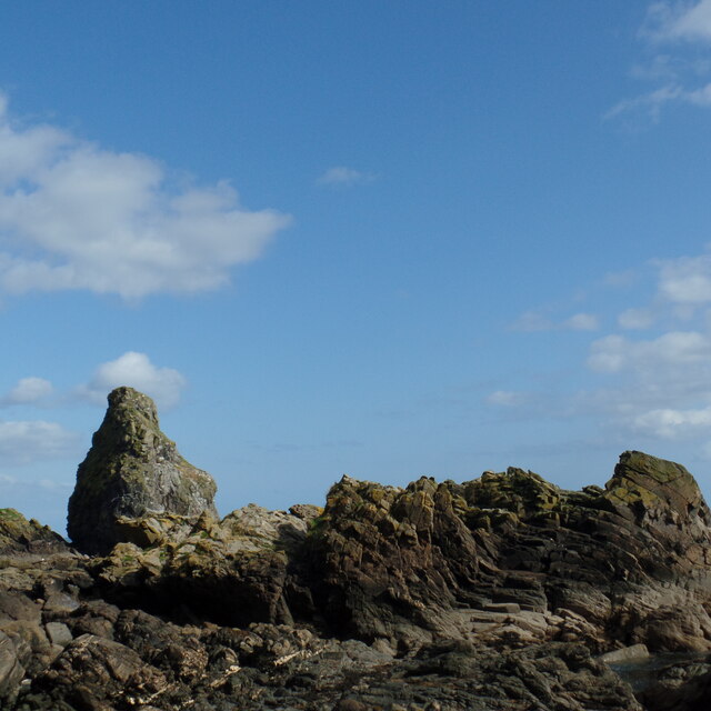
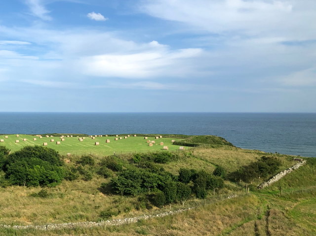
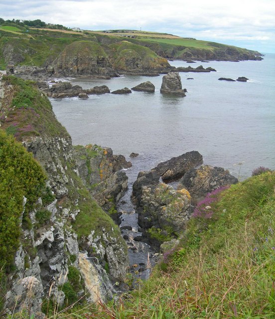
Dirten Craig is a small island located off the coast of Kincardineshire, Scotland. It is situated in the North Sea, approximately 2 miles east of the town of Stonehaven. The island is known for its rugged and dramatic cliffs, offering breathtaking views of the surrounding waters.
Covering an area of around 1.5 hectares, Dirten Craig is predominantly composed of rocky terrain, with sparse vegetation and no permanent human habitation. The island is accessible by boat, but it is not suitable for landing due to the steep cliffs that encircle it.
Dirten Craig is renowned for its rich wildlife, serving as an important breeding ground for various seabird species such as puffins, guillemots, and razorbills. The surrounding waters also support a diverse marine ecosystem, attracting seals and dolphins.
The island's geological features are of great interest to geologists and nature enthusiasts. It is predominantly composed of Old Red Sandstone, a sedimentary rock formation that dates back millions of years. The layers of rock reveal the island's ancient history, offering insights into the region's geological evolution.
Despite its small size, Dirten Craig holds a significant place in local folklore and history. It has been referenced in various tales and legends, often associated with mythical creatures and hidden treasures. Its secluded location and mesmerizing beauty make it a popular destination for birdwatchers, photographers, and nature lovers seeking a unique and remote experience.
If you have any feedback on the listing, please let us know in the comments section below.
Dirten Craig Images
Images are sourced within 2km of 56.993197/-2.1744696 or Grid Reference NO8989. Thanks to Geograph Open Source API. All images are credited.


Dirten Craig is located at Grid Ref: NO8989 (Lat: 56.993197, Lng: -2.1744696)
Unitary Authority: Aberdeenshire
Police Authority: North East
What 3 Words
///flattered.drilling.weeks. Near Stonehaven, Aberdeenshire
Nearby Locations
Related Wikis

Limpet Burn
Limpet Burn is a watercourse in Aberdeenshire, Scotland whose discharge is deemed part of the North Sea coastal drainage. Prominent geographic features...
Limpet Mill railway station
Limpet Mill was a railway station in Kincardineshire, Scotland from 1849 to 1850 on the Aberdeen Railway. == History == This station was opened on 1 November...
Kempstone Hill
Kempstone Hill is a landform in Aberdeenshire, Scotland within the Mounth Range of the Grampian Mountains. The peak elevation of this mountain is 132...
Megray Hill
Megray Hill is a low-lying coastal mountainous landform in Aberdeenshire, Scotland within the Mounth Range of the Grampian Mountains. The peak elevation...
Doonie Point
Doonie Point is a rocky headland situated approximately 1.5 kilometres south of the village of Muchalls in Aberdeenshire, Scotland. The clifftop of Doonie...

Chapel of St Mary and St Nathalan
The Chapel of St. Mary and St. Nathalan is a ruined chapel overlooking the North Sea immediately north of Stonehaven, in the Mearns of Scotland, along...
Mill of Muchalls
The Mill of Muchalls is an historic water-powered mill located along the Burn of Muchalls in Aberdeenshire, Scotland. This mill is situated near to the...
Bridge of Muchalls
Bridge of Muchalls is an entirely residential hamlet in Aberdeenshire, Scotland by the North Sea. It is on the A90 dual carriageway about three miles...
Nearby Amenities
Located within 500m of 56.993197,-2.1744696Have you been to Dirten Craig?
Leave your review of Dirten Craig below (or comments, questions and feedback).