The Needles

Island in Aberdeenshire

Scotland

The Needles

View of the coast from New Aberdour View of the coast from New Aberdour from the further point we could go that day
View of the coast from New Aberdour Credit: eric ramaz

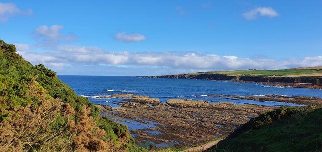
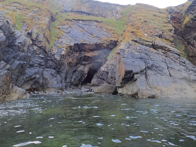
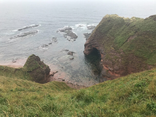
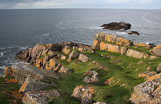
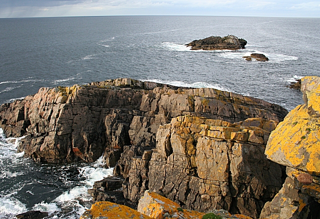
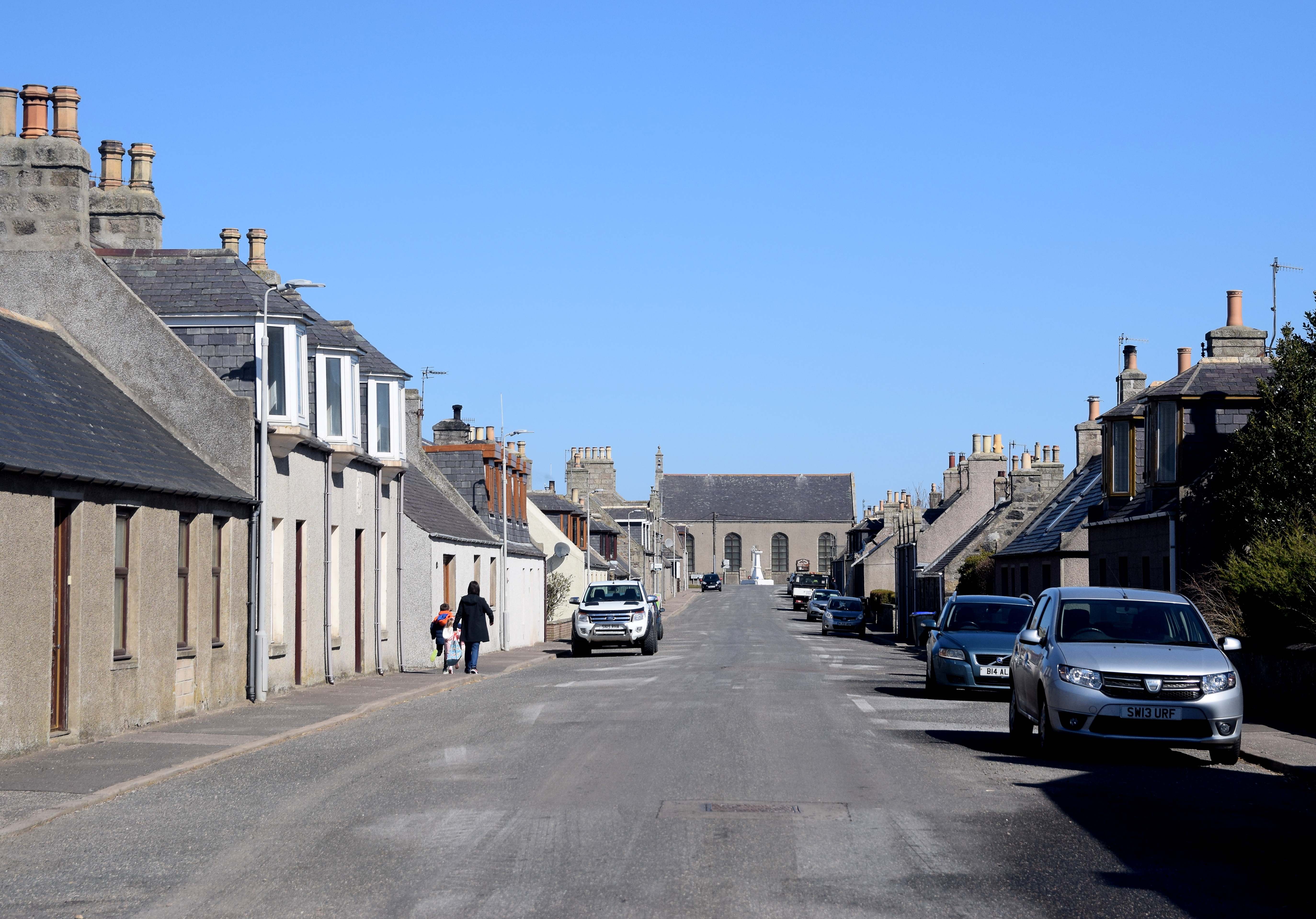
The Needles, located off the coast of Aberdeenshire, Scotland, is a small group of uninhabited islands. Situated in the North Sea, these islands are part of the dramatic coastal landscape of the area. The Needles are known for their towering sea stacks, which have been formed by the relentless erosion of the surrounding cliffs over centuries.

The largest of the islands, appropriately named The Needle, stands at an impressive 65 meters high. This towering landmark is a popular destination for birdwatchers, as it is home to a variety of seabirds including puffins, guillemots, and razorbills. The surrounding waters are also rich in marine life, making it a haven for seals and dolphins.

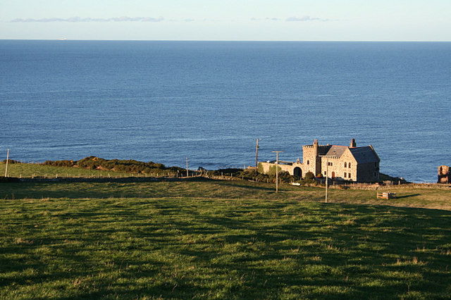
Accessible only by boat, The Needles provide a unique and untouched natural environment for visitors to explore. The islands offer breathtaking views of the Aberdeenshire coastline and the opportunity to observe the diverse wildlife that inhabits the area. The rugged terrain and crashing waves add to the wild and untamed atmosphere of the islands.

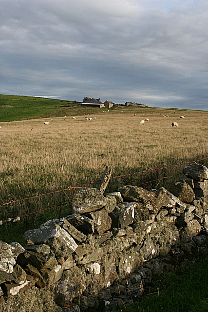
While there are no facilities or accommodations on The Needles, nearby coastal towns such as Fraserburgh and Peterhead provide a range of options for those wishing to visit. Boat tours and excursions are available from these towns, allowing visitors to experience the magnificent beauty of The Needles up close. Whether for birdwatching, photography, or simply to enjoy the tranquility of the remote Scottish islands, The Needles in Aberdeenshire offers a unique and unforgettable experience for nature enthusiasts.

If you have any feedback on the listing, please let us know in the comments section below.
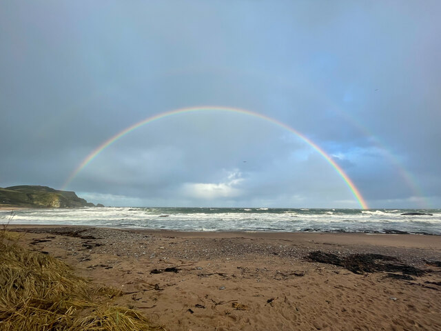
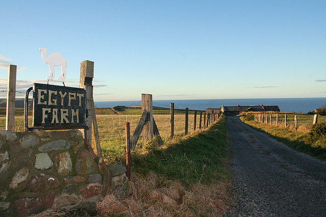
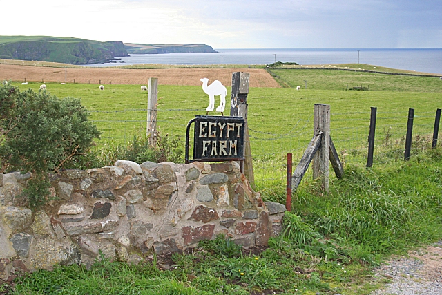
The Needles Images

Images are sourced within 2km of 57.672855/-2.184281 or Grid Reference NJ8964. Thanks to Geograph Open Source API. All images are credited.

View of the coast from New Aberdour View of the coast from New Aberdour from the further point we could go that day
View of the coast from New Aberdour
View of the coast from New Aberdour from the further point we could go that day
Quarry and Willie's Havens and Cat's Hole caves Quarry Haven is the near bay; Willie's Haven is the far one. There are two sea-caves at the bottom of the cliff on the far side of Willie's Haven. They are Cat's Hole North and South. Each has a chimney running up inside and parallel to the cliff face and each has a funnel shaped depression in the otherwise rather flat surface of the cliff top. These overlap. The depression has been used as a tip for building and other waste which may have blocked the south chimney, but the north one is still open.
Quarry and Willie's Havens and Cat's Hole caves
Quarry Haven is the near bay; Willie's Haven is the far one. There are two sea-caves at the bottom of the cliff on the far side of Willie's Haven. They are Cat's Hole North and South. Each has a chimney running up inside and parallel to the cliff face and each has a funnel shaped depression in the otherwise rather flat surface of the cliff top. These overlap. The depression has been used as a tip for building and other waste which may have blocked the south chimney, but the north one is still open.
Cat's Hole North Cave An intertidal sea-cave which has a chimney at the back which goes up to the surface of the top of the cliff above. Light from above could just be seen by eye, but has not made it into this photo. See the cave in context <a href="https://www.geograph.org.uk/photo/7555019">NJ9065 : Quarry and Willie's Havens and Cat's Hole caves</a>.
Cat's Hole North Cave
An intertidal sea-cave which has a chimney at the back which goes up to the surface of the top of the cliff above. Light from above could just be seen by eye, but has not made it into this photo. See the cave in context NJ9065 : Quarry and Willie's Havens and Cat's Hole caves.
Cat's Hole South Cave An intertidal sea-cave which has (or had) a chimney going up parallel to the cliff face to open into a depression in the flat cliff top. The top of the chimney has been partially, or perhaps totally blocked by building and other waste having been tipped into the depression. This cave can be seen in context in <a href="https://www.geograph.org.uk/photo/7555019">NJ9065 : Quarry and Willie's Havens and Cat's Hole caves</a>.
Cat's Hole South Cave
An intertidal sea-cave which has (or had) a chimney going up parallel to the cliff face to open into a depression in the flat cliff top. The top of the chimney has been partially, or perhaps totally blocked by building and other waste having been tipped into the depression. This cave can be seen in context in NJ9065 : Quarry and Willie's Havens and Cat's Hole caves.
Blowhole/Gloup at the top of Cat's Hole North Cave The triangular dark area is the open top of a natural chimney which extends down to the sea-cave below <a href="https://www.geograph.org.uk/photo/7555198">NJ9065 : Cat's Hole North Cave</a>. Evidence of this was the sound of doves cooing somewhere below.  Also dim light was seen from above when photographing said cave. It can be described as a blowhole. The down angle for this photo was about 30 degrees. Stones and other waste have been tipped from the west side, but this is partly grassed  over.
Blowhole/Gloup at the top of Cat's Hole North Cave
The triangular dark area is the open top of a natural chimney which extends down to the sea-cave below NJ9065 : Cat's Hole North Cave. Evidence of this was the sound of doves cooing somewhere below. Also dim light was seen from above when photographing said cave. It can be described as a blowhole. The down angle for this photo was about 30 degrees. Stones and other waste have been tipped from the west side, but this is partly grassed over.
Blowhole/Gloup at the top of Cat's Hole South Cave The view from a bit west of the blowhole from the north cave <a href="https://www.geograph.org.uk/photo/7555271">NJ9065 : Blowhole/Gloup at the top of Cat's Hole North Cave</a> towards what was the blowhole from the south cave <a href="https://www.geograph.org.uk/photo/7555249">NJ9065 : Cat's Hole South Cave</a>. It is possible to see something of the narrow part of the south blowhole by clambering down the trash pile. It is unclear whether or not it is fully blocked further down.
Blowhole/Gloup at the top of Cat's Hole South Cave
The view from a bit west of the blowhole from the north cave NJ9065 : Blowhole/Gloup at the top of Cat's Hole North Cave towards what was the blowhole from the south cave NJ9065 : Cat's Hole South Cave. It is possible to see something of the narrow part of the south blowhole by clambering down the trash pile. It is unclear whether or not it is fully blocked further down.
Caves at Aberdour beach From the top of the cliff looking down towards the beach and caves
Caves at Aberdour beach
From the top of the cliff looking down towards the beach and caves
Beach Rainbow
Beach Rainbow
Farm buildings at Egypt.   Where?? I wonder how the name was derived.
Farm buildings at Egypt. Where??
I wonder how the name was derived.
Lane to Egypt Farm.
Lane to Egypt Farm.
Lochhills Farmhouse
Lochhills Farmhouse
Egypt The camel on the farm sign would have caught my eye, even if the name on the map had not. It lies on top of the cliffs, with a fine view along the coast.
Egypt
The camel on the farm sign would have caught my eye, even if the name on the map had not. It lies on top of the cliffs, with a fine view along the coast.
Sheep on Quarry Head I'm not accustomed to sheep which, instead of running away as I approach, obligingly stand and pose for the camera! Note the half-eaten bale of hay. The white building is Ministry of Defence property.
Sheep on Quarry Head
I'm not accustomed to sheep which, instead of running away as I approach, obligingly stand and pose for the camera! Note the half-eaten bale of hay. The white building is Ministry of Defence property.
Helipad on Quarry Head The map marks the sea here as a danger area. This is because it is used for target practice by the Royal Air Force. Presumably the helipad in this remote spot, and the military building in the background, have something to do with that.
Helipad on Quarry Head
The map marks the sea here as a danger area. This is because it is used for target practice by the Royal Air Force. Presumably the helipad in this remote spot, and the military building in the background, have something to do with that.
Quarry Head This is almost all the land there is in this square. The headland is formed of dipping layers of rock, which unfortunately dip to the east so were in the shade in the later afternoon.
Quarry Head
This is almost all the land there is in this square. The headland is formed of dipping layers of rock, which unfortunately dip to the east so were in the shade in the later afternoon.
Quarry Head Evening sunlight on the yellow lichen which clothes the massive rock strata forming the headland.
Quarry Head
Evening sunlight on the yellow lichen which clothes the massive rock strata forming the headland.
Egypt The farm buildings at this oddly named farm, seen from the road below Quarryhead Farm.
Egypt
The farm buildings at this oddly named farm, seen from the road below Quarryhead Farm.
Lochlip A partly cut barley field under a dull sky at Lochlip.
Lochlip
A partly cut barley field under a dull sky at Lochlip.
Show me another place!

The Needles is located at Grid Ref: NJ8964 (Lat: 57.672855, Lng: -2.184281)

Unitary Authority: Aberdeenshire

Police Authority: North East

What 3 Words

///nimbly.unusable.calls. Near Rosehearty, Aberdeenshire

Related Wikis

Rescue from SS William Hope

In the 1884 rescue from SS William Hope in Aberdour Bay off the north coast of Aberdeenshire in Scotland Jane Whyte rescued fifteen sailors from their...

Dundarg Castle

Dundarg Castle is a ruined castle about 2 kilometres (1.2 mi) north-northeast of New Aberdour, Aberdeenshire, Scotland, built within the ramparts of an...

New Aberdour

New Aberdour is a small planned village in the Aberdour parish of Aberdeenshire, Scotland, situated south of Aberdour Bay on the Moray Firth. It lies 7...

Aberdour House (Aberdeenshire)

Aberdour House is Category A listed country house in New Aberdour, Aberdeenshire, Scotland. Dating to around 1740, it was built by John Forbes, of Knappernay...

Tyrie, Aberdeenshire

Tyrie is a hamlet and parish in the Banff and Buchan district of Aberdeenshire, north-east Scotland. Tyrie is located on the A98 road, around 5.5 miles...

Auchmeddan Castle

Auchmeddan Castle was a castle, most likely dating from the 16th century, now demolished, located 9 miles (14 km) west of Fraserburgh, at Mains of Auchmeddan...

Pennan

Pennan (Scots: Peenan) is a small village in Aberdeenshire, Scotland, consisting of a small harbour and a single row of homes, including a hotel. It is...

Rosehearty

Rosehearty (Scottish Gaelic: Ros Abhartaich) is a settlement on the Moray Firth coast, four miles west of the town Fraserburgh, in the historical county...

Nearby Amenities

Located within 500m of 57.672855,-2.184281
Source: Old Landsat image trace
Lat/Long: 57.6721612/-2.1850137
Source: Old Landsat image trace
Lat/Long: 57.6717787/-2.1921279
Source: Old Landsat image trace
Lat/Long: 57.6719924/-2.1913968
St Drostan's Well
Man Made: water_well
Lat/Long: 57.6709656/-2.1912766
Power: pole
Lat/Long: 57.6710581/-2.1782568
Power: pole
Lat/Long: 57.6715289/-2.1784144
Power: pole
Lat/Long: 57.6719847/-2.1785572
Power: pole
Lat/Long: 57.6724817/-2.1786752
Power: pole
Lat/Long: 57.6727234/-2.1779296
Power: pole
Lat/Long: 57.6720851/-2.1773797
Power: pole
Lat/Long: 57.6714554/-2.1768621
Power: pole
Lat/Long: 57.6696004/-2.1806393
Power: pole
Lat/Long: 57.6699777/-2.1798517
Power: pole
Lat/Long: 57.6703582/-2.1785509
Power: pole
Lat/Long: 57.6733471/-2.1784441
The data included in this document is from www.openstreetmap.org. The data is made available under ODbL.

Have you been to The Needles?

Leave your review of The Needles below (or comments, questions and feedback).