Girdle Rock

Island in Kincardineshire

Scotland

Girdle Rock

Castle Street, Wairds Park, Johnshaven Looking north-eastward.
Castle Street, Wairds Park, Johnshaven Credit: Peter Wood

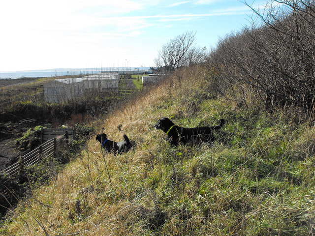
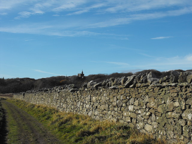
Girdle Rock is a small uninhabited island located off the coast of Kincardineshire, Scotland. Situated approximately 1.5 kilometers southeast of Dunnottar Castle, the island is visible from the mainland and attracts visitors due to its unique geological features and historical significance.

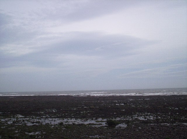
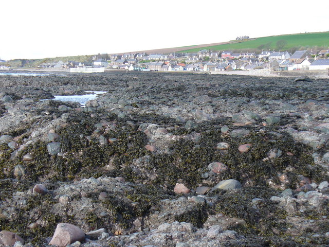
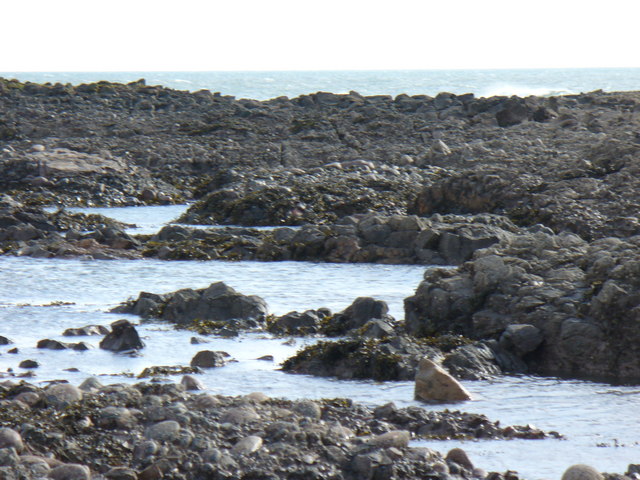
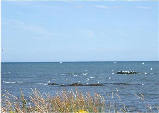
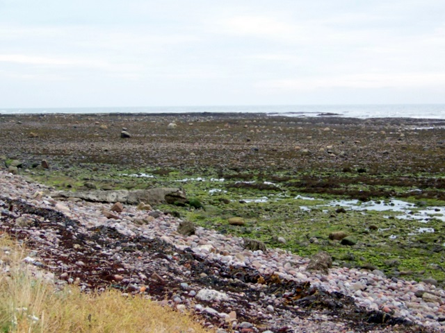
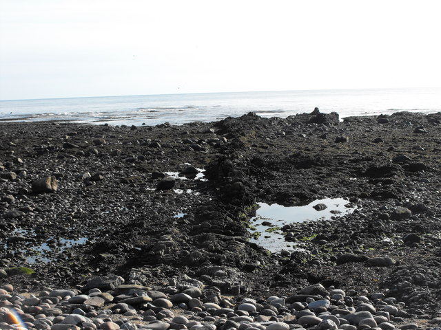
The island gets its name from its distinctive appearance, as it resembles a girdle or belt when viewed from certain angles. It is primarily composed of rugged cliffs and rocky outcrops, with a maximum elevation reaching around 30 meters above sea level. Girdle Rock is surrounded by the North Sea, and its shores are characterized by rocky beaches and tidal pools.

One of the notable features of Girdle Rock is the natural arch that has formed through years of erosion. This arch, known as Dunnicaer Arch, is an impressive sight and often draws photographers and nature enthusiasts to the island. It is believed to have been used as a natural defense by Picts, an ancient Celtic people, who occupied the island during the early medieval period.

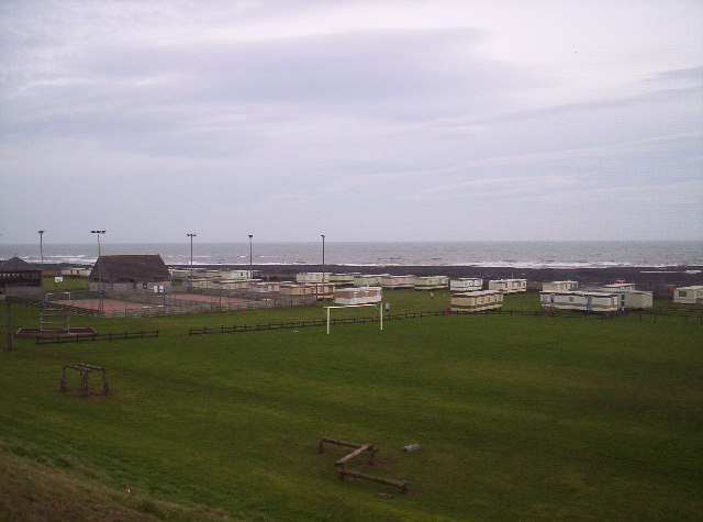
Access to Girdle Rock is limited due to its remote location and lack of facilities. However, during low tide, it is possible to approach the island on foot from the nearby Dunnottar Castle. It is important to note that caution should be exercised when visiting, as the terrain can be treacherous and the sea conditions unpredictable.

Overall, Girdle Rock is an intriguing destination for those interested in geology, history, and natural beauty. Its rugged cliffs, stunning arch, and historical significance make it a captivating place to explore and appreciate the wonders of Scotland's coastline.

If you have any feedback on the listing, please let us know in the comments section below.

Girdle Rock Images

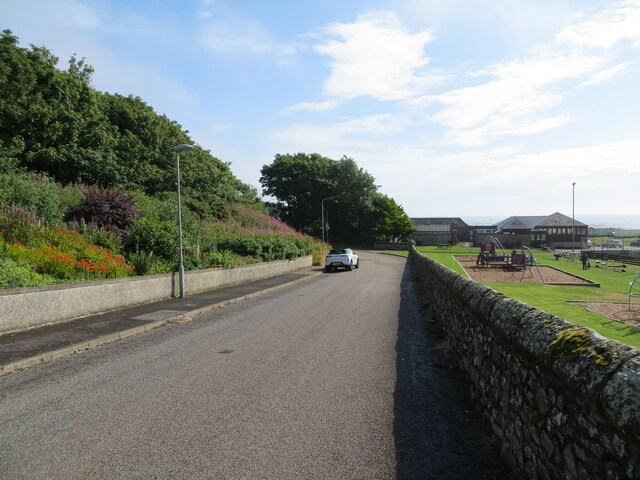
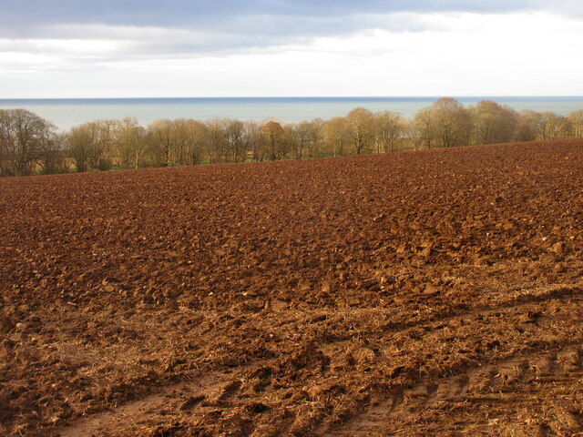
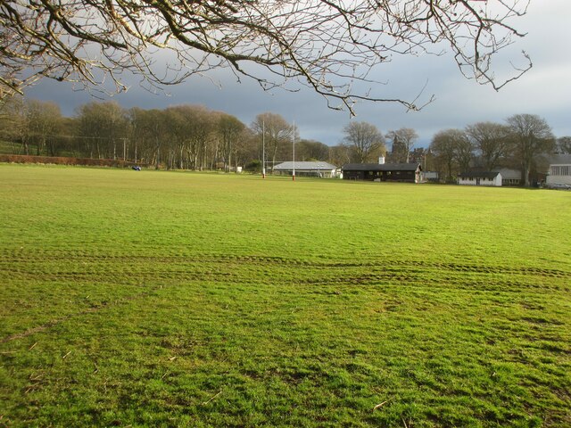
Images are sourced within 2km of 56.790761/-2.3350596 or Grid Reference NO7966. Thanks to Geograph Open Source API. All images are credited.

Castle Street, Wairds Park, Johnshaven Looking north-eastward.
Castle Street, Wairds Park, Johnshaven
Looking north-eastward.
Ploughed field above the sea Looking south down a ploughed field between the A92 and Lathallan School, with the North Sea beyond.
Ploughed field above the sea
Looking south down a ploughed field between the A92 and Lathallan School, with the North Sea beyond.
Rugby pitch at Lathallan School Rugby field on the Johnshaven side of Lathallan School.
Rugby pitch at Lathallan School
Rugby field on the Johnshaven side of Lathallan School.
Rock Pools near Johnshaven
East Long Skelly Rocks Exposed rocky wave-cut platform at Johnshaven.
East Long Skelly Rocks
Exposed rocky wave-cut platform at Johnshaven.
East Long Skelly Looking out to sea over the wave-cut platform at Johnshaven.
East Long Skelly
Looking out to sea over the wave-cut platform at Johnshaven.
Seabirds near East Long Skelly
Rocky foreshore, East Long Skelly The exposed rocky platform near Johnshaven.
Rocky foreshore, East Long Skelly
The exposed rocky platform near Johnshaven.
Wairds Park Bowling Green Looking down from the old railway embankment to Wairds Park bowling green
Wairds Park Bowling Green
Looking down from the old railway embankment to Wairds Park bowling green
Football at Johnshaven The pitch that the local team play on is by the campsite. This is to the west of the village. Other activities nearby are bowling, tennis and pitch-and-putt.
The whole site is run by the local community for the benefit of the local area. 
Just across a very small road to rock pools.
Football at Johnshaven
The pitch that the local team play on is by the campsite. This is to the west of the village. Other activities nearby are bowling, tennis and pitch-and-putt. The whole site is run by the local community for the benefit of the local area. Just across a very small road to rock pools.
Old railway bridge at Johnshaven This bridge is part of the now dismantled Johnshaven to Gourdon line. Very attractive railings. To the east of the campsite.
Old railway bridge at Johnshaven
This bridge is part of the now dismantled Johnshaven to Gourdon line. Very attractive railings. To the east of the campsite.
Railway embankment, Johnshaven This is taken at the east end of the campsite. The disused railway line goes to Gourdon.
Railway embankment, Johnshaven
This is taken at the east end of the campsite. The disused railway line goes to Gourdon.
Lathallen School, Johnshaven South elevation. Obviously a baronial mansion home converted to a school.
Lathallen School, Johnshaven
South elevation. Obviously a baronial mansion home converted to a school.
Fence posts, Johnshaven Two very different types of post by the side of the disused railway to Gourdon. Could the metal one be the original when the railway was built? Embankment behind posts.
Fence posts, Johnshaven
Two very different types of post by the side of the disused railway to Gourdon. Could the metal one be the original when the railway was built? Embankment behind posts.
Foreshore, Johnshaven Between Johnshaven and Gourdon. Thought this may have been some kind of pipeline but getting closer saw it was an interesting geological rock formation. Will research further unless someone else can explain....
Foreshore, Johnshaven
Between Johnshaven and Gourdon. Thought this may have been some kind of pipeline but getting closer saw it was an interesting geological rock formation. Will research further unless someone else can explain....
Stone wall, Johnshaven This wall is still mostly complete with only a few small areas broken. The wall runs for several hundred metres. I wonder if it is the original boundary for Lathallen when it was a private estate. The top of Lathallan School can be seen in the centre.
Stone wall, Johnshaven
This wall is still mostly complete with only a few small areas broken. The wall runs for several hundred metres. I wonder if it is the original boundary for Lathallen when it was a private estate. The top of Lathallan School can be seen in the centre.
Footpath, Johnshaven to Gourdon This footpath follows the disused railway then a long stone wall to Gourdon. The buildings in the centre are timber stables for the horses on the other side of the wall.
Footpath, Johnshaven to Gourdon
This footpath follows the disused railway then a long stone wall to Gourdon. The buildings in the centre are timber stables for the horses on the other side of the wall.
Show me another place!

Girdle Rock is located at Grid Ref: NO7966 (Lat: 56.790761, Lng: -2.3350596)

Unitary Authority: Aberdeenshire

Police Authority: North East

What 3 Words

///reclined.treble.debt. Near St Cyrus, Aberdeenshire

Related Wikis

Johnshaven

Johnshaven is a coastal village along the North Sea located in Aberdeenshire, Scotland. About 2 miles (3 km) southwest of Johnshaven lies Milton Ness,...

Johnshaven railway station

Johnshaven railway station served the area of Johnshaven, Aberdeenshire, Scotland from 1865 to 1951 on the Montrose and Bervie Railway. == History == The...
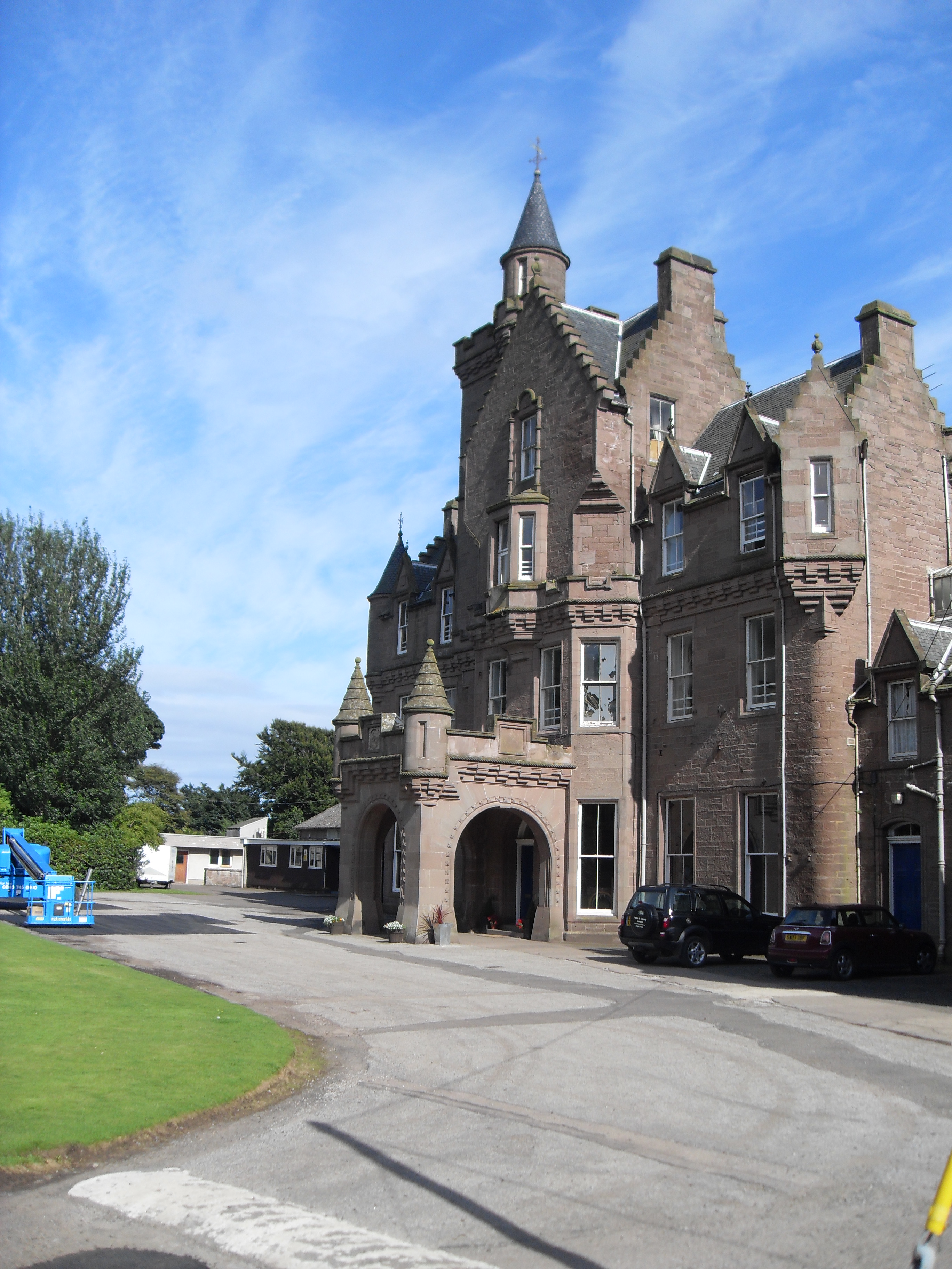
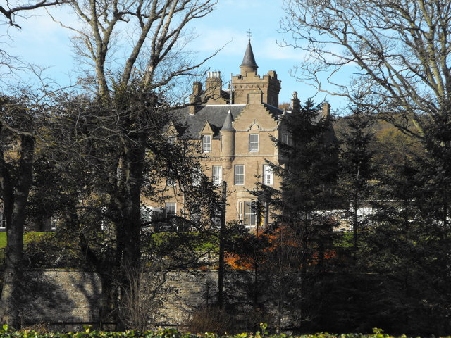
Lathallan School

Lathallan School is a co-educational all-through independent school at Brotherton Castle in Scotland, UK. It also offers outdoor learning programs on its...

Birnie Road Halt railway station

Birnie Road Halt railway station served the settlement of Benholm, Aberdeenshire, Scotland from 1865 to 1966 on the Montrose and Bervie Railway. ��2�...

Nearby Amenities

Located within 500m of 56.790761,-2.3350596
Source: PGS
Lat/Long: 56.7912471/-2.3432184
Source: PGS
Lat/Long: 56.7917761/-2.340933
Source: PGS
Lat/Long: 56.791846/-2.339505
Source: PGS
Lat/Long: 56.7919914/-2.3388815
Source: PGS
Lat/Long: 56.7925306/-2.3376026
Source: PGS
Lat/Long: 56.7928447/-2.3371683
Source: PGS
Lat/Long: 56.7929122/-2.3371606
Source: PGS
Lat/Long: 56.7931582/-2.3374732
Source: PGS
Lat/Long: 56.7934805/-2.3371348
Source: PGS
Lat/Long: 56.7936766/-2.3366856
Source: PGS
Lat/Long: 56.7938758/-2.3367544
Source: PGS
Lat/Long: 56.7941625/-2.3357057
Source: PGS
Lat/Long: 56.7935411/-2.3355752
Source: PGS
Lat/Long: 56.7943114/-2.3347233
Source: PGS
Lat/Long: 56.7944082/-2.3339156
Source: PGS
Lat/Long: 56.7947164/-2.3318529
Johnshaven
Loc Name: Johner
Place: village
Population: 640
Wikidata: Q1009153
Wikipedia: en:Johnshaven
Lat/Long: 56.7948936/-2.3357887
Post Office
Johnshaven Post Office
Addr City: Montrose
Addr Housenumber: 1
Addr Postcode: DD10 0HD
Addr Street: New Road
Addr Suburb: Johnshaven
Opening Hours: Mo 13:15-16:00; Tu 09:00-12:30; Th 13:15-16:00
Ref Pol Id: 96914
Source: OS OpenData StreetView
Lat/Long: 56.7944935/-2.3366987
Source: PGS
Lat/Long: 56.7937378/-2.3366137
Seamark Light Category: lower
Seamark Light Character: F
Seamark Light Colour: red
Seamark Light Height: 5
Seamark Light Reference: A 3226
Seamark Type: light_minor
Source: US NGA Pub. 114. 2011-05-26.
Lat/Long: 56.7939361/-2.3367267
Seamark Information: Shows R when unsafe to enter harbor
Seamark Light Category: upper
Seamark Light Character: F
Seamark Light Colour: green
Seamark Light Height: 20
Seamark Light Reference: A 3226.1
Seamark Type: light_minor
Source: US NGA Pub. 114. 2011-05-26.
Lat/Long: 56.7945299/-2.3377773
Entrance: main
Lat/Long: 56.7934211/-2.3394275
Leisure: slipway
Lat/Long: 56.7941738/-2.3356662
Bench
Backrest: yes
Colour: brown
Material: wood
Seats: 3
Lat/Long: 56.7948473/-2.3317438
Starfish Studio
Addr City: Montrose
Addr Housenumber: 3
Addr Postcode: DD10 0EN
Addr Street: Anchor Lane
Addr Suburb: Johnshaven
Description: Gift shop selling products handmade in the British Isles. Also a craft workshop venue seasonally.
Opening Hours: Tu-Su 11:00-16:00
Phone: +44 1561 360118
Shop: gift
Website: https://www.starfishstudio.co.uk/
Lat/Long: 56.7943585/-2.336872
Bench
Backrest: yes
Colour: brown
Material: wood
Seats: 3
Lat/Long: 56.7945489/-2.3364752
Historic: memorial
Memorial: war_memorial
Lat/Long: 56.7945989/-2.3364649
Telephone
Booth: K6
Covered: booth
Listed Status: Category B
Lat/Long: 56.794569/-2.3369642
Bench
Lat/Long: 56.7943567/-2.3378204
Crossing
Lat/Long: 56.7930768/-2.3379458
Cafe
Hidden Treasure Tearoom
Addr City: Montrose
Addr Housename: Auld Boat Builders
Addr Postcode: DD10 0EU
Addr Street: Fore Street
Addr Suburb: Johnshaven
Fhrs Id: 1256908
Opening Hours: Th-Fr 09:30-16:00; Sa-Su 10:00-16:00
Outdoor Seating: no
Lat/Long: 56.7943809/-2.3358925
Barrier: cycle_barrier
Lat/Long: 56.793816/-2.3380239
Barrier: step
Lat/Long: 56.7939392/-2.3377284
Bus Stop
The Square
Bench: yes
Bin: no
Bus: yes
Departures Board: timetable
Naptan AtcoCode: 630045121
Naptan Bearing: SE
Naptan CommonName: The Square
Naptan Indicator: at
Naptan NaptanCode: 23625396
Naptan Street: Mid Street
Naptan Verified: no
Operator: Stagecoach
Public Transport: platform
Ref: 630045121
Shelter: yes
Source: naptan;bing;naptan_compare_tool
Lat/Long: 56.7944471/-2.3361652
Post Box
Collection Times: Mo-Fr 16:30; Sa 11:45; Su off
Colour: #9D383A
Drive Through: no
Operator: Royal Mail
Post Box Mounting: wall
Post Box Type: wall
Ref: DD10 83
Royal Cypher: scottish_crown
Lat/Long: 56.7946508/-2.3368664
Historic: memorial
Inscription: IN MEMORY|OF THE|REV JAMES GLEN A.M.|BORN 1791|DIED 1866|"JESUS STOOD & CRIED, SAYING,|IF ANY MAN THIRST, LET HIM COME|UNTO ME, AND DRINK."
Material: granite
Memorial: fountain
Lat/Long: 56.7948886/-2.336218
Access: private
Addr City: Montrose
Addr Housenumber: 3
Addr Postcode: DD10 0HD
Addr Street: New Road
Addr Suburb: Johnshaven
Door: yes
Entrance: home
Level: 0
Lat/Long: 56.7943606/-2.3360657
Access: private
Addr City: Montrose
Addr Housenumber: 2
Addr Postcode: DD10 0HG
Addr Street: The Square
Addr Suburb: Johnshaven
Door: yes
Entrance: staircase
Level: 0
Lat/Long: 56.7944378/-2.3360671
Access: private
Addr City: Montrose
Addr Housenumber: 30
Addr Postcode: DD10 0HA
Addr Street: Main Street
Addr Suburb: Johnshaven
Door: yes
Entrance: home
Level: 0
Lat/Long: 56.7930058/-2.3386699
Access: private
Addr City: Montrose
Addr Housenumber: 27
Addr Postcode: DD10 0HA
Addr Street: Main Street
Addr Suburb: Johnshaven
Door: yes
Entrance: home
Level: 0
Lat/Long: 56.7929054/-2.3388133
Access: private
Addr City: Montrose
Addr Housenumber: 28,29
Addr Postcode: DD10 0HA
Addr Street: Main Street
Addr Suburb: Johnshaven
Door: yes
Entrance: staircase
Level: 0
Lat/Long: 56.7929923/-2.3388251
Access: private
Addr City: Montrose
Addr Housename: Lilybank
Addr Housenumber: 1
Addr Postcode: DD10 0HF
Addr Street: Seaview Terrace
Addr Suburb: Johnshaven
Door: yes
Entrance: home
Level: 0
Lat/Long: 56.7939181/-2.3381892
Access: private
Addr City: Montrose
Addr Housename: Lilybank
Addr Housenumber: 2
Addr Postcode: DD10 0HF
Addr Street: Seaview Terrace
Addr Suburb: Johnshaven
Door: yes
Entrance: home
Level: 0
Lat/Long: 56.7939629/-2.3381338
Ararat
Natural: rock
Seamark Type: rock
Lat/Long: 56.789802/-2.3382563
Girdle Rock
Natural: rock
Seamark Type: rock
Lat/Long: 56.7908597/-2.3348875
Long Skelly
Natural: rock
Seamark Type: rock
Lat/Long: 56.790607/-2.335955
Sully Rock
Natural: rock
Seamark Type: rock
Lat/Long: 56.7899077/-2.3364002
Millend Garage
Addr City: Montrose
Addr Housename: Millend Garage
Addr Postcode: DD10 0HL
Addr Street: West Street
Addr Suburb: Johnshaven
Shop: car_repair
Lat/Long: 56.7917255/-2.3424135
Pub
Ship Hotel
Addr City: Montrose
Addr Housenumber: 1-3
Addr Postcode: DD10 0ER
Addr Street: Castle Street
Addr Suburb: Johnshaven
Opening Hours: Su-Th 12:00-24:00; Fr-Sa 12:00-01:00
Lat/Long: 56.7947341/-2.3365239
Pub
The Anchor Hotel
Addr City: Montrose
Addr Housename: The Anchor Hotel
Addr Postcode: DD10 0HD
Addr Street: New Road
Addr Suburb: Johnshaven
Cuisine: seafood
Email: info@anchorhoteljohnshaven.com
Fhrs Id: 140863
Internet Access: wlan
Internet Access Fee: no
Phone: +44 1561 362288
Website: https://www.anchorhoteljohnshaven.co.uk
Lat/Long: 56.7943941/-2.3365051
Odyssee Hair Design
Addr City: Montrose
Addr Housenumber: 1-3
Addr Postcode: DD10 0HA
Addr Street: Main Street
Addr Suburb: Johnshaven
Phone: +44 1561 362035
Shop: hairdresser
Lat/Long: 56.7944141/-2.3369862
Johnshaven Stores
Addr City: Montrose
Addr Housenumber: 1
Addr Postcode: DD10 0HD
Addr Street: New Road
Addr Suburb: Johnshaven
Fhrs Id: 140854
Opening Hours: Mo-Fr 06:15-20:00; Sa 07:30-20:00; Su 08:30-20:00
Shop: convenience
Lat/Long: 56.7945105/-2.3367465
Source: PGS
Lat/Long: 56.7935486/-2.3355917
Waste Basket
Waste: trash
Lat/Long: 56.7939073/-2.3367967
Man Made: planter
Lat/Long: 56.7941333/-2.3362986
Man Made: planter
Lat/Long: 56.7942272/-2.335901
Man Made: planter
Lat/Long: 56.7940644/-2.3364179
Man Made: planter
Lat/Long: 56.7940316/-2.3365037
Man Made: planter
Lat/Long: 56.7939844/-2.3366346
Man Made: planter
Lat/Long: 56.7939678/-2.3366853
Bench
Backrest: yes
Lat/Long: 56.7942625/-2.3354909
Guide Type: destination
Information: guidepost
Tourism: information
Lat/Long: 56.7942189/-2.3359333
Bench
Backrest: yes
Lat/Long: 56.7942314/-2.3358547
Bench
Backrest: yes
Lat/Long: 56.7940722/-2.3363999
Bench
Backrest: yes
Lat/Long: 56.7940579/-2.3364397
Bench
Backrest: yes
Lat/Long: 56.7940438/-2.3364821
Bench
Backrest: yes
Lat/Long: 56.794001/-2.3365905
Bench
Backrest: yes
Lat/Long: 56.7939782/-2.3366606
Bench
Backrest: yes
Lat/Long: 56.7939602/-2.3367062
The Lobster Shop
Addr City: Montrose
Addr Postcode: DD10 0HX
Addr Street: Fore Street
Addr Suburb: Johnshaven
Contact Email: info@thelobster.shop
Contact Phone: +44 1561 362207
Contact Website: https://thelobster.shop/
Opening Hours: We-Fr 12:00-17:00; Sa 12:00-15:00
Shop: seafood
Lat/Long: 56.7943504/-2.3347691
Power: pole
Lat/Long: 56.7942063/-2.3395216
Power: pole
Lat/Long: 56.7936754/-2.3403888
Power: pole
Lat/Long: 56.7932114/-2.341347
Power: pole
Lat/Long: 56.792745/-2.3422985
Power: pole
Lat/Long: 56.792338/-2.3426002
Power: pole
Lat/Long: 56.791761/-2.3428608
Power: pole
Lat/Long: 56.7945767/-2.3382618
Defibrillator
Access: yes
Brand: HeartSafe
Defibrillator Location: Exterior wall of village hall
Emergency: defibrillator
Indoor: no
Ref GB The Circuit: E0BC49DF-FA7A-49A4-A940-0CC8C068E30B
Lat/Long: 56.794834/-2.3347093
Defibrillator
Access: yes
Brand: HeartSafe
Defibrillator Location: Exterior wall of masonic lodge
Emergency: defibrillator
Indoor: no
Lat/Long: 56.7931814/-2.3386772
St John 119
Club: freemasonry
Lat/Long: 56.7932039/-2.3385711
The data included in this document is from www.openstreetmap.org. The data is made available under ODbL.

Have you been to Girdle Rock?

Leave your review of Girdle Rock below (or comments, questions and feedback).