Archie's Cap
Island in Banffshire
Scotland
Archie's Cap

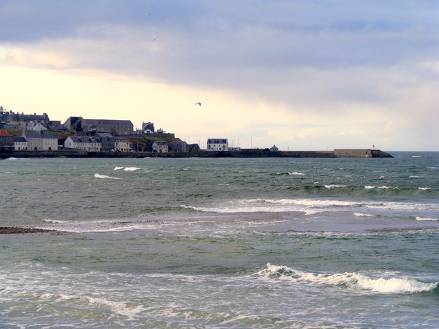
Archie's Cap is a small island located off the coast of Banffshire, a historic county in northeastern Scotland. This picturesque island is situated in the North Sea, near the mouth of the River Deveron. With a land area of approximately 0.3 hectares, Archie's Cap is one of the smallest islands in the region.
The island gets its name from a prominent rock formation resembling a cap or hat, which can be seen from a distance. It is believed that Archie's Cap received its name from a local fisherman named Archie who often wore a distinctive cap while navigating the waters around the island.
Despite its small size, Archie's Cap is a popular spot for birdwatchers and nature enthusiasts. The island is home to a diverse range of bird species, including puffins, guillemots, and cormorants. The surrounding waters also attract seals and occasionally dolphins, providing opportunities for wildlife observation.
Access to Archie's Cap is primarily by boat, with local fishing charters and tour operators offering trips to the island. Visitors can enjoy stunning views of the rugged coastline, the nearby Banff Bay, and the surrounding Scottish landscapes.
While there are no permanent human inhabitants on Archie's Cap, the island's natural beauty, tranquility, and wildlife make it a sought-after destination for those seeking a unique and immersive experience in the Banffshire area.
If you have any feedback on the listing, please let us know in the comments section below.
Archie's Cap Images
Images are sourced within 2km of 57.673525/-2.4983294 or Grid Reference NJ7064. Thanks to Geograph Open Source API. All images are credited.


Archie's Cap is located at Grid Ref: NJ7064 (Lat: 57.673525, Lng: -2.4983294)
Unitary Authority: Aberdeenshire
Police Authority: North East
What 3 Words
///lecturing.describe.legroom. Near Macduff, Aberdeenshire
Nearby Locations
Related Wikis

Macduff Lifeboat Station
Macduff Lifeboat Station is a Royal National Lifeboat Institution (RNLI) marine-rescue facility in Macduff, Aberdeenshire, Scotland, United Kingdom. The...

Macduff, Aberdeenshire
Macduff (Scottish Gaelic: An Dùn) is a town in the Banff and Buchan area of Aberdeenshire, Scotland. It is situated on Banff Bay and faces the town of...

Macduff Marine Aquarium
Macduff Marine Aquarium is an aquarium in Macduff, Scotland. == History == Macduff Marine Aquarium opened in 1997.In 2017, the aquarium closed to allow...

Macduff Town Hall
Macduff Town Hall is a municipal building in Shore Street, Macduff, Aberdeenshire, Scotland. The structure, which was the meeting place of Macduff Burgh...

Macduff railway station
Macduff railway station was a railway station serving the settlements of Banff and Macduff, Aberdeenshire, Scotland. It was the terminus of a branch line...
Banff Bay
Banff Bay (Scottish Gaelic: Bàgh Bhanbh) is a coastal embayment in Scotland situated between the towns of Banff, Aberdeenshire and Macduff, Aberdeenshire...

River Deveron
The River Deveron (Scottish Gaelic: Uisge Dubh Èireann) is a river in the north east of Scotland. The river has a length of 60 miles (97 km), and has a...
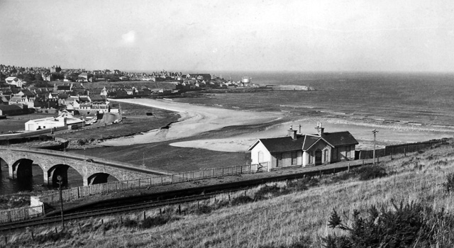
Banff Bridge railway station
Banff Bridge railway station was a railway station in Banff Bridge, Banff, Aberdeenshire. It was the penultimate stop on a branch line from Inveramsay...
Nearby Amenities
Located within 500m of 57.673525,-2.4983294Have you been to Archie's Cap?
Leave your review of Archie's Cap below (or comments, questions and feedback).