Craigs of Gives Den
Island in Angus
Scotland
Craigs of Gives Den

Craigs of Gives Den is a small island located off the coast of Angus, Scotland. It is situated in the North Sea, about 2 miles northeast of Arbroath. The island is part of a group of three small islands, including the nearby Bell Rock and Inchcape, which are known for their natural beauty and wildlife.
Craigs of Gives Den covers an area of approximately 6 acres and is characterized by rugged rocky terrain and steep cliffs that drop into the sea. The island is uninhabited and inaccessible to the public, making it a haven for various seabird species. It is particularly well-known for being a breeding ground for gannets, puffins, and kittiwakes.
Due to its isolated location, Craigs of Gives Den has a rich marine ecosystem surrounding it. The waters around the island are teeming with marine life, including seals, dolphins, and various species of fish. This makes it a popular spot for wildlife enthusiasts and birdwatchers, who can observe the diverse range of species from boat trips or viewpoints on the mainland.
The island's name, Craigs of Gives Den, originates from the Old Norse language and translates to "rocky gorge." This name accurately reflects the island's topography, with its rocky cliffs and deep gorges carved by the relentless force of the sea.
Overall, Craigs of Gives Den is a picturesque island that offers a glimpse into the natural beauty and wildlife diversity of the Angus coastline. Its rugged landscape and abundant birdlife make it a must-visit destination for nature lovers and those seeking a tranquil escape.
If you have any feedback on the listing, please let us know in the comments section below.
Craigs of Gives Den Images
Images are sourced within 2km of 56.602553/-2.5005372 or Grid Reference NO6945. Thanks to Geograph Open Source API. All images are credited.


Craigs of Gives Den is located at Grid Ref: NO6945 (Lat: 56.602553, Lng: -2.5005372)
Unitary Authority: Angus
Police Authority: Tayside
What 3 Words
///mango.tailors.cracks. Near Arbroath, Angus
Nearby Locations
Related Wikis
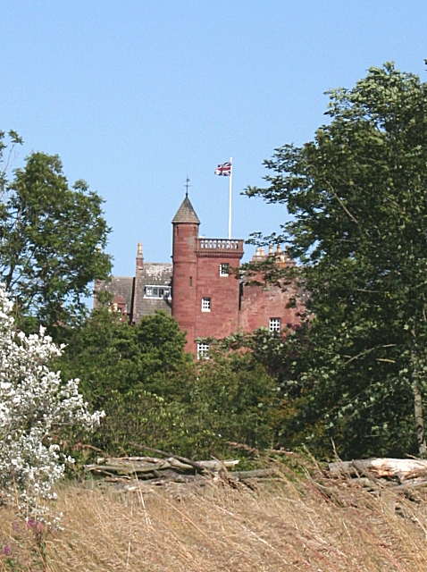
Ethie Castle
Ethie Castle is a 15,091 square feet (1,402.0 m2) 14th-century castle, situated around 3 miles north of the fishing town of Arbroath in Angus, Scotland...

Auchmithie
Auchmithie is a small fishing village in Angus, Scotland, three miles north east of the town of Arbroath. It sits atop a cliff of red sandstone conglomerate...

Cauldcots railway station
Cauldcots railway station served the hamlet of Cauldcots, Angus, Scotland, from 1883 to 1930 on the North British, Arbroath and Montrose Railway. ��2...

Inverkeilor railway station
Inverkeilor railway station served the village of Inverkeilor, Angus, Scotland from 1883 to 1930 on the North British, Arbroath and Montrose Railway....
Nearby Amenities
Located within 500m of 56.602553,-2.5005372Have you been to Craigs of Gives Den?
Leave your review of Craigs of Gives Den below (or comments, questions and feedback).