Burn Stools
Island in Fife
Scotland
Burn Stools

Burntisland is a historic town located in the Kingdom of Fife, Scotland. Often referred to as "Burntisland" or "Burn Stools" by locals, it sits on the northern shore of the Firth of Forth, approximately 10 miles north of the city of Edinburgh. The town has a population of around 6,000 people.
The origins of Burntisland can be traced back to the 12th century when it was established as a royal burgh by King David I. Throughout its history, the town has played a crucial role in trade and shipping due to its convenient coastal location. It developed as a popular port and was once a significant center for the export of coal and salt.
One of the notable features of Burntisland is its stunning sandy beach, which stretches for around two miles and attracts many visitors, especially during the summer months. The town also boasts a picturesque promenade and a Victorian-era swimming pool, known as the Burntisland Pool.
Historic landmarks in Burntisland include the ruins of Rossend Castle, a 15th-century tower house, and the Burntisland Parish Church, which dates back to the 17th century. The town is also home to the Binn Hill, a prominent volcanic plug that offers panoramic views of the surrounding area.
Every year, Burntisland hosts the Burntisland Highland Games, a popular event that showcases traditional Scottish sports such as caber tossing, Highland dancing, and pipe band competitions. The games attract participants and spectators from all over Scotland and beyond.
Overall, Burntisland, or Burn Stools, is a charming coastal town with a rich history, natural beauty, and a strong sense of community.
If you have any feedback on the listing, please let us know in the comments section below.
Burn Stools Images
Images are sourced within 2km of 56.338338/-2.7775852 or Grid Reference NO5216. Thanks to Geograph Open Source API. All images are credited.


Burn Stools is located at Grid Ref: NO5216 (Lat: 56.338338, Lng: -2.7775852)
Unitary Authority: Fife
Police Authority: Fife
What 3 Words
///exhaled.nutty.tweeted. Near St Andrews, Fife
Nearby Locations
Related Wikis
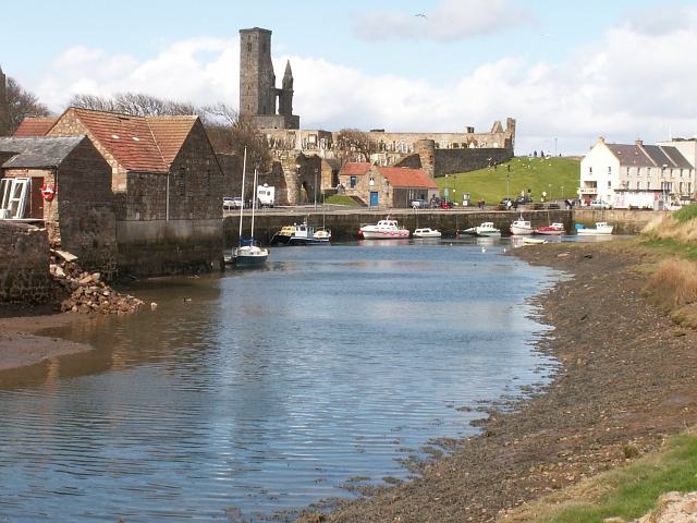
Kinness Burn
The Kinness Burn is a 5+3⁄4 miles (9.5 kilometres) long burn (stream) in Fife, Scotland. It flows into the North Sea through the inner harbour of St Andrews...

Church of St Mary on the Rock
The Church of St Mary on the Rock or St Mary's Collegiate Church, was a secular college of priests based on the seaward side of St Andrews Cathedral, St...

St Nicholas Hospital, St Andrews
St Nicholas Hospital was a medieval hospital in St Andrews, Fife. It was located around what is today St Nicholas farmhouse at the Steading, between Albany...
St Andrews Cathedral Priory
St Andrews Cathedral Priory was a priory of Augustinian canons in St Andrews, Fife, Scotland. It was one of the great religious houses in Scotland, and...
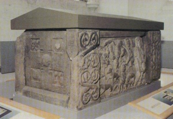
St Andrews Sarcophagus
The Saint Andrews Sarcophagus is a Pictish monument dating from the second half of the 8th century. The sarcophagus was recovered beginning in 1833 during...
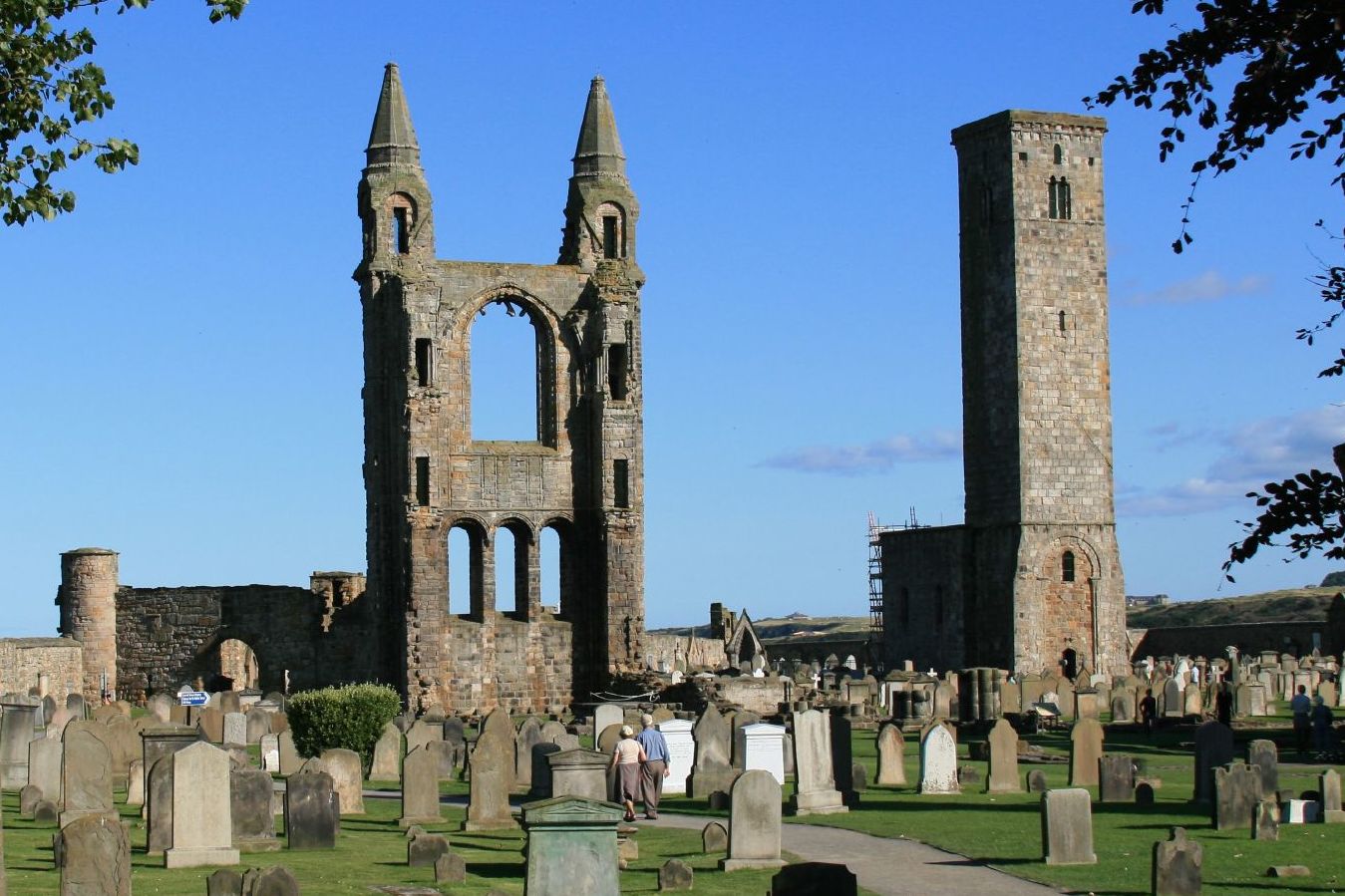
St Andrews Cathedral
The Cathedral of St Andrew (often referred to as St Andrews Cathedral) is a ruined cathedral in St Andrews, Fife, Scotland. It was built in 1158 and became...
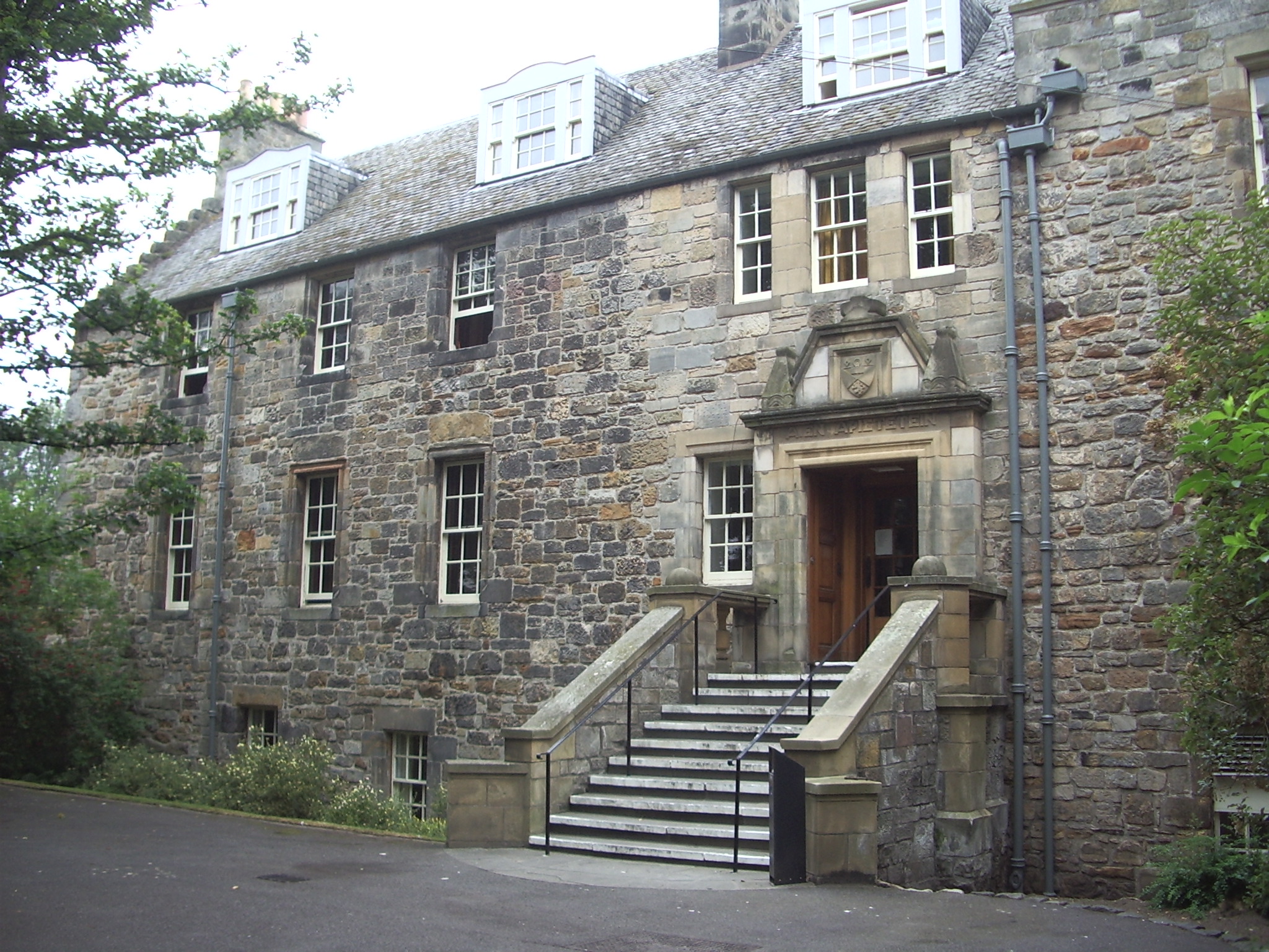
Deans Court
Deans Court is a student hall of residence at the University of St Andrews originating from the 12th century, thus, arguably, the oldest dwelling house...

St Leonards School
St Leonards School is a private boarding and day school for pupils aged 4–19 in St Andrews, Fife, Scotland. Founded in 1877 as St Andrews School for Girls...
Nearby Amenities
Located within 500m of 56.338338,-2.7775852Have you been to Burn Stools?
Leave your review of Burn Stools below (or comments, questions and feedback).