Canty Rocks

Island in Banffshire

Scotland

Canty Rocks

Rock outcrop This outcrop is partly in Cullen Links and partly on the Cullen Sands.
Rock outcrop Credit: don cload

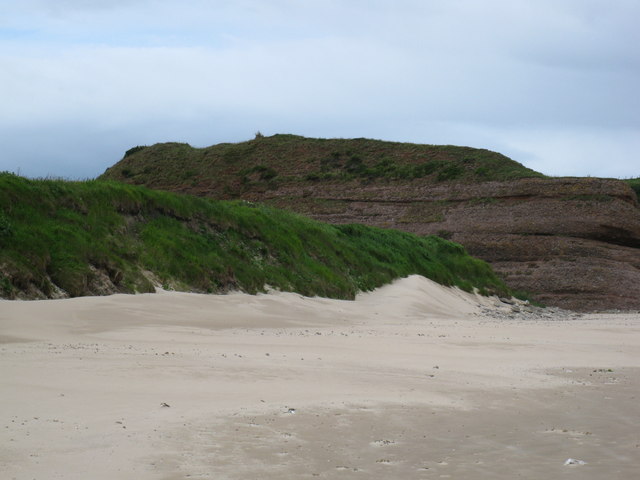
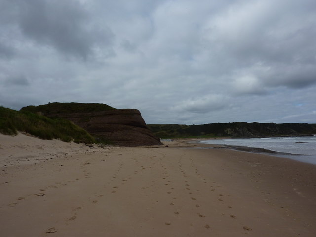
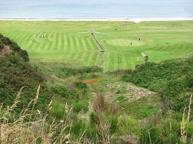
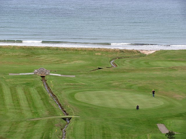
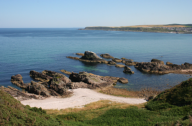
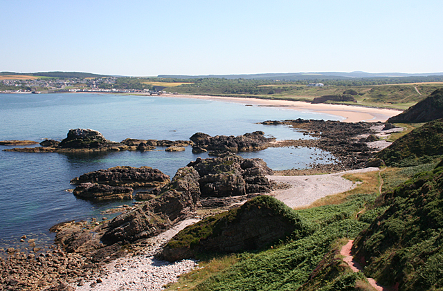
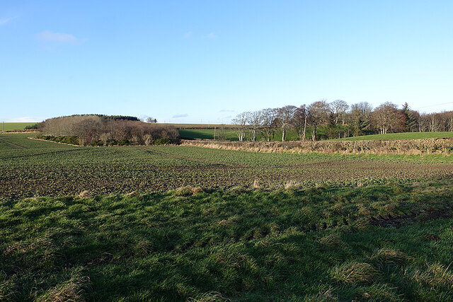
Canty Rocks is a small island located off the coast of Banffshire, Scotland. With a total area of approximately 0.1 square kilometers, it is one of the many uninhabited islands in the region. The island is situated in the North Sea, about 2 kilometers northeast of the town of Portsoy.

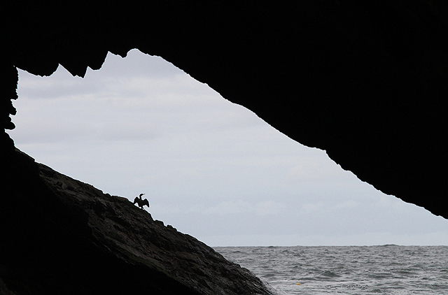
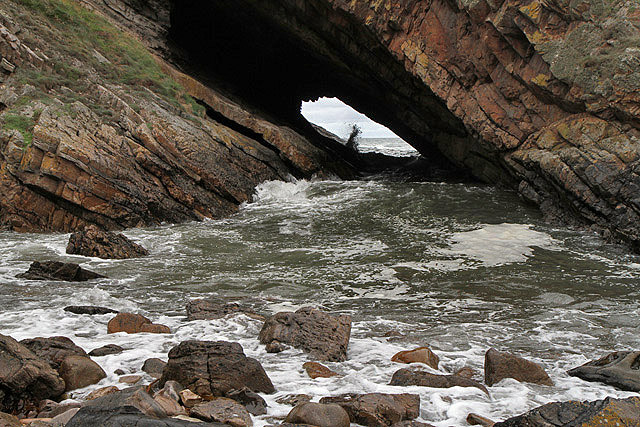
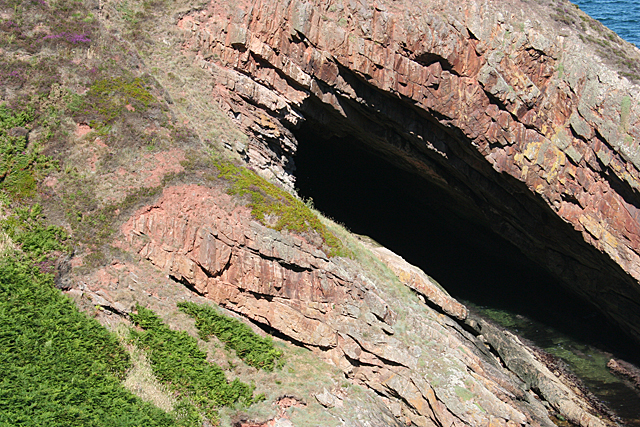
Canty Rocks is known for its stunning natural beauty, with rugged cliffs and rocky shores that provide a habitat for a variety of seabirds. The island is a designated Site of Special Scientific Interest (SSSI) due to its importance for breeding colonies of guillemots, razorbills, and kittiwakes. These birds can often be seen nesting on the steep cliffs during the summer months.

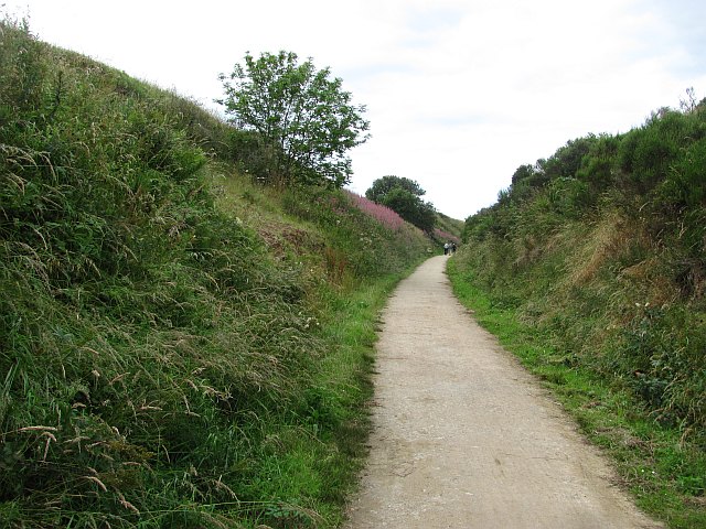
Access to Canty Rocks is limited, as there are no regular ferry services or public transportation options to the island. However, it is possible to visit the island by private boat or kayak, for those seeking a unique and secluded adventure.

The island's rocky terrain and lack of vegetation make it unsuitable for permanent human habitation. Nevertheless, Canty Rocks serves as an important sanctuary for wildlife and offers visitors a chance to experience the untamed beauty of the Scottish coastline. It is a popular destination for birdwatchers, nature enthusiasts, and those looking to explore the remote corners of Banffshire.

If you have any feedback on the listing, please let us know in the comments section below.

Canty Rocks Images

Images are sourced within 2km of 57.695758/-2.8218033 or Grid Reference NJ5167. Thanks to Geograph Open Source API. All images are credited.

Rock outcrop This outcrop is partly in Cullen Links and partly on the Cullen Sands.
Rock outcrop
This outcrop is partly in Cullen Links and partly on the Cullen Sands.
Reddish rock outcrop in Cullen Bay
Moray Coast Railway A cutting behind Cullen Links. The trackbed is now a path.
Moray Coast Railway
A cutting behind Cullen Links. The trackbed is now a path.
Ordnance Survey  Flush Bracket G4051 This can be found on a boundary wall at Cullen Bay Hotel.
For more detail see : <span class="nowrap"><a title="http://www.bench-marks.org.uk/bm16939" rel="nofollow ugc noopener" href="http://www.bench-marks.org.uk/bm16939">Link</a><img style="margin-left:2px;" alt="External link" title="External link - shift click to open in new window" src="https://s1.geograph.org.uk/img/external.png" width="10" height="10"/></span>
Ordnance Survey Flush Bracket G4051
This can be found on a boundary wall at Cullen Bay Hotel. For more detail see : LinkExternal link
Cullen Golf Club A links course tucked in between sea and the former Moray Coast Railway. There has been some slippage of the steep slope beneath the railway trackbed here.
Cullen Golf Club
A links course tucked in between sea and the former Moray Coast Railway. There has been some slippage of the steep slope beneath the railway trackbed here.
Cullen Golf Club View from the old railway.
Cullen Golf Club
View from the old railway.
A cormorant in the Whale’s Mou' A cormorant is drying its wings at this natural arch on the coastline at Portknockie. For a wider view of the arch, see <a href="https://www.geograph.org.uk/photo/247956">NJ4968 : The Whale's Mou'</a>.
A cormorant in the Whale’s Mou'
A cormorant is drying its wings at this natural arch on the coastline at Portknockie. For a wider view of the arch, see NJ4968 : The Whale's Mou'.
The Whale’s Mou’ This natural arch is on the coastline at Portknockie.
The Whale’s Mou’
This natural arch is on the coastline at Portknockie.
Toshie's Long Craigs The name is applied to the furthest out of this group of rocks, which are at the northern end of the beach in Cullen Bay.
Toshie's Long Craigs
The name is applied to the furthest out of this group of rocks, which are at the northern end of the beach in Cullen Bay.
Cullen Bay Rocky outcrops and shingle beaches lie to the north of the fine sandy beach at Cullen.
Cullen Bay
Rocky outcrops and shingle beaches lie to the north of the fine sandy beach at Cullen.
Old Red Sandstone On the beach at Cullen are some large outcrops of coarse Old Red Sandstone conglomerate. The tiny sloping layers of rock in the middle of this image are fossilised ripples laid down by a stream something like 350 million years ago. Close inspection tells geologists that the rock is the right way up, and therefore have not been overturned by tectonic movements, like some of the other rocks in the Scottish Highlands.
Old Red Sandstone
On the beach at Cullen are some large outcrops of coarse Old Red Sandstone conglomerate. The tiny sloping layers of rock in the middle of this image are fossilised ripples laid down by a stream something like 350 million years ago. Close inspection tells geologists that the rock is the right way up, and therefore have not been overturned by tectonic movements, like some of the other rocks in the Scottish Highlands.
The Whale's Mou' The cave is between layers of Cullen Quartzite. The red colour is iron staining from overlying Old Red Sandstone.
The Whale's Mou'
The cave is between layers of Cullen Quartzite. The red colour is iron staining from overlying Old Red Sandstone.
A98 Approaching the Cullen Bay Hotel
The outside of the Whale's Mou from the south The top of the south west entrance is just visible above the nearer cliff slope. There is a semi-circular layer of rock which has eroded away above the middle of the cave tunnel. Taken near low tide.
The outside of the Whale's Mou from the south
The top of the south west entrance is just visible above the nearer cliff slope. There is a semi-circular layer of rock which has eroded away above the middle of the cave tunnel. Taken near low tide.
Cullen House Home Farm The long range of stone buildings with square castellated central tower dates from 1816, and is a Category B Listed building. See <span class="nowrap"><a title="http://portal.historicenvironment.scot/designation/LB15518" rel="nofollow ugc noopener" href="http://portal.historicenvironment.scot/designation/LB15518">Link</a><img style="margin-left:2px;" alt="External link" title="External link - shift click to open in new window" src="https://s1.geograph.org.uk/img/external.png" width="10" height="10"/></span> for full details.
Cullen House Home Farm
The long range of stone buildings with square castellated central tower dates from 1816, and is a Category B Listed building. See LinkExternal link for full details.
Field at Cullen Home Farm Like many others on the estate, this field has a wide grassy margin left uncultivated for the benefit of wildlife.
Field at Cullen Home Farm
Like many others on the estate, this field has a wide grassy margin left uncultivated for the benefit of wildlife.
Dry stone wall - Home Farm
Logie Head Logie Head comprises the whole of this promontory. At both ends of the headland the rocks belong to the Cullen Quartzite Formation, but in between is the Dicky Hare Semipelite Member. In simple terms, quartzite is metamorphosed pure sand, but semipelite is metamorphosed muddy sand. As well as being metamorphosed, the strata have been tilted through 90º by tectonic forces, and you can see in this view that the cliff looks like a row of verticals. The name Dicky Hare is applied to the beach below the semipelite cliffs, but I have no as yet discovered the origin of this rather odd name.
Logie Head
Logie Head comprises the whole of this promontory. At both ends of the headland the rocks belong to the Cullen Quartzite Formation, but in between is the Dicky Hare Semipelite Member. In simple terms, quartzite is metamorphosed pure sand, but semipelite is metamorphosed muddy sand. As well as being metamorphosed, the strata have been tilted through 90º by tectonic forces, and you can see in this view that the cliff looks like a row of verticals. The name Dicky Hare is applied to the beach below the semipelite cliffs, but I have no as yet discovered the origin of this rather odd name.
Show me another place!

Canty Rocks is located at Grid Ref: NJ5167 (Lat: 57.695758, Lng: -2.8218033)

Unitary Authority: Moray

Police Authority: North East

What 3 Words

///burying.blacken.slab. Near Cullen, Moray

Related Wikis

Cullen railway station

Cullen railway station was a railway station that served the small fishing village of Cullen, close to Portknockie in Moray. The railway station was opened...
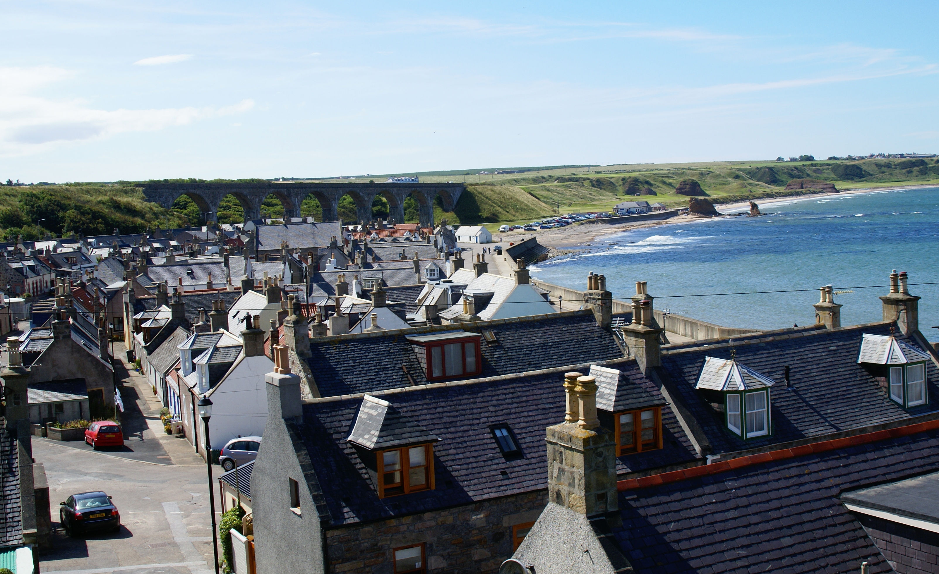
Cullen, Moray

Cullen (Scottish Gaelic: Inbhir Cuilinn) is a village and former royal burgh in Moray but historically in Banffshire, Scotland, on the North Sea coast...

Cullen Town Hall

Cullen Town Hall is a municipal building in The Square, Cullen, Moray, Scotland. The structure, which is currently used as a heritage centre, is a Category...
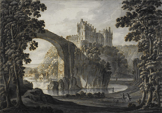
Cullen Castle

Cullen Castle was a royal castle about 0.5 miles (0.80 km) west of Cullen, Moray, Scotland, west of the burn of Deskford, and south of Seatown. The remains...
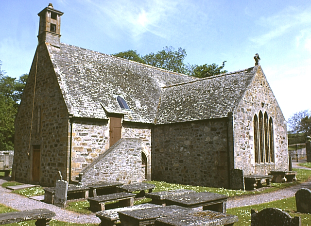
Cullen Old Church

Cullen Old Church (also known as Cullen Auld Kirk) is the parish church for Cullen and Deskford, in Moray. It was originally a part of the Roman Catholic...

Cullen House

Cullen House is a large house, about 1 kilometre (0.6 mi) south-west of the coastal town of Cullen in Moray, Scotland. It was the seat of the Ogilvies...

Bow Fiddle Rock

Bow Fiddle Rock is a natural sea arch near Portknockie on the north-eastern coast of Scotland. It is so called because it resembles the tip of a fiddle...

Tochieneal railway station

Tochieneal railway station was a railway station that served the small industrial village of Tochieneal, close to Cullen in Moray. The railway station...

Nearby Amenities

Located within 500m of 57.695758,-2.8218033
Source: PGS
Lat/Long: 57.6959713/-2.8135497
Source: PGS
Lat/Long: 57.6957228/-2.8140805
Source: PGS
Lat/Long: 57.6951578/-2.8151691
Source: PGS
Lat/Long: 57.6951254/-2.8152838
Source: PGS
Lat/Long: 57.6949596/-2.8158436
Source: PGS
Lat/Long: 57.6945228/-2.8168219
Source: PGS
Lat/Long: 57.6945049/-2.8188728
Source: PGS
Lat/Long: 57.6943151/-2.8209095
Source: PGS
Lat/Long: 57.694242/-2.8220473
Source: PGS
Lat/Long: 57.6940793/-2.8229252
Source: PGS
Lat/Long: 57.6941745/-2.8232662
Source: PGS
Lat/Long: 57.6941793/-2.8233652
Source: PGS
Lat/Long: 57.6939922/-2.8236736
Source: PGS
Lat/Long: 57.693518/-2.8239322
Source: PGS
Lat/Long: 57.6931323/-2.8240438
Source: PGS
Lat/Long: 57.6926516/-2.8238657
Source: PGS
Lat/Long: 57.6925654/-2.8271349
Cullen
Name Gd: Cuileann
Name Ru: Каллен
Place: town
Population: 1380
Source: npe
Wikidata: Q1969309
Wikipedia: en:Cullen, Moray
Lat/Long: 57.6919685/-2.8242377
Fast Food
Eddie's Sheddy
Lat/Long: 57.6924123/-2.8209728
Man Made: lighthouse
Lat/Long: 57.6938966/-2.8236191
Give Way
Direction: backward
Lat/Long: 57.691646/-2.8186477
Fast Food
Linda's Fish and Chips
Addr City: Buckie
Addr Country: GB
Addr Postcode: AB56 4SW
Addr Street: Seafield Street
Addr Town: Cullen
Cuisine: fish_and_chips
Fhrs Authority: Moray
Fhrs Id: 18065
Fhrs Local Authority Id: 06/00065/COMM
Lat/Long: 57.6916805/-2.8207186
Toilets
Lat/Long: 57.6938278/-2.8221402
Cullen
Historic Railway: station
Wikidata: Q20713572
Wikipedia: en:Cullen railway station
Lat/Long: 57.692069/-2.8170659
Give Way
Direction: backward
Lat/Long: 57.6917561/-2.8205057
Noexit: yes
Lat/Long: 57.6922654/-2.8228379
Bench
Backrest: yes
Lat/Long: 57.6918672/-2.8218159
Bench
Backrest: yes
Lat/Long: 57.6919212/-2.8216738
Bench
Backrest: yes
Lat/Long: 57.6919695/-2.8215485
Covered: no
Leisure: picnic_table
Lat/Long: 57.6920929/-2.821941
Covered: no
Leisure: picnic_table
Lat/Long: 57.6921398/-2.8218313
Bench
Lat/Long: 57.6921288/-2.8223044
Bench
Lat/Long: 57.6923786/-2.8223765
Bench
Lat/Long: 57.6922391/-2.8223376
Bench
Lat/Long: 57.69241/-2.8221661
Bench
Lat/Long: 57.6924793/-2.8224007
Waste Basket
Lat/Long: 57.6919103/-2.8217471
Charging Station
Lat/Long: 57.6915753/-2.8190211
Recycling
Portlong Lane Recycling Centre
Addr City: Cullen
Addr Postcode: AB56 4AG
Addr Street: Portlong Lane
Owner: Moray County Council
Ownership: municipal
Recycling Type: centre
Lat/Long: 57.6941257/-2.8205727
War Memorial Cullen
Historic: memorial
Memorial: war_memorial
Url: https://www.tracesofwar.com/sights/82026/War-Memorial-Cullen.htm
Lat/Long: 57.6915712/-2.8187898
Telephone
Booth: K6
Covered: booth
Listed Status: Category B
Lat/Long: 57.6919146/-2.8242791
Bench
Lat/Long: 57.6955735/-2.8141571
Information: guidepost
Tourism: information
Lat/Long: 57.6943267/-2.8180167
Bench
Lat/Long: 57.693465/-2.8212235
Bench
Lat/Long: 57.6934542/-2.8213022
Bench
Lat/Long: 57.6935966/-2.819861
Bench
Lat/Long: 57.6934054/-2.8173264
Bench
Lat/Long: 57.6935161/-2.817046
Information: guidepost
Tourism: information
Lat/Long: 57.6934921/-2.816661
Bench
Lat/Long: 57.691626/-2.822626
Bench
Lat/Long: 57.6932355/-2.8220205
Man Made: tower
Tower Type: firefighter_training
Lat/Long: 57.6928711/-2.8175211
Waste Basket
Lat/Long: 57.6919812/-2.8215102
Grit Bin
Lat/Long: 57.692052/-2.8214224
Generator Method: photovoltaic
Generator Output Electricity: yes
Generator Source: solar
Generator Type: solar_photovoltaic_panel
Location: roof
Power: generator
Lat/Long: 57.6928757/-2.8173159
Grit Bin
Lat/Long: 57.6928793/-2.8194563
The data included in this document is from www.openstreetmap.org. The data is made available under ODbL.

Have you been to Canty Rocks?

Leave your review of Canty Rocks below (or comments, questions and feedback).