Brannie's Craigs

Island in Banffshire

Scotland

Brannie's Craigs

Coast path, Banffshire Well surfaced but not tarred section of the cycle route. It runs through a barley field by Tronach Head. A line on the horizon may be the haar, out at sea but ready to return.
Coast path, Banffshire Credit: Richard Webb

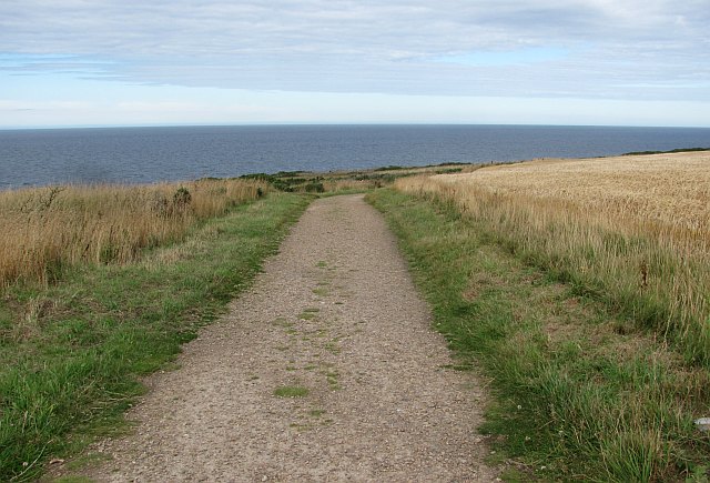
Brannie's Craigs is a picturesque island located in Banffshire, Scotland. Situated off the northeast coast, it is a popular tourist destination due to its natural beauty and historical significance. The island covers an area of approximately 100 acres and is surrounded by the North Sea.

One of the most notable features of Brannie's Craigs is its rugged cliffs that rise dramatically from the sea. These cliffs provide a stunning backdrop for visitors and offer breathtaking views of the surrounding landscape. The island is also home to a diverse range of flora and fauna, with various species of birds nesting in the cliffs and seals frequently spotted in the waters below.

In addition to its natural attractions, Brannie's Craigs has a rich history that dates back centuries. It is believed to have been inhabited as early as the Neolithic period, and evidence of ancient settlements and burial sites can still be found on the island. The remains of a medieval chapel dedicated to St. Brandon, after whom the island is named, are also present.

Access to Brannie's Craigs is limited due to its remote location, and visitors can reach the island by boat or kayak. Once there, they can explore the rugged coastline, take in the stunning views, and immerse themselves in the island's history. The peaceful and untouched nature of Brannie's Craigs makes it a hidden gem for nature lovers and history enthusiasts alike.

If you have any feedback on the listing, please let us know in the comments section below.

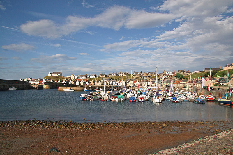
Brannie's Craigs Images

Images are sourced within 2km of 57.699896/-2.9114917 or Grid Reference NJ4568. Thanks to Geograph Open Source API. All images are credited.

Coast path, Banffshire Well surfaced but not tarred section of the cycle route. It runs through a barley field by Tronach Head. A line on the horizon may be the haar, out at sea but ready to return.
Coast path, Banffshire
Well surfaced but not tarred section of the cycle route. It runs through a barley field by Tronach Head. A line on the horizon may be the haar, out at sea but ready to return.
Sandy Creek, Findochty A view from the cycle path.
Sandy Creek, Findochty
A view from the cycle path.
Station Road, Findochty Caithness on the horizon. Morven appears to get closer as you travel westward along the coast.
Station Road, Findochty
Caithness on the horizon. Morven appears to get closer as you travel westward along the coast.
Moray Coast Railway The trackbed is now a cycle path (NCN1). A long focus view towards Buckie.
Moray Coast Railway
The trackbed is now a cycle path (NCN1). A long focus view towards Buckie.
Moor of Scotstown View from the railway path, over a barley field towards Bin of Cullen.
Moor of Scotstown
View from the railway path, over a barley field towards Bin of Cullen.
Portessie Station A platform remains at the site of the station. This was a junction with a line to Keith.
Portessie Station
A platform remains at the site of the station. This was a junction with a line to Keith.
The Salvation Army, Findochty View of this interesting building in Chapel Street.
The Salvation Army, Findochty
View of this interesting building in Chapel Street.
Triangulation Pillar S7218 at Strathlene Golf Course
War Memorial with Gull - Findochty
Ordnance Survey Cut Mark This mark can be found on the boundary wall of Hillhead Cemetery.
For more detail see : <span class="nowrap"><a title="http://www.bench-marks.org.uk/bm45914" rel="nofollow ugc noopener" href="http://www.bench-marks.org.uk/bm45914">Link</a><img style="margin-left:2px;" alt="External link" title="External link - shift click to open in new window" src="https://s1.geograph.org.uk/img/external.png" width="10" height="10"/></span>
Ordnance Survey Cut Mark
This mark can be found on the boundary wall of Hillhead Cemetery. For more detail see : LinkExternal link
Millennium milepost On the coast path with a view over to Caithness.
Millennium milepost
On the coast path with a view over to Caithness.
Ruins, Mains of Findochty
Moray Coast Railway The trackbed is now a foot or cycle path.
Moray Coast Railway
The trackbed is now a foot or cycle path.
Moray Coast Railway Eastward view from the site of Portessie Station. The trackbed is now used as a cycle path.
Moray Coast Railway
Eastward view from the site of Portessie Station. The trackbed is now used as a cycle path.
Sandy Creek, Findochty
Houses at Findochty This was viewed from a dismantled railway line which is now a coastal path.
Houses at Findochty
This was viewed from a dismantled railway line which is now a coastal path.
A Millennium milepost This national cycle network post is on the coast path between Findochty and Portknockie.
A Millennium milepost
This national cycle network post is on the coast path between Findochty and Portknockie.
Triple Chapels On the left is the Salvation Army Chapel, which was originally a Methodist chapel. To its right is a Gospel Hall, and looking down from above is the new <a href="https://www.geograph.org.uk/photo/3922530">NJ4667 : Methodist Church</a> that replaced the one now in use by the Salvation Army. This little cul-de-sac is called Chapel Street with good reason.
Triple Chapels
On the left is the Salvation Army Chapel, which was originally a Methodist chapel. To its right is a Gospel Hall, and looking down from above is the new NJ4667 : Methodist Church that replaced the one now in use by the Salvation Army. This little cul-de-sac is called Chapel Street with good reason.
Show me another place!

Brannie's Craigs is located at Grid Ref: NJ4568 (Lat: 57.699896, Lng: -2.9114917)

Unitary Authority: Moray

Police Authority: North East

What 3 Words

///obscuring.closes.breeding. Near Findochty, Moray

Nearby Locations

Brannie's Craigs Edin Doon

Related Wikis

Strathlene Golf Course

Strathlene at Findochty, near Buckie, is one of the oldest golf courses in Scotland. It was established in 1877 and is home to Strathlene Buckie Golf Club...

Findochty

Findochty (pronounced , Scots: Finichty, Scottish Gaelic: Am Fionn Ochdamh) is a village in Moray, Scotland, on the shores of the Moray Firth; historically...

Strathlene

Strathlene is an area between Buckie and Findochty which has a caravan site facing onto the Moray Firth. At one time the Strathlene House Hotel, a former...

Findochty Castle

Findochty Castle is a ruined 16th century L-plan tower house, near Findochty, Moray, Scotland, about 2.5 miles (4.0 km) north-east of Buckie, and about...

Nearby Amenities

Located within 500m of 57.699896,-2.9114917
Source: PGS
Lat/Long: 57.6985854/-2.914241
Created By: almien_coastlines
Source: PGS
Lat/Long: 57.698466/-2.914583
Source: PGS
Lat/Long: 57.6984314/-2.9150311
Source: PGS
Lat/Long: 57.6981017/-2.9159253
Created By: almien_coastlines
Source: PGS
Lat/Long: 57.697828/-2.916259
Source: PGS
Lat/Long: 57.6975688/-2.9162864
Created By: almien_coastlines
Source: PGS
Lat/Long: 57.697188/-2.916977
Source: PGS
Lat/Long: 57.6972294/-2.9168807
Source: PGS
Lat/Long: 57.6968475/-2.9173019
Restaurant
Admirals Inn
Addr Housenumber: 6
Addr Postcode: AB56 4QA
Addr Street: Jubilee Terrace
Cuisine: regional
Fhrs Id: 19385
Source Addr: FHRS Open Data
Wheelchair: limited
Lat/Long: 57.6980595/-2.9074293
Bus Stop
Bus: yes
Public Transport: platform
Lat/Long: 57.6966676/-2.9084508
Bus Stop
Bus: yes
Public Transport: platform
Lat/Long: 57.6963051/-2.9100683
The data included in this document is from www.openstreetmap.org. The data is made available under ODbL.

Have you been to Brannie's Craigs?

Leave your review of Brannie's Craigs below (or comments, questions and feedback).