A' Chlèit

Island in Sutherland

Scotland

A' Chlèit

Sea from Meall a' Bhuic on Faraid Head A sea square with possible rocks visible at low tide in the south west corner. The rocks on the map did not correspond to what could be seen at this very low tide of 0.3m.
Sea from Meall a' Bhuic on Faraid Head Credit: Chris and Meg Mellish

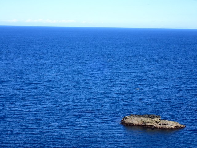
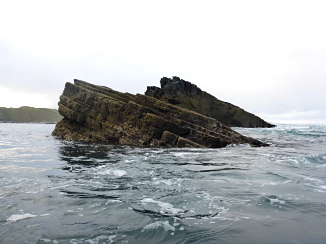
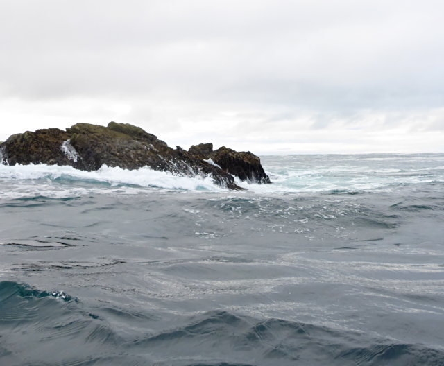
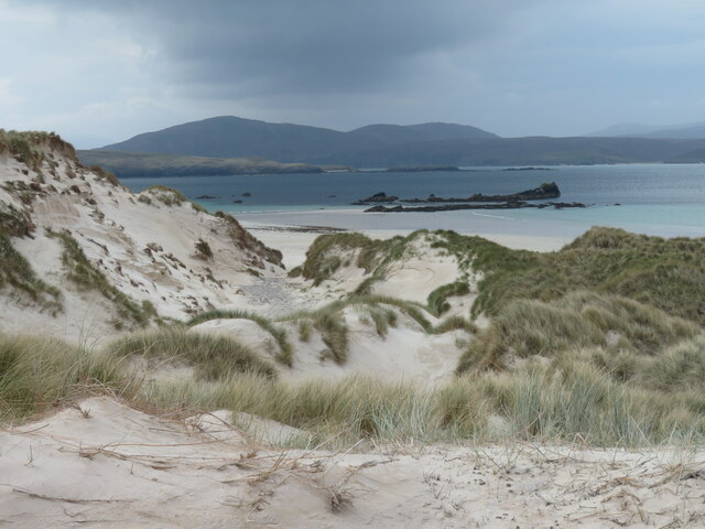
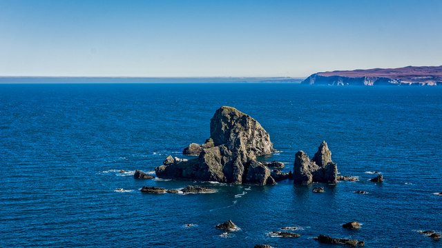
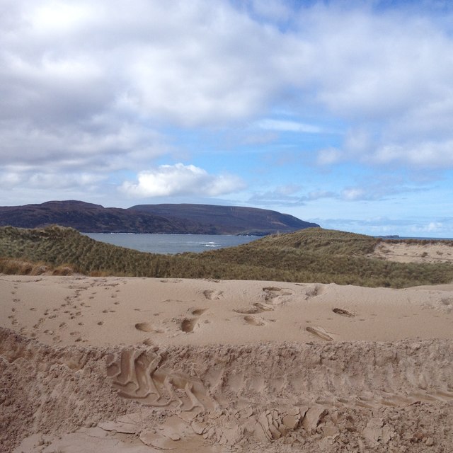
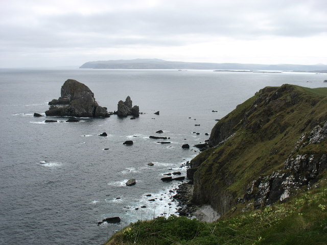
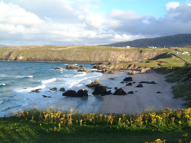
A' Chlèit is a small island located off the coast of Sutherland, in the northern region of Scotland. With an area of approximately 1.5 square kilometers, it is situated in the North Atlantic Ocean, near the mouth of the Loch Shin. The island is known for its breathtaking natural beauty, characterized by rugged cliffs, rocky shorelines, and stunning sea views.

A' Chlèit is uninhabited and lacks any permanent structures or facilities. It is primarily visited by nature enthusiasts and birdwatchers due to its diverse wildlife population. The island serves as an important breeding ground for various species of seabirds, including puffins, guillemots, and razorbills. Visitors can observe these birds in their natural habitat, making it a popular spot for ornithologists and photographers.

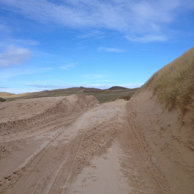
The island's terrain is predominantly heather-covered moorland, providing a habitat for other wildlife such as otters and seals. The surrounding waters are also home to a variety of fish, making it a favored spot for fishing enthusiasts. Boat trips are available to reach the island, allowing visitors to explore its shores and enjoy the tranquility of the remote location.

A' Chlèit offers visitors a chance to immerse themselves in the unspoiled beauty of nature. Its isolation and lack of human activity make it a peaceful retreat away from the hustle and bustle of city life. However, visitors should come prepared with appropriate outdoor gear and take necessary precautions as the island lacks amenities and services.

If you have any feedback on the listing, please let us know in the comments section below.

A' Chlèit Images

Images are sourced within 2km of 58.589388/-4.7804291 or Grid Reference NC3870. Thanks to Geograph Open Source API. All images are credited.

Sea from Meall a' Bhuic on Faraid Head A sea square with possible rocks visible at low tide in the south west corner. The rocks on the map did not correspond to what could be seen at this very low tide of 0.3m.
Sea from Meall a' Bhuic on Faraid Head
A sea square with possible rocks visible at low tide in the south west corner. The rocks on the map did not correspond to what could be seen at this very low tide of 0.3m.
Skerry off Meall a' Bhuic
Tidal rock by Clach Mhòr na Faraid
Route across the sands of the An Fharaid desert There is a small area of tarmac visible in this shot, but the road from Balnakeil out to the installations on the headland is often lost when passing through the extensive dune system. A small convoy of 4 vehicles had recently passed through leaving tyre tracks in the sand.
Route across the sands of the An Fharaid desert
There is a small area of tarmac visible in this shot, but the road from Balnakeil out to the installations on the headland is often lost when passing through the extensive dune system. A small convoy of 4 vehicles had recently passed through leaving tyre tracks in the sand.
Through the dunes to Balnakeil Bay A view from the northern end of the extensive dune system on Faraid Head towards Balnakeil Bay and the mist enshrouded hills of the Cape Wrath peninsula beyond.
Through the dunes to Balnakeil Bay
A view from the northern end of the extensive dune system on Faraid Head towards Balnakeil Bay and the mist enshrouded hills of the Cape Wrath peninsula beyond.
Sheepfold - with sheep Beyond the sand dune barrier there is some reasonable grassland where sheep graze.
Sheepfold - with sheep
Beyond the sand dune barrier there is some reasonable grassland where sheep graze.
Cliffs on northern side of Faraid Head Taken from a relatively sheltered picnic spot on a day of near gale-force easterly winds which whipped up the sand in the dunes further down the peninsula.
Cliffs on northern side of Faraid Head
Taken from a relatively sheltered picnic spot on a day of near gale-force easterly winds which whipped up the sand in the dunes further down the peninsula.
NW corner of the Faraid peninsula The view looks west towards the cliff line leading to Cape Wrath.
NW corner of the Faraid peninsula
The view looks west towards the cliff line leading to Cape Wrath.
The Shepherds' bothy on Faraid Head It's lambing time way back then and here we have  a picture of the late Donald Campbell and his dog , Cap outside the bothy on Faraid head. See how they dress for the hills. hob-nailed boots, light waterproof clothing, a cap, and a woollen jumper. A man of gentle nature whom I knew well, Donald died tragically in a house fire some years after this picture was taken.
The Shepherds' bothy on Faraid Head
It's lambing time way back then and here we have a picture of the late Donald Campbell and his dog , Cap outside the bothy on Faraid head. See how they dress for the hills. hob-nailed boots, light waterproof clothing, a cap, and a woollen jumper. A man of gentle nature whom I knew well, Donald died tragically in a house fire some years after this picture was taken.
Sou'easterly from the puffin slopes at Faraid Head This is one of the most scenic corners of Scotland and that's saying something. The Puffin is common here as are the raven, the cormorant and other members of the Auk family.
Sou'easterly from the puffin slopes at Faraid Head
This is one of the most scenic corners of Scotland and that's saying something. The Puffin is common here as are the raven, the cormorant and other members of the Auk family.
Sea Stacks east of Faraid Head
Old Winding gear on Faraid Head
View from track to An Fharaid
Track to An Fharaid
Track to An Fharaid
Clach Mhor na Faraid A 53m sea stack south-east of Faraid Head, with Whiten Head beyond. There is a lower stack, Clach Bheag na Faraid, directly in front of Clach Mhor, and a little study should enable you to distinguish the two.
Clach Mhor na Faraid
A 53m sea stack south-east of Faraid Head, with Whiten Head beyond. There is a lower stack, Clach Bheag na Faraid, directly in front of Clach Mhor, and a little study should enable you to distinguish the two.
Cliffs at Faraid Head Part of the MoD station at the summit can be seen here.
Cliffs at Faraid Head
Part of the MoD station at the summit can be seen here.
Cliffs and rocks at Cuarnagaig West of Faraid Head.
Cliffs and rocks at Cuarnagaig
West of Faraid Head.
Cliffs at the far west of Faraid Head Being somewhat less confident than I was thirty years ago, I took care to get no closer to the cliff edge than this!
Cliffs at the far west of Faraid Head
Being somewhat less confident than I was thirty years ago, I took care to get no closer to the cliff edge than this!
Show me another place!

A' Chlèit is located at Grid Ref: NC3870 (Lat: 58.589388, Lng: -4.7804291)

Unitary Authority: Highland

Police Authority: Highlands and Islands

What 3 Words

///book.correct.absorbing. Near Oldshoremore, Highland

Nearby Locations

A' Chlèit

Related Wikis

Faraid Head

Faraid Head (Scottish Gaelic: An Fharaird) is a small peninsula on the northern coast of Sutherland, Highland, Scotland, located around 2 miles (3 kilometres...

Balnakeil

Balnakeil is a hamlet in the parish of Durness, Sutherland, Scottish Highlands, and is in the Scottish council area of Highland. It is on the north coast...

Durness

Durness (Scottish Gaelic: Diùranais) is a village and civil parish in the north-west Highlands of Scotland. It lies on the north coast of the country in...

Achiemore, Durness

Achiemore was a crofting community located on the Cape Wrath peninsula near the village of Durness in the Scottish county of Sutherland. The hamlet is...

Nearby Amenities

Located within 500m of 58.589388,-4.7804291
Source: PGS
Lat/Long: 58.5926151/-4.7762097
Source: PGS
Lat/Long: 58.592223/-4.7759735
Source: PGS
Lat/Long: 58.5910985/-4.7753321
Source: PGS
Lat/Long: 58.5899159/-4.7737556
Source: PGS
Lat/Long: 58.5893408/-4.7724741
The data included in this document is from www.openstreetmap.org. The data is made available under ODbL.

Have you been to A' Chlèit?

Leave your review of A' Chlèit below (or comments, questions and feedback).