Clog Cidwm

Island in Caernarfonshire

Wales

Clog Cidwm

Porth Ysgo Looking across towards Maen Gwenonwy.
Porth Ysgo Credit: Trevor Harris

Clog Cidwm is a small, uninhabited island located off the coast of Caernarfonshire in Wales. Situated in the Irish Sea, it is part of a group of islands known as the Ynysoedd y Moelrhoniaid, or the Moelrhon Islands. Clog Cidwm is the largest island in this cluster, measuring approximately 1.5 hectares in area.

The island is characterized by its rocky terrain and is devoid of any vegetation. Its name, Clog Cidwm, translates to "Cidwm's Bell," which is believed to be a reference to a mythical figure associated with the island. The origins of this legend, however, remain unclear.

Due to its remote location and lack of amenities, Clog Cidwm is not accessible to the general public. It is primarily visited by researchers, scientists, and conservationists interested in studying its unique ecosystem and bird population.

The island is home to a variety of seabirds, including puffins, razorbills, and guillemots. These species find refuge on the island during the breeding season, utilizing the cliffs and rocky crevices as nesting sites. The surrounding waters also support a diverse marine life, making Clog Cidwm an important ecological site.

Overall, Clog Cidwm is a picturesque and ecologically significant island, contributing to the biodiversity and natural beauty of the Caernarfonshire coastline.

If you have any feedback on the listing, please let us know in the comments section below.

Clog Cidwm Images

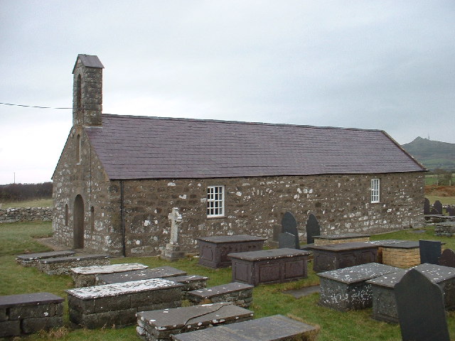
Images are sourced within 2km of 52.79971/-4.6789541 or Grid Reference SH1925. Thanks to Geograph Open Source API. All images are credited.

Porth Ysgo Looking across towards Maen Gwenonwy.
Porth Ysgo
Looking across towards Maen Gwenonwy.
Farm building, Ysgo, Llanfaelrhys
Church path, Eglwys Maelrhys Sant, Llanfaelrhys
Eglwys Maelrhys Sant, Llanfaelrhys
Through the Arch Window, Eglwys Maelrhys Sant, Llanfaelrhys
Altar, Eglwys Maelrhys Sant, Llanfaelrhys
Brass memorials, Eglwys Maelrhys Sant, Llanfaelrhys
Eglwys Maelrhys Sant, Llanfaelrhys
Ysgo from Llanfaelrhys church
Porth Ysgo
Porth Ysgo
Incline Drum, Nant Mine Manganese mine.
Incline Drum, Nant Mine
Manganese mine.
Farmland near Llanfaelrhys Farmland on the Lleyn peninsula near Llanfaelrhys, Mynydd Rhiw with its radio masts can be seen in the background.
Farmland near Llanfaelrhys
Farmland on the Lleyn peninsula near Llanfaelrhys, Mynydd Rhiw with its radio masts can be seen in the background.
Eroding till with erratics Thick deposits of till reach almost to sea level here. Massive, erratic blocks of gabbro are being eroded from the clay-rich material to form an exceptional shoreline, and many more large boulders can be seen in precarious positions on the slope towards Porth Ysgo. While some of the boulders are quite rounded, implying transport for some distance, others are very fresh and angular. It appears that this material was channelled along the western side of Mynydd Rhiw and Mynydd Penarfynydd, from which they are clearly derived as they comprise spectacular gabbros. Once again my patient assistant is posing for scale. An interesting feature here are the remains of timbers still embedded in the ground from the jetty used for loading ships with manganese ore (see <a href="https://www.geograph.org.uk/photo/612104">SH2126 : View down the final incline towards the now disappeared pier at Nant y Gadwen</a>).
Eroding till with erratics
Thick deposits of till reach almost to sea level here. Massive, erratic blocks of gabbro are being eroded from the clay-rich material to form an exceptional shoreline, and many more large boulders can be seen in precarious positions on the slope towards Porth Ysgo. While some of the boulders are quite rounded, implying transport for some distance, others are very fresh and angular. It appears that this material was channelled along the western side of Mynydd Rhiw and Mynydd Penarfynydd, from which they are clearly derived as they comprise spectacular gabbros. Once again my patient assistant is posing for scale. An interesting feature here are the remains of timbers still embedded in the ground from the jetty used for loading ships with manganese ore (see SH2126 : View down the final incline towards the now disappeared pier at Nant y Gadwen).
Sea-washed boulders Massive boulders of gabbro eroded from till deposits on the nearby cliffs are being pounded by rough weather in a rising southerly gale. Not a lot of light, but a powerful image, I think. See also: <a href="https://www.geograph.org.uk/photo/4237802">SH2026 : Eroding till with erratics</a>.
Sea-washed boulders
Massive boulders of gabbro eroded from till deposits on the nearby cliffs are being pounded by rough weather in a rising southerly gale. Not a lot of light, but a powerful image, I think. See also: SH2026 : Eroding till with erratics.
Porth Llawenan
Porth Llawenan
Nant Mine Railway Incline Remains Closed 1927 One of three mines that were part of the largest manganese producing companies in the UK. The Nant Mine raised 45,655 tons of ore.
Nant Mine Railway Incline Remains Closed 1927
One of three mines that were part of the largest manganese producing companies in the UK. The Nant Mine raised 45,655 tons of ore.
Boulder shore The shore on the south end of Porth Llawenan is a mass of dark-coloured, gabbro boulders derived by glacial action from the ridge stretching to the northeast. The dark colour is due to the gabbro intrusion which makes the hills a very special geological area of interest. The orange colours are due to Caloplaca liches on some surfaces.
Boulder shore
The shore on the south end of Porth Llawenan is a mass of dark-coloured, gabbro boulders derived by glacial action from the ridge stretching to the northeast. The dark colour is due to the gabbro intrusion which makes the hills a very special geological area of interest. The orange colours are due to Caloplaca liches on some surfaces.
Show me another place!

Clog Cidwm is located at Grid Ref: SH1925 (Lat: 52.79971, Lng: -4.6789541)

Unitary Authority: Gwynedd

Police Authority: North Wales

What 3 Words

///sport.stable.dumpling. Near Nefyn, Gwynedd

Related Wikis

Llanfaelrhys

Llanfaelrhys is a village and former civil parish in the Welsh county of Gwynedd, located on the Llŷn Peninsula. The parish was abolished in 1934 and...

St Hywyn's Church, Aberdaron

The Church of St Hywyn, Aberdaron, Gwynedd, Wales, is a parish church dating from the 12th century. Its origins are earlier, as a clas church from the...

Aberdaron

Aberdaron (Welsh pronunciation: [abɛrˈdarɔn]) is a community, electoral ward and former fishing village at the western tip of the Llŷn Peninsula in the...
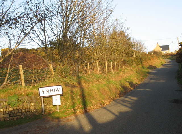
Y Rhiw

Y Rhiw () is a small village on the south west tip of the Llŷn Peninsula in Gwynedd, Wales. The village forms part of the community of Aberdaron. From...

Nearby Amenities

Located within 500m of 52.79971,-4.6789541
Source: PGS
Lat/Long: 52.7963665/-4.683595
Source: PGS
Lat/Long: 52.7966776/-4.6833506
Source: PGS
Lat/Long: 52.7969093/-4.6832271
Source: PGS
Lat/Long: 52.7974581/-4.6830883
Source: PGS
Lat/Long: 52.7977902/-4.6830697
Created By: dmgroom_coastlines
Source: PGS
Lat/Long: 52.7978864/-4.6823028
Source: PGS
Lat/Long: 52.7984289/-4.6820703
Source: PGS
Lat/Long: 52.7989099/-4.681432
Created By: dmgroom_coastlines
Source: PGS
Lat/Long: 52.7991502/-4.6812202
Source: PGS
Lat/Long: 52.7993802/-4.6805546
Source: PGS
Lat/Long: 52.8009858/-4.6776579
Source: PGS
Lat/Long: 52.8010846/-4.677411
Source: PGS
Lat/Long: 52.8011736/-4.6771754
Source: PGS
Lat/Long: 52.8012918/-4.6753586
Barrier: kissing_gate
Bicycle: no
Horse: no
Motor Vehicle: no
Lat/Long: 52.8022129/-4.6778801
Barrier: kissing_gate
Bicycle: no
Horse: no
Motor Vehicle: no
Lat/Long: 52.7996525/-4.6817691
The data included in this document is from www.openstreetmap.org. The data is made available under ODbL.

Have you been to Clog Cidwm?

Leave your review of Clog Cidwm below (or comments, questions and feedback).