Carreg Wystrys

Island in Caernarfonshire

Wales

Carreg Wystrys

The beach at Aberdaron The Tŷ Newydd Hotel is on the left.
The beach at Aberdaron Credit: Steve Daniels

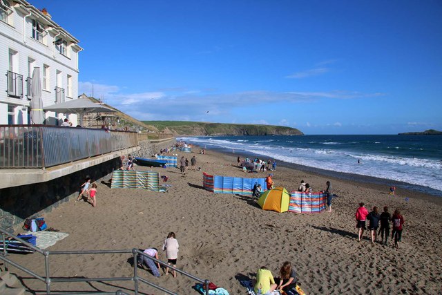
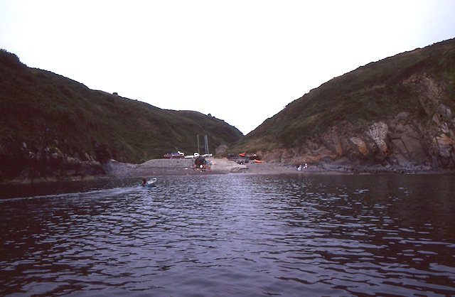
Carreg Wystrys is a small island located off the coast of Caernarfonshire, Wales. It is situated in the Irish Sea, approximately 1.5 miles west of the mainland. The island covers an area of around 25 acres and has a rugged and rocky terrain.

The name "Carreg Wystrys" translates to "Island of the Stray Rock" in Welsh, which accurately describes the island's rocky landscape. The island is uninhabited and lacks any permanent structures, making it a popular destination for nature enthusiasts and birdwatchers.

Despite its small size, Carreg Wystrys is home to a diverse range of wildlife. The island's cliffs provide nesting sites for various seabird species, including puffins, razorbills, and guillemots. Visitors can observe these magnificent creatures in their natural habitat during the breeding season.

Access to Carreg Wystrys is primarily by boat or kayak, as there are no regular ferry services to the island. However, caution is advised when approaching the island, as the surrounding waters can be treacherous due to strong currents and submerged rocks.

The island offers breathtaking views of the surrounding coastline and the Snowdonia mountain range in the distance. Visitors can also explore the island's rocky shores and discover tidal pools teeming with marine life.

Carreg Wystrys is a hidden gem for those seeking solitude and a chance to immerse themselves in the untouched beauty of nature. It is a place where wildlife thrives and where the sounds of crashing waves and calling seabirds create a serene and peaceful atmosphere.

If you have any feedback on the listing, please let us know in the comments section below.

Carreg Wystrys Images

Images are sourced within 2km of 52.802006/-4.7136063 or Grid Reference SH1726. Thanks to Geograph Open Source API. All images are credited.
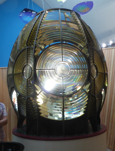
The beach at Aberdaron The Tŷ Newydd Hotel is on the left.
The beach at Aberdaron
The Tŷ Newydd Hotel is on the left.
Bridge over Afon Cyllyfelin (Pont Fach) Photographed from the bridge over the Afon Daron (Pont Fawr).
Bridge over Afon Cyllyfelin (Pont Fach)
Photographed from the bridge over the Afon Daron (Pont Fawr).
Resurfaced car park at Porth y Swnt
Porth y Swnt Interpretation Centre Owned by the National Trust. Its prize exhibit is the old [redundant] optic from the lighthouse on Ynys Enlli.
Porth y Swnt Interpretation Centre
Owned by the National Trust. Its prize exhibit is the old [redundant] optic from the lighthouse on Ynys Enlli.
The lighthouse optic in Porth y Swnt The part-figure gives the scale. Some of the glass lens sections have damage which are allegedly bullet chips from World War II attempts by German planes to extinguish the light.
The lighthouse optic in Porth y Swnt
The part-figure gives the scale. Some of the glass lens sections have damage which are allegedly bullet chips from World War II attempts by German planes to extinguish the light.
Porth Meudwy Leaving Porth Meudwy for a trip to Ynys Enlli.
Porth Meudwy
Leaving Porth Meudwy for a trip to Ynys Enlli.
Becws Islyn The former corrugated iron <a href="https://www.geograph.org.uk/photo/357618">SH1726 : Becws Islyn Bakery Aberdaron</a> was demolished in 2015 and replaced by a newly built bakery, shop and coffee house. It is an impressive building and a great addition to Aberdaron, though the colour-washed walls and thatched roof are very much out of character with the otherwise white and grey grittiness of this windswept village.
Becws Islyn
The former corrugated iron SH1726 : Becws Islyn Bakery Aberdaron was demolished in 2015 and replaced by a newly built bakery, shop and coffee house. It is an impressive building and a great addition to Aberdaron, though the colour-washed walls and thatched roof are very much out of character with the otherwise white and grey grittiness of this windswept village.
Porth y Swnt For information about the National Trust centre opened in 2014 see <span class="nowrap"><a title="http://www.nationaltrust.org.uk/porth-y-swnt" rel="nofollow ugc noopener" href="http://www.nationaltrust.org.uk/porth-y-swnt">Link</a><img style="margin-left:2px;" alt="External link" title="External link - shift click to open in new window" src="https://s1.geograph.org.uk/img/external.png" width="10" height="10"/></span>
Porth y Swnt
For information about the National Trust centre opened in 2014 see LinkExternal link
Arwyddbost yng nghanol y pentref - Signpost in the centre of the village
Mynwent Eglwys Hywyn Sant - St Hywyn's Church graveyard
Y ffordd i'r Rhiw - The road to Rhiw The row of cottages opposite the church are now mostly holiday lets.
Y ffordd i'r Rhiw - The road to Rhiw
The row of cottages opposite the church are now mostly holiday lets.
Bagét ar y Traeth - Baguette on the Beach A seasonal takeaway facing the beach.
Bagét ar y Traeth - Baguette on the Beach
A seasonal takeaway facing the beach.
Bwydlen ddwyiethog Bilingual menu Fare on offer at <a href="https://www.geograph.org.uk/photo/4845125">SH1726 : Bagét ar y Traeth - Baguette on the Beach</a>
Bwydlen ddwyiethog Bilingual menu
Ordnance Survey Cut Mark This OS cut mark can be found on the NE face of St Hywyn's Church. It marks a point 9.826m above mean sea level.
Ordnance Survey Cut Mark
This OS cut mark can be found on the NE face of St Hywyn's Church. It marks a point 9.826m above mean sea level.
Milestone
Milestone
Ordnance Survey Cut Mark This OS cut mark can be found on the SW face of the Church. It marks a point 47.742m above mean sea level.
Ordnance Survey Cut Mark
This OS cut mark can be found on the SW face of the Church. It marks a point 47.742m above mean sea level.
Show me another place!

Carreg Wystrys is located at Grid Ref: SH1726 (Lat: 52.802006, Lng: -4.7136063)

Unitary Authority: Gwynedd

Police Authority: North Wales

What 3 Words

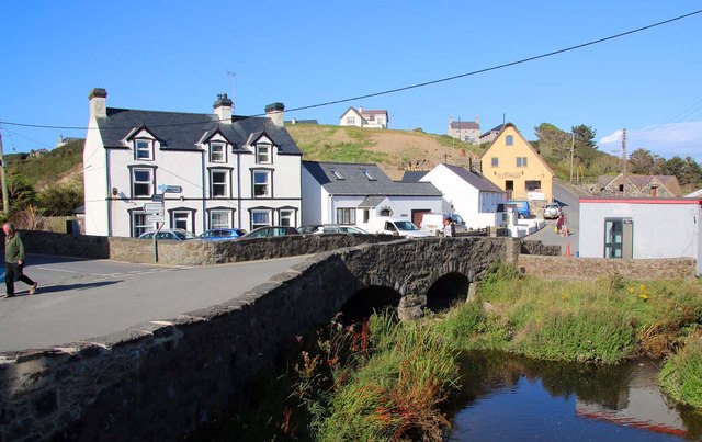
///syndicate.deflated.left. Near Nefyn, Gwynedd

Related Wikis

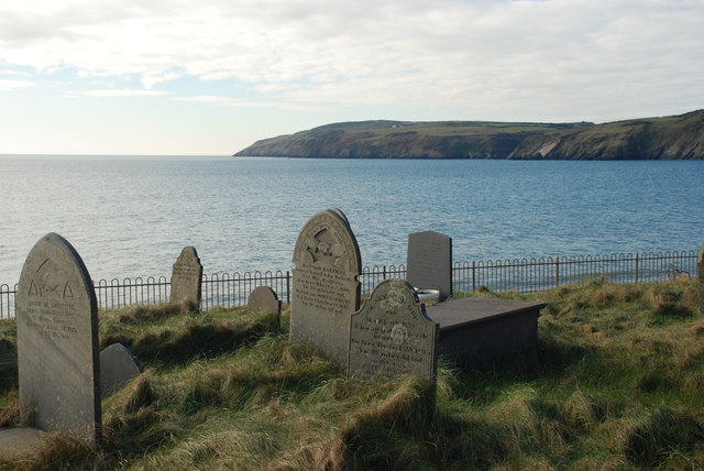
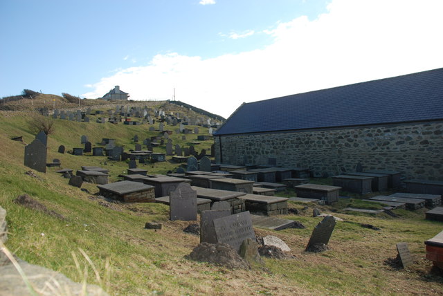
St Hywyn's Church, Aberdaron

The Church of St Hywyn, Aberdaron, Gwynedd, Wales, is a parish church dating from the 12th century. Its origins are earlier, as a clas church from the...
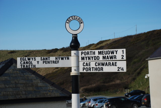
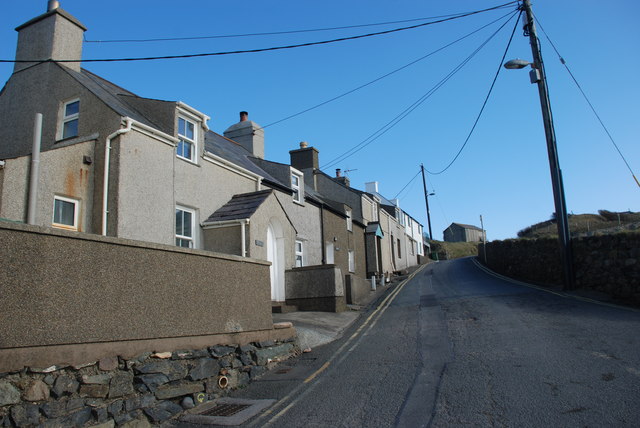
Aberdaron

Aberdaron is a community, electoral ward and former fishing village at the western tip of the Llŷn Peninsula in the Welsh county of Gwynedd. It lies 14...
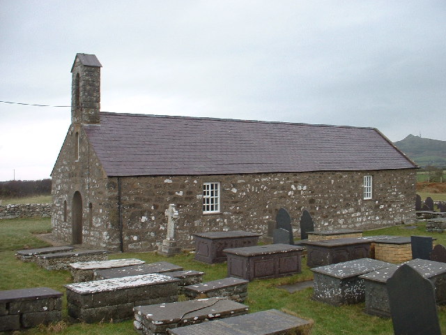
Llanfaelrhys

Llanfaelrhys is a village and former civil parish in the Welsh county of Gwynedd, located on the Llŷn Peninsula. The parish was abolished in 1934 and...

Bodferin

Bodferin is a former civil parish in the Welsh county of Gwynedd. It was abolished in 1934, and incorporated into Aberdaron. == References ==
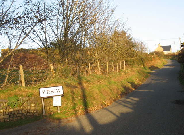
Y Rhiw

Y Rhiw () is a small village on the south west tip of the Llŷn Peninsula in Gwynedd, Wales. The village forms part of the community of Aberdaron. From...

Bardsey Bird and Field Observatory

Bardsey Bird and Field Observatory is a bird observatory on Bardsey Island, off the Welsh coast. It was founded in 1953 by a group of ornithologists from...

Bardsey Island

Bardsey Island (Welsh: Ynys Enlli), known as the legendary "Island of 20,000 Saints", is located 1.9 miles (3.1 km) off the Llŷn Peninsula in the Welsh...

Bryncroes

Bryncroes is a hamlet and former civil parish in Gwynedd in Wales, and lies on the Llŷn Peninsula approximately 2 km west of Sarn Meyllteyrn. The parish...

Nearby Amenities

Located within 500m of 52.802006,-4.7136063
Toilets
Lat/Long: 52.8041428/-4.7135334
Toilets
Lat/Long: 52.8042601/-4.7072592
Toilets
Lat/Long: 52.8044389/-4.7123858
Aberdaron
Place: village
Lat/Long: 52.8050969/-4.7126197
Barrier: kissing_gate
Foot: yes
Lat/Long: 52.8034055/-4.720033
Barrier: kissing_gate
Lat/Long: 52.8046858/-4.7150523
Board Type: board
Information: board
Tourism: information
Lat/Long: 52.8039521/-4.713665
Tourism: picnic_site
Lat/Long: 52.8039641/-4.713568
Tourism: picnic_site
Lat/Long: 52.8039844/-4.7137284
Tourism: picnic_site
Lat/Long: 52.8040191/-4.7136294
Barrier: kissing_gate
Bicycle: yes
Foot: yes
Material: metal
Source: survey
Lat/Long: 52.8048012/-4.7150331
Leisure: slipway
Lat/Long: 52.8036989/-4.7120533
Aberdaron Bay
Natural: bay
Lat/Long: 52.8006243/-4.7111752
Bench
Backrest: no
Lat/Long: 52.8053552/-4.7104516
Bench
Backrest: yes
Lat/Long: 52.8041396/-4.7124566
Bench
Backrest: yes
Lat/Long: 52.804139/-4.7124668
Addr Housename: Glandon
Lat/Long: 52.8039539/-4.7130003
Addr Housename: Uwch y Dor
Lat/Long: 52.8040838/-4.7128857
Addr Housename: Gwynfor
Lat/Long: 52.8040483/-4.7129121
Addr Housename: Glasfor
Lat/Long: 52.8040174/-4.7129374
Carreg Meudwy
Natural: cliff
Lat/Long: 52.8027877/-4.7065367
Carreg Ring
Natural: cliff
Lat/Long: 52.8029194/-4.7119272
Carreg Wystrys
Natural: cliff
Lat/Long: 52.8028322/-4.7143423
Queen's
Leisure: park
Lat/Long: 52.8040025/-4.7141157
Barrier: kissing_gate
Bicycle: no
Foot: yes
Horse: no
Motor Vehicle: no
Lat/Long: 52.8054556/-4.7090024
Bench
Lat/Long: 52.8038161/-4.7193259
Direction: 165
Generator Method: photovoltaic
Generator Output Electricity: yes
Generator Solar Modules: 16
Generator Source: solar
Generator Type: solar_photovoltaic_panel
Location: roof
Power: generator
Lat/Long: 52.8053039/-4.7121209
Direction: SSE
Generator Method: photovoltaic
Generator Output Electricity: yes
Generator Solar Modules: 7
Generator Source: solar
Generator Type: solar_photovoltaic_panel
Location: roof
Power: generator
Lat/Long: 52.8057837/-4.7146117
Direction: SSE
Generator Method: photovoltaic
Generator Output Electricity: yes
Generator Solar Modules: 18
Generator Source: solar
Generator Type: solar_photovoltaic_panel
Location: roof
Power: generator
Lat/Long: 52.8058439/-4.713985
Direction: 255
Generator Method: photovoltaic
Generator Output Electricity: yes
Generator Solar Modules: 12
Generator Source: solar
Generator Type: solar_photovoltaic_panel
Location: roof
Power: generator
Lat/Long: 52.8063725/-4.7145443
Parking
Lat/Long: 52.8045484/-4.7132706
Man Made: utility_pole
Lat/Long: 52.8049488/-4.7191
Man Made: utility_pole
Lat/Long: 52.8048159/-4.7184536
Man Made: utility_pole
Lat/Long: 52.8047072/-4.7177267
Man Made: utility_pole
Lat/Long: 52.8046943/-4.7171406
Man Made: utility_pole
Lat/Long: 52.8047332/-4.7162931
Man Made: utility_pole
Lat/Long: 52.8047632/-4.7157191
Man Made: utility_pole
Lat/Long: 52.8048159/-4.7152323
Man Made: utility_pole
Lat/Long: 52.8050364/-4.7145322
Man Made: utility_pole
Lat/Long: 52.8054118/-4.7124012
Man Made: utility_pole
Lat/Long: 52.805263/-4.7122516
Man Made: utility_pole
Lat/Long: 52.8050449/-4.7120089
Man Made: utility_pole
Lat/Long: 52.8051065/-4.7120317
Man Made: utility_pole
Lat/Long: 52.8048066/-4.7119948
Man Made: utility_pole
Lat/Long: 52.8048921/-4.7130315
Man Made: utility_pole
Lat/Long: 52.8051572/-4.713124
Man Made: utility_pole
Lat/Long: 52.8057977/-4.7140749
Man Made: utility_pole
Lat/Long: 52.8056347/-4.714276
Man Made: utility_pole
Lat/Long: 52.8057377/-4.7137892
Man Made: utility_pole
Lat/Long: 52.8056372/-4.7135814
Man Made: utility_pole
Lat/Long: 52.8054523/-4.7133721
Man Made: utility_pole
Lat/Long: 52.8054458/-4.7132528
Man Made: utility_pole
Lat/Long: 52.8057126/-4.7133923
Man Made: utility_pole
Lat/Long: 52.8060271/-4.71357
Man Made: utility_pole
Lat/Long: 52.8063968/-4.7138999
Power: pole
Source: Bing
Lat/Long: 52.8059477/-4.7150525
Power: portal
Source: Bing
Lat/Long: 52.8050883/-4.7146422
Power: pole
Source: bing
Lat/Long: 52.8052269/-4.7104512
Power: pole
Source: bing
Lat/Long: 52.8056165/-4.7099577
Power: pole
Source: bing
Lat/Long: 52.8049261/-4.7108603
Power: pole
Source: bing
Lat/Long: 52.8046635/-4.7114
Power: pole
Source: bing
Lat/Long: 52.8048256/-4.7104619
Power: pole
Source: bing
Lat/Long: 52.8048759/-4.7097015
The data included in this document is from www.openstreetmap.org. The data is made available under ODbL.

Have you been to Carreg Wystrys?

Leave your review of Carreg Wystrys below (or comments, questions and feedback).