Norway Craig

Island in Wigtownshire

Scotland

Norway Craig

Fields above Knockencule Farm On the west coast of the Rhins.
Fields above Knockencule Farm Credit: David Purchase

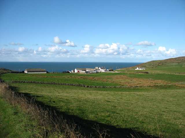
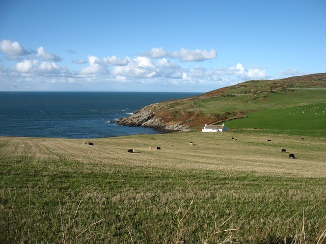
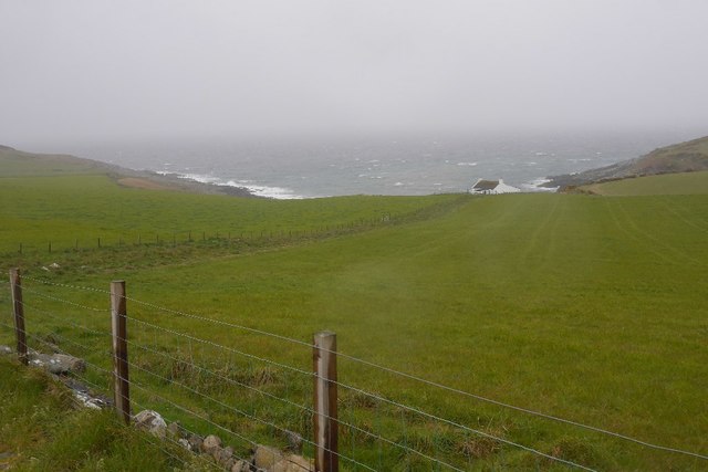
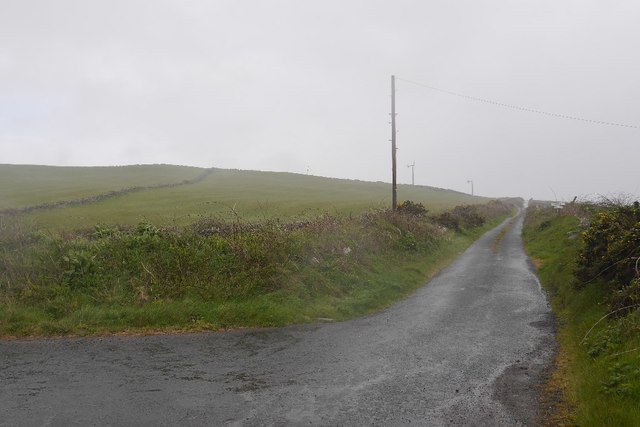
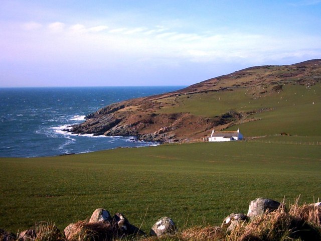
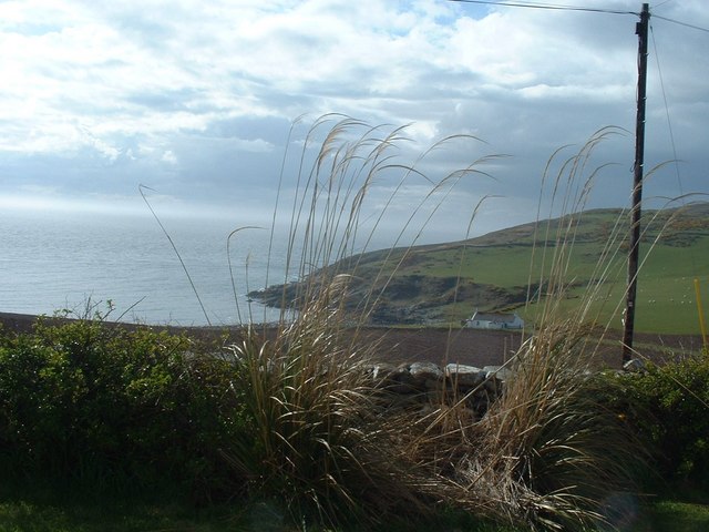
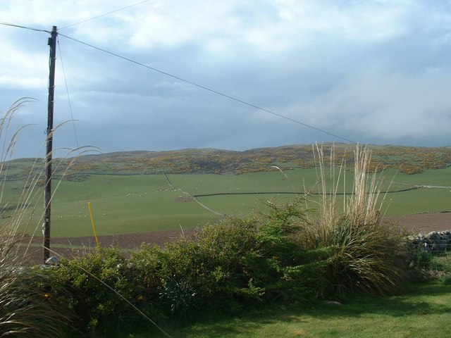
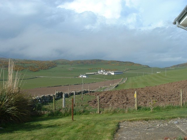
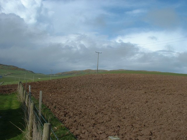
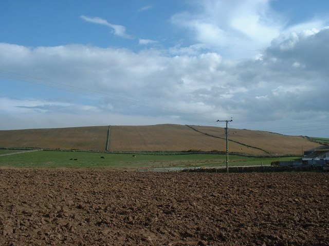
Norway Craig is a small island located off the coast of Wigtownshire in Scotland. It is situated in the Irish Sea, approximately 3 miles south of the town of Drummore. The island covers an area of around 10 acres and is known for its rugged and picturesque landscape.

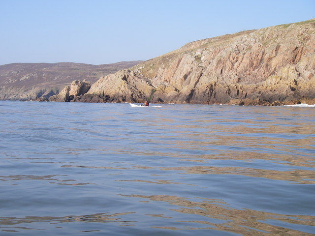
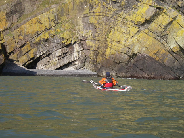
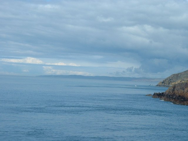
The island gets its name from its resemblance to the Norwegian coastline, with its steep cliffs and rocky outcrops. It is predominantly made up of granite, which gives it a distinctive appearance. The cliffs on the eastern side of Norway Craig are particularly impressive, rising up to 90 feet above sea level.

Despite its small size, Norway Craig is home to a variety of wildlife. Seabirds such as puffins, guillemots, and razorbills can be spotted nesting on the cliffs during the breeding season. The surrounding waters are also rich in marine life, attracting seals, dolphins, and occasional sightings of minke whales.

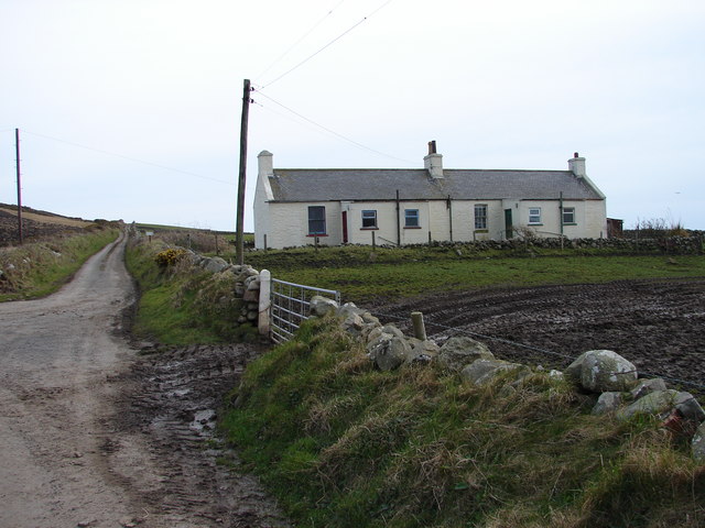
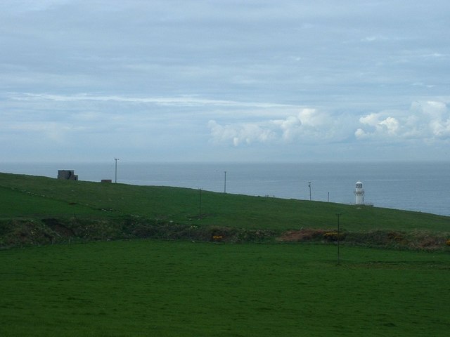
Accessible only by boat, Norway Craig is a popular destination for birdwatchers, nature enthusiasts, and photographers. Its remote location and untouched natural beauty make it an ideal spot for peaceful walks, picnics, and exploring the rocky shoreline. However, visitors should be aware that there are no facilities or accommodation on the island.

Overall, Norway Craig offers a unique and tranquil experience for those seeking a slice of unspoiled nature in the heart of Wigtownshire. Its dramatic cliffs, diverse wildlife, and breathtaking views make it a hidden gem for outdoor enthusiasts.

If you have any feedback on the listing, please let us know in the comments section below.

Norway Craig Images

Images are sourced within 2km of 54.669453/-4.9654459 or Grid Reference NX0834. Thanks to Geograph Open Source API. All images are credited.

Fields above Knockencule Farm On the west coast of the Rhins.
Fields above Knockencule Farm
On the west coast of the Rhins.
The west shore of The Rhins Bay House in view, just right of centre.
The west shore of The Rhins
Bay House in view, just right of centre.
Bay House The bay is Portencorkrie. The west side of the Rhins is wild and there is a gale blowing out to sea.
Bay House
The bay is Portencorkrie. The west side of the Rhins is wild and there is a gale blowing out to sea.
Road to Slockmill Serving scattered dwellings on the exposed west coast of the Rhins of Galloway.
Road to Slockmill
Serving scattered dwellings on the exposed west coast of the Rhins of Galloway.
Bay House, Portencorkrie An idyllic traditional Galloway cottage above Portencorkrie Bay.
Bay House, Portencorkrie
An idyllic traditional Galloway cottage above Portencorkrie Bay.
North of Crammag Head
Arched Rock bed at Portdown bay
Knockencule Cottages Farm cottages at Knockencule in the remote south-west corner of South Rhins.
Knockencule Cottages
Farm cottages at Knockencule in the remote south-west corner of South Rhins.
North End Portencorkrie Bay The beach side house is now boarded up and abandoned.
North End Portencorkrie Bay
The beach side house is now boarded up and abandoned.
Towards Barncorkrie Moor The gorse on the hillside glows brightly against the new spring grass in the sheep pasture.
Towards Barncorkrie Moor
The gorse on the hillside glows brightly against the new spring grass in the sheep pasture.
Barncorkrie Farm With Barncorkrie Moor behind and the minor road to Inshanks Fell in front.
Barncorkrie Farm
With Barncorkrie Moor behind and the minor road to Inshanks Fell in front.
Fields towards Cairn Fell With Barncorkrie Moor to left.
Fields towards Cairn Fell
With Barncorkrie Moor to left.
Fields by Knockencule With outbuildings of Knockencule Farm to right.
Fields by Knockencule
With outbuildings of Knockencule Farm to right.
Buildings on Crammag Head To left, abandoned coastguard lookout.  To right, newly erected glass fibre lighthouse.
Buildings on Crammag Head
To left, abandoned coastguard lookout. To right, newly erected glass fibre lighthouse.
View north from Crammag Head From north side of new lighthouse, with Laggantalluch Head middle right and Black Head, beyond Portpatrick in left far distance.
View north from Crammag Head
From north side of new lighthouse, with Laggantalluch Head middle right and Black Head, beyond Portpatrick in left far distance.
New lighthouse at Crammag Head Erected over the winter of 2009/2010 by specialist builders from the Orkney's, this glass fibre lighthouse replaced previous structure whose square base is visible to left. Coast of Northern Ireland near Belfast just visible on far horizon.
New lighthouse at Crammag Head
Erected over the winter of 2009/2010 by specialist builders from the Orkney's, this glass fibre lighthouse replaced previous structure whose square base is visible to left. Coast of Northern Ireland near Belfast just visible on far horizon.
Towards Mull of Galloway From south side of newly erected lighthouse at Crammag Head along western coast line of South Rhinns with Isle of Mann visible on far horizon.
Towards Mull of Galloway
From south side of newly erected lighthouse at Crammag Head along western coast line of South Rhinns with Isle of Mann visible on far horizon.
Old coastguard lookout Derelict but still identifiable.
Old coastguard lookout
Derelict but still identifiable.
Show me another place!

Norway Craig is located at Grid Ref: NX0834 (Lat: 54.669453, Lng: -4.9654459)

Unitary Authority: Dumfries and Galloway

Police Authority: Dumfries and Galloway

What 3 Words

///ultra.guitars.attending. Near Drummore, Dumfries & Galloway

Related Wikis

Kirkmaiden (village)

Kirkmaiden (sometimes Maidenkirk; Scottish Gaelic: Cill M'Eudan) is a small settlement in Galloway, Scotland, located approximately 17 miles (27 km) south...

Kirkmaiden

Kirkmaiden is a parish in the Rhins of Galloway, the most southerly in Scotland; the present Church of Scotland parish has the same name as and is approximately...

Cairngaan

Cairngaan, Wigtownshire, is the southmost settlement in Scotland. The hamlet of Cairngaan lies just north of the Mull of Galloway (which contains Scotland...

Drummore

Drummore (drum-ORE; (from Gaelic An Druim Mòr meaning "the great ridge") is the southernmost village in Scotland, located at the southern end of the Rhins...

Port Logan

Port Logan, formerly Port Nessock, is a small village in the parish of Kirkmaiden in the Rhins of Galloway in Wigtownshire. The Gaelic name is Port Neasaig...

Mull of Galloway

The Mull of Galloway (Scottish Gaelic: Maol nan Gall, pronounced [mɯːlˠ̪ nəŋ ˈkaulˠ̪]; grid reference NX158303) is the southernmost point of Scotland....

Logan Botanic Garden

Logan Botanic Garden is a botanical garden near Port Logan on the Rhins of Galloway, at the south-western tip of Scotland. The Botanic Garden was established...

Nearby Amenities

Located within 500m of 54.669453,-4.9654459
Source: PGS
Lat/Long: 54.6736397/-4.9672154
Source: PGS
Lat/Long: 54.6725908/-4.9678126
Source: PGS
Lat/Long: 54.6714149/-4.9670322
Source: PGS
Lat/Long: 54.6705957/-4.9665063
Source: PGS
Lat/Long: 54.6701356/-4.966182
Source: PGS
Lat/Long: 54.6702772/-4.9652552
Source: PGS
Lat/Long: 54.6696979/-4.9652594
Source: PGS
Lat/Long: 54.6692618/-4.9646008
Source: PGS
Lat/Long: 54.6687577/-4.9648199
Source: PGS
Lat/Long: 54.6682275/-4.9645684
Source: PGS
Lat/Long: 54.6682364/-4.9642728
Source: PGS
Lat/Long: 54.667834/-4.9642782
Source: PGS
Lat/Long: 54.6677324/-4.9643814
Source: PGS
Lat/Long: 54.6670916/-4.9641226
Source: PGS
Lat/Long: 54.6668263/-4.9641096
Source: PGS
Lat/Long: 54.6665327/-4.9644907
Source: PGS
Lat/Long: 54.6659404/-4.9650845
Source: PGS
Lat/Long: 54.6655861/-4.965063
Crammag Head Lighthouse
Man Made: lighthouse
Seamark Light Character: Fl
Seamark Light Colour: white
Seamark Light Height: 35
Seamark Light Period: 10
Seamark Light Range: 18
Seamark Light Reference: A 4608
Seamark Light Sequence: 0.4+(9.6)
Seamark Type: light_major
Source: US NGA Pub. 114. 2011-05-26.
Website: https://www.nlb.org.uk/lighthouses/crammag-head/
Lat/Long: 54.6651621/-4.9648172
The data included in this document is from www.openstreetmap.org. The data is made available under ODbL.

Have you been to Norway Craig?

Leave your review of Norway Craig below (or comments, questions and feedback).