Blind Hooies

Island in Wigtownshire

Scotland

Blind Hooies

Oyster catchers on Ardwell Bay nx070450 Ardwell bay, looking ENE across the bay, Oyster Catchers can be seen looking for a late lunch we were waiting to eat ours as well....
Oyster catchers on Ardwell Bay nx070450 Credit: Dave Smethurst

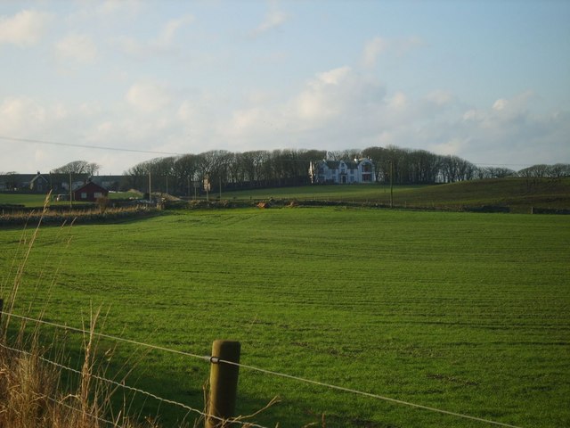
Blind Hooies is a small island located off the coast of Wigtownshire, Scotland. With a land area of approximately 1 square kilometer, it is one of the lesser-known islands in the region. The island gets its peculiar name from the local legend that sailors who approach it lose their sight temporarily due to the blinding reflection of the sun on the surrounding waters.

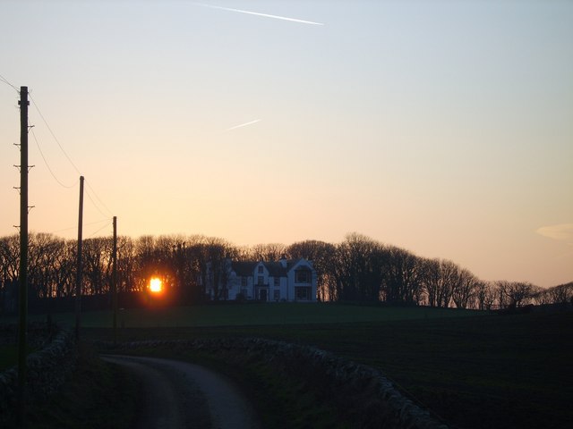
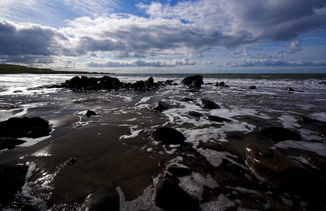
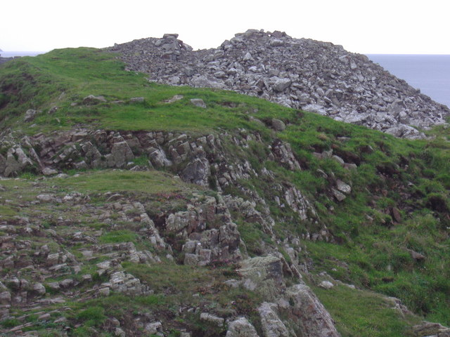
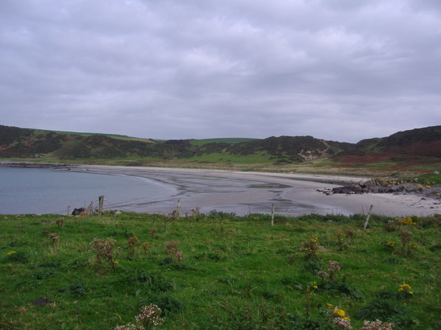
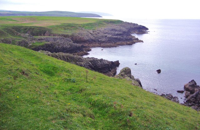
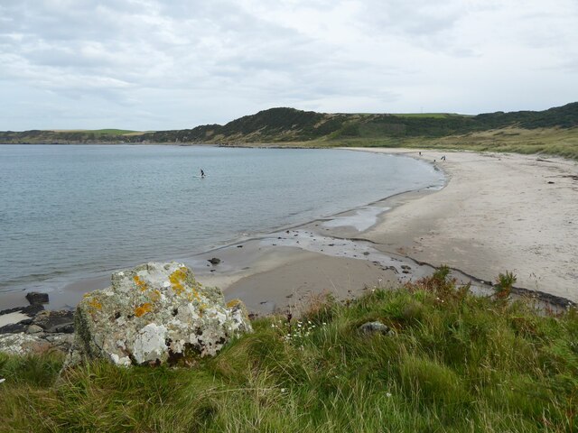
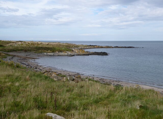
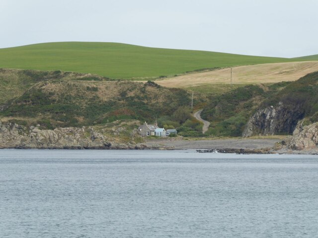
Despite its small size, Blind Hooies boasts stunning natural beauty and a diverse ecosystem. The island is characterized by rugged cliffs, sandy beaches, and lush greenery, making it a haven for birdwatchers and nature enthusiasts. It is home to a variety of bird species, including puffins, guillemots, and kittiwakes, which nest along the cliffs during the breeding season.

Access to Blind Hooies is limited, with no regular ferry services available. However, adventurous visitors can reach the island by private boat or kayak, taking into account the tides and weather conditions. The lack of human settlement on the island means there are no facilities or amenities for tourists, making it a destination for those seeking solitude and a true natural experience.

Blind Hooies offers breathtaking coastal walks and opportunities for wildlife spotting. Visitors can explore the island's rocky shores, admire the panoramic views, and witness the abundant marine life in the surrounding waters. It is important to note that visitors should adhere to responsible tourism practices, respecting the island's fragile ecosystem and leaving no trace behind.

In conclusion, Blind Hooies is a hidden gem in Wigtownshire, offering a unique and untouched natural experience to those willing to venture off the beaten path. Its stunning landscapes, diverse birdlife, and isolation from modern civilization make it a destination worth exploring for nature enthusiasts.

If you have any feedback on the listing, please let us know in the comments section below.

Blind Hooies Images

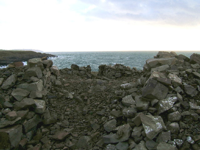
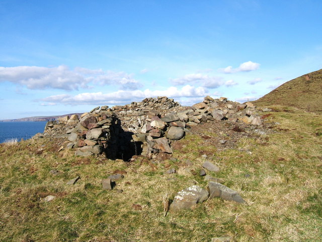
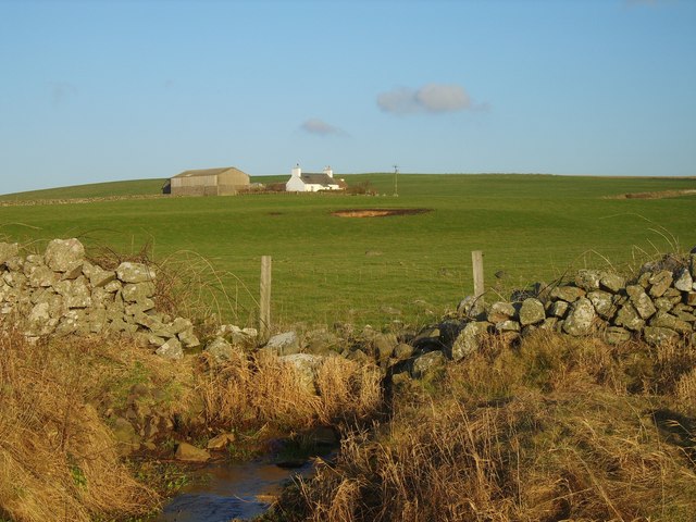
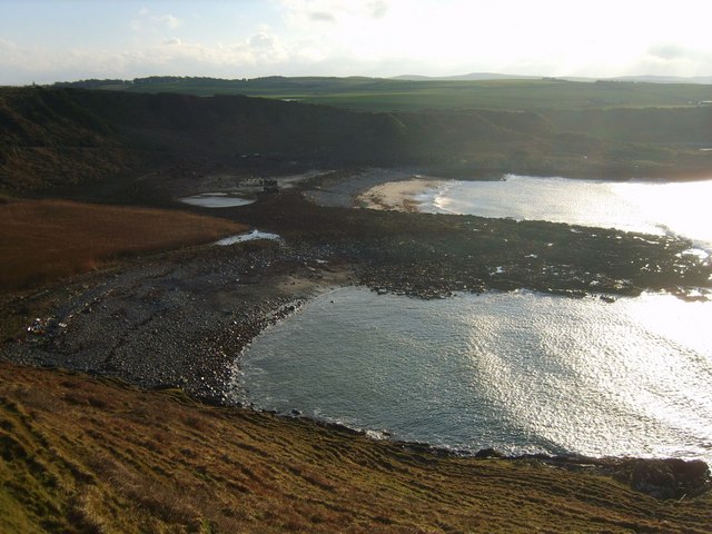
Images are sourced within 2km of 54.757799/-5.0042881 or Grid Reference NX0644. Thanks to Geograph Open Source API. All images are credited.

Oyster catchers on Ardwell Bay nx070450 Ardwell bay, looking ENE across the bay, Oyster Catchers can be seen looking for a late lunch we were waiting to eat ours as well....
Oyster catchers on Ardwell Bay nx070450
Ardwell bay, looking ENE across the bay, Oyster Catchers can be seen looking for a late lunch we were waiting to eat ours as well....
Ardwell Bay (or High Ardwell Bay as the locals call it). Ardwell Bay on the west side if the Rhins of Galloway peninsula facing onto the Irish Sea with good views to Northern Ireland on a clear day.
Ardwell Bay (or High Ardwell Bay as the locals call it).
Ardwell Bay on the west side if the Rhins of Galloway peninsula facing onto the Irish Sea with good views to Northern Ireland on a clear day.
Doon Castle Broch, High Ardwell. This pile of stones is all that remains of Doon Castle Broch. Dating from approx 100BC it would have presented a spectacular sight when first built. The remains of a doorway and some lower walls can still be seen, but the remainder has collapsed. This castle occupied a prominent position at High Ardwell point and great views to the south towards the Mull of Galloway (as per photo) and west towards Northern Ireland can be had. Unfortunately, this photo was taken on a dull day, but I will endeavour to post a better photo of this location soon. Dating from approx 100BC, would have presented a spectacular sight when first built.
Doon Castle Broch, High Ardwell.
This pile of stones is all that remains of Doon Castle Broch. Dating from approx 100BC it would have presented a spectacular sight when first built. The remains of a doorway and some lower walls can still be seen, but the remainder has collapsed. This castle occupied a prominent position at High Ardwell point and great views to the south towards the Mull of Galloway (as per photo) and west towards Northern Ireland can be had. Unfortunately, this photo was taken on a dull day, but I will endeavour to post a better photo of this location soon. Dating from approx 100BC, would have presented a spectacular sight when first built.
Doon Castle Broch, High Ardwell Bay A much better view of the landmark on a pleasant February day as promised after my first photo of this.
Doon Castle Broch, High Ardwell Bay
A much better view of the landmark on a pleasant February day as promised after my first photo of this.
South Ardwell A typical Rhins whitewashed farm with views over the Irish Sea
South Ardwell
A typical Rhins whitewashed farm with views over the Irish Sea
Drumbreddan Bay View of drumbreddan Bay taken from the hill fort
Drumbreddan Bay
View of drumbreddan Bay taken from the hill fort
Salt Pan Cottage This cottage was where salt was obtained by the evaporation of sea water
Salt Pan Cottage
This cottage was where salt was obtained by the evaporation of sea water
Drumbreddan Farm Large South Rhins Farm, backs on to sea and fronts arable land
Drumbreddan Farm
Large South Rhins Farm, backs on to sea and fronts arable land
Whitewashed Cottages on Quiet lane Two typical one storey cottages facing each other on a deserted country lane leading to the sea
Whitewashed Cottages on Quiet lane
Two typical one storey cottages facing each other on a deserted country lane leading to the sea
Drumbreddan Sunset
Drumbreddan Sunset
Port Gill Muddy track leads down from Port Gill farmyard to the coast at Port Gill.
Port Gill
Muddy track leads down from Port Gill farmyard to the coast at Port Gill.
Retreating Tide Ardwell Bay
Doon Castle Broch at Ardwell Bay. This broch, known as Doon Castle, is the best example of an Iron age broch in Dumfries and Galloway.  It is believed to date from the 1st century AD.  Sadly the walls are gradually falling down.
Doon Castle Broch at Ardwell Bay.
This broch, known as Doon Castle, is the best example of an Iron age broch in Dumfries and Galloway. It is believed to date from the 1st century AD. Sadly the walls are gradually falling down.
Ardwell Bay Ardwell Bay is on the west of the Rhins peninsula.  It is a fine, sandy bay which is reached by an uneven, narrow track with no passing places even though there is a drop to one side.
Ardwell Bay
Ardwell Bay is on the west of the Rhins peninsula. It is a fine, sandy bay which is reached by an uneven, narrow track with no passing places even though there is a drop to one side.
The cliff top at Doon Castle Broch. The views from the cliff top look southwards, down the Rhins of Galloway.
The cliff top at Doon Castle Broch.
The views from the cliff top look southwards, down the Rhins of Galloway.
Boulder on beach At Ardwell Bay.
Boulder on beach
At Ardwell Bay.
Slipway into Ardwell Bay Mary Wilson’s Slunk, beyond the point, is the site of a wreck. In the Rhins the word slunk is used to describe a gully on a rocky shore.  Many ships have been wrecked and most have been forgotten but the Mary Wilson is remembered through a place name.
Slipway into Ardwell Bay
Mary Wilson’s Slunk, beyond the point, is the site of a wreck. In the Rhins the word slunk is used to describe a gully on a rocky shore. Many ships have been wrecked and most have been forgotten but the Mary Wilson is remembered through a place name.
Saltpan Cottage Across Ardwell Bay.
Saltpan Cottage
Across Ardwell Bay.
Show me another place!

Blind Hooies is located at Grid Ref: NX0644 (Lat: 54.757799, Lng: -5.0042881)

Unitary Authority: Dumfries and Galloway

Police Authority: Dumfries and Galloway

What 3 Words

///target.chairing.dragonfly. Near Drummore, Dumfries & Galloway

Related Wikis

Doon Castle Broch

Doon Castle Broch is an iron-age broch located in Dumfries and Galloway, Scotland (grid reference NX 06702 44683). == Location == The Broch is located...

Clachanmore

Clachanmore is a village in the South Rhins of Galloway near Ardwell in the south west of Scotland. It has also been known as Low Ardwell.The name of the...

Logan Botanic Garden

Logan Botanic Garden is a botanical garden near Port Logan on the Rhins of Galloway, at the south-western tip of Scotland. The Botanic Garden was established...

Ardwell

Ardwell (from Gaelic Àrd Bhaile meaning "high town", pronounced as "Ardwell") is a village in the Scottish unitary council area of Dumfries and Galloway...

Nearby Amenities

Located within 500m of 54.757799,-5.0042881
Created By: dmgroom_coastlines
Source: PGS
Lat/Long: 54.7619526/-5.0023056
Source: PGS
Lat/Long: 54.7619122/-5.0027429
Source: PGS
Lat/Long: 54.7621659/-5.0042732
Created By: dmgroom_coastlines
Source: PGS
Lat/Long: 54.762174/-5.005817
Created By: dmgroom_coastlines
Source: PGS
Lat/Long: 54.761658/-5.006014
Created By: dmgroom_coastlines
Source: PGS
Lat/Long: 54.76089/-5.005976
Created By: dmgroom_coastlines
Source: PGS
Lat/Long: 54.760634/-5.005963
Created By: dmgroom_coastlines
Source: PGS
Lat/Long: 54.759859/-5.006368
Created By: dmgroom_coastlines
Source: PGS
Lat/Long: 54.759091/-5.00633
Created By: dmgroom_coastlines
Source: PGS
Lat/Long: 54.758966/-5.006101
Created By: dmgroom_coastlines
Source: PGS
Lat/Long: 54.758974/-5.005659
Created By: dmgroom_coastlines
Source: PGS
Lat/Long: 54.759106/-5.005445
Created By: dmgroom_coastlines
Source: PGS
Lat/Long: 54.759237/-5.005229
Created By: dmgroom_coastlines
Source: PGS
Lat/Long: 54.759244/-5.004786
Created By: dmgroom_coastlines
Source: PGS
Lat/Long: 54.75912/-5.00456
Source: PGS
Lat/Long: 54.7594763/-5.0038012
Source: PGS
Lat/Long: 54.7591835/-5.0032551
Created By: dmgroom_coastlines
Source: PGS
Lat/Long: 54.758747/-5.003876
Created By: dmgroom_coastlines
Source: PGS
Lat/Long: 54.758623/-5.003649
Source: PGS
Lat/Long: 54.7583353/-5.0038323
Created By: dmgroom_coastlines
Source: PGS
Lat/Long: 54.757844/-5.004274
Created By: dmgroom_coastlines
Source: PGS
Lat/Long: 54.757592/-5.004041
Created By: dmgroom_coastlines
Source: PGS
Lat/Long: 54.75708/-5.004016
Created By: dmgroom_coastlines
Source: PGS
Lat/Long: 54.756824/-5.004003
Created By: dmgroom_coastlines
Source: PGS
Lat/Long: 54.756056/-5.003965
Created By: dmgroom_coastlines
Source: PGS
Lat/Long: 54.755544/-5.00394
Created By: dmgroom_coastlines
Source: PGS
Lat/Long: 54.755288/-5.003927
Created By: dmgroom_coastlines
Source: PGS
Lat/Long: 54.754776/-5.003902
Created By: dmgroom_coastlines
Source: PGS
Lat/Long: 54.754652/-5.003674
Source: PGS
Lat/Long: 54.7541031/-5.0025341
Source: PGS
Lat/Long: 54.7541136/-5.0003594
Ardwell Point
Place: locality
Lat/Long: 54.7618565/-5.0062603
Doon Hill
Natural: peak
Lat/Long: 54.7602148/-5.0040748
Power: pole
Lat/Long: 54.7572667/-4.9977771
Power: pole
Lat/Long: 54.7577097/-4.9987842
Power: pole
Lat/Long: 54.7581134/-4.9997373
Power: pole
Lat/Long: 54.758639/-5.0004721
Power: pole
Lat/Long: 54.7591442/-5.0012022
Power: pole
Lat/Long: 54.7596603/-5.0019629
The data included in this document is from www.openstreetmap.org. The data is made available under ODbL.

Have you been to Blind Hooies?

Leave your review of Blind Hooies below (or comments, questions and feedback).