Belloue

Island in Wigtownshire

Scotland

Belloue

Car park at south end of Portpatrick Harbour Car park at south end of Portpatrick Harbour.
Car park at south end of Portpatrick Harbour Credit: andy

Belloue is a small island located off the coast of Wigtownshire in southwestern Scotland. With a total land area of approximately 0.5 square kilometers, it is considered one of the smallest islands in the region. The island is situated in the Irish Sea, just over a kilometer from the mainland.

Belloue is known for its stunning natural beauty, featuring rolling green hills, rugged cliffs, and picturesque coastal views. The island's landscape is predominantly rural, with a few scattered farmhouses and fields. The vegetation mainly consists of grasses and wildflowers, adding to its idyllic charm.

Access to Belloue is primarily by boat, with no established ferry service. Due to its small size and limited infrastructure, the island has a very small population, estimated to be less than 10 people. Consequently, there are no shops, schools, or other amenities on the island. The residents primarily rely on the nearby mainland for their daily needs.

The island attracts visitors who seek solitude and tranquility in a remote setting. It is a popular destination for birdwatching enthusiasts, as it is home to various seabirds, including guillemots, puffins, and gannets. The surrounding waters also offer opportunities for fishing and boating.

In summary, Belloue is a tiny island off the coast of Wigtownshire, Scotland, known for its natural beauty and peaceful ambiance. With its sparse population and limited facilities, it is an ideal destination for those seeking a quiet retreat amidst stunning coastal scenery.

If you have any feedback on the listing, please let us know in the comments section below.

Belloue Images

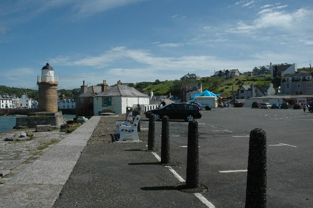
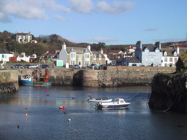
Images are sourced within 2km of 54.828278/-5.0954256 or Grid Reference NX0152. Thanks to Geograph Open Source API. All images are credited.

Car park at south end of Portpatrick Harbour Car park at south end of Portpatrick Harbour.
Car park at south end of Portpatrick Harbour
Car park at south end of Portpatrick Harbour.
The south side of Portpatrick Harbour
Portpatrick Harbour entrance Looking south.
Portpatrick Harbour entrance
Looking south.
Sea View Portpatrick
Portpatrick Harbour
Portpatrick Harbour
Portpatrick panorama This photo looks back at Portpatrick harbour from the headland and shows the lighthouse, the pottery next door and the hotel in the distance.  The small island can be seen at the entrance of the harbour.
Portpatrick panorama
This photo looks back at Portpatrick harbour from the headland and shows the lighthouse, the pottery next door and the hotel in the distance. The small island can be seen at the entrance of the harbour.
Portpatrick entrance to harbour Looking across the entrance  of the harhour
into the Irish Sea
Portpatrick entrance to harbour
Looking across the entrance of the harhour into the Irish Sea
Portpatrick Lighthouse Sunset Beautiful December sunset looking towards Ireland
Portpatrick Lighthouse Sunset
Beautiful December sunset looking towards Ireland
Portpatrick Lighthouse The view of Portpatrick Lighthouse and the Pottery next to it.
Portpatrick Lighthouse
The view of Portpatrick Lighthouse and the Pottery next to it.
Car Park The view of the sea wall and the south western edge of the car park at the lighthouse and pottery.
Car Park
The view of the sea wall and the south western edge of the car park at the lighthouse and pottery.
Portpatrick Harbour Until the 1860s and at advent of larger ships Portpatrick was the harbour from which ships sailed to Ireland.
Portpatrick Harbour
Until the 1860s and at advent of larger ships Portpatrick was the harbour from which ships sailed to Ireland.
Portpatrick Harbourside pubs and properties in Portpatrick.
Portpatrick
Harbourside pubs and properties in Portpatrick.
Portpatrick Lighthouse Portpatrick lighthouse and harbour.
Portpatrick Lighthouse
Portpatrick lighthouse and harbour.
Portpatrick Lighthouse The building behind houses the Lighthouse Pottery.
Portpatrick Lighthouse
The building behind houses the Lighthouse Pottery.
Old limekiln This is situated next to Campbells restaurant
Old limekiln
This is situated next to Campbells restaurant
Disused Lighthouse on South Pier
Main Street Portpatrick The large blue building is The Downshire Arms Hotel.
Main Street Portpatrick
The large blue building is The Downshire Arms Hotel.
The old lighthouse at the entrance to Portpatrick harbour
Show me another place!

Belloue is located at Grid Ref: NX0152 (Lat: 54.828278, Lng: -5.0954256)

Unitary Authority: Dumfries and Galloway

Police Authority: Dumfries and Galloway

What 3 Words

///ballooned.attends.common. Near Stranraer, Dumfries & Galloway

Related Wikis

Dunskey Castle

Dunskey Castle is a ruined, 12th-century tower house or castle, located 0.5 miles (0.80 km) south of the village of Portpatrick, Rhinns, Wigtownshire,...

Knockinaam Lodge

Knockinaam Lodge is a hotel and restaurant located about 3.5 miles South of Portpatrick, Dumfries & Galloway, Scotland. As of 2008, the restaurant holds...

Dunskey

Dunskey Estate (also known as Portree Estate) is north of Portpatrick on the west coast of Scotland. The B-listed mansion dates from the start of the twentieth...

Portpatrick railway station

Portpatrick railway station was a railway station serving the village of Portpatrick, Dumfries & Galloway, Scotland. Opened in 1862 the station served...

Nearby Amenities

Located within 500m of 54.828278,-5.0954256
Created By: dmgroom_coastlines
Source: PGS
Lat/Long: 54.829082/-5.101432
Created By: dmgroom_coastlines
Source: PGS
Lat/Long: 54.829353/-5.100559
Created By: dmgroom_coastlines
Source: PGS
Lat/Long: 54.829489/-5.100122
Created By: dmgroom_coastlines
Source: PGS
Lat/Long: 54.828977/-5.100096
Created By: dmgroom_coastlines
Source: PGS
Lat/Long: 54.829008/-5.098322
Created By: dmgroom_coastlines
Source: PGS
Lat/Long: 54.828748/-5.098531
Created By: dmgroom_coastlines
Source: PGS
Lat/Long: 54.828236/-5.098505
Created By: dmgroom_coastlines
Source: PGS
Lat/Long: 54.828112/-5.098276
Created By: dmgroom_coastlines
Source: PGS
Lat/Long: 54.828158/-5.095616
Created By: dmgroom_coastlines
Source: PGS
Lat/Long: 54.82829/-5.095402
Created By: dmgroom_coastlines
Source: PGS
Lat/Long: 54.828421/-5.095186
Source: PGS
Lat/Long: 54.8291998/-5.0949343
Source: PGS
Lat/Long: 54.8291389/-5.0927612
Created By: dmgroom_coastlines
Source: PGS
Lat/Long: 54.828498/-5.090752
Created By: dmgroom_coastlines
Source: PGS
Lat/Long: 54.828257/-5.089852
Created By: dmgroom_coastlines
Source: PGS
Lat/Long: 54.828017/-5.088953
Created By: dmgroom_coastlines
Source: PGS
Lat/Long: 54.827893/-5.088725
Created By: dmgroom_coastlines
Source: PGS
Lat/Long: 54.827768/-5.088496
Morroch Bay
Natural: bay
Lat/Long: 54.8270584/-5.0915381
Barrier: kissing_gate
Foot: yes
Lat/Long: 54.8302406/-5.0933672
Barrier: kissing_gate
Foot: yes
Lat/Long: 54.829809/-5.0908888
Barrier: kissing_gate
Foot: yes
Lat/Long: 54.8301009/-5.0938721
The data included in this document is from www.openstreetmap.org. The data is made available under ODbL.

Have you been to Belloue?

Leave your review of Belloue below (or comments, questions and feedback).