An t-Saothair

Island in Ross-shire

Scotland

An t-Saothair

Counryside at Laide
Counryside at Laide Credit: Eirian Evans

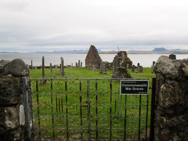
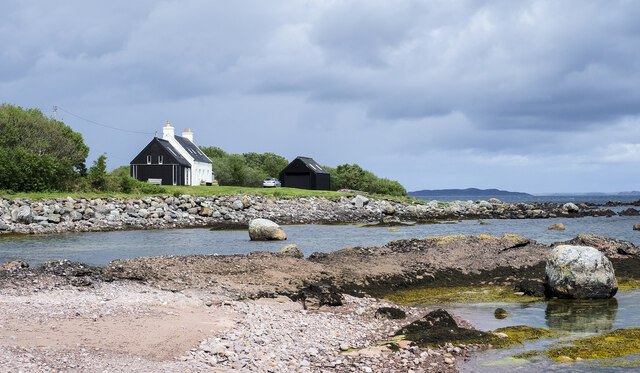
An t-Saothair, Ross-shire (Island) is a small island located off the coast of Ross-shire, Scotland. It is situated within the Inner Hebrides archipelago, specifically in the Inner Sound between Skye and the mainland. The island measures approximately 1.5 miles long and 0.5 miles wide, with a total area of around 0.6 square miles.

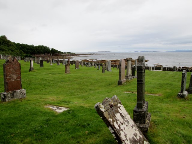
An t-Saothair is known for its stunning natural beauty and rugged coastline. It is surrounded by clear blue waters and offers breathtaking views of the surrounding islands and mainland. The island is predominantly rocky, with some areas covered in grass and heather. It is home to a variety of bird species, including seabirds and waders, making it a popular spot for birdwatching enthusiasts.

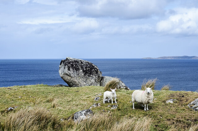
There are no permanent residents on An t-Saothair, as it is primarily used for grazing livestock. However, it attracts visitors who appreciate its tranquility and untouched landscape. The island is accessible by boat, with regular ferry services operating from nearby ports. It offers opportunities for outdoor activities such as hiking, fishing, and wildlife spotting.

An t-Saothair is a peaceful retreat for those seeking an escape from the hustle and bustle of everyday life. Its isolation and unspoiled natural environment make it a haven for nature lovers and adventurers alike. Whether exploring its coastal paths, admiring the panoramic views, or simply enjoying the serenity of the island, An t-Saothair offers a unique and unforgettable experience.

If you have any feedback on the listing, please let us know in the comments section below.

An t-Saothair Images

Images are sourced within 2km of 57.86541/-5.5105302 or Grid Reference NG9191. Thanks to Geograph Open Source API. All images are credited.

Counryside at Laide
Counryside at Laide
Ruin at First Coast
Ruin at First Coast
Gruinard Bay
Gruinard Bay
A foxglove at Gruinard Bay The foxglove (Digitalis purpurea) is a beautiful but poisonous flower common throughout Britain. I isolated the foxglove against the sea for a uniform background. For a wider view, see <a href="https://www.geograph.org.uk/photo/5834969">NG9291 : Gruinard Bay</a>.
A foxglove at Gruinard Bay
The foxglove (Digitalis purpurea) is a beautiful but poisonous flower common throughout Britain. I isolated the foxglove against the sea for a uniform background. For a wider view, see NG9291 : Gruinard Bay.
The A832 between First Coast and Second Coast This route is popular with motor cyclists.
The A832 between First Coast and Second Coast
This route is popular with motor cyclists.
Wester Ross coastal scenery at First Coast A favourite of many a calendar. In the distance lie the line of hills extending from Sàil Mhòr to An Teallach.
Wester Ross coastal scenery at First Coast
A favourite of many a calendar. In the distance lie the line of hills extending from Sàil Mhòr to An Teallach.
The  old  burial  ground  and  remains  of  chapel
The old burial ground and remains of chapel
Old  burial  ground  Laide  with  Gruinard  Bay  beyond
Old burial ground Laide with Gruinard Bay beyond
Minor  road  from  Laide  to  Mellon  Udrigle
Minor road from Laide to Mellon Udrigle
House  alongside  the A832  at  First  Coast A small number of spread out properties make up First Coast, with the same further along being Second Coast.
House alongside the A832 at First Coast
A small number of spread out properties make up First Coast, with the same further along being Second Coast.
Sheep with lamb and boulders The animals are beside the A832 at Second Coast. Gruinard Bay is beyond the boulders with part of Gruinard Island in view at the right side of the image.
Sheep with lamb and boulders
The animals are beside the A832 at Second Coast. Gruinard Bay is beyond the boulders with part of Gruinard Island in view at the right side of the image.
Boulders at shore of Gruinard Bay Two lone boulders are prominent in the view at the seashore at Laide near to the south-western corner of Gruinard Bay.
Boulders at shore of Gruinard Bay
Two lone boulders are prominent in the view at the seashore at Laide near to the south-western corner of Gruinard Bay.
A832, Second Coast The A832 runs 127 miles from the Black Isle to Braemore Junction <a href="https://www.geograph.org.uk/photo/7232275">NH2077 : Braemore Junction</a>.
<span class="nowrap"><a title="https://www.sabre-roads.org.uk/wiki/index.php?title=A832" rel="nofollow ugc noopener" href="https://www.sabre-roads.org.uk/wiki/index.php?title=A832">Link</a><img style="margin-left:2px;" alt="External link" title="External link - shift click to open in new window" src="https://s1.geograph.org.uk/img/external.png" width="10" height="10"/></span>
A832, Second Coast
The A832 runs 127 miles from the Black Isle to Braemore Junction NH2077 : Braemore Junction. LinkExternal link
A832, Second Coast The North Coast 500 is a 516 mile scenic route around the north coast of Scotland, starting and ending at Inverness Castle. The route is also known as the NC500 and was launched in 2015, linking many features in the north Highlands of Scotland in one touring route.
The route has increased visitor numbers to parts of the north of Scotland, which has brought economic benefits to some areas. The increase in traffic has also led to more instances of bad and dangerous driving, as well as damage to the roads and concerns about the environmental impact. 
Apparently the route was amended in 2022 with detours etc being removed.
Wikipedia: <span class="nowrap"><a title="https://en.wikipedia.org/wiki/North_Coast_500" rel="nofollow ugc noopener" href="https://en.wikipedia.org/wiki/North_Coast_500">Link</a><img style="margin-left:2px;" alt="External link" title="External link - shift click to open in new window" src="https://s1.geograph.org.uk/img/external.png" width="10" height="10"/></span> 
Original route map: <span class="nowrap"><a title="https://en.wikipedia.org/wiki/North_Coast_500#/media/File:North_Coast_500,_Scotland.svg" rel="nofollow ugc noopener" href="https://en.wikipedia.org/wiki/North_Coast_500#/media/File:North_Coast_500,_Scotland.svg">Link</a><img style="margin-left:2px;" alt="External link" title="External link - shift click to open in new window" src="https://s1.geograph.org.uk/img/external.png" width="10" height="10"/></span> 
Latest route map: <span class="nowrap"><a title="https://www.northcoast500.com/explore-the-route/" rel="nofollow ugc noopener" href="https://www.northcoast500.com/explore-the-route/">Link</a><img style="margin-left:2px;" alt="External link" title="External link - shift click to open in new window" src="https://s1.geograph.org.uk/img/external.png" width="10" height="10"/></span>
A832, Second Coast
The North Coast 500 is a 516 mile scenic route around the north coast of Scotland, starting and ending at Inverness Castle. The route is also known as the NC500 and was launched in 2015, linking many features in the north Highlands of Scotland in one touring route. The route has increased visitor numbers to parts of the north of Scotland, which has brought economic benefits to some areas. The increase in traffic has also led to more instances of bad and dangerous driving, as well as damage to the roads and concerns about the environmental impact. Apparently the route was amended in 2022 with detours etc being removed. Wikipedia: LinkExternal link Original route map: LinkExternal link Latest route map: LinkExternal link
A832, First Coast The A832 runs 127 miles from the Black Isle to Braemore Junction <a href="https://www.geograph.org.uk/photo/7232275">NH2077 : Braemore Junction</a>.
<span class="nowrap"><a title="https://www.sabre-roads.org.uk/wiki/index.php?title=A832" rel="nofollow ugc noopener" href="https://www.sabre-roads.org.uk/wiki/index.php?title=A832">Link</a><img style="margin-left:2px;" alt="External link" title="External link - shift click to open in new window" src="https://s1.geograph.org.uk/img/external.png" width="10" height="10"/></span>
A832, First Coast
The A832 runs 127 miles from the Black Isle to Braemore Junction NH2077 : Braemore Junction. LinkExternal link
Entering Laide, A832 The A832 runs 127 miles from the Black Isle to Braemore Junction <a href="https://www.geograph.org.uk/photo/7232275">NH2077 : Braemore Junction</a>.
<span class="nowrap"><a title="https://www.sabre-roads.org.uk/wiki/index.php?title=A832" rel="nofollow ugc noopener" href="https://www.sabre-roads.org.uk/wiki/index.php?title=A832">Link</a><img style="margin-left:2px;" alt="External link" title="External link - shift click to open in new window" src="https://s1.geograph.org.uk/img/external.png" width="10" height="10"/></span>
Entering Laide, A832
The A832 runs 127 miles from the Black Isle to Braemore Junction NH2077 : Braemore Junction. LinkExternal link
Ruin in the moorland at Second Coast
Gruinard Bay Shingle and sand beach at First Coast
Gruinard Bay
Shingle and sand beach at First Coast
Show me another place!

An t-Saothair is located at Grid Ref: NG9191 (Lat: 57.86541, Lng: -5.5105302)

Unitary Authority: Highland

Police Authority: Highlands and Islands

What 3 Words

///dialect.manuals.dentistry. Near Gairloch, Highland

Related Wikis

First Coast, Highland

First Coast is a small settlement in Wester Ross in the North West Highlands of Scotland. It is situated on the south shore of Gruinard Bay and on the...

Sand, Highland

Sand (Scottish Gaelic: Sannda) is a small hamlet, located on the southern shore of Gruinard Bay, and lying to the west of the village of Laide in Ross...

Laide

Laide (Scottish Gaelic: An Leathad) is a small village in the northwest of the Highlands of Scotland. It is situated on the southern shore of Gruinard...

Gruinard Bay

Gruinard Bay is a large remote coastal embayment, located 12 miles north of Poolewe, in northwestern Ross and Cromarty, and is in the former parish of...

Nearby Amenities

Located within 500m of 57.86541,-5.5105302
Created By: almien_coastlines
Source: PGS
Lat/Long: 57.865283/-5.517106
Source: PGS
Lat/Long: 57.8649398/-5.518078
Source: PGS
Lat/Long: 57.8615713/-5.5080664
Source: PGS
Lat/Long: 57.8618333/-5.5088834
Source: PGS
Lat/Long: 57.8621526/-5.5100834
Source: PGS
Lat/Long: 57.862398/-5.5103838
Source: PGS
Lat/Long: 57.8625961/-5.5106778
Source: PGS
Lat/Long: 57.8629014/-5.5110812
Source: PGS
Lat/Long: 57.8632447/-5.5113065
Created By: almien_coastlines
Source: PGS
Lat/Long: 57.863474/-5.511455
Source: PGS
Lat/Long: 57.8636998/-5.5119299
Source: PGS
Lat/Long: 57.8639909/-5.5125012
Source: PGS
Lat/Long: 57.8641815/-5.5128456
Source: PGS
Lat/Long: 57.8644118/-5.5135451
Source: PGS
Lat/Long: 57.8644941/-5.5138059
Created By: almien_coastlines
Source: PGS
Lat/Long: 57.864819/-5.514671
Source: PGS
Lat/Long: 57.8651438/-5.516117
Created By: almien_coastlines
Source: PGS
Lat/Long: 57.86542/-5.516636
Parking
Parking: street_side
Source: Bing
Lat/Long: 57.8633732/-5.5146617
Parking
Lat/Long: 57.864104/-5.5179899
Parking
Lat/Long: 57.8626011/-5.5126346
The data included in this document is from www.openstreetmap.org. The data is made available under ODbL.

Have you been to An t-Saothair?

Leave your review of An t-Saothair below (or comments, questions and feedback).