Sròn nan Oban

Island in Ross-shire

Scotland

Sròn nan Oban

Meall na h-Airighe Riabhaich Fine lichen covered cairn
Meall na h-Airighe Riabhaich Credit: David Brown

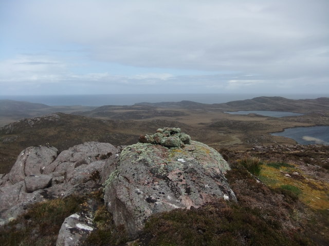
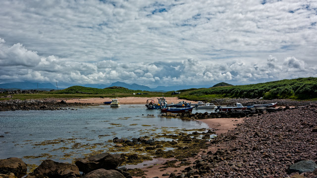
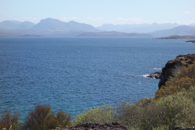
Sròn nan Oban is a small island located off the coast of Ross-shire, Scotland. It is situated in the Inner Hebrides, specifically in the Sound of Raasay, between the Isle of Skye and the mainland. The island is approximately 70 hectares in size and primarily consists of rugged and hilly terrain, with its highest point reaching around 120 meters above sea level.

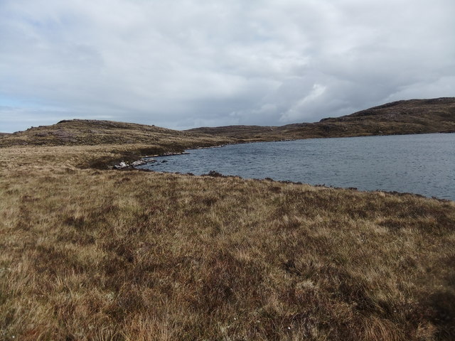
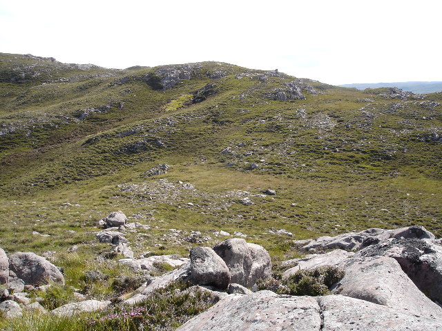
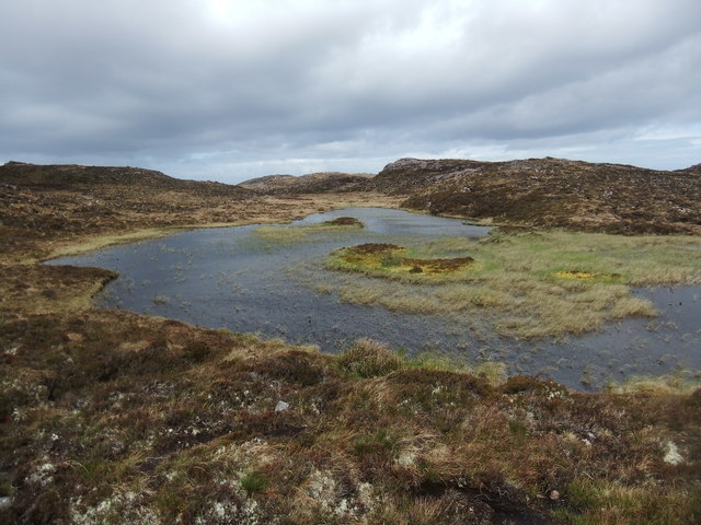
The landscape of Sròn nan Oban is characterized by rocky cliffs, heather-covered hills, and stunning coastal views. It is known for its diverse wildlife, including various seabirds such as puffins, guillemots, and razorbills. The waters surrounding the island are home to seals, dolphins, and occasional sightings of whales.

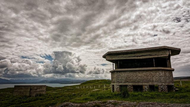
The island has a rich history, with evidence of human habitation dating back thousands of years. There are several ancient ruins and standing stones that attest to its past. Sròn nan Oban also played a significant role during the Viking era, serving as a strategic location for trade and defense.

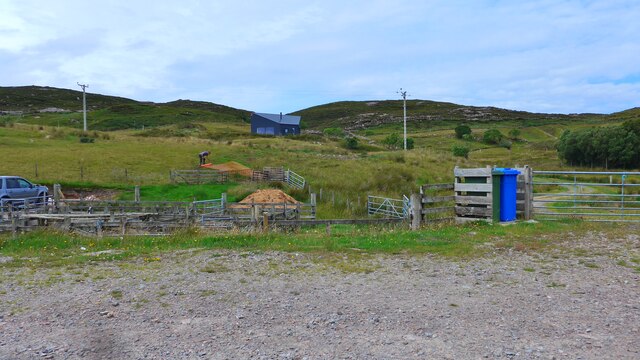
Today, Sròn nan Oban is largely uninhabited, with no permanent residents. However, the island attracts visitors who are drawn to its natural beauty and peaceful atmosphere. It is a popular destination for outdoor enthusiasts, offering opportunities for hiking, birdwatching, and photography.

Access to Sròn nan Oban is mainly by boat, with regular ferry services operating from nearby ports. The island provides a unique and tranquil escape for those seeking a remote and unspoiled Scottish island experience.

If you have any feedback on the listing, please let us know in the comments section below.

Sròn nan Oban Images

Images are sourced within 2km of 57.851873/-5.6884232 or Grid Reference NG8190. Thanks to Geograph Open Source API. All images are credited.

Meall na h-Airighe Riabhaich Fine lichen covered cairn
Meall na h-Airighe Riabhaich
Fine lichen covered cairn
Loch na h-Uamhaidh Beag
The car park at Cove Here there are information boards describing the part Loch Ewe played in the WW2 Arctic Convoys.
The car park at Cove
Here there are information boards describing the part Loch Ewe played in the WW2 Arctic Convoys.
Information board at Rubha nan Sasan, Cove This describes the part Loch Ewe played in the WW2 Arctic Convoys.
Information board at Rubha nan Sasan, Cove
This describes the part Loch Ewe played in the WW2 Arctic Convoys.
New house near Cove
New house near Cove
View from Airigh Riahach Looking South across the grid square towards Meall na h-Airighe Riabhaich
View from Airigh Riahach
Looking South across the grid square towards Meall na h-Airighe Riabhaich
Lochan on Meall na h-Uamhaidh
Command post at Rubha nan Sasan
Boats at Cove
Boats at Cove
Loch Ewe and the road to Cove
Loch Ewe
Loch Ewe
Light anti-aircraft gun emplacement, Rubha nan Sasan, Ross and Cromarty The gun emplacement lies within the Rubha nan Sasan coastal battery which was part of the Second World War defences of Loch Ewe from where Russian Arctic Convoys sailed.
Light anti-aircraft gun emplacement, Rubha nan Sasan, Ross and Cromarty
The gun emplacement lies within the Rubha nan Sasan coastal battery which was part of the Second World War defences of Loch Ewe from where Russian Arctic Convoys sailed.
Light anti-aircraft gun emplacement, Rubha nan Sasan, Ross and Cromarty The gun emplacement lies within the Rubha nan Sasan coastal battery.
Light anti-aircraft gun emplacement, Rubha nan Sasan, Ross and Cromarty
The gun emplacement lies within the Rubha nan Sasan coastal battery.
Memorial  stone  for  over  3000  men  lost  on  Russian  Convoys Erected on the headland of Rubha nan Sasan by the Russian Arctic Convoy Club. Loch Ewe was the heavily fortified base for the convoys to assemble prior to departure. <span class="nowrap"><a title="www.russianarcticconvoymuseum.org" rel="nofollow ugc noopener" href="http://www.russianarcticconvoymuseum.org">Link</a><img style="margin-left:2px;" alt="External link" title="External link - shift click to open in new window" src="https://s1.geograph.org.uk/img/external.png" width="10" height="10"/></span> is the museum at Aultbea on the A832 which is well worth a visit
Memorial stone for over 3000 men lost on Russian Convoys
Erected on the headland of Rubha nan Sasan by the Russian Arctic Convoy Club. Loch Ewe was the heavily fortified base for the convoys to assemble prior to departure. LinkExternal link is the museum at Aultbea on the A832 which is well worth a visit
WW2   buildings  NW  of  the  Arctic  Convoy  Memorial This whole headland was a military camp covering the entrance into Loch Ewe
WW2 buildings NW of the Arctic Convoy Memorial
This whole headland was a military camp covering the entrance into Loch Ewe
Hydrographic  Survey  Pillar  overlooking  Loch  Ewe On the headland of Rubha nan Sasan which in WW2 was a protective battery covering the entrance to Loch Ewe. This survey pillar was placed here in 1951 by HMS Cook during survey work on the west coast of Scotland
Hydrographic Survey Pillar overlooking Loch Ewe
On the headland of Rubha nan Sasan which in WW2 was a protective battery covering the entrance to Loch Ewe. This survey pillar was placed here in 1951 by HMS Cook during survey work on the west coast of Scotland
Road (B8057) between Stirkhill and Cove Looking north-westward.
Road (B8057) between Stirkhill and Cove
Looking north-westward.
Road (B8057) at Cove Looking southward.
Road (B8057) at Cove
Looking southward.
Show me another place!

Sròn nan Oban is located at Grid Ref: NG8190 (Lat: 57.851873, Lng: -5.6884232)

Unitary Authority: Highland

Police Authority: Highlands and Islands

What 3 Words

///engrossed.fans.topics. Near Gairloch, Highland

Related Wikis

Cove, Highland

Cove is a remote hamlet located on the northwestern shore of the sea loch Loch Ewe, and 8 mi (13 km) northwest of Poolewe in Ross-shire, Scottish Highlands...

Mellon Charles

Mellon Charles (Scottish Gaelic: Meallan Theàrlaich) is a remote crofting village on the north east shore of Loch Ewe near Gairloch in Wester Ross, in...

Ormiscaig

Ormiscaig (Scottish Gaelic: Ormasgaig) is a remote crofting village on the north east shore of Loch Ewe in Achnasheen, Ross-shire, Scottish Highlands and...

Isle of Ewe

The Isle of Ewe (Scottish Gaelic: Eilean Iùbh) is a small Scottish island on the west coast of Ross and Cromarty. The island is inhabited by a single family...

Loch Ewe

Loch Ewe (Scottish Gaelic: Loch Iùbh) is a sea loch in the region of Wester Ross in the Northwest Highlands of Scotland. The shores are inhabited by a...

Inverasdale

Inverasdale (Scottish Gaelic: Inbhir Àsdail) is a hamlet in the Northwest Highlands of Scotland, located by Loch Ewe, in the region of Wester Ross. �...

Aultbea

Aultbea (Gaelic: An t-Allt Beithe) is a small coastal fishing village in the North-West Highlands of Scotland. It is situated on the southeast shore of...

Rubha Mòr

Rubha Mòr is a remote peninsula in west Scotland, in the western region of Ross and Cromarty. The peninsula stretches from Greenstone Point in the north...

Nearby Amenities

Located within 500m of 57.851873,-5.6884232
Created By: almien_coastlines
Source: PGS
Lat/Long: 57.848012/-5.690986
Created By: almien_coastlines
Source: PGS
Lat/Long: 57.848523/-5.691024
Source: PGS
Lat/Long: 57.8487897/-5.6913393
Source: PGS
Lat/Long: 57.8492848/-5.6921959
Source: PGS
Lat/Long: 57.8495099/-5.6925666
Source: PGS
Lat/Long: 57.8497034/-5.6931019
Source: PGS
Lat/Long: 57.8499405/-5.6935204
Source: PGS
Lat/Long: 57.8507589/-5.6931766
Source: PGS
Lat/Long: 57.8510296/-5.6921092
Source: PGS
Lat/Long: 57.8513652/-5.6917871
Source: PGS
Lat/Long: 57.8512456/-5.6884034
Source: PGS
Lat/Long: 57.8513781/-5.688541
Source: PGS
Lat/Long: 57.8513981/-5.6881978
Created By: almien_coastlines
Source: PGS
Lat/Long: 57.851658/-5.688135
Source: PGS
Lat/Long: 57.8522245/-5.6879637
Source: PGS
Lat/Long: 57.8521513/-5.689094
Created By: almien_coastlines
Source: PGS
Lat/Long: 57.853934/-5.689506
Created By: almien_coastlines
Source: PGS
Lat/Long: 57.85418/-5.690005
Source: PGS
Lat/Long: 57.8543075/-5.6907691
Source: PGS
Lat/Long: 57.8546466/-5.6916366
Created By: almien_coastlines
Source: PGS
Lat/Long: 57.85466/-5.691482
Source: PGS
Lat/Long: 57.854678/-5.6910605
Source: PGS
Lat/Long: 57.8548488/-5.6911073
Created By: almien_coastlines
Source: PGS
Lat/Long: 57.855448/-5.69058
Telephone
Booth: K6
Covered: booth
Phone: +44 1445 781220
Source: survey
Lat/Long: 57.8522861/-5.69308
Post Box
Post Box Type: lamp
Ref: IV22 228
Royal Cypher: scottish_crown
Source: survey
Lat/Long: 57.8534562/-5.6932671
Cove Pier
Leisure: slipway
Source: survey
Lat/Long: 57.8543001/-5.6922809
Sron nan Oban
Place: locality
Lat/Long: 57.8516243/-5.6883652
Camas Bubh
Natural: bay
Lat/Long: 57.8502198/-5.6918842
Power: pole
Lat/Long: 57.8549608/-5.6938368
Power: pole
Lat/Long: 57.8542554/-5.694242
Power: pole
Lat/Long: 57.8537393/-5.694705
Power: pole
Lat/Long: 57.852822/-5.6951101
Power: pole
Lat/Long: 57.8525522/-5.6937886
Power: pole
Lat/Long: 57.8528206/-5.6957757
Power: pole
Lat/Long: 57.8529034/-5.6964123
Power: pole
Lat/Long: 57.8502747/-5.6950095
Power: pole
Lat/Long: 57.8509244/-5.6950385
Power: pole
Lat/Long: 57.8516269/-5.6950522
Power: pole
Lat/Long: 57.8532759/-5.6951418
Power: pole
Lat/Long: 57.8496155/-5.6949737
Power: pole
Lat/Long: 57.8492327/-5.6949627
The data included in this document is from www.openstreetmap.org. The data is made available under ODbL.

Have you been to Sròn nan Oban?

Leave your review of Sròn nan Oban below (or comments, questions and feedback).