Am Fraoch-eilean

Island in Inverness-shire

Scotland

Am Fraoch-eilean

Inlet off Loch nan Uamh Taken from the end of a narrow lane that ends at this point. Not a good place to come by car and expect to find a turning space. Worth the visit to see the black throated diver.
Inlet off Loch nan Uamh Credit: Gordon Hatton

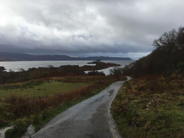
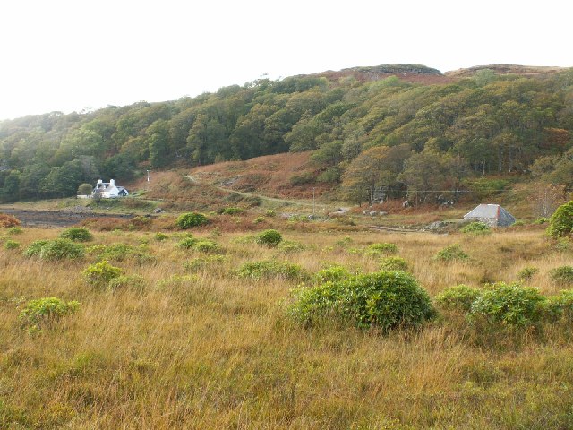
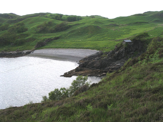
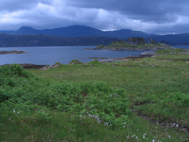
Am Fraoch-eilean is a small island located in Loch Ness, in the county of Inverness-shire in Scotland. The island is situated near the village of Dores and is known for its stunning natural beauty and tranquil surroundings.

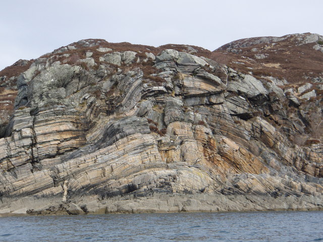
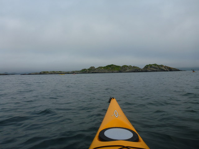
The island is approximately 150 meters long and 50 meters wide, making it a popular destination for visitors looking to escape the hustle and bustle of everyday life. It is accessible by boat or kayak, and offers breathtaking views of the surrounding mountains and Loch Ness.

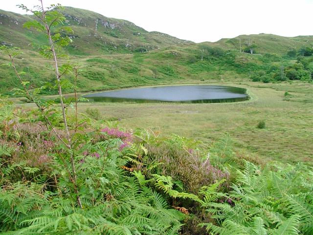
Am Fraoch-eilean is home to a variety of wildlife, including birds, otters, and occasionally red deer. The island is also a popular spot for fishing, with anglers coming to try their luck at catching trout and salmon in the waters surrounding the island.

Visitors to Am Fraoch-eilean can enjoy picnicking, hiking, and wildlife watching, making it a perfect destination for nature lovers and outdoor enthusiasts. The island's peaceful atmosphere and stunning scenery make it a must-visit destination for anyone exploring the Loch Ness area.

If you have any feedback on the listing, please let us know in the comments section below.

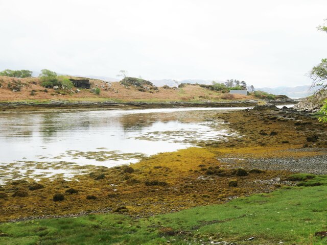
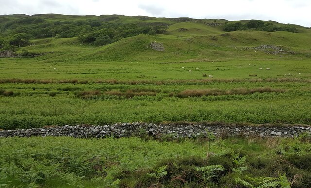
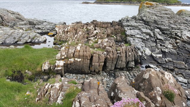
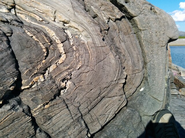
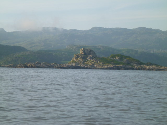
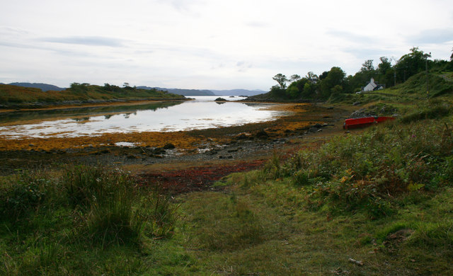
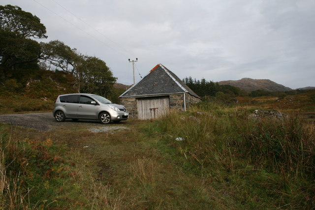
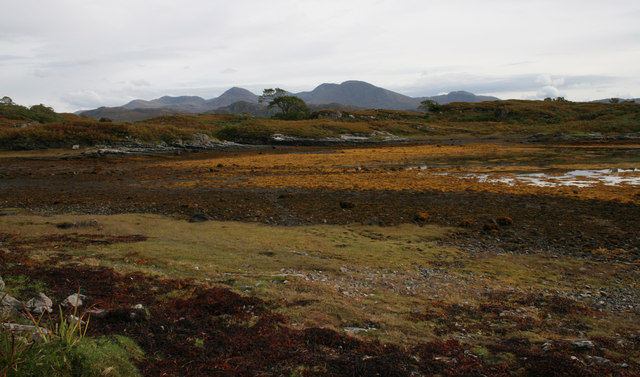
Am Fraoch-eilean Images

Images are sourced within 2km of 56.880422/-5.8190438 or Grid Reference NM6783. Thanks to Geograph Open Source API. All images are credited.

Inlet off Loch nan Uamh Taken from the end of a narrow lane that ends at this point. Not a good place to come by car and expect to find a turning space. Worth the visit to see the black throated diver.
Inlet off Loch nan Uamh
Taken from the end of a narrow lane that ends at this point. Not a good place to come by car and expect to find a turning space. Worth the visit to see the black throated diver.
Raised beach inland from Camas Ghaoideil Flat farm land is the location of a fossil raised beach inland from Camas Ghaoideil
Raised beach inland from Camas Ghaoideil
Flat farm land is the location of a fossil raised beach inland from Camas Ghaoideil
Geological dyke on shore of Rubha Aird Mhoir Rocky foreshore showing a sheet of brown igneous rock cutting grey Moine metamorphic rocks
Geological dyke on shore of Rubha Aird Mhoir
Rocky foreshore showing a sheet of brown igneous rock cutting grey Moine metamorphic rocks
Spectacular folded rocks on foreshore Foreshore near Druimindarroch showing spectacular fold within metamorphosed Moine rocks.
Spectacular folded rocks on foreshore
Foreshore near Druimindarroch showing spectacular fold within metamorphosed Moine rocks.
Road to Druimindarroch
Rock Formations Rock formations taken at the narrows between An Garbh eilean and the mainland.
Rock Formations
Rock formations taken at the narrows between An Garbh eilean and the mainland.
Cup Marked Stone A large bowl shaped depression you could eat your porridge from is surrounded by about 60 to 70 smaller cup marks maybe half an inch deep. Answers on a postcard.
Cup Marked Stone
A large bowl shaped depression you could eat your porridge from is surrounded by about 60 to 70 smaller cup marks maybe half an inch deep. Answers on a postcard.
An Glas-eilean A short paddle from Druimindarroch, quite difficult to land.
An Glas-eilean
A short paddle from Druimindarroch, quite difficult to land.
Eilean an Sgurra Interesting rock formations
Eilean an Sgurra
Interesting rock formations
Druimindarroch road
Druimindarroch road
Saideal Druim an Daraich An inlet on Loch nan Uamh.
Saideal Druim an Daraich
An inlet on Loch nan Uamh.
Boat house at the head of Saideal Druim an Daraich
Head of Saideal Druim an Daraich An inlet on Loch nan Uamh.  Taken at low water.
Head of Saideal Druim an Daraich
An inlet on Loch nan Uamh. Taken at low water.
Loch Dubh Viewed from the high point of the track to the north  (NM672851)
Loch Dubh
Viewed from the high point of the track to the north (NM672851)
Druimindarroch Druimindarroch showing on old estate house on the left and the boat house on the right. The "Oak Ridge" is behind the houses.
Druimindarroch
Druimindarroch showing on old estate house on the left and the boat house on the right. The "Oak Ridge" is behind the houses.
Cragtop Hut The building marked on the map at Camus Ghaoideil is perched atop a narrow rocky spur.
Cragtop Hut
The building marked on the map at Camus Ghaoideil is perched atop a narrow rocky spur.
Eilean nan Cabar Taken from the mainland, this image shows that Eilean nan Cabar, safe from grazing sheep, has a significant number of trees on it, although you would never guess this from the bleak 1:50000 OS map representation.
Eilean nan Cabar
Taken from the mainland, this image shows that Eilean nan Cabar, safe from grazing sheep, has a significant number of trees on it, although you would never guess this from the bleak 1:50000 OS map representation.
From the Borrodale vitrified fort This vitrified fort commands a powerful position by the mouth of the Borrodale Burn on the North shore of the sea loch, Loch nan Uamh. The southern edge of the fort and these two rocky points are just about all the land in this square. Beyond lies Eilean nan Caber with Ardnamurchan Point in the far distance.
From the Borrodale vitrified fort
This vitrified fort commands a powerful position by the mouth of the Borrodale Burn on the North shore of the sea loch, Loch nan Uamh. The southern edge of the fort and these two rocky points are just about all the land in this square. Beyond lies Eilean nan Caber with Ardnamurchan Point in the far distance.
Show me another place!

Am Fraoch-eilean is located at Grid Ref: NM6783 (Lat: 56.880422, Lng: -5.8190438)

Unitary Authority: Highland

Police Authority: Highlands and Islands

What 3 Words

///freed.splinters.helm. Near Arisaig, Highland

Related Wikis

Druimindarroch

Druimindarroch (Scottish Gaelic: Druim nan Darach) is a small settlement which lies on the north coast of Loch nan Uamh in Lochaber, Scottish Highlands...

Prince Charlie's Cave

There are many Prince Charlies Caves in the Highlands, caves where Charles Edward Stuart was said to have sheltered when on the run from the Duke of Cumberland...

Rhu Peninsula

Rhu Peninsula (Scottish Gaelic: Rudha Arasaig) and originally known as the Rhu Arisaig peninsula is a small, remote and largely deserted peninsula, at...
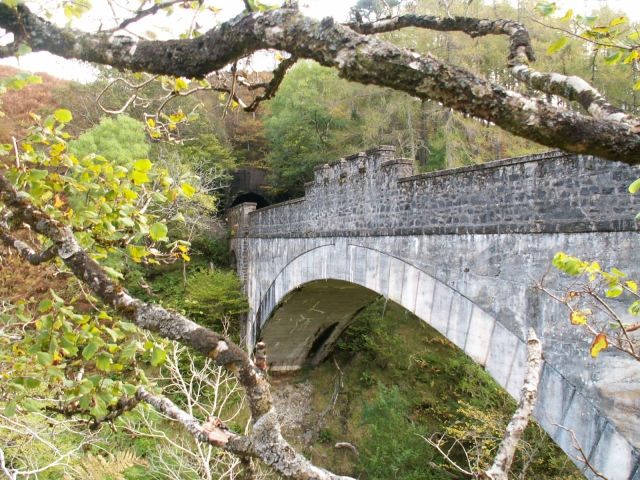
Borrodale Viaduct

The Borrodale Viaduct is a railway viaduct that carries the West Highland Line over the Borrodale Burn. == History == The West Highland Railway was built...

Nearby Amenities

Located within 500m of 56.880422,-5.8190438
Created By: dmgroom_coastlines
Source: PGS
Lat/Long: 56.880822/-5.820138
Created By: dmgroom_coastlines
Source: PGS
Lat/Long: 56.880981/-5.818746
Created By: dmgroom_coastlines
Source: PGS
Lat/Long: 56.880992/-5.818279
Created By: dmgroom_coastlines
Source: PGS
Lat/Long: 56.880958/-5.81797
Created By: dmgroom_coastlines
Source: PGS
Lat/Long: 56.881131/-5.817822
Created By: dmgroom_coastlines
Source: PGS
Lat/Long: 56.881141/-5.817355
Created By: dmgroom_coastlines
Source: PGS
Lat/Long: 56.880886/-5.817335
Created By: dmgroom_coastlines
Source: PGS
Lat/Long: 56.880791/-5.817637
Created By: dmgroom_coastlines
Source: PGS
Lat/Long: 56.880619/-5.817783
Created By: dmgroom_coastlines
Source: PGS
Lat/Long: 56.880609/-5.81825
Created By: dmgroom_coastlines
Source: PGS
Lat/Long: 56.880097/-5.818212
Created By: dmgroom_coastlines
Source: PGS
Lat/Long: 56.879937/-5.819603
Created By: dmgroom_coastlines
Source: PGS
Lat/Long: 56.879799/-5.820061
Created By: dmgroom_coastlines
Source: PGS
Lat/Long: 56.877433/-5.817075
Created By: dmgroom_coastlines
Source: PGS
Lat/Long: 56.877422/-5.817542
Created By: dmgroom_coastlines
Source: PGS
Lat/Long: 56.877646/-5.818963
Created By: dmgroom_coastlines
Source: PGS
Lat/Long: 56.877636/-5.81943
Created By: dmgroom_coastlines
Source: PGS
Lat/Long: 56.877487/-5.820354
Created By: dmgroom_coastlines
Source: PGS
Lat/Long: 56.877999/-5.820393
Created By: dmgroom_coastlines
Source: PGS
Lat/Long: 56.877988/-5.82086
Created By: dmgroom_coastlines
Source: PGS
Lat/Long: 56.878244/-5.820879
Created By: dmgroom_coastlines
Source: PGS
Lat/Long: 56.878393/-5.819955
Created By: dmgroom_coastlines
Source: PGS
Lat/Long: 56.878669/-5.81904
Created By: dmgroom_coastlines
Source: PGS
Lat/Long: 56.87884/-5.817181
Created By: dmgroom_coastlines
Source: PGS
Lat/Long: 56.878589/-5.816929
Created By: dmgroom_coastlines
Source: PGS
Lat/Long: 56.878078/-5.816891
Created By: dmgroom_coastlines
Source: PGS
Lat/Long: 56.877822/-5.816872
Created By: dmgroom_coastlines
Source: PGS
Lat/Long: 56.877566/-5.816852
Created By: dmgroom_coastlines
Source: PGS
Lat/Long: 56.877509/-5.825035
Created By: dmgroom_coastlines
Source: PGS
Lat/Long: 56.877659/-5.82411
Created By: dmgroom_coastlines
Source: PGS
Lat/Long: 56.877147/-5.824071
Created By: dmgroom_coastlines
Source: PGS
Lat/Long: 56.877137/-5.824538
Source: PGS
Lat/Long: 56.8847775/-5.8209762
Created By: dmgroom_coastlines
Source: PGS
Lat/Long: 56.884637/-5.821361
Created By: dmgroom_coastlines
Source: PGS
Lat/Long: 56.884488/-5.822286
Source: PGS
Lat/Long: 56.8842148/-5.8234009
Source: PGS
Lat/Long: 56.884039/-5.8229718
Created By: dmgroom_coastlines
Source: PGS
Lat/Long: 56.88329/-5.824302
Created By: dmgroom_coastlines
Source: PGS
Lat/Long: 56.883023/-5.82475
Created By: dmgroom_coastlines
Source: PGS
Lat/Long: 56.882768/-5.824731
Created By: dmgroom_coastlines
Source: PGS
Lat/Long: 56.882262/-5.824457
Created By: dmgroom_coastlines
Source: PGS
Lat/Long: 56.882293/-5.823056
Source: PGS
Lat/Long: 56.8820225/-5.8222422
Source: PGS
Lat/Long: 56.8817529/-5.8237657
Created By: dmgroom_coastlines
Source: PGS
Lat/Long: 56.881622/-5.824409
Created By: dmgroom_coastlines
Source: PGS
Lat/Long: 56.881345/-5.825324
Source: PGS
Lat/Long: 56.8810964/-5.8255467
Created By: dmgroom_coastlines
Source: PGS
Lat/Long: 56.880685/-5.82621
Created By: dmgroom_coastlines
Source: PGS
Lat/Long: 56.880834/-5.825285
Created By: dmgroom_coastlines
Source: PGS
Lat/Long: 56.880844/-5.824818
Created By: dmgroom_coastlines
Source: PGS
Lat/Long: 56.880722/-5.824576
Created By: dmgroom_coastlines
Source: PGS
Lat/Long: 56.880216/-5.824303
Created By: dmgroom_coastlines
Source: PGS
Lat/Long: 56.880226/-5.823836
Created By: dmgroom_coastlines
Source: PGS
Lat/Long: 56.880738/-5.823875
Created By: dmgroom_coastlines
Source: PGS
Lat/Long: 56.880897/-5.822483
Created By: dmgroom_coastlines
Source: PGS
Lat/Long: 56.881031/-5.82226
Created By: dmgroom_coastlines
Source: PGS
Lat/Long: 56.881163/-5.822035
Created By: dmgroom_coastlines
Source: PGS
Lat/Long: 56.881297/-5.821812
Source: PGS
Lat/Long: 56.8820694/-5.8210406
Source: PGS
Lat/Long: 56.8824329/-5.8219203
Created By: dmgroom_coastlines
Source: PGS
Lat/Long: 56.882837/-5.821693
Created By: dmgroom_coastlines
Source: PGS
Lat/Long: 56.882995/-5.820302
Created By: dmgroom_coastlines
Source: PGS
Lat/Long: 56.883129/-5.820079
Source: PGS
Lat/Long: 56.8833412/-5.8198615
Created By: dmgroom_coastlines
Source: PGS
Lat/Long: 56.883528/-5.819406
Source: PGS
Lat/Long: 56.8836562/-5.8192287
Created By: dmgroom_coastlines
Source: PGS
Lat/Long: 56.883672/-5.818716
Source: PGS
Lat/Long: 56.8841686/-5.8181236
Source: PGS
Lat/Long: 56.8846603/-5.8182726
Source: PGS
Lat/Long: 56.8847089/-5.8186728
Source: PGS
Lat/Long: 56.8847658/-5.8190879
The data included in this document is from www.openstreetmap.org. The data is made available under ODbL.

Have you been to Am Fraoch-eilean?

Leave your review of Am Fraoch-eilean below (or comments, questions and feedback).