Caistealan

Island in Ross-shire

Scotland

Caistealan

Traigh Mhòr Beach Traigh Mhòr Beach, Isle of Lewis, looking north towards cliffs round to Garry Beach
Traigh Mhòr Beach Credit: Adam Forsyth

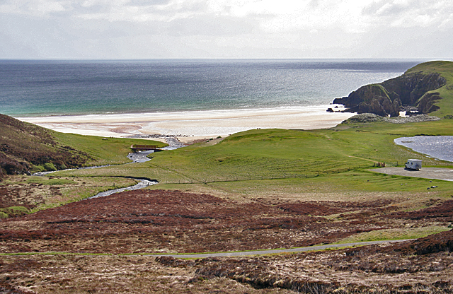
Caistealan is a small island located in Ross-shire, Scotland. Situated in the Inner Hebrides, it is surrounded by the picturesque waters of the North Atlantic Ocean. The island is known for its stunning natural beauty and rich history.

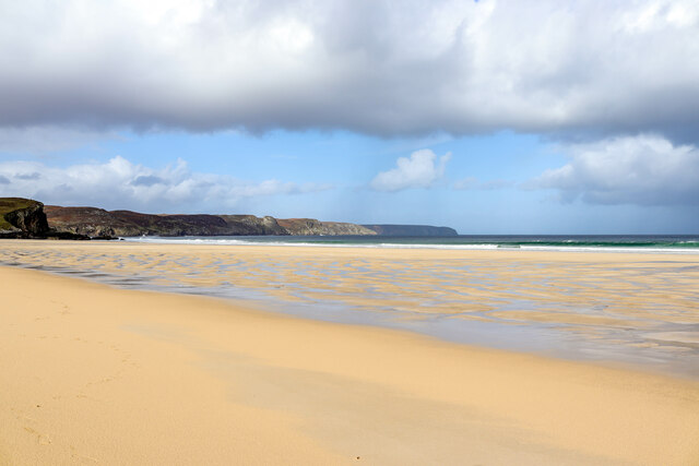
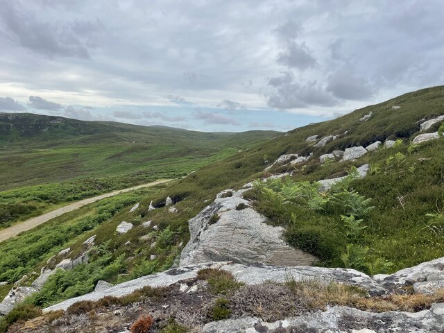
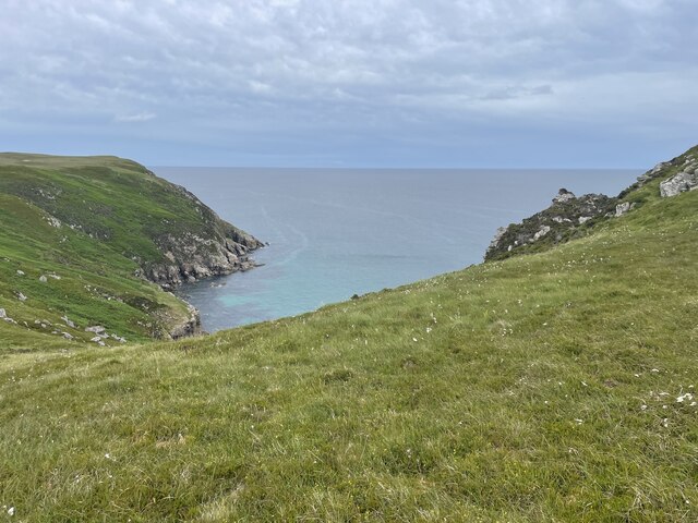
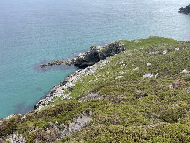
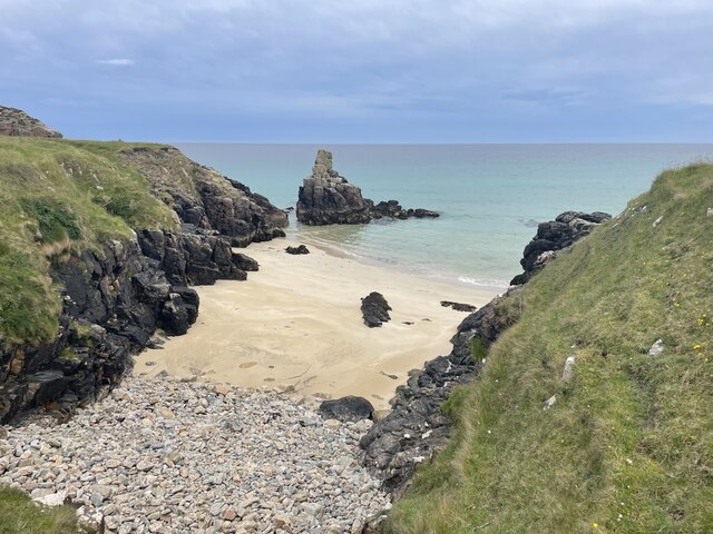
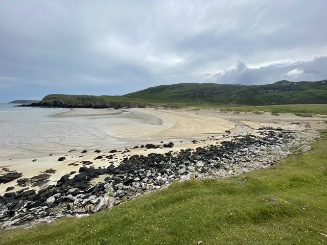
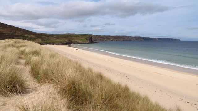
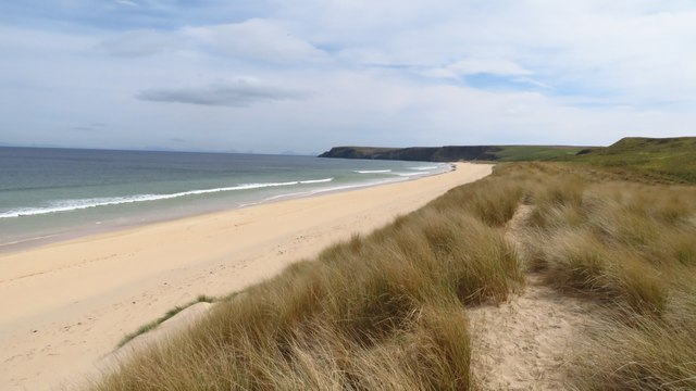
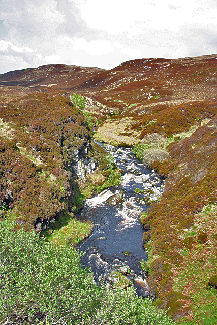
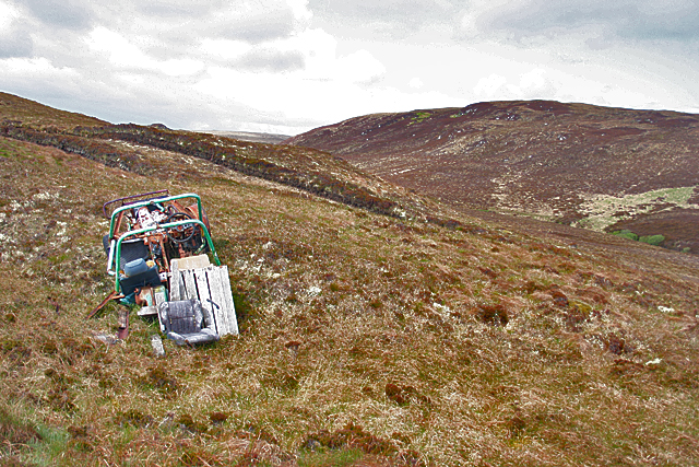
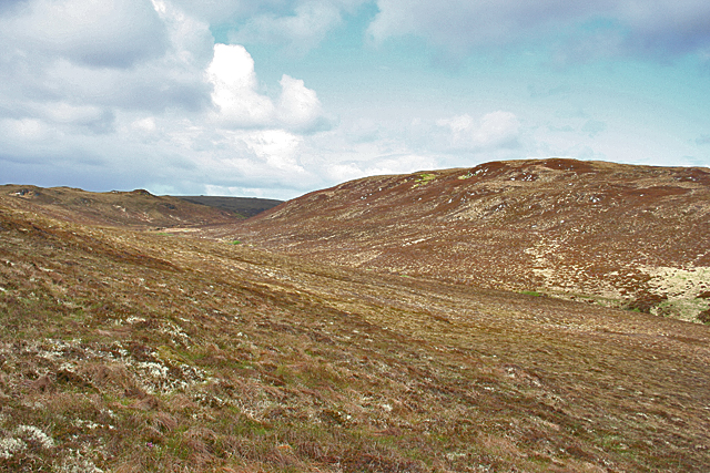
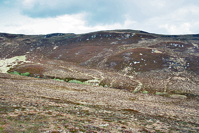
Measuring approximately 1 square mile, Caistealan is home to a small population of around 50 residents. The island’s landscape is characterized by rolling hills, rocky cliffs, and beautiful sandy beaches. The lush greenery is dotted with wildflowers, adding to its charm.

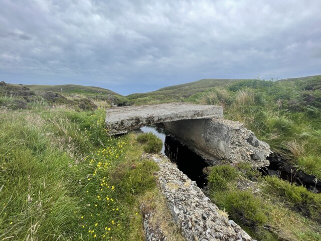
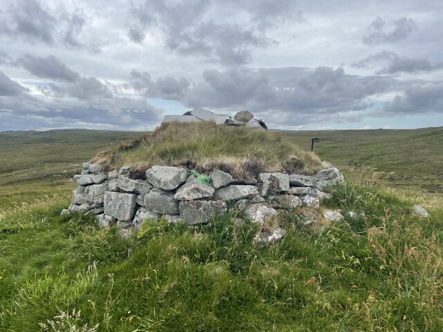
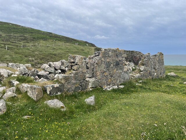
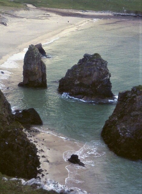
Caistealan is known for its ancient castle ruins, which date back to the 14th century. These ruins stand atop a hill and provide breathtaking views of the island and its surroundings. The castle was once a stronghold for local clans, serving as a strategic defense point. Today, visitors can explore the remains of the castle and learn about its historical significance.

The island offers various recreational activities for outdoor enthusiasts. Hiking trails crisscross the landscape, allowing visitors to appreciate the island’s natural wonders. The surrounding waters are ideal for fishing, sailing, and wildlife spotting. Caistealan is home to a diverse range of bird species, making it a haven for birdwatchers.

Caistealan is accessible by ferry from the mainland, with regular services connecting it to nearby towns. The island has limited amenities, including a small grocery store and a charming local pub. Visitors seeking a tranquil escape or a glimpse into Scotland's past will find Caistealan to be a captivating destination.

If you have any feedback on the listing, please let us know in the comments section below.

Caistealan Images

Images are sourced within 2km of 58.366362/-6.2141747 or Grid Reference NB5349. Thanks to Geograph Open Source API. All images are credited.

Traigh Mhòr Beach Traigh Mhòr Beach, Isle of Lewis, looking north towards cliffs round to Garry Beach
Traigh Mhòr Beach
Traigh Mhòr Beach, Isle of Lewis, looking north towards cliffs round to Garry Beach
Lewis Coastal path
Lewis Coastal path
The real bridge to nowhere Geocaching is a type of global treasure hunt of people looking for caches, or hidden stashes of objects. Geocaching may also be described as a series of hide-and-seek games, where hiders provide online clues for seekers. Seekers use global positioning system (GPS) devices to find hidden caches
The real bridge to nowhere
Geocaching is a type of global treasure hunt of people looking for caches, or hidden stashes of objects. Geocaching may also be described as a series of hide-and-seek games, where hiders provide online clues for seekers. Seekers use global positioning system (GPS) devices to find hidden caches
A secret bothy Geocaching is a type of global treasure hunt of people looking for caches, or hidden stashes of objects. Geocaching may also be described as a series of hide-and-seek games, where hiders provide online clues for seekers. Seekers use global positioning system (GPS) devices to find hidden caches
A secret bothy
Geocaching is a type of global treasure hunt of people looking for caches, or hidden stashes of objects. Geocaching may also be described as a series of hide-and-seek games, where hiders provide online clues for seekers. Seekers use global positioning system (GPS) devices to find hidden caches
The coast of Lewis
The coast of Lewis
Lewis coastline
Lewis coastline
Old building on Lewis
A private beach
A private beach
Sea stacks on Tràigh Ghearadha
Waves at Traigh Mhòr beach, Isle of Lewis The waves at Traigh Mhòr beach, Isle of Lewis seen breaking as they reach the shore of the Western Isles
Waves at Traigh Mhòr beach, Isle of Lewis
The waves at Traigh Mhòr beach, Isle of Lewis seen breaking as they reach the shore of the Western Isles
Tràigh Ghearadha beach
Traigh Mhor, North Tolsta - northern end of beach
Traigh Mhor, North Tolsta - view towards southern end of beach
Abhainn Ghearadha (Garry River) Abhainn Ghearadha drains a gentle boggy glen on to Tràigh Ghearadha (Garry Beach). This is the view of the river from Lord Leverhulme's <a href="https://www.geograph.org.uk/photo/2423596">NB5350 : A Bridge to Nowhere</a>.
Abhainn Ghearadha (Garry River)
Abhainn Ghearadha drains a gentle boggy glen on to Tràigh Ghearadha (Garry Beach). This is the view of the river from Lord Leverhulme's NB5350 : A Bridge to Nowhere.
Abandoned Vehicle This looks like the remains of one of those little 4wd things with roll-over bars. Presumably it expired or got irrevocably stuck in the bog here on Cnocan Ruairidh, and, not being visible from the public road, has escaped the attention of the council's collectors of rusting metal.
Abandoned Vehicle
This looks like the remains of one of those little 4wd things with roll-over bars. Presumably it expired or got irrevocably stuck in the bog here on Cnocan Ruairidh, and, not being visible from the public road, has escaped the attention of the council's collectors of rusting metal.
Nameless Glen The map doesn't name this rather featureless glen, though it does manage to name the river that drains it as Abhainn Ghearadha (River Garry).
Nameless Glen
The map doesn't name this rather featureless glen, though it does manage to name the river that drains it as Abhainn Ghearadha (River Garry).
Bella Chnoc Looking across the glen of the Abhiann Ghearadha from Cnocan Ruairidh. The slope on the far side of the glen is named as Bella Chnoc on the 1:25,000 map. This is a very odd-looking name because Gaelic, at least according to my dictionary, has no words beginning 'b' then 'e' then a consonant.
Bella Chnoc
Looking across the glen of the Abhiann Ghearadha from Cnocan Ruairidh. The slope on the far side of the glen is named as Bella Chnoc on the 1:25,000 map. This is a very odd-looking name because Gaelic, at least according to my dictionary, has no words beginning 'b' then 'e' then a consonant.
Tràigh Ghearadha (Garry Beach) This is one of the most beautiful of the beaches on the east coast of Lewis. The car park at lower right is the very end of the public road, and rather to my surprise the bus runs all the way to here. The grid line actually bisects the beach.
Tràigh Ghearadha (Garry Beach)
This is one of the most beautiful of the beaches on the east coast of Lewis. The car park at lower right is the very end of the public road, and rather to my surprise the bus runs all the way to here. The grid line actually bisects the beach.
Show me another place!

Caistealan is located at Grid Ref: NB5349 (Lat: 58.366362, Lng: -6.2141747)

Unitary Authority: Na h-Eileanan an Iar

Police Authority: Highlands and Islands

What 3 Words

///unit.fewer.drift. Near North Tolsta, Na h-Eileanan Siar

Related Wikis

New Tolsta

New Tolsta (Scottish Gaelic: Baile Ùr Tholastaidh) is a village on the Isle of Lewis in the Outer Hebrides, Scotland. New Tolsta is within the parish of...

North Tolsta

North Tolsta (Scottish Gaelic: Tolastadh bho Thuath) is a village in the Scottish Outer Hebrides, on the east side of the Isle of Lewis. North Tolsta is...

Gress

Gress (Scottish Gaelic: Griais), a hamlet on the Isle of Lewis in Scotland, is adjacent to the larger village of Back. Gress is within the parish of Stornoway...

Nearby Amenities

Located within 500m of 58.366362,-6.2141747
Passing Place
Lat/Long: 58.3630762/-6.2134595
Passing Place
Lat/Long: 58.3621147/-6.2161277
Barrier: kissing_gate
Source: survey
Lat/Long: 58.3678981/-6.2210151
Passing Place
Lat/Long: 58.3650279/-6.2132554
The data included in this document is from www.openstreetmap.org. The data is made available under ODbL.

Have you been to Caistealan?

Leave your review of Caistealan below (or comments, questions and feedback).