Sgeir Dhubh

Island in Inverness-shire

Scotland

Sgeir Dhubh

A87 near Sconser
A87 near Sconser Credit: Steven Brown

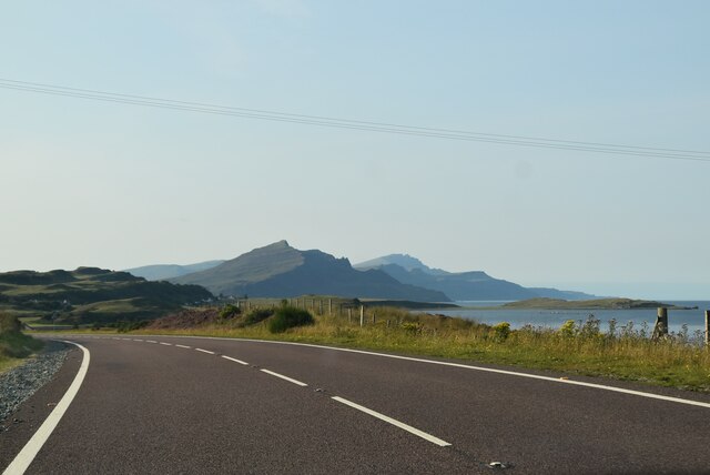
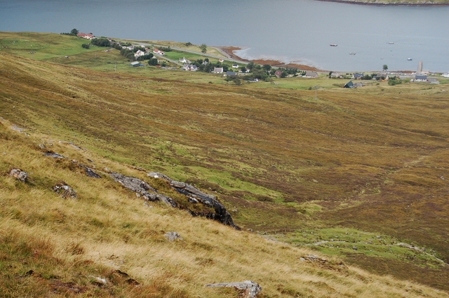
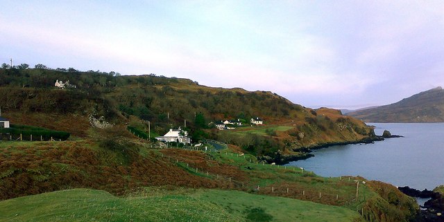
Sgeir Dhubh is a small, uninhabited island located off the coast of Inverness-shire in Scotland. The island is known for its rugged and rocky terrain, with steep cliffs and a small lighthouse perched on its highest point. Sgeir Dhubh is surrounded by the clear waters of the North Sea, making it a popular spot for birdwatching and wildlife observation.

The island is home to a variety of seabirds, including puffins, guillemots, and razorbills, as well as seals and dolphins that can often be seen swimming in the waters around the island. The waters surrounding Sgeir Dhubh are also popular with divers, who come to explore the underwater caves and rock formations that lie beneath the surface.

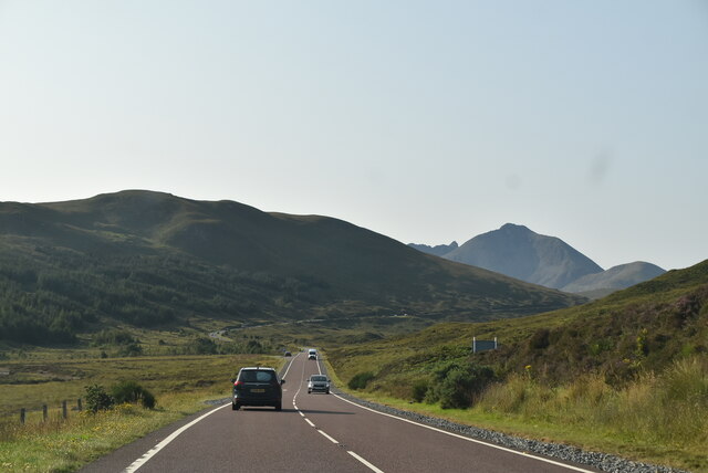
Access to Sgeir Dhubh is limited, with no scheduled boat services to the island. However, it can be reached by private boat or kayak, making it a peaceful and remote destination for those looking to escape the hustle and bustle of everyday life. Overall, Sgeir Dhubh offers a unique opportunity to experience the natural beauty and wildlife of the Scottish coast in a tranquil and unspoiled setting.

If you have any feedback on the listing, please let us know in the comments section below.

Sgeir Dhubh Images

Images are sourced within 2km of 57.318437/-6.1086511 or Grid Reference NG5232. Thanks to Geograph Open Source API. All images are credited.

A87 near Sconser
A87 near Sconser
A87 at Sconser
A87 at Sconser
New building at Torr Dubh
A87 south of Sconser The A87 runs 99 miles from Invergarry to Uig on the Isle of Skye <a href="https://www.geograph.org.uk/photo/7374675">NG3863 : End of the A87, Uig</a>.
<span class="nowrap"><a title="https://www.sabre-roads.org.uk/wiki/index.php?title=A87" rel="nofollow ugc noopener" href="https://www.sabre-roads.org.uk/wiki/index.php?title=A87">Link</a><img style="margin-left:2px;" alt="External link" title="External link - shift click to open in new window" src="https://s1.geograph.org.uk/img/external.png" width="10" height="10"/></span>
A87 south of Sconser
The A87 runs 99 miles from Invergarry to Uig on the Isle of Skye NG3863 : End of the A87, Uig. LinkExternal link
Entering Sconser, A87 The A87 runs 99 miles from Invergarry to Uig on the Isle of Skye <a href="https://www.geograph.org.uk/photo/7374675">NG3863 : End of the A87, Uig</a>.
<span class="nowrap"><a title="https://www.sabre-roads.org.uk/wiki/index.php?title=A87" rel="nofollow ugc noopener" href="https://www.sabre-roads.org.uk/wiki/index.php?title=A87">Link</a><img style="margin-left:2px;" alt="External link" title="External link - shift click to open in new window" src="https://s1.geograph.org.uk/img/external.png" width="10" height="10"/></span>
Entering Sconser, A87
The A87 runs 99 miles from Invergarry to Uig on the Isle of Skye NG3863 : End of the A87, Uig. LinkExternal link
A87, Sconser The A87 runs 99 miles from Invergarry to Uig on the Isle of Skye <a href="https://www.geograph.org.uk/photo/7374675">NG3863 : End of the A87, Uig</a>.
<span class="nowrap"><a title="https://www.sabre-roads.org.uk/wiki/index.php?title=A87" rel="nofollow ugc noopener" href="https://www.sabre-roads.org.uk/wiki/index.php?title=A87">Link</a><img style="margin-left:2px;" alt="External link" title="External link - shift click to open in new window" src="https://s1.geograph.org.uk/img/external.png" width="10" height="10"/></span>
A87, Sconser
The A87 runs 99 miles from Invergarry to Uig on the Isle of Skye NG3863 : End of the A87, Uig. LinkExternal link
A87 The A87 runs 99 miles from Invergarry to Uig on the Isle of Skye <a href="https://www.geograph.org.uk/photo/7374675">NG3863 : End of the A87, Uig</a>.
<span class="nowrap"><a title="https://www.sabre-roads.org.uk/wiki/index.php?title=A87" rel="nofollow ugc noopener" href="https://www.sabre-roads.org.uk/wiki/index.php?title=A87">Link</a><img style="margin-left:2px;" alt="External link" title="External link - shift click to open in new window" src="https://s1.geograph.org.uk/img/external.png" width="10" height="10"/></span>
A87
The A87 runs 99 miles from Invergarry to Uig on the Isle of Skye NG3863 : End of the A87, Uig. LinkExternal link
A87 to Kyle The A87 runs 99 miles from Invergarry to Uig on the Isle of Skye <a href="https://www.geograph.org.uk/photo/7374675">NG3863 : End of the A87, Uig</a>.
<span class="nowrap"><a title="https://www.sabre-roads.org.uk/wiki/index.php?title=A87" rel="nofollow ugc noopener" href="https://www.sabre-roads.org.uk/wiki/index.php?title=A87">Link</a><img style="margin-left:2px;" alt="External link" title="External link - shift click to open in new window" src="https://s1.geograph.org.uk/img/external.png" width="10" height="10"/></span>
A87 to Kyle
The A87 runs 99 miles from Invergarry to Uig on the Isle of Skye NG3863 : End of the A87, Uig. LinkExternal link
Sconser Pier and Ferry
A87, southbound The A87 runs 99 miles from Invergarry to Uig on the Isle of Skye <a href="https://www.geograph.org.uk/photo/7374675">NG3863 : End of the A87, Uig</a>.
<span class="nowrap"><a title="https://www.sabre-roads.org.uk/wiki/index.php?title=A87" rel="nofollow ugc noopener" href="https://www.sabre-roads.org.uk/wiki/index.php?title=A87">Link</a><img style="margin-left:2px;" alt="External link" title="External link - shift click to open in new window" src="https://s1.geograph.org.uk/img/external.png" width="10" height="10"/></span>
A87, southbound
The A87 runs 99 miles from Invergarry to Uig on the Isle of Skye NG3863 : End of the A87, Uig. LinkExternal link
Pier, slipway and ferry at Sconser The ferry waiting to travel to Raasay as it was on the morning of 23 August 1995 when to make the crossing to the island with three people in the car, we paid £16.50. There was room for three cars, a coal lorry and very little more. Little has changed in the view since that time: the current ferry is larger and so of course will be the cost involved!
The location at the far shore of Loch Sligachan is not of course the island of Raasay but ground which rises to Ben Lee.
Pier, slipway and ferry at Sconser
The ferry waiting to travel to Raasay as it was on the morning of 23 August 1995 when to make the crossing to the island with three people in the car, we paid £16.50. There was room for three cars, a coal lorry and very little more. Little has changed in the view since that time: the current ferry is larger and so of course will be the cost involved! The location at the far shore of Loch Sligachan is not of course the island of Raasay but ground which rises to Ben Lee.
Washing aggregate at Sconser Quarry Gravel, quarried at crushed at Sconser, is being washed by the red plant and dropped into piles by the two conveyers. The mechanical shovel on the left is both filling the hopper with fresh aggregate and, in this picture, removing the washed gravel ready for it to be mixed with bitumen to make asphalt.
With luck, some of it will be used to fill the winter potholes on Skye's roads.
Washing aggregate at Sconser Quarry
Gravel, quarried at crushed at Sconser, is being washed by the red plant and dropped into piles by the two conveyers. The mechanical shovel on the left is both filling the hopper with fresh aggregate and, in this picture, removing the washed gravel ready for it to be mixed with bitumen to make asphalt. With luck, some of it will be used to fill the winter potholes on Skye's roads.
Sconser Ferry Terminal Viewed from on board the MV Hallaig, just before departure for Raasay.  The hill in the background is Glamaig.
Sconser Ferry Terminal
Viewed from on board the MV Hallaig, just before departure for Raasay. The hill in the background is Glamaig.
Loch Sligachan from Sconser Looking west across the loch to the slopes of An Leitir under Ben Lee.
Loch Sligachan from Sconser
Looking west across the loch to the slopes of An Leitir under Ben Lee.
Loch Sligachan and Corran Ghlas The north shore of the loch, with steep wooded valleys on the slopes above.
Loch Sligachan and Corran Ghlas
The north shore of the loch, with steep wooded valleys on the slopes above.
Sconser Ferry Terminal Ramp access to the waiting room. The ferry serves the Isle of Raasay, visible in the distance.
Sconser Ferry Terminal
Ramp access to the waiting room. The ferry serves the Isle of Raasay, visible in the distance.
Moorings at Sconser Looking over Loch Sligachan from the Sconser/Raasay ferry terminal to the eastern end of Ben Lee.
Moorings at Sconser
Looking over Loch Sligachan from the Sconser/Raasay ferry terminal to the eastern end of Ben Lee.
Sconser Ferry Terminal plaque Marking its official opening in 2013.
Sconser Ferry Terminal plaque
Marking its official opening in 2013.
Show me another place!

Sgeir Dhubh is located at Grid Ref: NG5232 (Lat: 57.318437, Lng: -6.1086511)

Unitary Authority: Highland

Police Authority: Highlands and Islands

What 3 Words

///shifters.stow.fend. Near Portree, Highland

Nearby Locations

Sgeir Dhubh

Related Wikis

Sconser

Sconser (Scottish Gaelic: Sgonnsair) is a small crofting township on the island of Skye, in Scotland, situated on the south shore of Loch Sligachan. The...

Peinachorran

Peinchorran (Scottish Gaelic: Peighinn a' Chorrain; Peinachorrain on Ordnance Survey maps) is a remote settlement, lying at the end of the B883 road, on...

Gedintailor

Gedintailor (Scottish Gaelic: Gead an t-Sailleir) is a crofting village, lying on the shores of the Narrows of Raasay on the east coast of the island of...

Glamaig

Glamaig (Scottish Gaelic: Glàmaig) is the northernmost of the Red Hills on the Isle of Skye in Scotland. It lies immediately east of Sligachan. It is one...

Related Videos

Discover Glamaig the Red Hills Ep-9 A Scenic Ride and camp Through The Isle Of Skye! S03-EP24

Discover Glamaig the Red Hills Ep-9 A Scenic Ride and camp Through The Isle Of Skye! S03-EP24 In this episode we are riding ...

Red Cuillins On Visit To Isle Of Skye Inner Hebrides Scotland

Tour Scotland travel video, with Scottish music, of Red Cuillins, on visit to Isle of Skye, Inner Hebrides. The Red Cuillin are mainly ...

Four Go On A Ferry | Sconser Isle of Skye - Raasay | Caledonian MacBrayne

ROUTE: Sconser (Isle of Skye) - Raasay OPERATOR: Caledonian MacBrayne COST: £22.40 (two adults and car return) It's ...

Cute Scottish Cows 🐮 🏴󠁧󠁢󠁳󠁣󠁴󠁿 #travel #trending #viral

Cute Scottish Cows 󠁧󠁢󠁳󠁣󠁴󠁿 are often associated with specific breeds like Highland cattle, known for their long horns ...

Nearby Amenities

Located within 500m of 57.318437,-6.1086511
Source: PGS
Lat/Long: 57.3195225/-6.1121582
Passing Place
Lat/Long: 57.3215804/-6.1112984
Bus Stop
Road End
Local Ref: AT
Naptan AtcoCode: 6700713041
Naptan Bearing: N
Naptan CommonName: Road End
Naptan Indicator: at
Naptan Landmark: Turning Circle
Naptan NaptanCode: 45328473
Naptan Street: B883
Naptan Verified: no
Source: naptan_import
Lat/Long: 57.3203819/-6.1130882
Seamark Light Character: Q
Seamark Light Colour: red
Seamark Light Height: 8
Seamark Light Range: 3
Seamark Light Reference: A 3912.5
Seamark Type: light_minor
Source: US NGA Pub. 114. 2011-05-26.
Lat/Long: 57.3143/-6.11135
Location Transition: yes
Power: pole
Lat/Long: 57.3146414/-6.1051154
Location Transition: yes
Power: pole
Lat/Long: 57.3189185/-6.1055473
Power: pole
Lat/Long: 57.319547/-6.1060408
Power: pole
Lat/Long: 57.3201191/-6.1067274
Power: pole
Lat/Long: 57.3207911/-6.1074945
Power: pole
Lat/Long: 57.3214572/-6.1082241
Power: pole
Lat/Long: 57.322581/-6.1094552
Access: yes
Access Cattle: no
Barrier: cattle_grid
Lat/Long: 57.3226727/-6.1105742
Power: pole
Lat/Long: 57.3225793/-6.1110678
Power: pole
Lat/Long: 57.3218736/-6.1113677
Power: pole
Lat/Long: 57.3214539/-6.1118946
Power: pole
Lat/Long: 57.3210547/-6.1123691
Power: pole
Lat/Long: 57.3209218/-6.1111158
Power: pole
Lat/Long: 57.3208134/-6.1101828
Power: pole
Lat/Long: 57.3206664/-6.1089062
Power: pole
Lat/Long: 57.3205171/-6.1076689
Power: pole
Lat/Long: 57.3198942/-6.10669
Tourism: picnic_site
Lat/Long: 57.3202386/-6.1130494
Turning Circle
Lat/Long: 57.3203476/-6.1129964
An Corran
Place: locality
Lat/Long: 57.3171023/-6.1027658
Rubh' an Tòrra Mhòir
Natural: cape
Lat/Long: 57.3187273/-6.105271
Sgeir Dhubh
Natural: rock
Lat/Long: 57.3183942/-6.1086345
Tòrr Beag
Ele: 34
Natural: hill
Lat/Long: 57.3211546/-6.1034095
Power: pole
Lat/Long: 57.3147688/-6.1048293
Destination W: Sligachan: 3.2m
Ele: 5
Hiking: yes
Information: guidepost
Tourism: information
Lat/Long: 57.3202216/-6.1132975
Destination SW: Sligachan: 3.2 miles
Hiking: yes
Information: guidepost
Operator: Scottish Rights of Way an Access Society
Tourism: information
Lat/Long: 57.3199838/-6.1132122
The data included in this document is from www.openstreetmap.org. The data is made available under ODbL.

Have you been to Sgeir Dhubh?

Leave your review of Sgeir Dhubh below (or comments, questions and feedback).