Lutton
Settlement in Lincolnshire South Holland
England
Lutton

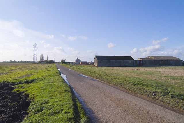
Lutton is a small village located in the South Holland district of Lincolnshire, England. Situated approximately 7 miles east of Spalding, Lutton is surrounded by open farmland, offering residents a peaceful and rural setting. The village is easily accessible via the A17 road, which runs nearby.
Lutton has a long history, with evidence of human habitation dating back to Roman times. Today, it is a close-knit community with a population of around 500 people. The village is known for its picturesque countryside, charming cottages, and traditional architecture, which reflects its rural heritage.
The village features a few amenities, including a primary school, village hall, and a pub. The primary school, Lutton St Nicholas Church of England Primary School, provides education for children aged 4 to 11. The village hall serves as a hub for community activities, hosting events and gatherings throughout the year. The pub, The Jolly Crispin, offers a friendly atmosphere and serves as a meeting place for locals.
Lutton is also surrounded by natural beauty, with ample opportunities for outdoor activities. The nearby Fens and Washes, an internationally important wetland area, provide scenic walks and bird-watching opportunities. The village is also within close proximity to the Lincolnshire Wolds, an Area of Outstanding Natural Beauty, which offers stunning landscapes and scenic trails for hiking and cycling enthusiasts.
Overall, Lutton is a charming and peaceful village that offers a tranquil rural lifestyle along with easy access to larger towns and natural beauty spots.
If you have any feedback on the listing, please let us know in the comments section below.
Lutton Images
Images are sourced within 2km of 52.808761/0.12609139 or Grid Reference TF4325. Thanks to Geograph Open Source API. All images are credited.


Lutton is located at Grid Ref: TF4325 (Lat: 52.808761, Lng: 0.12609139)
Division: Parts of Holland
Administrative County: Lincolnshire
District: South Holland
Police Authority: Lincolnshire
What 3 Words
///waddled.tiredness.cavalier. Near Fleet, Lincolnshire
Nearby Locations
Related Wikis

Lutton, Lincolnshire
Lutton (sometimes Lutton-Bourne) is a village and civil parish in the South Holland district of Lincolnshire, England. The population of the civil parish...

University Academy Long Sutton
University Academy Long Sutton (formerly The Peele Community College) is a co-educational secondary school located in Long Sutton in the English county...

Gedney Dyke
Gedney Dyke is a village in the civil parish of Gedney and the South Holland district of Lincolnshire, England. It is 40 miles (64 km) south-east from...
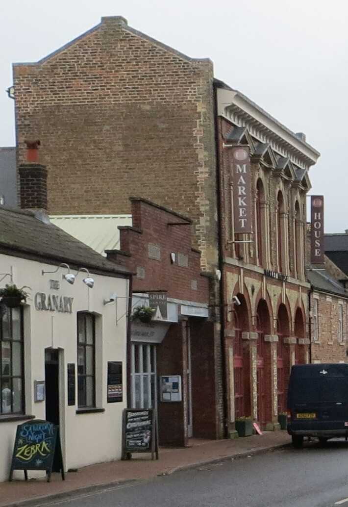
Long Sutton Market House
Long Sutton Market House, also known as Long Sutton Market House and Corn Exchange, is a commercial building in Market Street in Long Sutton, Lincolnshire...
Nearby Amenities
Located within 500m of 52.808761,0.12609139Have you been to Lutton?
Leave your review of Lutton below (or comments, questions and feedback).