An Carraigean
Island in Argyllshire
Scotland
An Carraigean

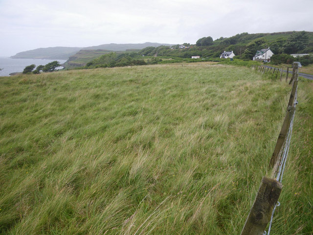
An Carraigean is a small island located in Argyllshire, Scotland. It is situated in the Inner Hebrides, specifically in the Firth of Lorn. The island covers an area of approximately 1.5 square kilometers and is known for its rugged and picturesque landscape.
The island is mostly uninhabited, with only a few scattered cottages and a lighthouse. It is a popular destination for tourists and nature enthusiasts due to its untouched beauty and tranquility. The island is surrounded by crystal clear waters and offers stunning views of the surrounding islands and the mainland.
An Carraigean is home to a variety of wildlife, including seabirds, seals, and occasionally otters. The island's rocky coastline provides a perfect habitat for these creatures, making it a haven for wildlife lovers and birdwatchers.
The island is accessible by boat, with regular ferry services operating between the mainland and the nearby town of Oban. Visitors can explore the island on foot, taking in the breathtaking views and enjoying the peaceful atmosphere. The rugged terrain offers opportunities for hiking and exploring, with several walking trails crisscrossing the island.
An Carraigean is a place of natural beauty and tranquility, offering visitors a chance to escape the hustle and bustle of everyday life. Whether it's admiring the stunning views, observing wildlife, or simply enjoying a peaceful walk along the coastline, this island is a hidden gem in the Scottish countryside.
If you have any feedback on the listing, please let us know in the comments section below.
An Carraigean Images
Images are sourced within 2km of 56.516534/-6.2049163 or Grid Reference NM4143. Thanks to Geograph Open Source API. All images are credited.


An Carraigean is located at Grid Ref: NM4143 (Lat: 56.516534, Lng: -6.2049163)
Unitary Authority: Argyll and Bute
Police Authority: Argyll and West Dunbartonshire
What 3 Words
///bounty.resources.thrilled. Near Dervaig, Argyll & Bute
Nearby Locations
Related Wikis

Achleck
Achleck is a small settlement in the north-west of the Isle of Mull in Argyll and Bute, Scotland. == References ==
Torloisk House
Torloisk House (sometimes referred to as Torluck House in 19th century references) on the Isle of Mull, Argyll in Scotland was the family seat held by...

Loch Tuath
Loch Tuath (Scottish Gaelic: Loch-a-Tuath) is a sea loch in the Inner Hebrides, Scotland that separates the Isle of Mull and the island of Ulva. Loch Tuath...

Ulva
Ulva (; Scottish Gaelic: Ulbha) is a small island in the Inner Hebrides of Scotland, off the west coast of Mull. It is separated from Mull by a narrow...

Ulva Ferry
Ulva Ferry (Scottish Gaelic: Caolas Ulbha) is a hamlet on the Hebridean island of Mull, on its west coast. Ulva Ferry is on the shore of Ulva Sound (Caolas...
Gometra
Gometra (Scottish Gaelic: Gòmastra) is an island in the Inner Hebrides of Scotland, lying west of Mull. It lies immediately west of Ulva, to which it is...
Eas Fors
Eas Fors is a waterfall on the island of Mull in Scotland. It is situated on the Ardow Burn south of Dervaig. There is another Eas Fors on the Allt an...

Dervaig
Dervaig (Scottish Gaelic: Dearbhaig) is a small village on the Isle of Mull off the west coast of Scotland. The village is within the parish of Kilninian...
Have you been to An Carraigean?
Leave your review of An Carraigean below (or comments, questions and feedback).