Am Fiasganach

Island in Argyllshire

Scotland

Am Fiasganach

Eilean Chormaic, Port Uisken
Eilean Chormaic, Port Uisken Credit: Steven Brown

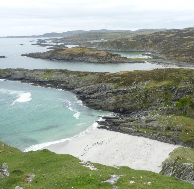
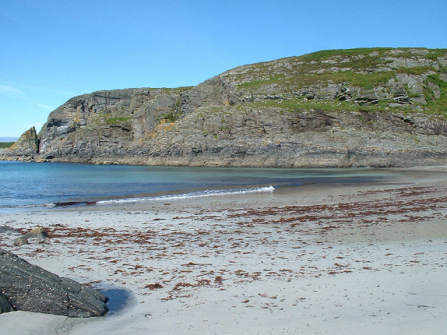
Am Fiasganach is a small island located in Argyllshire, Scotland. Situated off the western coast of the mainland, it is part of the Inner Hebrides archipelago. With a total area of approximately 2 square kilometers, the island boasts a rugged and picturesque landscape that is characteristic of the region.

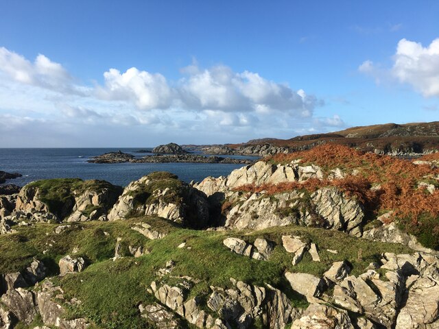
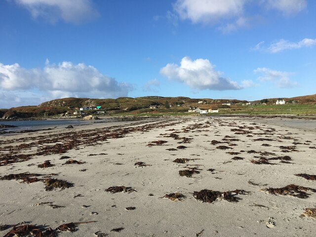
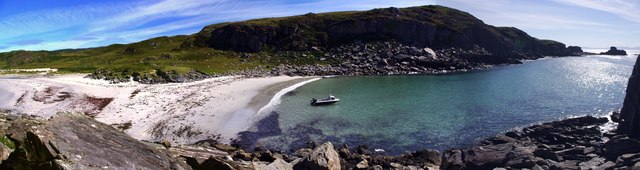
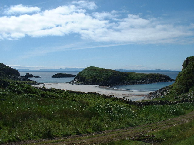
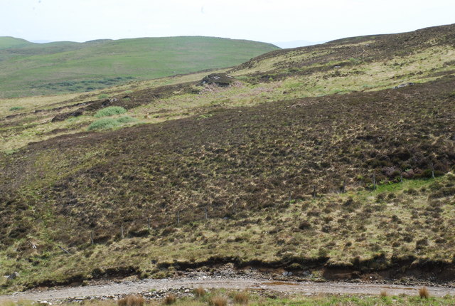
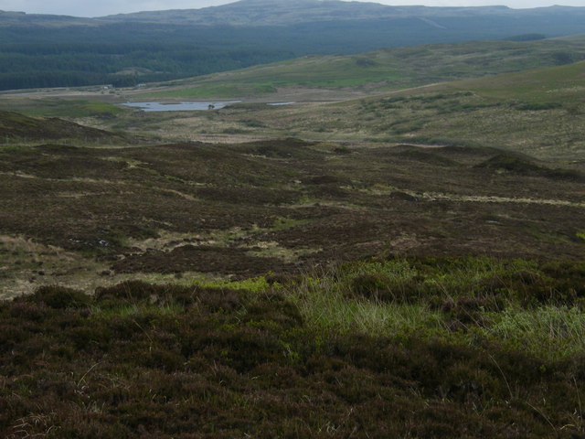
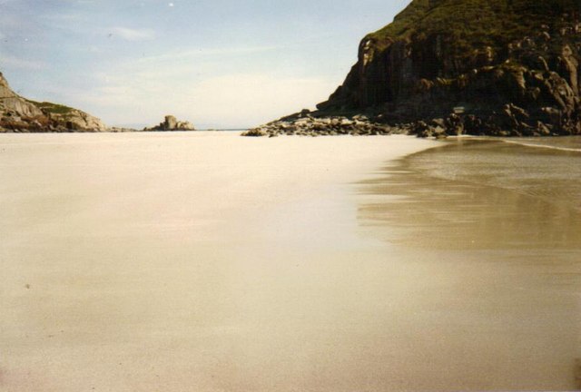
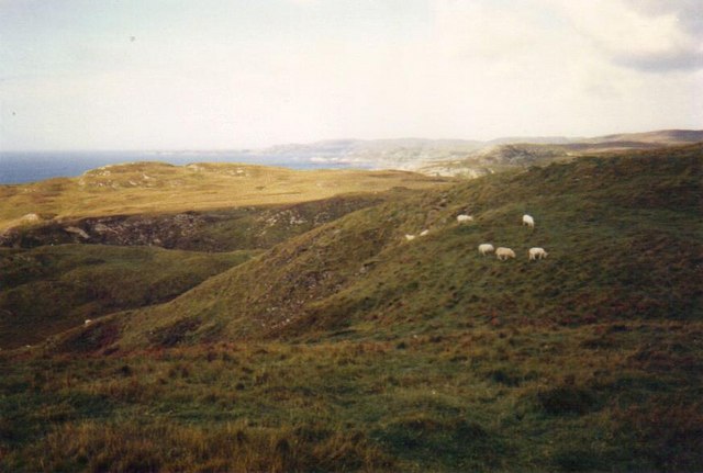
The terrain of Am Fiasganach is predominantly hilly, with rocky cliffs and a few small beaches dotting its coastline. The island is covered in lush green vegetation, including heather, grasses, and shrubs, which provide a habitat for various species of birds and wildlife. The surrounding waters are teeming with marine life, making it a popular spot for fishing and diving enthusiasts.

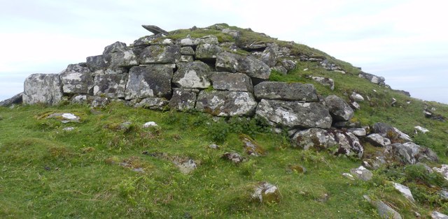
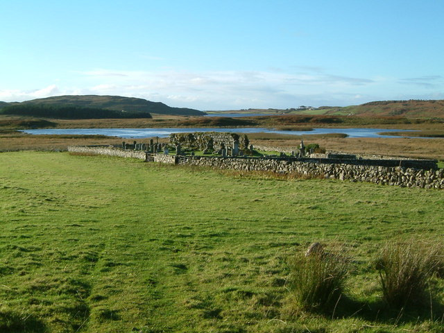
Am Fiasganach has a rich history, with evidence of human settlement dating back thousands of years. Ancient ruins and standing stones can be found scattered across the island, offering a glimpse into its past. Today, the island is uninhabited, with no permanent residents. However, it attracts visitors who seek tranquility and solitude amidst its unspoiled natural beauty.

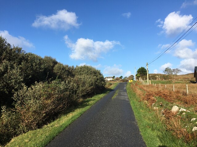
Access to Am Fiasganach is primarily by boat, with regular ferry services operating from nearby ports. The island offers limited amenities, so visitors are advised to come prepared with supplies. Walking and hiking are popular activities, with several trails providing breathtaking views of the surrounding islands and the Atlantic Ocean.

In summary, Am Fiasganach is a remote and idyllic island in Argyllshire, Scotland. Its rugged terrain, rich history, and unspoiled natural beauty make it a haven for nature enthusiasts and those seeking a peaceful retreat.

If you have any feedback on the listing, please let us know in the comments section below.

Am Fiasganach Images

Images are sourced within 2km of 56.286928/-6.2012854 or Grid Reference NM4018. Thanks to Geograph Open Source API. All images are credited.

Eilean Chormaic, Port Uisken
Beach at Uisken
Beach at Uisken
Near the road end at Uisken
Dun a' Gheird, Mull The name is probably a corruption of Dun nan Geard (Fort of the Guard). It is a well-preserved galleried dun with spectacular views west across the south coast of the Ross of Mull and south to Colonsay, Islay and Jura. At the time of our visit, however, we could only imagine such views!

For more information, visit <span class="nowrap"><a title="http://www.scotlandsplaces.gov.uk/record/rcahms/21974/dun-gheird-mull/rcahms" rel="nofollow ugc noopener" href="http://www.scotlandsplaces.gov.uk/record/rcahms/21974/dun-gheird-mull/rcahms">Link</a><img style="margin-left:2px;" alt="External link" title="External link - shift click to open in new window" src="https://s1.geograph.org.uk/img/external.png" width="10" height="10"/></span>
Dun a' Gheird, Mull
The name is probably a corruption of Dun nan Geard (Fort of the Guard). It is a well-preserved galleried dun with spectacular views west across the south coast of the Ross of Mull and south to Colonsay, Islay and Jura. At the time of our visit, however, we could only imagine such views! For more information, visit LinkExternal link
View south-west from Dun a' Gheird, Mull The south coast of the Ross of Mull is dotted with rocky islets and many attractive beaches, like this one.
View south-west from Dun a' Gheird, Mull
The south coast of the Ross of Mull is dotted with rocky islets and many attractive beaches, like this one.
Looking east from Garbh Eilean One of many beautiful and undisturbed beaches on the Ross of Mull
Looking east from Garbh Eilean
One of many beautiful and undisturbed beaches on the Ross of Mull
Loch Assapol from Scoor House The sunset from behind Scoor House, looking NW across the fields to Loch Assapol with the Treshnish Islands beyond.
Loch Assapol from Scoor House
The sunset from behind Scoor House, looking NW across the fields to Loch Assapol with the Treshnish Islands beyond.
Garbh Eilean and  Kilvickeon Beach, Mull Garbh Eilean is a tidal island on a beautiful beach. The grid line runs right down the middle of Garbh Eilean, so the left-hand side as seen here is actually in <a href="https://www.geograph.org.uk/gridref/NM4118">NM4118</a>. The islands of Jura and Islay are visible on the horizon.
Garbh Eilean and Kilvickeon Beach, Mull
Garbh Eilean is a tidal island on a beautiful beach. The grid line runs right down the middle of Garbh Eilean, so the left-hand side as seen here is actually in NM4118. The islands of Jura and Islay are visible on the horizon.
Kilvickeon Beach, Isle of Mull This is the beach in the North-East corner of the square - the photo is taken from NM409186 looking West. For a panoramic view of this beach, see adjoining grid square <a href="https://www.geograph.org.uk/gridref/NM4118">NM4118</a>.
Kilvickeon Beach, Isle of Mull
This is the beach in the North-East corner of the square - the photo is taken from NM409186 looking West. For a panoramic view of this beach, see adjoining grid square NM4118.
Old church on shore of Loch Assapol, Mull
Cnoc Mòr, L.Assapol, Mull Heather moorland in the foreground, but bracken and grass on Cnoc Mòr in the distance.
Cnoc Mòr, L.Assapol, Mull
Heather moorland in the foreground, but bracken and grass on Cnoc Mòr in the distance.
View over hillside towards Loch Assapol
Garbh Eilean and Kilvickeon Beach, Mull at low tide Near to Scoor, on the south side of Mull, lies Garbh Eilean, an island only when the tide comes in.  Here it can be seen on the right of the picture.  The areas of sand on both sides form a kind of double-beach when the tide is out.
Garbh Eilean and Kilvickeon Beach, Mull at low tide
Near to Scoor, on the south side of Mull, lies Garbh Eilean, an island only when the tide comes in. Here it can be seen on the right of the picture. The areas of sand on both sides form a kind of double-beach when the tide is out.
High tide at Kilvickeon Beach, Isle of Mull View from Kilvickeon Beach, with Garbh Eilean on the right of the picture.
High tide at Kilvickeon Beach, Isle of Mull
View from Kilvickeon Beach, with Garbh Eilean on the right of the picture.
Sheep near Kilvickeon Beach, Isle of Mull Near to Scoor, on the Ross of Mull.  Sheep graze near to Kilvickeon Beach.  The island in the centre of the photo is Garbh Eilean, which becomes part of the mainland again once the tide goes out.
Sheep near Kilvickeon Beach, Isle of Mull
Near to Scoor, on the Ross of Mull. Sheep graze near to Kilvickeon Beach. The island in the centre of the photo is Garbh Eilean, which becomes part of the mainland again once the tide goes out.
Garbh Eilean, Isle of Mull On Garbh Eilean, looking towards mainland Mull (the island is an island only when the tide is in, as it is in this photo).  Fishermen have wedged their fishing rods in cracks in the rocks.
Garbh Eilean, Isle of Mull
On Garbh Eilean, looking towards mainland Mull (the island is an island only when the tide is in, as it is in this photo). Fishermen have wedged their fishing rods in cracks in the rocks.
Rough grazing near Scoor, Isle of Mull Sheep on the hills to the south-east of Scoor House, Isle of Mull.
Rough grazing near Scoor, Isle of Mull
Sheep on the hills to the south-east of Scoor House, Isle of Mull.
Kilvickeon Beach from Garbh Eilean, Isle of Mull View from Garbh Eilean towards Kilvickeon Beach, near Scoor, Isle of Mull.
Kilvickeon Beach from Garbh Eilean, Isle of Mull
View from Garbh Eilean towards Kilvickeon Beach, near Scoor, Isle of Mull.
Show me another place!

Am Fiasganach is located at Grid Ref: NM4018 (Lat: 56.286928, Lng: -6.2012854)

Unitary Authority: Argyll and Bute

Police Authority: Argyll and West Dunbartonshire

What 3 Words

///jaws.today.prefect. Near Fionnphort, Argyll & Bute

Related Wikis

Uisken

Uisken (Scottish Gaelic: Uisgean, meaning "water-bay") is a settlement on a sandy bay on the Ross of Mull in the south of the Isle of Mull, on the west...

Ardalanish

Ardalanish (Scottish Gaelic: Àird Dealanais) is a village on the Isle of Mull in Argyll and Bute, Scotland. It is now an organic farm and weaving mill...

Knocknafenaig

Knocknafenaig (Scottish Gaelic: Cnoc na Fennaig) is a ruined township on the Isle of Mull, Scotland. Located in the south-western portion of the island...

Shiaba

Shiaba (Scottish Gaelic: Siaba) is a ruined township located on the southwestern peninsula of the Isle of Mull, Scotland. It lies about 8 km to the east...

Bunessan

Bunessan (Scottish Gaelic: Bun Easain) is a small village on the Ross of Mull in the south-west of the Isle of Mull, off the west coast of Scotland. The...

Suidhe

Suidhe (Scottish Gaelic: Suidhe) is a ruined township located on the southwestern peninsula of the Isle of Mull, Scotland. It lies just over 1 km to the...

Ardtun

Ardtun (Scottish Gaelic: Àird Tunna) is a settlement on the Isle of Mull, in Argyll and Bute, Scotland. Ardtun is within the parish of Kilfinichen and...

Knockan

Knockan (Scottish Gaelic: An Cnocan) is a township of six crofts in the community of Ardtun, in the south of the Isle of Mull off the west coast of Scotland...

Nearby Amenities

Located within 500m of 56.286928,-6.2012854
Created By: dmgroom_coastlines
Source: PGS
Lat/Long: 56.2881/-6.19361
Source: PGS
Lat/Long: 56.28817/-6.1946266
Source: PGS
Lat/Long: 56.2885338/-6.1943262
Created By: dmgroom_coastlines
Source: PGS
Lat/Long: 56.28876/-6.19449
Source: PGS
Lat/Long: 56.289483/-6.1954452
Source: PGS
Lat/Long: 56.2895425/-6.1957253
Created By: dmgroom_coastlines
Source: PGS
Lat/Long: 56.28969/-6.1958
Source: PGS
Lat/Long: 56.29062/-6.19665
Created By: dmgroom_coastlines
Source: PGS
Lat/Long: 56.28998/-6.19739
Created By: dmgroom_coastlines
Source: PGS
Lat/Long: 56.28973/-6.19741
Created By: dmgroom_coastlines
Source: PGS
Lat/Long: 56.28922/-6.19745
Source: PGS
Lat/Long: 56.2890145/-6.1976262
Created By: dmgroom_coastlines
Source: PGS
Lat/Long: 56.28885/-6.19816
Source: PGS
Lat/Long: 56.288652/-6.1989942
Created By: dmgroom_coastlines
Source: PGS
Lat/Long: 56.28912/-6.19906
Source: PGS
Lat/Long: 56.2892094/-6.1990681
Source: PGS
Lat/Long: 56.2896746/-6.1989603
Source: PGS
Lat/Long: 56.2904577/-6.1985536
Source: PGS
Lat/Long: 56.2909844/-6.1983256
Source: PGS
Lat/Long: 56.2910288/-6.1998415
Source: PGS
Lat/Long: 56.29056/-6.20011
Source: PGS
Lat/Long: 56.2901978/-6.2001835
Source: PGS
Lat/Long: 56.2898883/-6.2005532
Source: PGS
Lat/Long: 56.2893753/-6.2011694
Created By: dmgroom_coastlines
Source: PGS
Lat/Long: 56.28905/-6.2016
Source: PGS
Lat/Long: 56.2887394/-6.2021234
Source: PGS
Lat/Long: 56.2884893/-6.2024881
Source: PGS
Lat/Long: 56.2884238/-6.2025525
Source: PGS
Lat/Long: 56.288406/-6.2027027
Source: PGS
Lat/Long: 56.2883881/-6.2028636
Source: PGS
Lat/Long: 56.288394/-6.203046
Created By: dmgroom_coastlines
Source: PGS
Lat/Long: 56.28858/-6.20302
Created By: dmgroom_coastlines
Source: PGS
Lat/Long: 56.28909/-6.20298
Source: PGS
Lat/Long: 56.2892727/-6.2027562
Source: PGS
Lat/Long: 56.289825/-6.2023341
Source: PGS
Lat/Long: 56.2906321/-6.2016554
Source: PGS
Lat/Long: 56.2907381/-6.2041457
Created By: dmgroom_coastlines
Source: PGS
Lat/Long: 56.2904/-6.20427
Source: PGS
Lat/Long: 56.2896985/-6.2045
Source: PGS
Lat/Long: 56.288848/-6.2050354
Source: PGS
Lat/Long: 56.2886851/-6.2059199
Created By: dmgroom_coastlines
Source: PGS
Lat/Long: 56.28839/-6.20626
Source: PGS
Lat/Long: 56.2883223/-6.2062745
Source: PGS
Lat/Long: 56.2882974/-6.2072673
Source: PGS
Lat/Long: 56.2889985/-6.206813
Created By: dmgroom_coastlines
Source: PGS
Lat/Long: 56.28942/-6.20641
Source: PGS
Lat/Long: 56.2897747/-6.2061705
Source: PGS
Lat/Long: 56.2899783/-6.2065657
Source: PGS
Lat/Long: 56.2900657/-6.2068242
Source: PGS
Lat/Long: 56.2897224/-6.2074055
Source: PGS
Lat/Long: 56.2894617/-6.2079564
Source: PGS
Lat/Long: 56.2891633/-6.2081172
Source: PGS
Lat/Long: 56.2888538/-6.2084592
Source: PGS
Lat/Long: 56.29084/-6.20124
Source: PGS
Lat/Long: 56.2913067/-6.2023165
Source: PGS
Lat/Long: 56.2912084/-6.2036435
The data included in this document is from www.openstreetmap.org. The data is made available under ODbL.

Have you been to Am Fiasganach?

Leave your review of Am Fiasganach below (or comments, questions and feedback).