Stac an Tuill

Island in Inverness-shire

Scotland

Stac an Tuill

Dunan Thearna Sgurr A very distinctive lump on the clifftops between Loch Brittle and Loch Eynort.
Dunan Thearna Sgurr Credit: John Allan

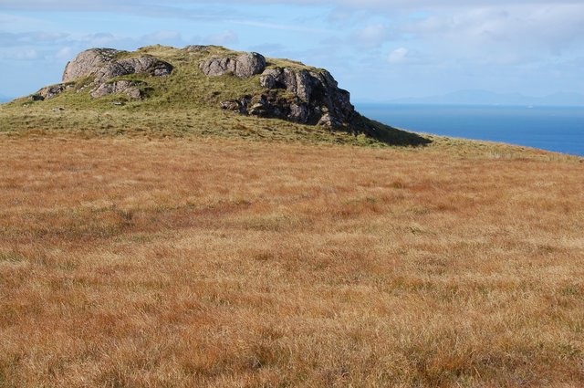
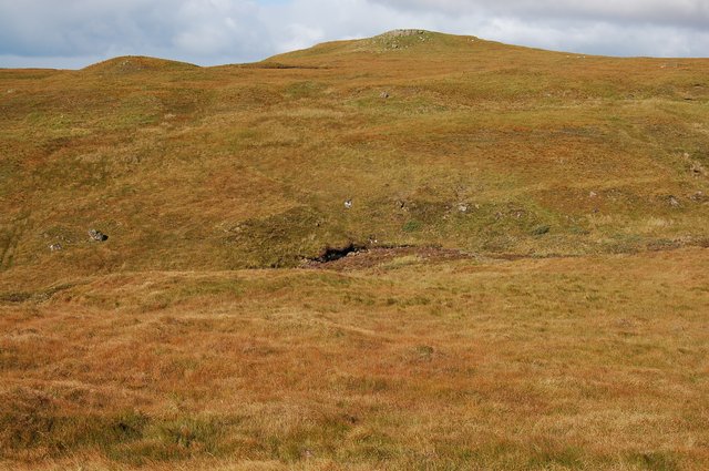
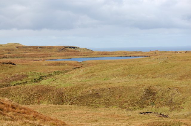
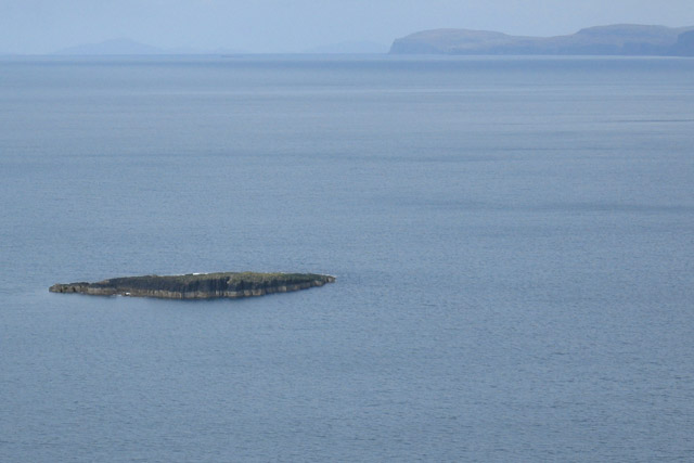
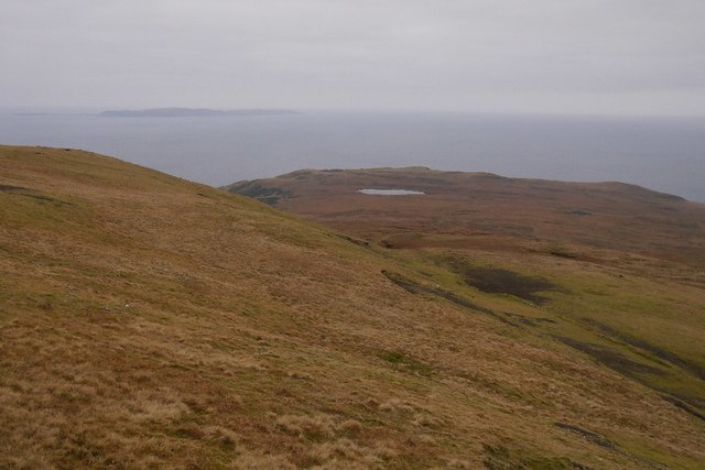
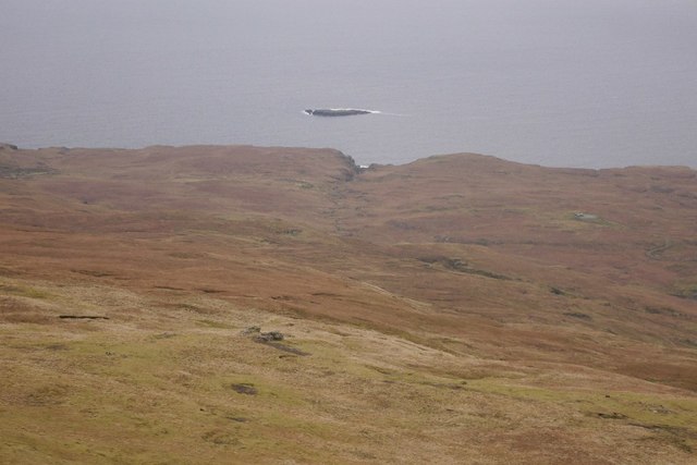
Stac an Tuill is a small island located in the Inverness-shire region of Scotland. Situated off the west coast in the Inner Hebrides, it is part of the Inner Hebrides archipelago. The island covers an area of approximately 0.6 hectares and has a maximum height of 41 meters.

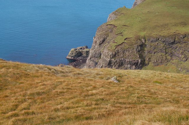
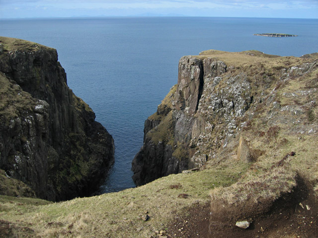
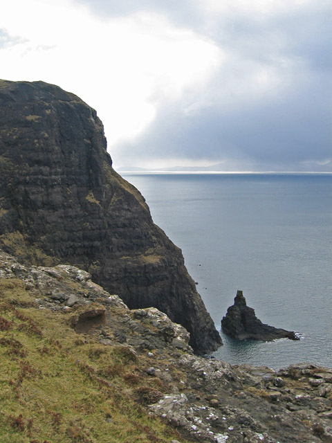
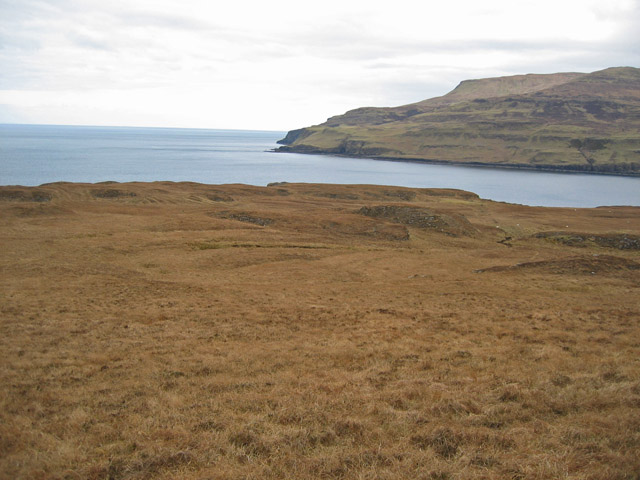
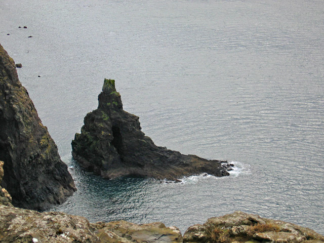
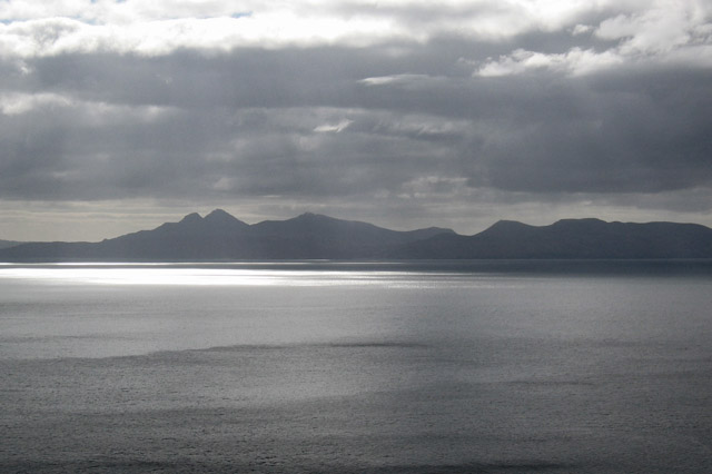
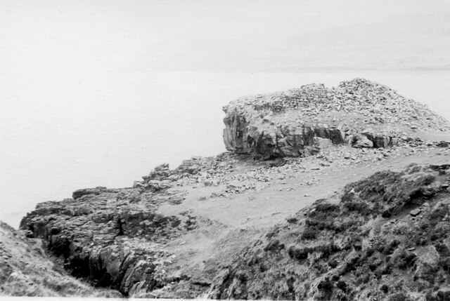
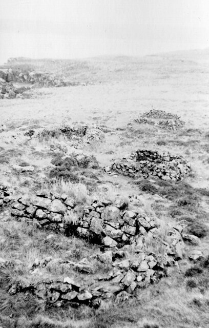
Stac an Tuill is known for its rugged and rocky terrain, with steep cliffs that provide breathtaking views of the surrounding sea and nearby islands. The island is uninhabited and lacks any significant vegetation, making it a haven for seabirds. It is home to a large colony of Atlantic puffins, as well as various other bird species such as guillemots and razorbills.

Access to Stac an Tuill can be challenging due to its remote location and the rough waters surrounding it. However, it is occasionally visited by birdwatchers and wildlife enthusiasts who appreciate the unique ecosystem and the opportunity to observe the diverse birdlife.

The island's isolation and natural beauty make it a popular destination for boat trips and bird-watching tours. Visitors are advised to take precautions and be mindful of the treacherous conditions when approaching the island.

Overall, Stac an Tuill is a picturesque and wildlife-rich island that offers a glimpse into the untouched and rugged beauty of the Inner Hebrides.

If you have any feedback on the listing, please let us know in the comments section below.

Stac an Tuill Images

Images are sourced within 2km of 57.207832/-6.3808292 or Grid Reference NG3521. Thanks to Geograph Open Source API. All images are credited.

Dunan Thearna Sgurr A very distinctive lump on the clifftops between Loch Brittle and Loch Eynort.
Dunan Thearna Sgurr
A very distinctive lump on the clifftops between Loch Brittle and Loch Eynort.
Valley of the Allt Mor Not many humans venture here. It is 4km from the nearest road, track, path or habitation - and the going is heavy.
Valley of the Allt Mor
Not many humans venture here. It is 4km from the nearest road, track, path or habitation - and the going is heavy.
Loch an Leth-uillt An attractive lochan in a remote spot. Seen here from out of square, across the valley of the Allt Mor.
Loch an Leth-uillt
An attractive lochan in a remote spot. Seen here from out of square, across the valley of the Allt Mor.
Mouth of the Geodh of the Allt Mor The Geodh is a big obstacle to walking the cliff-tops between Loch Brittle and Loch Eynort. It requires a lengthy diversion inland to get round the head of it.
Mouth of the Geodh of the Allt Mor
The Geodh is a big obstacle to walking the cliff-tops between Loch Brittle and Loch Eynort. It requires a lengthy diversion inland to get round the head of it.
Tributary of the Allt Mor This unnamed tributary joins the Allt Mor over a big waterfall into its Geodh. Up here on the open moorland, its small gorge provides the walker some welcome shelter from the wind.
Tributary of the Allt Mor
This unnamed tributary joins the Allt Mor over a big waterfall into its Geodh. Up here on the open moorland, its small gorge provides the walker some welcome shelter from the wind.
Geodha nan Gobhar A substantial geodh on the coast south of Loch Eynort. The cliff edges on this stretch of coast are convex and crumbly. Not a place to get too close to the edge.
Geodha nan Gobhar
A substantial geodh on the coast south of Loch Eynort. The cliff edges on this stretch of coast are convex and crumbly. Not a place to get too close to the edge.
Stac an Tuill The stack is so named because of its resemblance to a church belltower. It is holed through the middle in the manner of a high-arched window. The start of the hole can be seen in this view but it is not possible to see right through from a clifftop viewpoint - and there is no way down.
The cliff edges on this stretch of coast are convex and crumbly. Not a place to get too close to the edge.
Stac an Tuill
The stack is so named because of its resemblance to a church belltower. It is holed through the middle in the manner of a high-arched window. The start of the hole can be seen in this view but it is not possible to see right through from a clifftop viewpoint - and there is no way down. The cliff edges on this stretch of coast are convex and crumbly. Not a place to get too close to the edge.
Laimhrig na Moine Peaty moorland south of the mouth of Loch Eynort. Most of the land in the square can be seen in this view.
Laimhrig na Moine
Peaty moorland south of the mouth of Loch Eynort. Most of the land in the square can be seen in this view.
Radio station on Cnoc an Teine Presumably once a hill with a fire beacon, it now has the remains of a radio station on its summit. The two container-like boxes in the rear appear to be generators and the small wooden hut holds an empty computer cabinet with BT labels on it. I guess it is a redundant telephone relay that connected Skye and the Western Isles.
Radio station on Cnoc an Teine
Presumably once a hill with a fire beacon, it now has the remains of a radio station on its summit. The two container-like boxes in the rear appear to be generators and the small wooden hut holds an empty computer cabinet with BT labels on it. I guess it is a redundant telephone relay that connected Skye and the Western Isles.
Cairn by the Allt Sgeiteadh What appears to be a chambered burial cairn by the burn south of Cnoc an Teine. It is not marked on the OS maps.
Cairn by the Allt Sgeiteadh
What appears to be a chambered burial cairn by the burn south of Cnoc an Teine. It is not marked on the OS maps.
An Dubh-sgeir The sgeir is the only dry land in the square. This view is from the cliff top north of Geodha nan Gobhar.
An Dubh-sgeir
The sgeir is the only dry land in the square. This view is from the cliff top north of Geodha nan Gobhar.
Stac an Tuill The stack is so named because of its resemblance to a church belltower. It is holed through the middle in the manner of a high-arched window. The start of the hole can be seen in this view but it is not possible to see right through from the top of the cliffs - and there is no way down.
The cliff edges on this stretch of coast are convex and crumbly. Not a place to get too close to the edge.
Stac an Tuill
The stack is so named because of its resemblance to a church belltower. It is holed through the middle in the manner of a high-arched window. The start of the hole can be seen in this view but it is not possible to see right through from the top of the cliffs - and there is no way down. The cliff edges on this stretch of coast are convex and crumbly. Not a place to get too close to the edge.
Rum from Sgurr an Duine The view to Rum from the cliff top of Sgurr an Duine. A heavy, blustery, but thankfully brief hail shower had just passed over us on this otherwise sunny day. The picture shows the shower heading away across the sea to Rum, creating some interesting patterns of light and shade as it travels.
Rum from Sgurr an Duine
The view to Rum from the cliff top of Sgurr an Duine. A heavy, blustery, but thankfully brief hail shower had just passed over us on this otherwise sunny day. The picture shows the shower heading away across the sea to Rum, creating some interesting patterns of light and shade as it travels.
Loch an Leth-uillt A small lochan perched above a big drop to the sea. View from the summit of An Cruachan.
Loch an Leth-uillt
A small lochan perched above a big drop to the sea. View from the summit of An Cruachan.
An Dubh-sgeir A skerry of Loch Eynort, seen from the summit of An Cruachan.
An Dubh-sgeir
A skerry of Loch Eynort, seen from the summit of An Cruachan.
Dun on Loch Eynort, Skye The ruins of a stone structure on a rocky headland at the mouth of the sea loch. More details can be found at the Canmore website <span class="nowrap"><a title="https://canmore.org.uk/site/11042/skye-kraiknish" rel="nofollow ugc noopener" href="https://canmore.org.uk/site/11042/skye-kraiknish">Link</a><img style="margin-left:2px;" alt="External link" title="External link - shift click to open in new window" src="https://s1.geograph.org.uk/img/external.png" width="10" height="10"/></span> and the Megalithic Portal <span class="nowrap"><a title="https://www.megalithic.co.uk/article.php?sid=27605" rel="nofollow ugc noopener" href="https://www.megalithic.co.uk/article.php?sid=27605">Link</a><img style="margin-left:2px;" alt="External link" title="External link - shift click to open in new window" src="https://s1.geograph.org.uk/img/external.png" width="10" height="10"/></span>.
Dun on Loch Eynort, Skye
The ruins of a stone structure on a rocky headland at the mouth of the sea loch. More details can be found at the Canmore website LinkExternal link and the Megalithic Portal LinkExternal link.
Stone hut remains, Loch Eynort Skye I assume that these walls are the ones marked on the 1:25,000 map NE of the dun, but the positioning is approximate. 

See also the Canmore website <span class="nowrap"><a title="https://canmore.org.uk/site/11042/skye-kraiknish" rel="nofollow ugc noopener" href="https://canmore.org.uk/site/11042/skye-kraiknish">Link</a><img style="margin-left:2px;" alt="External link" title="External link - shift click to open in new window" src="https://s1.geograph.org.uk/img/external.png" width="10" height="10"/></span> and the Megalithic Portal <span class="nowrap"><a title="https://www.megalithic.co.uk/article.php?sid=27605" rel="nofollow ugc noopener" href="https://www.megalithic.co.uk/article.php?sid=27605">Link</a><img style="margin-left:2px;" alt="External link" title="External link - shift click to open in new window" src="https://s1.geograph.org.uk/img/external.png" width="10" height="10"/></span>.
Stone hut remains, Loch Eynort Skye
I assume that these walls are the ones marked on the 1:25,000 map NE of the dun, but the positioning is approximate. See also the Canmore website LinkExternal link and the Megalithic Portal LinkExternal link.
Sgurr nam Boc from Dunan Thearna Sgurr The 712ft top of Sgurr nam Boc from across the deep incision of the Allt Mor. The cliffs of Duirinish, as far as Neist Point, appear in the distance. The cream dots are sheep!
Sgurr nam Boc from Dunan Thearna Sgurr
The 712ft top of Sgurr nam Boc from across the deep incision of the Allt Mor. The cliffs of Duirinish, as far as Neist Point, appear in the distance. The cream dots are sheep!
Show me another place!

Stac an Tuill is located at Grid Ref: NG3521 (Lat: 57.207832, Lng: -6.3808292)

Unitary Authority: Highland

Police Authority: Highlands and Islands

What 3 Words

///sprint.recliner.jetliner. Near Carbost, Highland

Related Wikis

Bualintur

Bualintur (Scottish Gaelic: Buaile an Todhair) is a remote township, which lies at the head of Loch Brittle on the island of Skye in the Highlands of...

Glen Brittle

Glen Brittle (Gleann Breadail in Scottish Gaelic) is a large glen in the south of the Isle of Skye, in Scotland. It runs roughly south to north, along...

Loch Brittle

Loch Brittle is a sea loch on the southwest coast of Skye in Scotland. A sandy beach separates Glen Brittle from Loch Brittle. The land to the sides of...

Eas Mòr, Glen Brittle

Eas Mòr is a waterfall in Glen Brittle on the island of Skye in Scotland. It lies on the Allt Coire na Bannachdich in a small gorge east of Glenbrittle...

Nearby Amenities

Located within 500m of 57.207832,-6.3808292
Created By: dmgroom_coastlines
Source: PGS
Lat/Long: 57.21208/-6.38321
Source: PGS
Lat/Long: 57.211438/-6.3832528
Source: PGS
Lat/Long: 57.2107335/-6.3827248
Created By: dmgroom_coastlines
Source: PGS
Lat/Long: 57.21065/-6.38213
Created By: dmgroom_coastlines
Source: PGS
Lat/Long: 57.21052/-6.3819
Source: PGS
Lat/Long: 57.2105253/-6.3815191
Created By: dmgroom_coastlines
Source: PGS
Lat/Long: 57.21036/-6.38073
Source: PGS
Lat/Long: 57.2102534/-6.3801427
Source: PGS
Lat/Long: 57.2102807/-6.3790633
Source: PGS
Lat/Long: 57.2096977/-6.3783258
Source: PGS
Lat/Long: 57.2093946/-6.3783098
Created By: dmgroom_coastlines
Source: PGS
Lat/Long: 57.20916/-6.37822
Created By: dmgroom_coastlines
Source: PGS
Lat/Long: 57.2089/-6.378
Source: PGS
Lat/Long: 57.2085924/-6.3783485
Created By: dmgroom_coastlines
Source: PGS
Lat/Long: 57.20854/-6.37945
Created By: dmgroom_coastlines
Source: PGS
Lat/Long: 57.20843/-6.37993
Created By: dmgroom_coastlines
Source: PGS
Lat/Long: 57.20791/-6.37996
Source: PGS
Lat/Long: 57.2078224/-6.3791387
Source: PGS
Lat/Long: 57.2078378/-6.3780257
Source: PGS
Lat/Long: 57.2076881/-6.3775447
Source: PGS
Lat/Long: 57.2074396/-6.3771234
Source: PGS
Lat/Long: 57.2069842/-6.3761746
Source: PGS
Lat/Long: 57.2065901/-6.3756093
Created By: dmgroom_coastlines
Source: PGS
Lat/Long: 57.20633/-6.37795
Created By: dmgroom_coastlines
Source: PGS
Lat/Long: 57.20608/-6.3782
Created By: dmgroom_coastlines
Source: PGS
Lat/Long: 57.20594/-6.37727
Created By: dmgroom_coastlines
Source: PGS
Lat/Long: 57.2058/-6.37704
Created By: dmgroom_coastlines
Source: PGS
Lat/Long: 57.20567/-6.37682
Created By: dmgroom_coastlines
Source: PGS
Lat/Long: 57.20552/-6.37588
Created By: dmgroom_coastlines
Source: PGS
Lat/Long: 57.20501/-6.37568
Created By: dmgroom_coastlines
Source: PGS
Lat/Long: 57.20449/-6.37549
The data included in this document is from www.openstreetmap.org. The data is made available under ODbL.

Have you been to Stac an Tuill?

Leave your review of Stac an Tuill below (or comments, questions and feedback).