Eilean an Tobair

Island in Argyllshire

Scotland

Eilean an Tobair

Rough croft land south of Struan, Isle of Coll
Rough croft land south of Struan, Isle of Coll Credit: Alpin Stewart

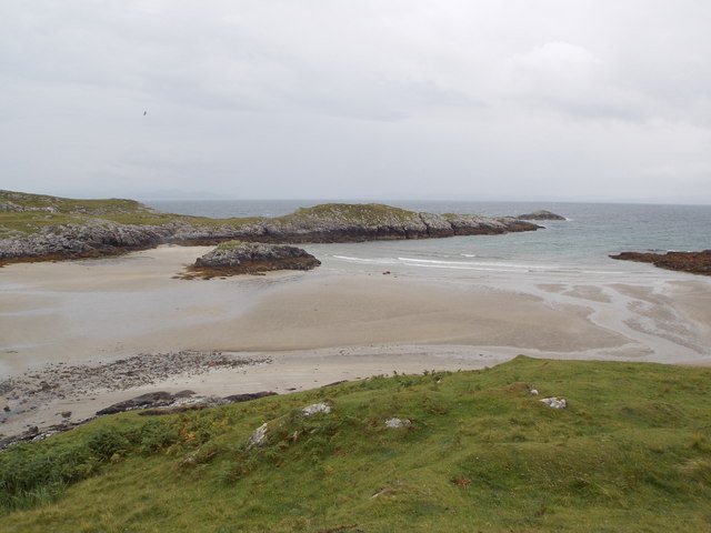
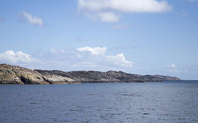
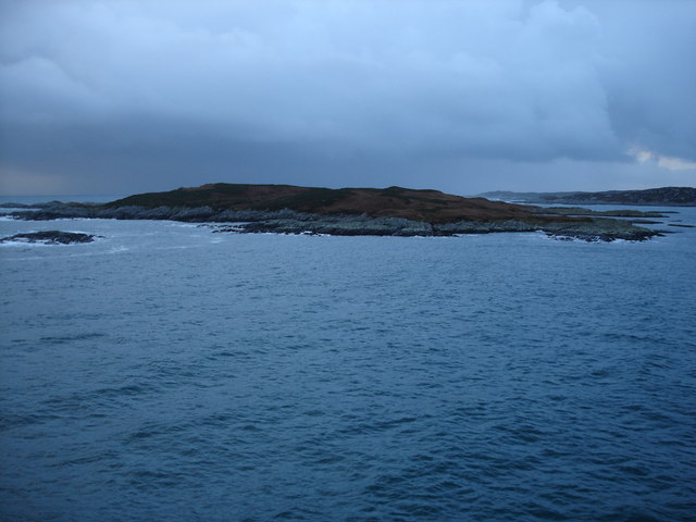
Eilean an Tobair, also known as the Well Island, is a small uninhabited island located off the west coast of Scotland in Argyllshire. Situated in the Firth of Lorn, just south of the Isle of Mull, it is part of the Inner Hebrides archipelago. The island covers an area of approximately 10 acres and features rugged cliffs on its western side.

Eilean an Tobair gets its name from a freshwater well that can be found on the island. The well is known for its clear and pure water, which was historically used by sailors and fishermen who frequented the area. The island itself is largely covered in grass and low-lying vegetation, providing a habitat for various bird species.

Due to its small size and lack of human habitation, Eilean an Tobair is primarily visited by nature enthusiasts and birdwatchers. The island is home to a range of bird species, including gulls, puffins, and guillemots. Its remote location and peaceful environment make it an ideal spot for bird nesting and breeding.

Access to Eilean an Tobair is possible by private boat or by hiring a local charter service. Visitors can explore the island on foot, taking in the breathtaking views of the surrounding sea and cliffs. It is important to note that there are no facilities or accommodations on the island, so visitors must bring their own supplies and take proper precautions to respect the fragile ecosystem.

If you have any feedback on the listing, please let us know in the comments section below.

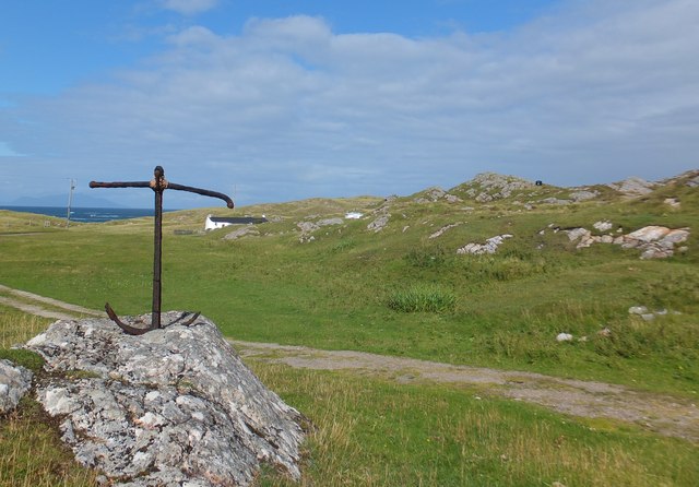
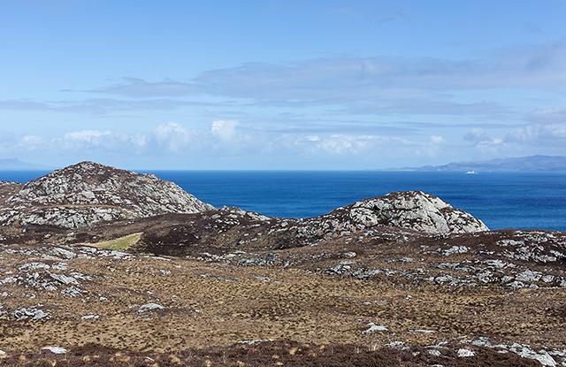
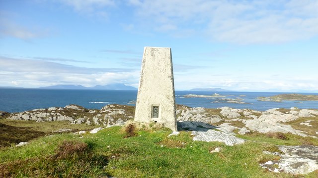
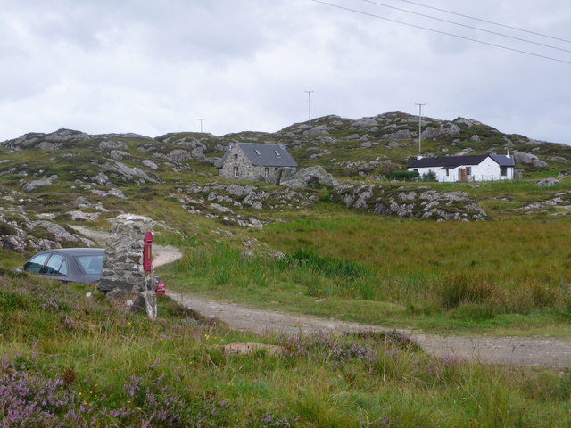
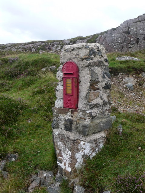
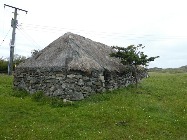
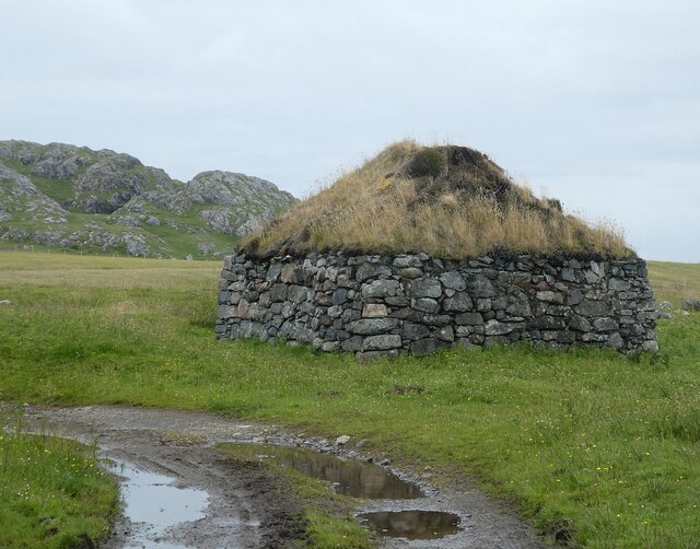
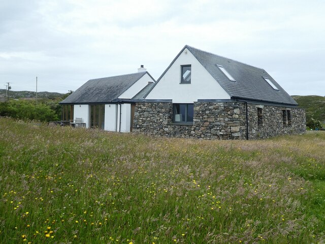
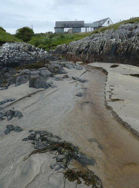
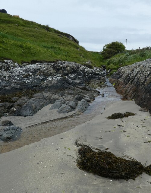
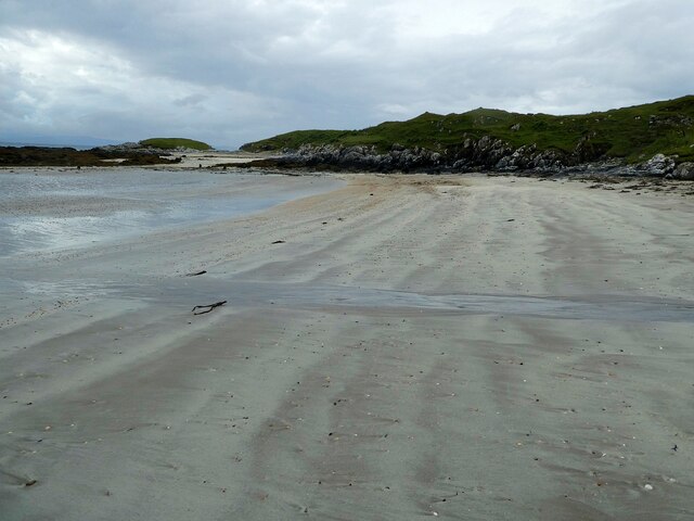
Eilean an Tobair Images

Images are sourced within 2km of 56.681197/-6.4545603 or Grid Reference NM2763. Thanks to Geograph Open Source API. All images are credited.

Rough croft land south of Struan, Isle of Coll
North east from Meall nan Uan Rugged terrain on Coll's north east coast, with the Isle of Mull visible in the distance.
North east from Meall nan Uan
Rugged terrain on Coll's north east coast, with the Isle of Mull visible in the distance.
Druim Nan Carn Trig A beautiful spot for a trig point on a sunny afternoon with Iain Brown and Martin Richardson.
Druim Nan Carn Trig
A beautiful spot for a trig point on a sunny afternoon with Iain Brown and Martin Richardson.
Isle of Coll: Bousd Two of the three properties on a little track off the B8072 at the north end of Coll.
Isle of Coll: Bousd
Two of the three properties on a little track off the B8072 at the north end of Coll.
Isle of Coll: postbox № PA78 104, Bousd This little George-V postbox is set into a brick pillar at <a href="https://www.geograph.org.uk/photo/4109935">NM2563 : Isle of Coll: Bousd</a> and serves the properties here along with the scattering of others in the surrounding area of northern Coll.

It has nonstandard collection times - see <a href="https://www.geograph.org.uk/photo/4109951">NM2563 : Isle of Coll: collection plate on the postbox at Bousd</a>.
Isle of Coll: postbox № PA78 104, Bousd
This little George-V postbox is set into a brick pillar at NM2563 : Isle of Coll: Bousd and serves the properties here along with the scattering of others in the surrounding area of northern Coll. It has nonstandard collection times - see NM2563 : Isle of Coll: collection plate on the postbox at Bousd.
Isle of Coll: collection plate on the postbox at Bousd A very old style of collection plate is still in use on this small, remote postbox (<a href="https://www.geograph.org.uk/photo/4109944">NM2563 : Isle of Coll: postbox № PA78 104, Bousd</a>).

The times are nonstandard - 8:15 on Monday and Wednesday and Saturday mornings, and 7:30 on Friday mornings. Presumably the ferry timetables for Tuesdays and Saturdays are such that no post collected would leave the island until the following day anyway.
Isle of Coll: collection plate on the postbox at Bousd
A very old style of collection plate is still in use on this small, remote postbox (NM2563 : Isle of Coll: postbox № PA78 104, Bousd). The times are nonstandard - 8:15 on Monday and Wednesday and Saturday mornings, and 7:30 on Friday mornings. Presumably the ferry timetables for Tuesdays and Saturdays are such that no post collected would leave the island until the following day anyway.
Isle of Coll: end of the B8072 at Sorisdale The road comes to an end at this turning area, although a footpath continues along the private driveway ahead to the bay.
Isle of Coll: end of the B8072 at Sorisdale
The road comes to an end at this turning area, although a footpath continues along the private driveway ahead to the bay.
Isle of Coll: old croft building at Sorisdale A derelict building among various houses old and new, just above the bay.
Isle of Coll: old croft building at Sorisdale
A derelict building among various houses old and new, just above the bay.
Isle of Coll: Sorisdale Bay A sandy bay at the northeast end of the island, which has a hamlet of a scattering of houses around it.
Isle of Coll: Sorisdale Bay
A sandy bay at the northeast end of the island, which has a hamlet of a scattering of houses around it.
Coastline of Coll The rugged northern coast of the island of Coll, viewed from a passing ferry.
Coastline of Coll
The rugged northern coast of the island of Coll, viewed from a passing ferry.
Coll - Sorisdale - Turning area The turning area at the end of the B8072 as it arrives at Sorisdale. If driving, you can't park in this area and have to find a reasonable place to abandon your vehicle which doesn't either block the lane or an access to the fields. Also, best to find somewhere where your wheels don't sink into the ground!
Coll - Sorisdale - Turning area
The turning area at the end of the B8072 as it arrives at Sorisdale. If driving, you can't park in this area and have to find a reasonable place to abandon your vehicle which doesn't either block the lane or an access to the fields. Also, best to find somewhere where your wheels don't sink into the ground!
Coll - Sorisdale - Abandoned croft and byre Two of the abandoned buildings at Sorisdale on the northern tip of Coll. I think that the nearer one was probably a croft, and the other a byre or barn.
Closer views of these two individually here:
<a href="https://www.geograph.org.uk/photo/7239702">NM2763 : Coll - Sorisdale - Former croft</a>
<a href="https://www.geograph.org.uk/photo/7239708">NM2763 : Coll - Sorisdale - Former byre or barn</a>
See also shared description below:
Coll - Sorisdale - Abandoned croft and byre
Two of the abandoned buildings at Sorisdale on the northern tip of Coll. I think that the nearer one was probably a croft, and the other a byre or barn. Closer views of these two individually here: NM2763 : Coll - Sorisdale - Former croft NM2763 : Coll - Sorisdale - Former byre or barn See also shared description below:
Coll - Sorisdale - Former croft This little building is, I believe, a former croft. It retains its thatched roof and by the looks of it was being used for storage.
Next to it is <a href="https://www.geograph.org.uk/photo/7239708">NM2763 : Coll - Sorisdale - Former byre or barn</a> which was most likely associated with it.
See <a href="https://www.geograph.org.uk/photo/7239697">NM2763 : Coll - Sorisdale - Abandoned croft and byre</a> to see the two buildings together.
See shared description below:
Coll - Sorisdale - Former croft
This little building is, I believe, a former croft. It retains its thatched roof and by the looks of it was being used for storage. Next to it is NM2763 : Coll - Sorisdale - Former byre or barn which was most likely associated with it. See NM2763 : Coll - Sorisdale - Abandoned croft and byre to see the two buildings together. See shared description below:
Coll - Sorisdale - Former byre or barn This little square stone-built and turf-roofed building is most likely a former byre or possibly a small barn. It was almost certainly associated with the adjacent <a href="https://www.geograph.org.uk/photo/7239702">NM2763 : Coll - Sorisdale - Former croft</a>
See <a href="https://www.geograph.org.uk/photo/7239697">NM2763 : Coll - Sorisdale - Abandoned croft and byre</a> to see the two buildings together.
See also shared description below:
Coll - Sorisdale - Former byre or barn
This little square stone-built and turf-roofed building is most likely a former byre or possibly a small barn. It was almost certainly associated with the adjacent NM2763 : Coll - Sorisdale - Former croft See NM2763 : Coll - Sorisdale - Abandoned croft and byre to see the two buildings together. See also shared description below:
Coll - Sorisdale - New build probably reusing old croft This newly built or extensively refurbished property is towards the northeastern end of the settlement of Sorisdale. It is near to the beach with superb views over Sorisdale Bay. Whether it is a home or a holiday cottage I don't know, but I think that it may incorporate one or possibly more former crofts.
Coll - Sorisdale - New build probably reusing old croft
This newly built or extensively refurbished property is towards the northeastern end of the settlement of Sorisdale. It is near to the beach with superb views over Sorisdale Bay. Whether it is a home or a holiday cottage I don't know, but I think that it may incorporate one or possibly more former crofts.
Coll - Sorisdale - Stream and house Several streams flow to the sea at Sorisdale Bay; this one has flowed along the southern side of the settlement of Sorisdale and trickles over the sands of the bay. See <a href="https://www.geograph.org.uk/photo/7239723">NM2763 : Coll - Sorisdale - Stream to south of hamlet</a>
Above and to the right can be seen one of the extant and lived-in houses that remain in this largely-abandoned settlement.
Coll - Sorisdale - Stream and house
Several streams flow to the sea at Sorisdale Bay; this one has flowed along the southern side of the settlement of Sorisdale and trickles over the sands of the bay. See NM2763 : Coll - Sorisdale - Stream to south of hamlet Above and to the right can be seen one of the extant and lived-in houses that remain in this largely-abandoned settlement.
Coll - Sorisdale - Stream to south of hamlet This small stream (which doesn't seem to be marked on the map) flows mostly to the south of the settlement of Sorisdale. It is seen reaching the beach in <a href="https://www.geograph.org.uk/photo/7239719">NM2763 : Coll - Sorisdale - Stream and house</a>.
Coll - Sorisdale - Stream to south of hamlet
This small stream (which doesn't seem to be marked on the map) flows mostly to the south of the settlement of Sorisdale. It is seen reaching the beach in NM2763 : Coll - Sorisdale - Stream and house.
Coll - Sorisdale - The beach The fine sands of the beach at Sorisdale which is lapped by the waters of Sorisdale Bay. Some of the crofts and houses (mostly the few intact ones) overlook this beach.
Coll - Sorisdale - The beach
The fine sands of the beach at Sorisdale which is lapped by the waters of Sorisdale Bay. Some of the crofts and houses (mostly the few intact ones) overlook this beach.
Show me another place!

Eilean an Tobair is located at Grid Ref: NM2763 (Lat: 56.681197, Lng: -6.4545603)

Unitary Authority: Argyll and Bute

Police Authority: Argyll and West Dunbartonshire

What 3 Words

///messaging.icicles.steered. Near Arinagour, Argyll & Bute

Related Wikis

Cairns of Coll

The Cairns of Coll refers primarily to a region of rocky outcrops in shallow waters extending from the north end of the Island of Coll in the Inner Hebrides...

Dùn Morbhaidh

Dùn Morbhaidh, also known as Dun Borbaidh, is a hill fort located on the Inner Hebridean island of Coll. The early 20th century antiquary Erskine Beveridge...

Arinagour

Arinagour (Scottish Gaelic: Àirigh nan Gobhar, "shieling of the goats") is a village on the island of Coll, in the Argyll and Bute council area of Scotland...

Coll

Coll (; Scottish Gaelic: Cola; Scots: Coll) is an island located west of the Isle of Mull in the Inner Hebrides of Scotland. Coll is known for its sandy...

Eilean Ornsay

Eilean Ornsay is a rocky and uninhabited island located off the south-western coast of the Inner Hebridean island of Coll. It is situated on the western...

Dùn Dubh

Dùn Dubh is a hillfort, located on the Inner Hebridean island of Coll. The fort is one of three associated with a local tradition which states that they...

Nearby Amenities

Located within 500m of 56.681197,-6.4545603
Sorisdale Bay
Name Gd: Bàgh Shòrasdail
Natural: bay
Lat/Long: 56.6797377/-6.4533952
Port a' Mhòr Mhuil
Natural: bay
Lat/Long: 56.6844331/-6.4516008
Sorisdale
Name Gd: Sòrasdal
Place: hamlet
Lat/Long: 56.6812904/-6.4575648
Cnoc Mòr
Lang: gd
Natural: peak
Lat/Long: 56.6843504/-6.456626
Ford: yes
Lat/Long: 56.6815582/-6.457171
Power: pole
Lat/Long: 56.6811989/-6.458078
Power: pole
Lat/Long: 56.6809455/-6.4576462
Power: pole
Lat/Long: 56.6805447/-6.4584053
Power: pole
Lat/Long: 56.6801808/-6.4586628
Power: pole
Lat/Long: 56.6797152/-6.4590409
Power: pole
Lat/Long: 56.6796548/-6.460146
Power: pole
Lat/Long: 56.6796518/-6.4611706
Power: pole
Lat/Long: 56.6796305/-6.4580458
Power: pole
Lat/Long: 56.6795097/-6.4569944
Location Transition: yes
Power: pole
Lat/Long: 56.6794146/-6.4560932
Power: pole
Lat/Long: 56.681478/-6.4570614
Power: pole
Lat/Long: 56.6811659/-6.4574352
Turning Circle
Lat/Long: 56.681278/-6.4589741
Ford: yes
Lat/Long: 56.6816413/-6.4584622
The data included in this document is from www.openstreetmap.org. The data is made available under ODbL.

Have you been to Eilean an Tobair?

Leave your review of Eilean an Tobair below (or comments, questions and feedback).