Sgeir Blàr nan Each
Island in Argyllshire
Scotland
Sgeir Blàr nan Each

The requested URL returned error: 429 Too Many Requests
If you have any feedback on the listing, please let us know in the comments section below.
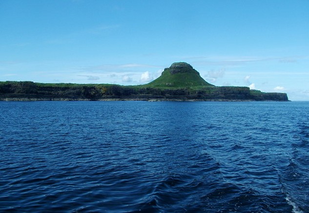
Sgeir Blàr nan Each Images
Images are sourced within 2km of 56.456489/-6.4761762 or Grid Reference NM2438. Thanks to Geograph Open Source API. All images are credited.


Sgeir Blàr nan Each is located at Grid Ref: NM2438 (Lat: 56.456489, Lng: -6.4761762)
Unitary Authority: Argyll and Bute
Police Authority: Argyll and West Dunbartonshire
What 3 Words
///glades.balconies.blogging. Near Fionnphort, Argyll & Bute
Nearby Locations
Related Wikis
Bac Mòr
Bac Mòr is a Scottish island, one of the Treshnish Isles, sometimes referred to as The Dutchman's Cap in English because of its shape. == Origin of... ==

Bac Beag
Bac Beag is a Scottish island, one of the Treshnish Isles in the Inner Hebrides. == Origin of name == The Gaelic name has several possible interpretations...
Lunga, Treshnish Isles
The island of Lunga is the largest of the Treshnish Isles in Argyll and Bute, Scotland. The Isles are part of the Loch Na Keal National Scenic Area....
Treshnish Isles
The Treshnish Isles are an archipelago of small islands and skerries, lying west of the Isle of Mull, in Scotland. They are part of the Inner Hebrides...
Nearby Amenities
Located within 500m of 56.456489,-6.4761762Have you been to Sgeir Blàr nan Each?
Leave your review of Sgeir Blàr nan Each below (or comments, questions and feedback).