Eilean Rainich

Island in Inverness-shire

Scotland

Eilean Rainich

Steinis and sea between Scalpay and the Mainland View from Scalpay Bridge.
Steinis and sea between Scalpay and the Mainland Credit: Sandy Gerrard

Eilean Rainich, also known as Eilean Rìgh Innis, is a small island located off the west coast of Scotland, in Inverness-shire. It is situated in the Sound of Raasay, between the Isle of Skye and the mainland.

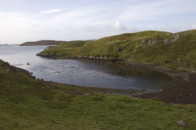
Measuring approximately 1.5 hectares in size, Eilean Rainich is a rocky outcrop with a distinct shape resembling a horseshoe. The island is uninhabited and has no permanent structures or facilities. It is covered in grass and heather, with a few scattered trees, providing a picturesque and natural landscape.

Eilean Rainich is notable for its historical significance. The island is believed to have been a religious site since ancient times, with evidence of early Christian crosses and a burial ground. It is also associated with Clan MacLeod and its history, as the island was gifted to the clan by King Haakon IV of Norway in the 13th century.

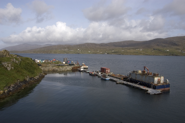
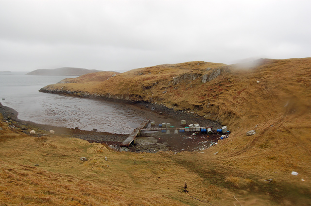
Access to Eilean Rainich is possible by boat, as there are no bridges connecting it to the mainland or other nearby islands. Visitors can enjoy the scenic beauty of the island, explore its historic remains, and take in the stunning views of the surrounding sea and mountains.

Overall, Eilean Rainich is a unique and historically rich island, offering a peaceful and beautiful retreat for those seeking a remote and untouched natural environment.

If you have any feedback on the listing, please let us know in the comments section below.

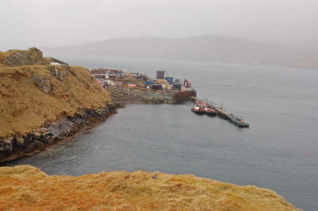
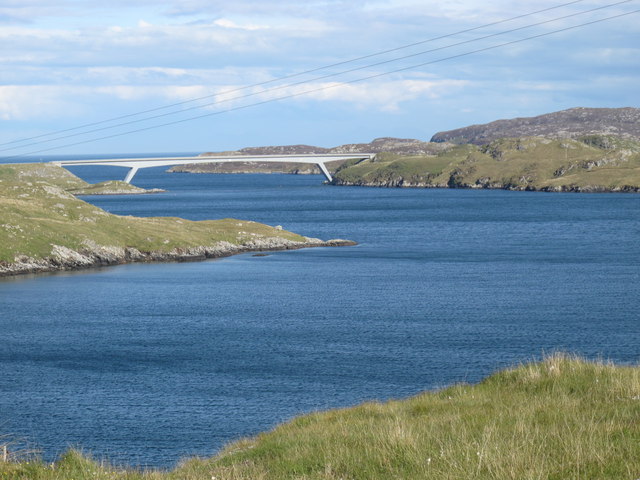
Eilean Rainich Images

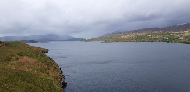
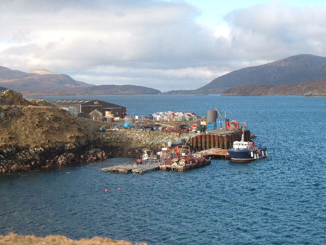
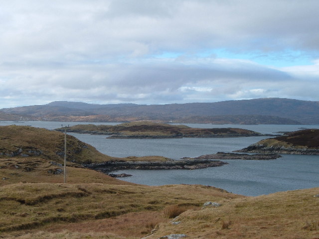
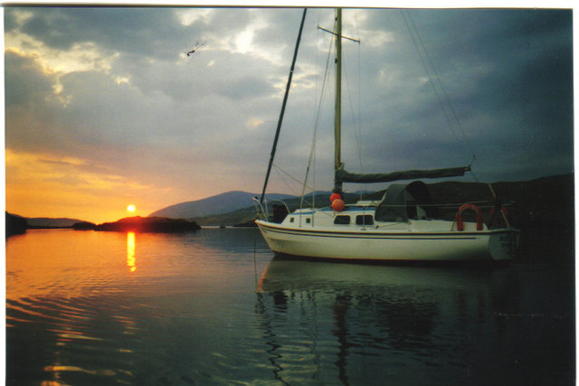
Images are sourced within 2km of 57.875834/-6.7384732 or Grid Reference NG1997. Thanks to Geograph Open Source API. All images are credited.

Steinis and sea between Scalpay and the Mainland View from Scalpay Bridge.
Steinis and sea between Scalpay and the Mainland
View from Scalpay Bridge.
Cuddy Point, Isle of Scalpay The pier at Cuddy Point, on the west side of Scalpay was built in 1899 and has historically served as the main landing point on the island for mail boats, supply vessels, fishing boats and - more recently - a growing number of fish farm vessels. 

Although there is now a local authority pier in the main village, this suffers from landing restrictions and Cuddy Point Pier - known locally as the Old Mail Boat Pier, is still widely used for deep-water landing of medium and large vessels.
Cuddy Point, Isle of Scalpay
The pier at Cuddy Point, on the west side of Scalpay was built in 1899 and has historically served as the main landing point on the island for mail boats, supply vessels, fishing boats and - more recently - a growing number of fish farm vessels. Although there is now a local authority pier in the main village, this suffers from landing restrictions and Cuddy Point Pier - known locally as the Old Mail Boat Pier, is still widely used for deep-water landing of medium and large vessels.
Islands off the West coast of Scalpay From Airdna Cille on the Isle of Scalpay, looking across East Loch Tarbert towards Drinisiadar, with the South Harris hills on the horizon.
Islands off the West coast of Scalpay
From Airdna Cille on the Isle of Scalpay, looking across East Loch Tarbert towards Drinisiadar, with the South Harris hills on the horizon.
Sunset from North Harbour Scalpay The sun dips into the Atlantic over West Loch Tarbert in distance
Sunset from North Harbour Scalpay
The sun dips into the Atlantic over West Loch Tarbert in distance
Small inlet on west coast of Scalpay
Pier, North Harbour, Scalpay
Looking over abandoned foundations to Loch an Tairbeairt At Ceann a' Ghàraidh from the road
Looking over abandoned foundations to Loch an Tairbeairt
At Ceann a' Ghàraidh from the road
View west along coast single-track with vernacular buildings
Looking east towards Caolas Scalpaigh with locals
Abandoned (?) House Quite a few apparently abandoned or falling-apart buildings on Harris & Lewis
Abandoned (?) House
Quite a few apparently abandoned or falling-apart buildings on Harris & Lewis
New-ish cutting with road near Ceann a' Ghàraidh
Bagh na Muice An inlet on Scalpay. By September 2009 <a href="https://www.geograph.org.uk/photo/1514170">NG2096 : Small inlet on west coast of Scalpay</a> the pontoons had disappeared.
Bagh na Muice
An inlet on Scalpay. By September 2009 NG2096 : Small inlet on west coast of Scalpay the pontoons had disappeared.
The pier at Rubha nan Cudaigean
Narrows at entrance to Sgalpaigh North Harbour, Harris View to north-west with adjacent North Harris main island.
Narrows at entrance to Sgalpaigh North Harbour, Harris
View to north-west with adjacent North Harris main island.
House at Caolas Sgalpaigh Spelling according to the OS map, but the roadsign has Scalpaigh, with a 'c'. The anglicised version would be Kyle of Scalpay. Note the palm trees.
House at Caolas Sgalpaigh
Spelling according to the OS map, but the roadsign has Scalpaigh, with a 'c'. The anglicised version would be Kyle of Scalpay. Note the palm trees.
Carragreich: postbox № HS3 108 A small postbox, emptied at 9:30 each weekday and Saturday morning.
Carragreich: postbox № HS3 108
A small postbox, emptied at 9:30 each weekday and Saturday morning.
Gob Steinish And Scalpay Bridge A view and a half across to Gob Steinish and onward to the Scalpay Bridge around 6pm on a Sunday.
Gob Steinish And Scalpay Bridge
A view and a half across to Gob Steinish and onward to the Scalpay Bridge around 6pm on a Sunday.
Cuidsgeir
Cuidsgeir
Show me another place!

Eilean Rainich is located at Grid Ref: NG1997 (Lat: 57.875834, Lng: -6.7384732)

Unitary Authority: Na h-Eileanan an Iar

Police Authority: Highlands and Islands

What 3 Words

///afford.steams.purifier. Near Tarbert, Na h-Eileanan Siar

Nearby Locations

Eilean Rainich

Related Wikis

Sgeotasaigh

Scotasay (Scottish Gaelic: Sgeotasaigh) is small island in the Outer Hebrides of Scotland. It lies 1 kilometre (0.6 miles) off the east coast of Harris...

East Loch Tarbert

East Loch Tarbert (Scottish Gaelic: Loch an Tairbeairt) is a sea loch that lies to the east of Harris in the Outer Hebrides of Scotland. The loch contains...

Scalpay, Outer Hebrides

Scalpay (; Scottish Gaelic: Sgalpaigh or Sgalpaigh na Hearadh; i.e. "Scalpay of Harris" to distinguish it from Scalpay off Skye) is an island in the Outer...

Harris distillery

Harris distillery is a Scotch whisky and Gin distillery in Tarbert on the Isle of Harris, Scotland. The distillery was the first legal distillery ever...

Nearby Amenities

Located within 500m of 57.875834,-6.7384732
Turning Circle
Lat/Long: 57.8767157/-6.7430951
Noexit: yes
Lat/Long: 57.8741494/-6.7431564
Generator Method: photovoltaic
Generator Output Electricity: yes
Generator Source: solar
Generator Type: solar_photovoltaic_panel
Power: generator
Lat/Long: 57.8749892/-6.7446356
Generator Method: photovoltaic
Generator Output Electricity: yes
Generator Source: solar
Generator Type: solar_photovoltaic_panel
Power: generator
Lat/Long: 57.8749101/-6.7444512
Access: private
Entrance: yes
Lat/Long: 57.8749494/-6.7446007
Access: private
Entrance: yes
Lat/Long: 57.8749278/-6.7445445
Generator Method: wind_turbine
Generator Source: wind
Generator Type: horizontal_axis
Power: generator
Lat/Long: 57.875193/-6.7430725
The data included in this document is from www.openstreetmap.org. The data is made available under ODbL.

Have you been to Eilean Rainich?

Leave your review of Eilean Rainich below (or comments, questions and feedback).