Sgeir nan Sgarbh

Island in Ross-shire

Scotland

Sgeir nan Sgarbh

Morning RIB Commute Seatrek worker on morning commute to work at Miabhaig on a RIB. Photo taken from the MV Lochlann.
Morning RIB Commute Credit: Rude Health

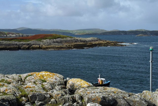
Sgeir nan Sgarbh is a small uninhabited island located off the coast of Ross-shire, Scotland. It is situated in the North Atlantic Ocean, specifically in the Inner Sound of Skye, between the Isle of Skye and the Scottish mainland. The island is known for its rugged and rocky terrain, with steep cliffs and rocky outcrops dominating its landscape.

Covering an area of about 1.5 hectares, Sgeir nan Sgarbh is a haven for various seabird species, including gulls, cormorants, and puffins. These birds use the island as a nesting site due to its remote and undisturbed nature. The surrounding waters are also home to a diverse range of marine life, including seals and dolphins, making it a popular spot for wildlife enthusiasts and birdwatchers.

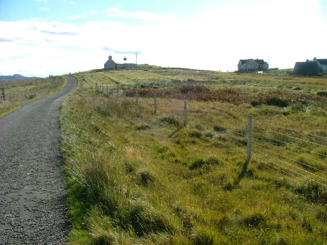
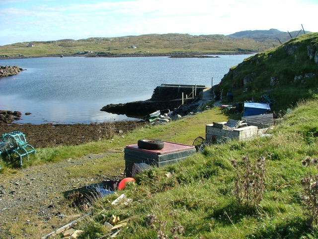
Access to Sgeir nan Sgarbh is primarily by boat, and it is a popular destination for boaters and kayakers exploring the Inner Sound. The island's rocky shores and rugged cliffs provide a picturesque backdrop against the clear blue waters, making it a favorite spot for photography enthusiasts.

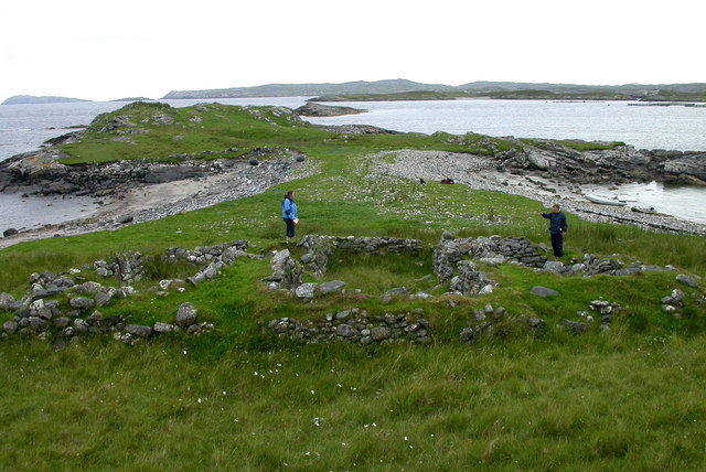
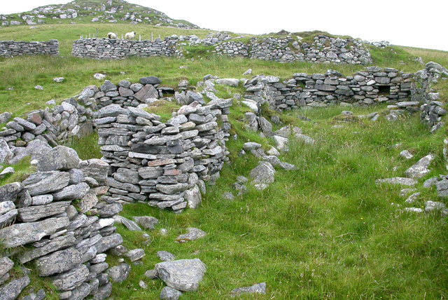
Despite its small size and lack of human habitation, Sgeir nan Sgarbh holds historical significance. It is believed to have been used as a lookout point during ancient times, with its elevated position providing a strategic vantage point for monitoring sea traffic.

In summary, Sgeir nan Sgarbh is a small, uninhabited island off the coast of Ross-shire, Scotland. Its rocky terrain, diverse wildlife, and historical significance make it an intriguing destination for nature lovers and history enthusiasts alike.

If you have any feedback on the listing, please let us know in the comments section below.

Sgeir nan Sgarbh Images

Images are sourced within 2km of 58.207616/-6.8746292 or Grid Reference NB1334. Thanks to Geograph Open Source API. All images are credited.

Morning RIB Commute Seatrek worker on morning commute to work at Miabhaig on a RIB. Photo taken from the MV Lochlann.
Morning RIB Commute
Seatrek worker on morning commute to work at Miabhaig on a RIB. Photo taken from the MV Lochlann.
Coastline, Rubha Domhain, Great Bernera Looking towards the island of Eunaigh Mòr.  The part of the island shown in the photo also lies within the grid square.
Coastline, Rubha Domhain, Great Bernera
Looking towards the island of Eunaigh Mòr. The part of the island shown in the photo also lies within the grid square.
Tacleit Road Looking north to Balasaigh.
Tacleit Road
Looking north to Balasaigh.
Lochan Sgeirean North of Tacleit.
Lochan Sgeirean
North of Tacleit.
Houses at Tacleit Tacleit is a small crofting settlement on the southeastern coast of Bearnaraigh (Great Bernera)
Houses at Tacleit
Tacleit is a small crofting settlement on the southeastern coast of Bearnaraigh (Great Bernera)
Tacleit Pier The township of Tacleit is on the southwest coast of Bearnaraigh.The view is towards Iarsiadar on the Lewis mainland.
Tacleit Pier
The township of Tacleit is on the southwest coast of Bearnaraigh.The view is towards Iarsiadar on the Lewis mainland.
Vuia Mhor in Loch Roag On the island of Vuia Mhor, looking at ruined croft houses between the two beaches.  On the point beyond is a ruined kiln.  The island was cleared of its inhabitants in 1841 and is now only used for grazing sheep.
Vuia Mhor in Loch Roag
On the island of Vuia Mhor, looking at ruined croft houses between the two beaches. On the point beyond is a ruined kiln. The island was cleared of its inhabitants in 1841 and is now only used for grazing sheep.
Ruined croft houses on Vuia Mhor The remains of houses and sheep fanks on the deserted island of Vuia Mhor in Loch Roag
Ruined croft houses on Vuia Mhor
The remains of houses and sheep fanks on the deserted island of Vuia Mhor in Loch Roag
Cliatasay On the island of Cliatasay in Loch Roag, on the site of a kelp kiln.  Vuia Mhor is visible in the distance.  The Geshader crofters used to graze their bull on this island.
Cliatasay
On the island of Cliatasay in Loch Roag, on the site of a kelp kiln. Vuia Mhor is visible in the distance. The Geshader crofters used to graze their bull on this island.
Cliatasay Natural landing stage on the island of Cliatasay in Loch Roag, used for the manufacture of potash from kelp in the early 19th century.  Vuia Mhor in the distance.
Cliatasay
Natural landing stage on the island of Cliatasay in Loch Roag, used for the manufacture of potash from kelp in the early 19th century. Vuia Mhor in the distance.
Cliatasay The rather featureless west-side of Cliatasay in Loch Roag; evidence of an old peat-cutting.
Cliatasay
The rather featureless west-side of Cliatasay in Loch Roag; evidence of an old peat-cutting.
Loch Barabhat and Dun. The dun in loch Barabhat with the crofts of Tacleit beyond. Featuring a fisherman and some rough moorland.
Loch Barabhat and Dun.
The dun in loch Barabhat with the crofts of Tacleit beyond. Featuring a fisherman and some rough moorland.
Creag na h-Iolaire Crags on the west side of Fuaigh Mòr.
Creag na h-Iolaire
Crags on the west side of Fuaigh Mòr.
Fuaigh Mòr Sun rising over the northern end of the island
Fuaigh Mòr
Sun rising over the northern end of the island
Fuaigh Mòr Sunrise over Fuaigh Mòr. Gneiss crags on the northern end of the island.
Fuaigh Mòr
Sunrise over Fuaigh Mòr. Gneiss crags on the northern end of the island.
Rubha Rollanais The northern tip of Fuaigh Mòr.
Rubha Rollanais
The northern tip of Fuaigh Mòr.
Rubha Rollanais Northern tip of Fuaigh Mòr in evening light.
Rubha Rollanais
Northern tip of Fuaigh Mòr in evening light.
Fuaigh Mòr West coast of Fuaigh Mòr.
Fuaigh Mòr
West coast of Fuaigh Mòr.
Show me another place!

Sgeir nan Sgarbh is located at Grid Ref: NB1334 (Lat: 58.207616, Lng: -6.8746292)

Unitary Authority: Na h-Eileanan an Iar

Police Authority: Highlands and Islands

What 3 Words

///dugouts.vies.cuddled. Near Carloway, Na h-Eileanan Siar

Related Wikis

Fuaigh Mòr

Fuaigh Mòr (sometimes anglicised as Vuia Mor) is an island in the Outer Hebrides of Scotland. It is off the west coast of Lewis near Great Bernera in...

Loch Ròg

Loch Ròg or Loch Roag is a large sea loch on the west coast of Lewis, Outer Hebrides. It is broadly divided into East Loch Roag and West Loch Roag with...

Fuaigh Beag

Fuaigh Beag or Vuia Be(a)g is an island in the Outer Hebrides. It is off the west coast of Lewis near Great Bernera in Loch Roag. Its name means "little...

Dun Bharabhat, Great Bernera

Dun Bharabhat (or Dun Baravat) is an Iron Age galleried dun or "semi-broch" situated on the island of Great Bernera near Lewis in Scotland (grid reference...

Callanish VIII

The Callanish VIII stone setting is one of many megalithic structures around the better-known (and larger) Calanais I on the west coast of the Isle of...

Great Bernera

Great Bernera (; Scottish Gaelic: Beàrnaraigh Mòr), often known just as Bernera (Scottish Gaelic: Beàrnaraigh), is an island and community in the Outer...

Vacsay

Vacsay (Scottish Gaelic: Bhacsaigh from Old Norse "bakkiey" meaning "peat bank island") is one of the Outer Hebrides. It is off the west coast of Lewis...

Breaclete

Breacleit (or Roulanish; Scottish Gaelic: Breacleit; Old Norse: Breiðiklettr) is the central village on Great Bernera in the Outer Hebrides, Scotland....

Have you been to Sgeir nan Sgarbh?

Leave your review of Sgeir nan Sgarbh below (or comments, questions and feedback).