An Clèireach

Island in Argyllshire

Scotland

An Clèireach

Port Chunn Nèill, Isle of Tiree
Port Chunn Nèill, Isle of Tiree Credit: Alpin Stewart

An Clèireach is a small island located off the coast of Argyllshire, Scotland. It is situated in the Inner Hebrides, specifically in the Sound of Mull, between the mainland and the Isle of Mull. The island spans approximately 1.5 miles in length and 0.5 miles in width, covering an area of around 100 acres.

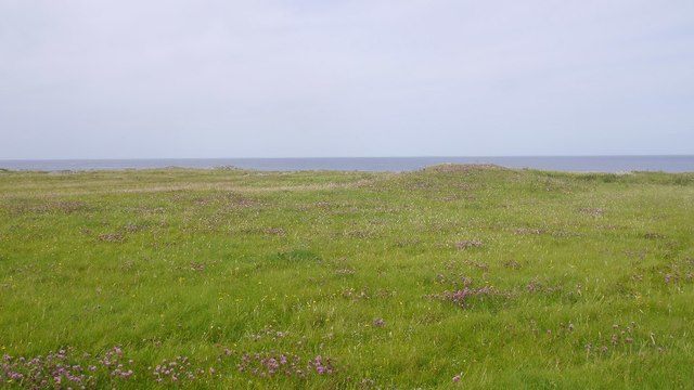
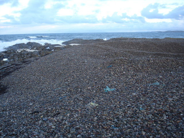
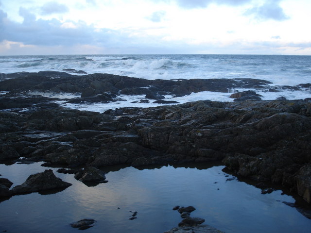
An Clèireach is known for its rugged and picturesque landscapes, with steep cliffs and rocky shores. The highest point on the island reaches about 200 feet above sea level, offering stunning panoramic views of the surrounding waters and neighboring islands. The island is home to a variety of wildlife, including seabirds such as puffins, guillemots, and razorbills.

There are no permanent residents on An Clèireach, as it is mainly used for grazing sheep and cattle. However, the island has historical significance, with evidence of human activity dating back to prehistoric times. Ruins of a chapel dedicated to St. Clement, from which the island's name is derived, can still be found.

Access to An Clèireach is primarily by boat, with visitors being able to explore the island's stunning natural beauty, go birdwatching, or enjoy fishing in the surrounding waters. The island offers a peaceful and remote experience, with opportunities for hiking and photography.

Overall, An Clèireach is a hidden gem in Argyllshire, offering visitors a chance to immerse themselves in the unspoiled beauty of the Scottish coast and explore its rich history and wildlife.

If you have any feedback on the listing, please let us know in the comments section below.

An Clèireach Images

Images are sourced within 2km of 56.551012/-6.7664836 or Grid Reference NM0750. Thanks to Geograph Open Source API. All images are credited.

Port Chunn Nèill, Isle of Tiree
Northeastern corner of Tiree Coastal heath and rock at Urvaig. The basking shark tour boat is off shore with several snorkelling passengers and a couple of basking sharks.  Saw the boat from Coll the previous day but no sharks.
Northeastern corner of Tiree
Coastal heath and rock at Urvaig. The basking shark tour boat is off shore with several snorkelling passengers and a couple of basking sharks. Saw the boat from Coll the previous day but no sharks.
East coast of Tiree View past Gunna, along the coast of Coll towards the Sgùrr of Eigg.
East coast of Tiree
View past Gunna, along the coast of Coll towards the Sgùrr of Eigg.
Machair, Urvaig The northeast tip of Tiree.
Machair, Urvaig
The northeast tip of Tiree.
Port Chunn Nèill An eider creche off Tiree.
Port Chunn Nèill
An eider creche off Tiree.
Port Chunn Nèill, Tiree
Coastal grassland at Urvaig
Port Chunn Nèill, northeast Tiree Gunna Sound leading into the Sea of the Hebrides.
Port Chunn Nèill, northeast Tiree
Gunna Sound leading into the Sea of the Hebrides.
Urvaig, Tiree Storm beach, looking north from Urvaig, Tiree
Urvaig, Tiree
Storm beach, looking north from Urvaig, Tiree
Watching for sharks off the Sound Of Gunna Looking north from Urvaig, Tiree, across Sound of Gunna towards Isle of Coll
Watching for sharks off the Sound Of Gunna
Looking north from Urvaig, Tiree, across Sound of Gunna towards Isle of Coll
Rocky coast of the most northerly part of Tiree The house in the distance on the 1:25000 is named Urvaig, but then so is the tip of the peninsula.
Rocky coast of the most northerly part of Tiree
The house in the distance on the 1:25000 is named Urvaig, but then so is the tip of the peninsula.
Across the Gunna Sound Unsurprising it is Gunna to be seen across the sound.  Coll can be made out behind Gunna.
Across the Gunna Sound
Unsurprising it is Gunna to be seen across the sound. Coll can be made out behind Gunna.
Foam on the rocks at Urvaig Roughs seas had generated foam which has collected here, much to the amusement of the dog.
Foam on the rocks at Urvaig
Roughs seas had generated foam which has collected here, much to the amusement of the dog.
Pebble beach at Urvaig The dip in the pebbles at the right hand side is where some have been removed and probably crushed and used as aggregate.
Pebble beach at Urvaig
The dip in the pebbles at the right hand side is where some have been removed and probably crushed and used as aggregate.
Rock pool reflection at Urvaig Rough seas contrast with the flat calm on the rock pool.
Rock pool reflection at Urvaig
Rough seas contrast with the flat calm on the rock pool.
Rocks and pebble bank at Urvaig
The beach at Port Chunn Neill The Sound of Gunna and the island of Gunna in the distance.
The beach at Port Chunn Neill
The Sound of Gunna and the island of Gunna in the distance.
The Clansman in Gunna Sound, Tiree On a Thursday it is possible to take a day trip to Tiree from Oban. Leaving Tiree the ferry goes on to the Outer Hebrides and returns to Tiree via Gunna Sound, between Coll and Tiree, thus affording excellent opportunities to photograph this magnificent vessel.
The Clansman in Gunna Sound, Tiree
On a Thursday it is possible to take a day trip to Tiree from Oban. Leaving Tiree the ferry goes on to the Outer Hebrides and returns to Tiree via Gunna Sound, between Coll and Tiree, thus affording excellent opportunities to photograph this magnificent vessel.
Show me another place!

An Clèireach is located at Grid Ref: NM0750 (Lat: 56.551012, Lng: -6.7664836)

Unitary Authority: Argyll and Bute

Police Authority: Argyll and West Dunbartonshire

What 3 Words

///saving.lives.otter. Near Scarinish, Argyll & Bute

Related Wikis

Dun Mor Vaul

Dun Mor Vaul (or simply Dun Mor; Scottish Gaelic: Dùn Mòr) is an iron-age broch located on the north coast of the island of Tiree, in Scotland. ��2�...

Gunna, Scotland

Gunna (Gaelic: Gunnaigh) is an island in the Inner Hebrides of Scotland. == Geography and geology == Gunna lies between Coll and Tiree, closer to Coll...

Tiree

Tiree (; Scottish Gaelic: Tiriodh, pronounced [ˈtʲʰiɾʲəɣ]) is the most westerly island in the Inner Hebrides of Scotland. The low-lying island, southwest...

Scarinish

Scarinish (Scottish Gaelic: Sgairinis [ˈs̪kaɾʲɪnɪʃ]) is the main village on the island of Tiree, in the Inner Hebrides of Scotland. It is located on the...

Tiree Airport

Tiree Airport (Scottish Gaelic: Port-adhair Thiriodh) (IATA: TRE, ICAO: EGPU) is located 2.5 nautical miles (4.6 km; 2.9 mi) north northeast of Balemartine...

Breachacha crannog

The Breachacha crannog is a crannog located near Loch Breachacha, on the Inner Hebridean island of Coll. The crannog is recognised in the United Kingdom...

Breachacha Castle

Breachacha Castle (also spelled Breacachadh) is either of two structures on the shore of Loch Breachacha, on the Inner Hebridean island of Coll, Scotland...

Nearby Amenities

Located within 500m of 56.551012,-6.7664836
Created By: dmgroom_coastlines
Source: PGS
Lat/Long: 56.54665/-6.76503
Created By: dmgroom_coastlines
Source: PGS
Lat/Long: 56.54718/-6.76547
Created By: dmgroom_coastlines
Source: PGS
Lat/Long: 56.54743/-6.76568
Created By: dmgroom_coastlines
Source: PGS
Lat/Long: 56.54755/-6.76521
Created By: dmgroom_coastlines
Source: PGS
Lat/Long: 56.54767/-6.76474
Created By: dmgroom_coastlines
Source: PGS
Lat/Long: 56.54716/-6.76477
Created By: dmgroom_coastlines
Source: PGS
Lat/Long: 56.54714/-6.76384
Created By: dmgroom_coastlines
Source: PGS
Lat/Long: 56.54689/-6.76363
The data included in this document is from www.openstreetmap.org. The data is made available under ODbL.

Have you been to An Clèireach?

Leave your review of An Clèireach below (or comments, questions and feedback).