Sgeir Stevain

Island in Inverness-shire

Scotland

Sgeir Stevain

Grocis North Buoy The buoy is red, indicating that it is a port hand buoy, so of you are sailing in the direction of buoyage you leave it to your left as you pass. Beyond it is the beacon on Grocis Sgeir.
Grocis North Buoy Credit: Anne Burgess

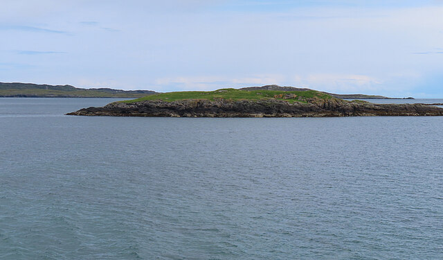
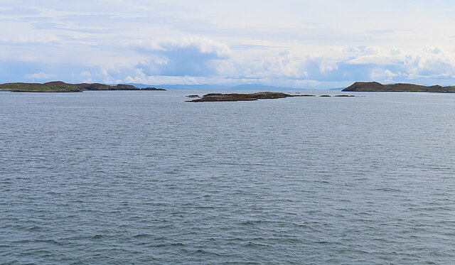
Sgeir Stevain is a small island located off the west coast of Scotland, specifically in Inverness-shire. It is situated in the Inner Hebrides, a group of islands known for their rugged landscapes and rich cultural history.

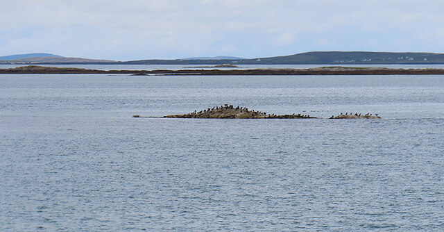
With an area of approximately 6 hectares, Sgeir Stevain is relatively tiny in size. The island is uninhabited and lacks any permanent structures or human population. Its terrain is characterized by rocky outcrops and low-lying grassy areas, offering a diverse habitat for various bird species.

The island is particularly renowned for its seabird colonies, which attract ornithologists and birdwatchers from around the world. Species such as guillemots, puffins, and razorbills can be spotted nesting on the cliffs of Sgeir Stevain during the breeding season. The surrounding waters are also home to a variety of marine life, including seals and dolphins.

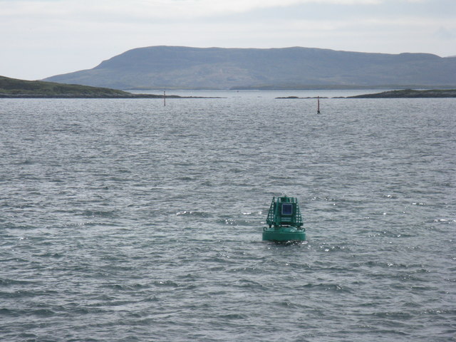
Access to Sgeir Stevain is typically limited, as it is primarily visited by wildlife enthusiasts, researchers, and boat tours. The island's isolation and untouched nature make it an ideal spot for those seeking a peaceful and unspoiled environment.

Overall, Sgeir Stevain offers a unique opportunity to experience the raw beauty of Scotland's coastal landscapes and observe a diverse range of bird species in their natural habitat.

If you have any feedback on the listing, please let us know in the comments section below.

Sgeir Stevain Images

Images are sourced within 2km of 57.729992/-7.0156019 or Grid Reference NG0182. Thanks to Geograph Open Source API. All images are credited.

Grocis North Buoy The buoy is red, indicating that it is a port hand buoy, so of you are sailing in the direction of buoyage you leave it to your left as you pass. Beyond it is the beacon on Grocis Sgeir.
Grocis North Buoy
The buoy is red, indicating that it is a port hand buoy, so of you are sailing in the direction of buoyage you leave it to your left as you pass. Beyond it is the beacon on Grocis Sgeir.
Grocis Sgeir A beacon warns vessels to keep away from this skerry, which is submerged at high tide.
Grocis Sgeir
A beacon warns vessels to keep away from this skerry, which is submerged at high tide.
Knight's Rock A skerry to be avoided, unless you are a seabird, in which case it's a handy roost until the tide rises and submerges it.
Knight's Rock
A skerry to be avoided, unless you are a seabird, in which case it's a handy roost until the tide rises and submerges it.
Port Hand Buoy I'm not sure what the name of this one is - or even if it has a name. Camera position from GPS.
Port Hand Buoy
I'm not sure what the name of this one is - or even if it has a name. Camera position from GPS.
Langaigh The north end of the long narrow island of Langaigh. Camera position from GPS.
Langaigh
The north end of the long narrow island of Langaigh. Camera position from GPS.
North-West Rodel Rocks Buoy This buoy, being green, should be to starboard when you pass it, if you are going in the direction of buoyage. Camera position from GPS.
North-West Rodel Rocks Buoy
This buoy, being green, should be to starboard when you pass it, if you are going in the direction of buoyage. Camera position from GPS.
Heisgeir Heisgeir is the closest skerry. Beyond it, and out of this square, are Gilsaigh on the left and Grodhaigh on the right with Liungaigh partly behind it.
Heisgeir
Heisgeir is the closest skerry. Beyond it, and out of this square, are Gilsaigh on the left and Grodhaigh on the right with Liungaigh partly behind it.
Mile Sgeir Starboard Lateral Buoy Green buoy which emits a green flashing light every five seconds at night.
Mile Sgeir Starboard Lateral Buoy
Green buoy which emits a green flashing light every five seconds at night.
Rocks of Mile-Sgeir The rocks giving their name to the channel buoy in the adjacent square <a href="https://www.geograph.org.uk/photo/4687535">NG0082 : Mile Sgeir Starboard Lateral Buoy</a>.
Rocks of Mile-Sgeir
The rocks giving their name to the channel buoy in the adjacent square NG0082 : Mile Sgeir Starboard Lateral Buoy.
Grocis North Port Lateral Buoy This red buoy emits a flashing red light every eight seconds at night.
Grocis North Port Lateral Buoy
This red buoy emits a flashing red light every eight seconds at night.
In the Sound of Harris The photographer's GPS location is rather accurate but the evidence of the rocks jutting from the sea does not conform with OS maps so the direction of the image may be in error.
In the Sound of Harris
The photographer's GPS location is rather accurate but the evidence of the rocks jutting from the sea does not conform with OS maps so the direction of the image may be in error.
Off Langaigh on the Harris to Berneray ferry GPS located but some way from the track identified for the vessel on the OS maps.
Off Langaigh on the Harris to Berneray ferry
GPS located but some way from the track identified for the vessel on the OS maps.
Front deck of the Harris to Berneray ferry in the Sound of Harris With a steady speed of 11 mph you are hardly exposed to the elements if you face the view in the open at the front of the vessel.
Front deck of the Harris to Berneray ferry in the Sound of Harris
With a steady speed of 11 mph you are hardly exposed to the elements if you face the view in the open at the front of the vessel.
Near Heisgeir in the Sound of Harris A calm ferry crossing between the islands of the Sound of Harris.
Near Heisgeir in the Sound of Harris
A calm ferry crossing between the islands of the Sound of Harris.
NW RODEL ROCKS starboard buoy Looking northeast past the skerries of Langaigh to Rodel and the hill of Roineabhal on South Harris.
NW RODEL ROCKS starboard buoy
Looking northeast past the skerries of Langaigh to Rodel and the hill of Roineabhal on South Harris.
Knight's Rock
Knight's Rock
Sound of Harris The ferry crossing the Sound of Harris takes a very indirect route to avoid skerries such as this one.
Sound of Harris
The ferry crossing the Sound of Harris takes a very indirect route to avoid skerries such as this one.
Small island Taken from ferry. Not sure which island it is but know it was on port side of ferry
Small island
Taken from ferry. Not sure which island it is but know it was on port side of ferry
Show me another place!

Sgeir Stevain is located at Grid Ref: NG0182 (Lat: 57.729992, Lng: -7.0156019)

Unitary Authority: Na h-Eileanan an Iar

Police Authority: Highlands and Islands

What 3 Words

///twist.rising.flopping. Near Leverburgh, Na h-Eileanan Siar

Nearby Locations

Mile-sgeir Sgeir Stevain

Related Wikis

Rodel

Rodel (Scottish Gaelic: Roghadal) is a village on the south-eastern coast of Harris, an island in the Scottish Outer Hebrides. Rodel is situated in the...

Outer Hebrides

The Outer Hebrides ( HEB-rid-eez) or Western Isles (Scottish Gaelic: na h-Eileanan Siar [nə ˈhelanən ˈʃiəɾ] , na h-Eileanan an Iar [nə ˈhelanən əɲ ˈiəɾ...

St Clement's Church, Rodel

St Clement's Church (Scottish Gaelic: Tùr Chliamhainn, meaning Clement's Tower) is a late fifteenth-century or early sixteenth-century church in Rodel...

Killegray

Killegray is an island in the Sound of Harris in the Outer Hebrides of Scotland. == Geography == Situated in the Sound of Harris, a channel of water between...

Have you been to Sgeir Stevain?

Leave your review of Sgeir Stevain below (or comments, questions and feedback).