Sgeir Liath

Island in Inverness-shire

Scotland

Sgeir Liath

Isle of Harris Golf Club Looking south-west over the course with Scarista beach beyond.
Isle of Harris Golf Club Credit: Richard Dorrell

Sgeir Liath is a small island located in Inverness-shire, Scotland. It is situated in the North Atlantic Ocean, approximately 2.5 kilometers off the coast of the mainland. The island is part of a group of islands known as the Inner Hebrides, which are renowned for their stunning natural beauty.

Covering an area of around 1.5 hectares, Sgeir Liath is a rocky island characterized by its rugged cliffs and sparse vegetation. The island is uninhabited and lacks any permanent structures or facilities. It is primarily visited by wildlife enthusiasts, birdwatchers, and nature photographers who are attracted by its abundant birdlife and unique coastal landscape.

Sgeir Liath is home to a variety of seabirds including puffins, razorbills, guillemots, and fulmars. These birds nest on the cliffs and use the island as a breeding ground during the summer months. The surrounding waters are also rich in marine life, making it a popular spot for diving and snorkeling.

Access to Sgeir Liath is mainly by boat, with several charter companies offering trips to the island. Visitors are advised to wear appropriate clothing and footwear due to the uneven terrain and potential for slippery rocks. It is important to note that there are no facilities on the island, so visitors should bring their own food, water, and other necessary supplies.

Sgeir Liath provides a unique opportunity to experience Scotland's rugged coastline and observe a diverse range of bird species in their natural habitat. Its remote location and untouched beauty make it a must-visit destination for nature lovers and outdoor enthusiasts.

If you have any feedback on the listing, please let us know in the comments section below.
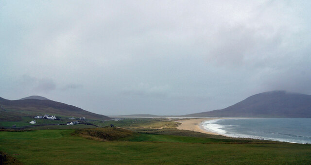
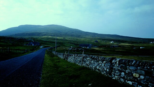
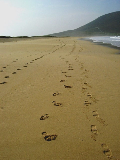
Sgeir Liath Images

Images are sourced within 2km of 57.834367/-7.0402699 or Grid Reference NG0093. Thanks to Geograph Open Source API. All images are credited.

Isle of Harris Golf Club Looking south-west over the course with Scarista beach beyond.
Isle of Harris Golf Club
Looking south-west over the course with Scarista beach beyond.
Groundworks for a New House at Scarasta
Borvemore in 1981
Borvemore in 1981
Traigh Scarasta Footprints in the sand
Traigh Scarasta
Footprints in the sand
Scarista: dunes and a view to Taransay The island of Taransay and Harris hills behind it form the backdrop to this view across the dunes at Traigh Sgarasta (Scarista beach).
Scarista: dunes and a view to Taransay
The island of Taransay and Harris hills behind it form the backdrop to this view across the dunes at Traigh Sgarasta (Scarista beach).
Scarista: view across the dunes back to the road Looking across the dunes inland towards the A859.
Scarista: view across the dunes back to the road
Looking across the dunes inland towards the A859.
Scarista: dunes to Ceapabhal A view of the 368m summit of Ceapabhal from across the dunes of Scarista beach.
Scarista: dunes to Ceapabhal
A view of the 368m summit of Ceapabhal from across the dunes of Scarista beach.
Calves by the Dunes, by Traigh Scarasta
Scarasta Beach
Scarasta Beach
Crystal Clear Sea at Scarista Beach
Tràigh Scarasta looking South West Looking over Tràigh Scarasta to Ceapabhal, with dramatic sky
Tràigh Scarasta looking South West
Looking over Tràigh Scarasta to Ceapabhal, with dramatic sky
Tràigh Scarasta The isthmus on the Isle of Taransay <a href="https://www.geograph.org.uk/gridref/NB0000">NB0000</a> can be clearly seen.
Tràigh Scarasta
The isthmus on the Isle of Taransay NB0000 can be clearly seen.
Dunes at Tràigh Scarasta A narrow belt of dunes separates the beach from the flats behind, with the machair further inland again. Maodal <a href="https://www.geograph.org.uk/gridref/NF9990">NF9990</a> can be seen with cloud cover beyond.
Dunes at Tràigh Scarasta
A narrow belt of dunes separates the beach from the flats behind, with the machair further inland again. Maodal NF9990 can be seen with cloud cover beyond.
Tràigh Scarasta Looking east towards the township of Sgarasta.
Tràigh Scarasta
Looking east towards the township of Sgarasta.
An amazing beach - Traigh Scarasta With skies so huge and beach so perfect, who would have thought that you were in the UK? It completely took my breath away.
An amazing beach - Traigh Scarasta
With skies so huge and beach so perfect, who would have thought that you were in the UK? It completely took my breath away.
Sand dunes, Traigh Scarasta These white sands,coupled with the ever changing skies are like something out of a movie. I could watch it all day - and I did.
Sand dunes, Traigh Scarasta
These white sands,coupled with the ever changing skies are like something out of a movie. I could watch it all day - and I did.
Images in the sand As the tide goes out, there were these patterns left behind, which to me looked like feathers.
Images in the sand
As the tide goes out, there were these patterns left behind, which to me looked like feathers.
There's nothing idle about a Lazy bed A Lazy bed is a method of cultivation used in the Western Isles and the west of Ireland. It consists of parallel banks of ridge and furrow dug by spade up to 3 yards in width. Consisting largely of peat they are fertilized with desalinated seaweed and the foliage of the upturned turfs. Potatoes were the principal crop grown in the lazy bed. In the Hebrides these are known as "feannagan" in Scottish Gaelic.
There's nothing idle about a Lazy bed
A Lazy bed is a method of cultivation used in the Western Isles and the west of Ireland. It consists of parallel banks of ridge and furrow dug by spade up to 3 yards in width. Consisting largely of peat they are fertilized with desalinated seaweed and the foliage of the upturned turfs. Potatoes were the principal crop grown in the lazy bed. In the Hebrides these are known as "feannagan" in Scottish Gaelic.
Show me another place!

Sgeir Liath is located at Grid Ref: NG0093 (Lat: 57.834367, Lng: -7.0402699)

Unitary Authority: Na h-Eileanan an Iar

Police Authority: Highlands and Islands

What 3 Words

///sometimes.cross.crass. Near Leverburgh, Na h-Eileanan Siar

Related Wikis

Borve, Harris

Borve (Scottish Gaelic: Na Buirgh) is a village in Harris in the Outer Hebrides, Scotland. Borve is also within the parish of Harris, and is on the A859...

1990 Scotland RAF Shackleton crash

On 30 April 1990, a Royal Air Force Avro Shackleton AEW Mk II aircraft, of No. 8 Squadron RAF, based at RAF Lossiemouth, crashed into a hill on the Isle...

Taransay

Taransay (Scottish Gaelic: Tarasaigh, pronounced [ˈt̪ʰaɾas̪aj]) is an island in the Outer Hebrides of Scotland. It was the host of the British television...

Leverburgh

Leverburgh (Scottish Gaelic: An t-Òb [ən̪ˠ ˈt̪ɔːp]) is the second largest village, after Tarbert, in Harris in the Outer Hebrides of Scotland. Leverburgh...

Related Videos

Scarista beach, Isle of Harris, Outer Hebrides

One of the many beautiful beaches which line the west coast of the Isle of Harris, Scottish Outer Hebrides.

Isle of Harris Golf Club

EGG member Paul McLean enjoys some holiday golf on the Isle of Harris, sampling the fine 9 hole links of Isle of Harris Golf Club.

Nearby Amenities

Located within 500m of 57.834367,-7.0402699
Oran Na Mara
Tourism: hotel
Website: http://OranNaMara.com
Lat/Long: 57.8309225/-7.0358215
Blue Reef Cottages
Tourism: apartment
Website: https://www.stay-hebrides.com/
Lat/Long: 57.8323638/-7.034592
Barrier: cattle_grid
Lat/Long: 57.8326777/-7.0348138
Turning Circle
Lat/Long: 57.8323825/-7.0339966
Turning Circle
Lat/Long: 57.8318092/-7.0353859
Barrier: cattle_grid
Lat/Long: 57.8307902/-7.0362516
Golf: tee
Surface: grass
Lat/Long: 57.8321013/-7.036884
Golf: pin
Lat/Long: 57.8335065/-7.0390539
Golf: tee
Surface: grass
Lat/Long: 57.8336264/-7.0336975
Golf: pin
Lat/Long: 57.8322056/-7.0362858
Golf: tee
Surface: grass
Lat/Long: 57.8335978/-7.038504
Golf: pin
Lat/Long: 57.8338206/-7.0347543
Golf: tee
Surface: grass
Lat/Long: 57.8320749/-7.037226
Golf: pin
Lat/Long: 57.8312588/-7.0374714
Golf: tee
Surface: grass
Lat/Long: 57.8317129/-7.0381366
Golf: pin
Lat/Long: 57.8300506/-7.0384906
Golf: tee
Surface: grass
Lat/Long: 57.8299021/-7.0396064
Golf: pin
Lat/Long: 57.8309018/-7.0373855
Entrance: yes
Lat/Long: 57.8318667/-7.0367534
Entrance: yes
Lat/Long: 57.8318044/-7.0367386
The data included in this document is from www.openstreetmap.org. The data is made available under ODbL.

Have you been to Sgeir Liath?

Leave your review of Sgeir Liath below (or comments, questions and feedback).