Sgeir Abhainn

Island in Argyllshire

Scotland

Sgeir Abhainn

Tràigh Bheag East side of Balephetrish Bay, Tiree
Tràigh Bheag Credit: Richard Webb

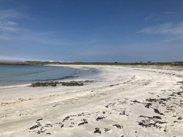
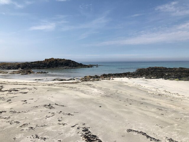
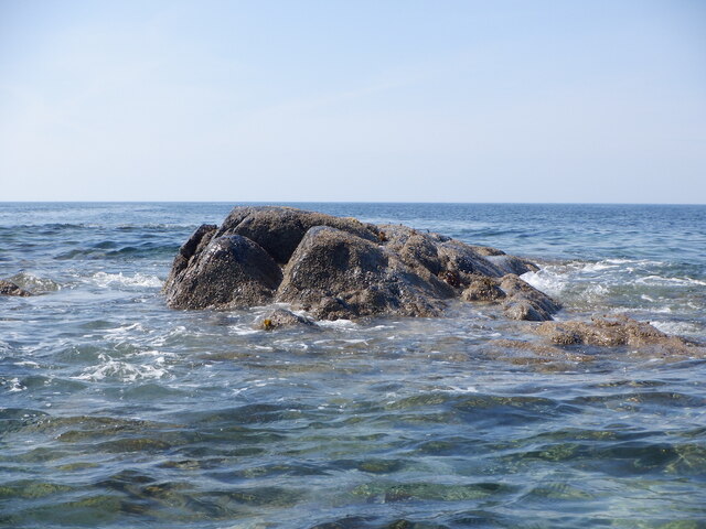
Sgeir Abhainn is a small island located in Argyllshire, Scotland. It is situated in the Inner Hebrides, specifically in the Sound of Jura. The island is approximately 1.5 acres in size and is made up of rocky terrain with some patches of grass and heather.

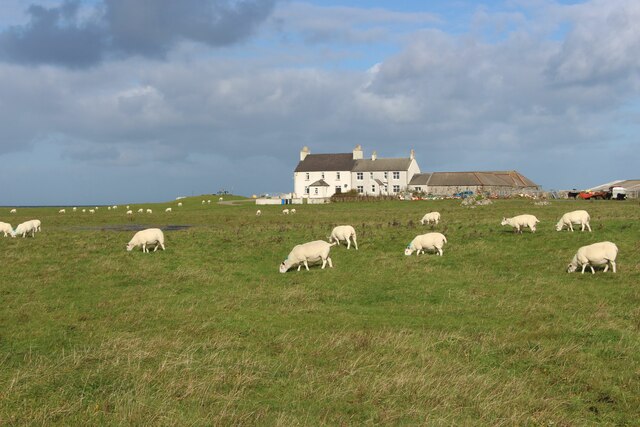
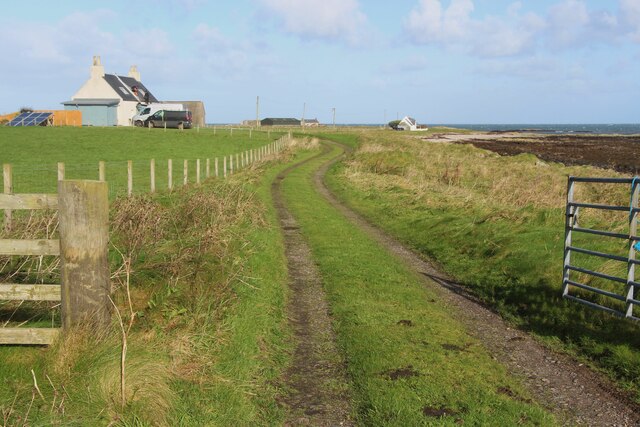
Sgeir Abhainn is uninhabited and lacks any infrastructure or buildings. It is primarily known for its rich wildlife and natural beauty. The surrounding waters are abundant with marine life, making it a popular spot for fishing and birdwatching. Seals are often spotted lounging on the rocky shores, and various species of seabirds can be seen nesting on the cliffs.

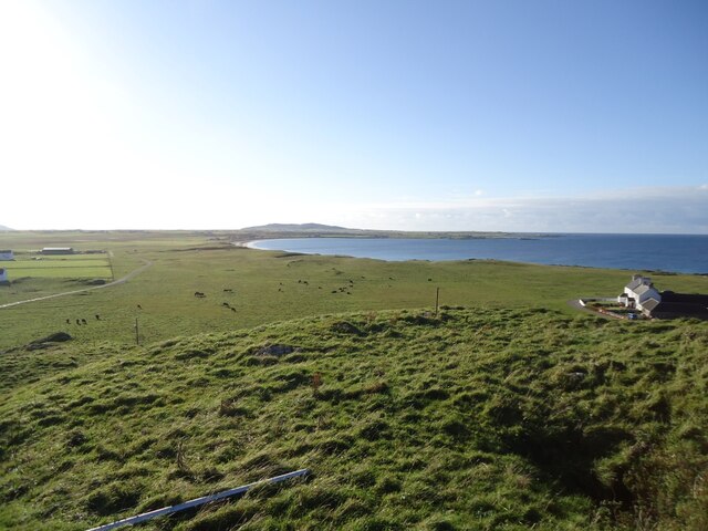
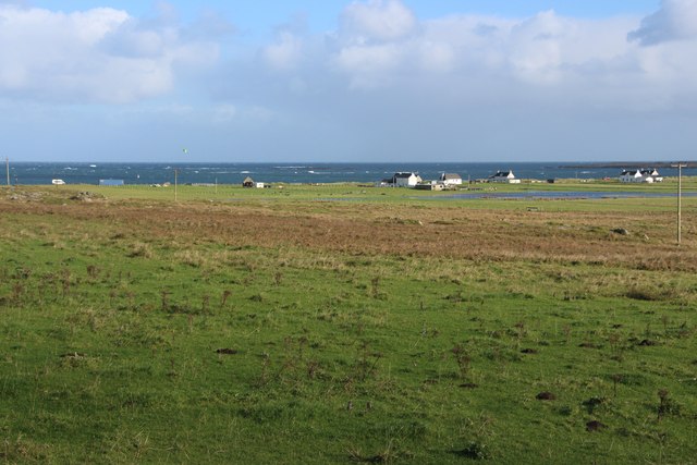
The island offers stunning views of the surrounding landscape, including the neighboring islands of Jura and Scarba. The rugged coastline and rocky outcrops provide opportunities for exploration and photography.

Access to Sgeir Abhainn is possible by boat, as there are no regular ferry services. The island is a popular destination for boating enthusiasts and nature lovers seeking a peaceful retreat. However, visitors should be aware that there are no facilities or services available on the island, so it is necessary to bring all supplies, including food and water.

Sgeir Abhainn offers a unique and untouched experience for those who appreciate the raw beauty of nature and seek solitude in a remote island setting.

If you have any feedback on the listing, please let us know in the comments section below.

Sgeir Abhainn Images

Images are sourced within 2km of 56.525385/-6.8669112 or Grid Reference NM0047. Thanks to Geograph Open Source API. All images are credited.

Tràigh Bheag East side of Balephetrish Bay, Tiree
Tràigh Bheag
East side of Balephetrish Bay, Tiree
Tràigh Bheag
Tràigh Bheag
From the summit of Balephetrish Hill, Tiree Central and eastern Tiree is very flat, and this hill, though only 36m high, gives an extensive view. In the distance, about 6km away, is Beinn Hough, which at only 119m is the second highest hill on Tiree.
From the summit of Balephetrish Hill, Tiree
Central and eastern Tiree is very flat, and this hill, though only 36m high, gives an extensive view. In the distance, about 6km away, is Beinn Hough, which at only 119m is the second highest hill on Tiree.
Tràigh Bheag, Balephetrish
Port Bàn, Balephetrish
Port Bàn, Balephetrish Got a telling off from the local oystercatchers, there was a lot of activity here, the isolated rock on the left in particular seemed to be a nesting site for several species. Retreat made.
Port Bàn, Balephetrish
Got a telling off from the local oystercatchers, there was a lot of activity here, the isolated rock on the left in particular seemed to be a nesting site for several species. Retreat made.
Crops harvested and baled at Balephetrish
Balephetrish, a farm on north Tiree
Rough grazing and moor at Aird Chirenis
Wet track to Cnoc Ruaidh
Barnacle geese over Tiree They may be resting en route to Galloway from Greenland via Iceland. A low flying jet has disturbed these and others.
Barnacle geese over Tiree
They may be resting en route to Galloway from Greenland via Iceland. A low flying jet has disturbed these and others.
Sgeir Fada Very little of the skerry emerges from a neap high water. Another rock nearby was also dry.
Sgeir Fada
Very little of the skerry emerges from a neap high water. Another rock nearby was also dry.
Houses at Balephetrish Bay
Road to Kenovay Farm and Ard Mor The west side of Balephetrish Bay on Tiree.
Road to Kenovay Farm and Ard Mor
The west side of Balephetrish Bay on Tiree.
Natural Arch, Balephetrish Bay, Tiree one of a number of arches at the west end of the bay
Natural Arch, Balephetrish Bay, Tiree
one of a number of arches at the west end of the bay
West coast of Balephetrish Bay A lot of seaweed on this corner of the beach, and very rocky further along.
West coast of Balephetrish Bay
A lot of seaweed on this corner of the beach, and very rocky further along.
Looking towards Kenovay across the machair In summer these grasslands should be full of flower, might have to go back and see.
Looking towards Kenovay across the machair
In summer these grasslands should be full of flower, might have to go back and see.
Looking north-east from Kennovay Fields running down to Balephetrish Bay.
Looking north-east from Kennovay
Fields running down to Balephetrish Bay.
Show me another place!

Sgeir Abhainn is located at Grid Ref: NM0047 (Lat: 56.525385, Lng: -6.8669112)

Unitary Authority: Argyll and Bute

Police Authority: Argyll and West Dunbartonshire

What 3 Words

///stutter.permanent.lots. Near Scarinish, Argyll & Bute

Related Wikis

Tiree Airport

Tiree Airport (Scottish Gaelic: Port-adhair Thiriodh) (IATA: TRE, ICAO: EGPU) is located 2.5 nautical miles (4.6 km; 2.9 mi) north northeast of Balemartine...

Tiree

Tiree (; Scottish Gaelic: Tiriodh, pronounced [ˈtʲʰiɾʲəɣ]) is the most westerly island in the Inner Hebrides of Scotland. The low-lying island, southwest...

Dun Mor Vaul

Dun Mor Vaul (or simply Dun Mor; Scottish Gaelic: Dùn Mòr) is an iron-age broch located on the north coast of the island of Tiree, in Scotland. ��2�...

Scarinish

Scarinish (Scottish Gaelic: Sgairinis [ˈs̪kaɾʲɪnɪʃ]) is the main village on the island of Tiree, in the Inner Hebrides of Scotland. It is located on the...

Tiree Music Festival

Tiree Music Festival is a Scottish folk music festival held annually on the Island of Tiree in the Inner Hebrides. The festival was founded in 2010 by...

Mannal

Mannal is a coastal hamlet on the west side of Hynish Bay, on the island of Tiree, Scotland. The township of Mannal lies on the southwest corner of Tiree...

Nearby Amenities

Located within 500m of 56.525385,-6.8669112
Source: PGS
Lat/Long: 56.5215536/-6.8643126
Source: PGS
Lat/Long: 56.5217816/-6.8638542
Source: PGS
Lat/Long: 56.5220024/-6.8635485
Source: PGS
Lat/Long: 56.5224344/-6.8632298
Source: PGS
Lat/Long: 56.523011/-6.8634983
Source: PGS
Lat/Long: 56.5230099/-6.8642005
Source: PGS
Lat/Long: 56.5232884/-6.8641051
Source: PGS
Lat/Long: 56.523345/-6.8635307
Created By: dmgroom_coastlines
Source: PGS
Lat/Long: 56.52379/-6.86323
Created By: dmgroom_coastlines
Source: PGS
Lat/Long: 56.52429/-6.86273
Created By: dmgroom_coastlines
Source: PGS
Lat/Long: 56.5248/-6.86247
Created By: dmgroom_coastlines
Source: PGS
Lat/Long: 56.52477/-6.86062
Created By: dmgroom_coastlines
Source: PGS
Lat/Long: 56.52528/-6.86059
Created By: dmgroom_coastlines
Source: PGS
Lat/Long: 56.52514/-6.86014
Created By: dmgroom_coastlines
Source: PGS
Lat/Long: 56.52501/-6.85968
Created By: dmgroom_coastlines
Source: PGS
Lat/Long: 56.52552/-6.85942
Created By: dmgroom_coastlines
Source: PGS
Lat/Long: 56.52576/-6.85894
The data included in this document is from www.openstreetmap.org. The data is made available under ODbL.

Have you been to Sgeir Abhainn?

Leave your review of Sgeir Abhainn below (or comments, questions and feedback).