Eilean a' Mhurain

Island in Inverness-shire

Scotland

Eilean a' Mhurain

Maragaidh Beag One of many low-lying islands east of the Long Isle.
Maragaidh Beag Credit: Toby Speight

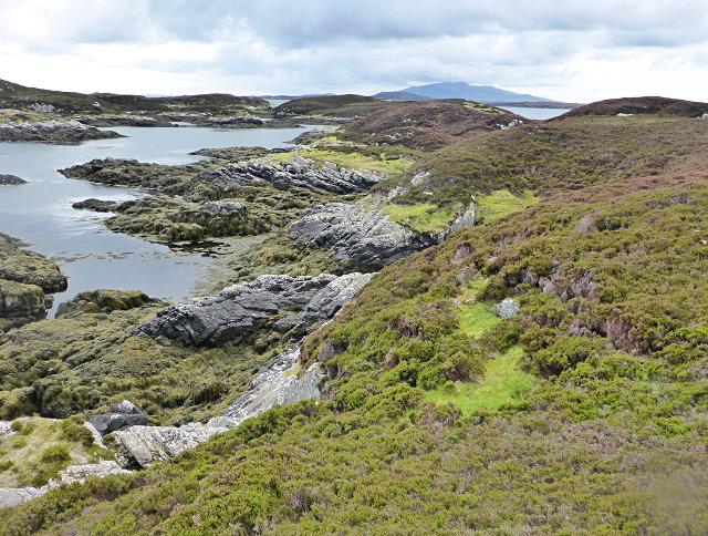
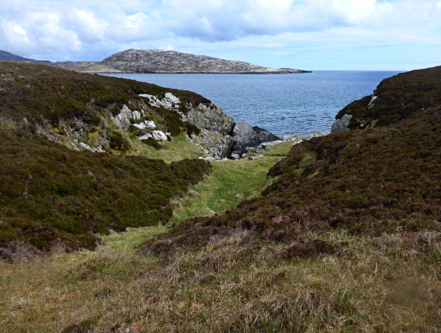
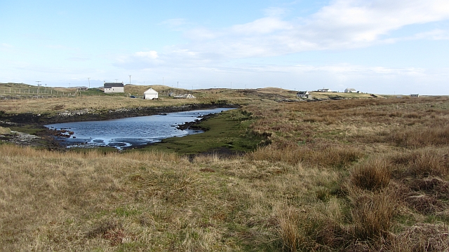
Eilean a' Mhurain, also known as the Island of Muckle Sands, is a small uninhabited island located off the coast of Inverness-shire, Scotland. Situated in the Moray Firth, it is approximately 4 miles southwest of Avoch and covers an area of around 10 acres.

The island is known for its stunning natural beauty and is a popular destination for birdwatchers and nature enthusiasts. It is home to a variety of bird species, including oystercatchers, eiders, and terns, making it a haven for birdwatching enthusiasts. The surrounding waters are also teeming with marine life, attracting seals, dolphins, and porpoises.

Eilean a' Mhurain is accessible by boat, and there are several local operators that offer guided tours to the island. Visitors can explore the sandy beaches, dunes, and grassy areas, taking in the picturesque views of the surrounding coastline and the nearby Black Isle.

The island has a rich historical past, with evidence of human activity dating back to prehistoric times. There are remnants of ancient settlements and burial mounds, adding to the island's intrigue and historical significance.

Overall, Eilean a' Mhurain offers a peaceful and idyllic retreat for those seeking a connection with nature and a glimpse into Scotland's rich history. Its unspoiled beauty and abundant wildlife make it a must-visit destination for nature lovers and history enthusiasts alike.

If you have any feedback on the listing, please let us know in the comments section below.

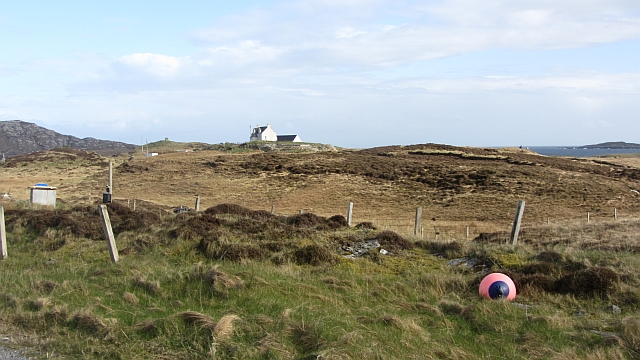
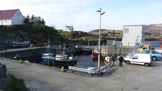
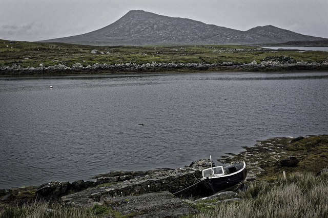
Eilean a' Mhurain Images

Images are sourced within 2km of 57.471556/-7.2128918 or Grid Reference NF8754. Thanks to Geograph Open Source API. All images are credited.

Maragaidh Beag One of many low-lying islands east of the Long Isle.
Maragaidh Beag
One of many low-lying islands east of the Long Isle.
Maragaidh Beag In the background is Beinn Rodagrich, on Rònaigh.
Maragaidh Beag
In the background is Beinn Rodagrich, on Rònaigh.
Bagh Sgotbheinn Not all Hebridean buildings fall into disrepair. I note that Dave Fergusson's 2007 photograph includes this small building, but now, twelve years later it has a new roof and is looking well cared for.
Bagh Sgotbheinn
Not all Hebridean buildings fall into disrepair. I note that Dave Fergusson's 2007 photograph includes this small building, but now, twelve years later it has a new roof and is looking well cared for.
Kallin Harbour, Grimsay
Old harbour, Grimsay A crofthouse sitting on a reclaimed piece of land at Baymore (Bagh mor) which was the main harbour on the island before the Kallin (Ceallan) development.  The harbour is littered with lots of old creels and other flotsam and there are many old stone piers.
Old harbour, Grimsay
A crofthouse sitting on a reclaimed piece of land at Baymore (Bagh mor) which was the main harbour on the island before the Kallin (Ceallan) development. The harbour is littered with lots of old creels and other flotsam and there are many old stone piers.
Kallin Harbour The smaller vessels in the harbour are inshore lobster boats which use creels to trap crabs and lobsters.  The larger vessels are offshore prawn boats which use trawl nets to catch the shellfish.
Kallin Harbour
The smaller vessels in the harbour are inshore lobster boats which use creels to trap crabs and lobsters. The larger vessels are offshore prawn boats which use trawl nets to catch the shellfish.
Cottage on Ronay Ronay
Cottage on Ronay
Ronay
Vallastrome, Kallin The view along the Vallastrome channel towards the biggest hill on the island of Ronaigh. The trig point at 115m can just be seen.
Vallastrome, Kallin
The view along the Vallastrome channel towards the biggest hill on the island of Ronaigh. The trig point at 115m can just be seen.
Coming in to harbour Small fishing boat entering Kallin harbour on a summer evening. This little boat has a 'FY' registration for Fowey in Cornwall, but arrived at Kallin on the back of a lorry. The 'Stelimar'is a local boat based here.
Coming in to harbour
Small fishing boat entering Kallin harbour on a summer evening. This little boat has a 'FY' registration for Fowey in Cornwall, but arrived at Kallin on the back of a lorry. The 'Stelimar'is a local boat based here.
Baymore: postbox № HS6 15 One of four postboxes on the island of Grimsay. Apart from the one on the main road close to the post office, they are emptied at 11:45am on weekdays and at 9:30am on Saturdays.
Baymore: postbox № HS6 15
One of four postboxes on the island of Grimsay. Apart from the one on the main road close to the post office, they are emptied at 11:45am on weekdays and at 9:30am on Saturdays.
Kallin: postbox № HS6 25 One of four postboxes on the island of Grimsay. Apart from the one on the main road close to the post office, they are emptied at 11:45am on weekdays and at 9:30am on Saturdays.
Kallin: postbox № HS6 25
One of four postboxes on the island of Grimsay. Apart from the one on the main road close to the post office, they are emptied at 11:45am on weekdays and at 9:30am on Saturdays.
Kallin: a deer He spotted me as soon as I spotted him!
Kallin: a deer
He spotted me as soon as I spotted him!
Kallin: the harbour Looking across the harbour from the road above.
Kallin: the harbour
Looking across the harbour from the road above.
Kallin: open-air phone box This telephone box is missing two glass panels and also its roof panel, which is leaning against the wall behind the box.
Kallin: open-air phone box
This telephone box is missing two glass panels and also its roof panel, which is leaning against the wall behind the box.
Inlet, Ceannaraigh An inlet of Bàgh Sgotbheinn, Grimsay.
Inlet, Ceannaraigh
An inlet of Bàgh Sgotbheinn, Grimsay.
Near Kallin Bog on Grimsay.
Near Kallin
Bog on Grimsay.
Kallin Harbour A modernised home for a fishing fleet on Grimsay.
Kallin Harbour
A modernised home for a fishing fleet on Grimsay.
Boat beside Bagh Mor
Show me another place!

Eilean a' Mhurain is located at Grid Ref: NF8754 (Lat: 57.471556, Lng: -7.2128918)

Unitary Authority: Na h-Eileanan an Iar

Police Authority: Highlands and Islands

What 3 Words

///oils.spines.neatly. Near Balivanich, Na h-Eileanan Siar

Related Wikis

Ronay

Ronay (Scottish Gaelic: Rònaigh) is an island in the Outer Hebrides of Scotland, which lies a short distance off the east coast of Grimsay. == Geography... ==

Grimsay

Grimsay (Scottish Gaelic: Griomasaigh) is a tidal island in the Outer Hebrides of Scotland. == Geography == Grimsay is the largest of the low-lying stepping...

Flodaigh

Flodaigh is a tidal island lying to the north of Benbecula and south of Grimsay in the Outer Hebrides, Scotland. It is connected to Benbecula by a causeway...

Fraoch-Eilean

Fraoch-eilean is a small island with an uncertain population north of Benbecula in the Outer Hebrides of Scotland. It is about 55 hectares (140 acres...

Nearby Amenities

Located within 500m of 57.471556,-7.2128918
Turning Circle
Lat/Long: 57.4751198/-7.2123342
Power: pole
Lat/Long: 57.4759508/-7.2141475
Power: pole
Lat/Long: 57.4754192/-7.2129263
Power: pole
Lat/Long: 57.4751574/-7.2121383
Generator Method: photovoltaic
Generator Output Electricity: small_installation
Generator Source: solar
Generator Type: solar_photovoltaic_panel
Power: generator
Lat/Long: 57.475031/-7.211693
The data included in this document is from www.openstreetmap.org. The data is made available under ODbL.

Have you been to Eilean a' Mhurain?

Leave your review of Eilean a' Mhurain below (or comments, questions and feedback).