An Crois-eilean

Island in Inverness-shire

Scotland

An Crois-eilean

Houses at Samhla
Houses at Samhla Credit: Sandy Gerrard

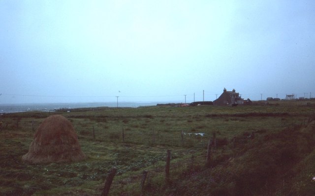
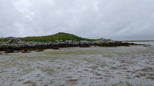
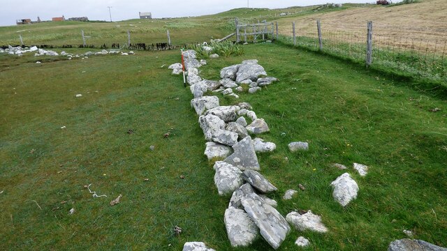
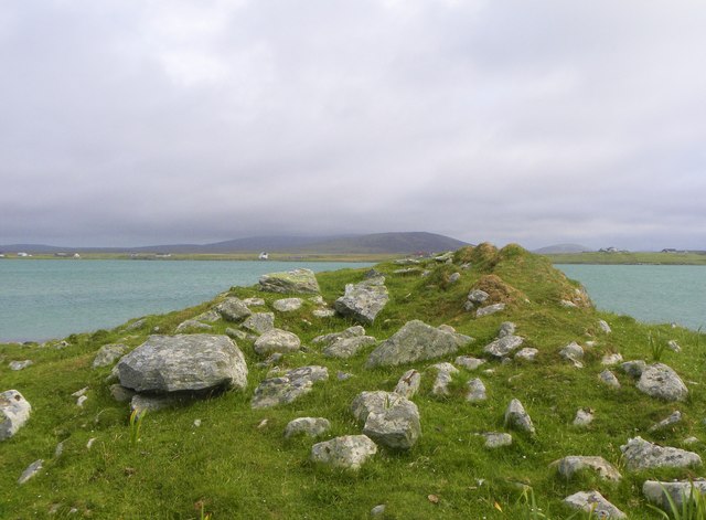
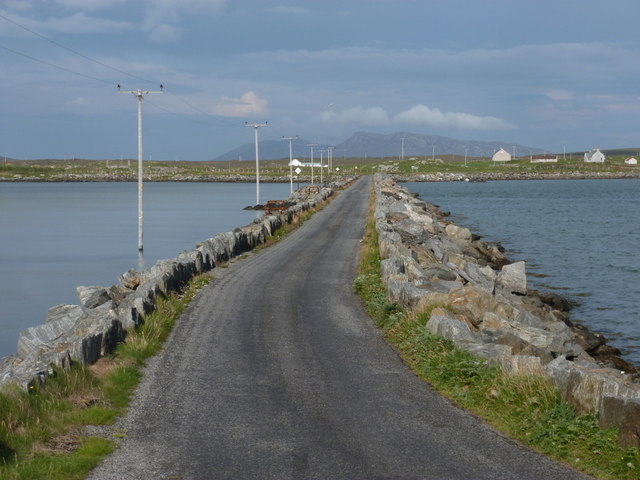
An Crois-eilean is a small island located in Inverness-shire, Scotland. It is situated in the Inner Hebrides, off the west coast of Scotland. The island is known for its rugged and picturesque landscape, with rocky cliffs, sandy beaches, and lush greenery.

An Crois-eilean is home to a small population of residents, who primarily make a living through fishing and tourism. The island has a quaint village with traditional stone cottages and a small harbor where fishing boats can be seen coming and going.

Visitors to An Crois-eilean can enjoy outdoor activities such as hiking, birdwatching, and beachcombing. The island is also a popular spot for wildlife enthusiasts, as it is home to a variety of seabirds, seals, and otters.

The island can be accessed by ferry from the mainland, making it a popular destination for day trips or longer stays. An Crois-eilean offers a peaceful retreat from the hustle and bustle of city life, with stunning natural beauty and a laid-back atmosphere.

If you have any feedback on the listing, please let us know in the comments section below.

An Crois-eilean Images

Images are sourced within 2km of 57.553011/-7.3539704 or Grid Reference NF7964. Thanks to Geograph Open Source API. All images are credited.

Houses at Samhla
Houses at Samhla
Clachan Stores What was a decent general store at the Clachan Junction until a couple of years ago is trading no more. The caravan that was parked in the driveway in 2007 <a href="https://www.geograph.org.uk/photo/445214">NF8164 : Clachan Stores</a> is still in place though...
Clachan Stores
What was a decent general store at the Clachan Junction until a couple of years ago is trading no more. The caravan that was parked in the driveway in 2007 NF8164 : Clachan Stores is still in place though...
North Uist War Memorial Memorial to the men of North Uist who laid down their lives during the first and second world wars.
North Uist War Memorial
Memorial to the men of North Uist who laid down their lives during the first and second world wars.
Baleshare - North Uist Causeway Looking east from Samhla to North Uist. Interestingly, although both sides are open to the sea, there is water to the south but it was dry on the north.
Baleshare - North Uist Causeway
Looking east from Samhla to North Uist. Interestingly, although both sides are open to the sea, there is water to the south but it was dry on the north.
Shore at Samhla Looking south from the west end of the causeway.
Shore at Samhla
Looking south from the west end of the causeway.
Cladach Iolaraigh West side of North Uist
Cladach Iolaraigh
West side of North Uist
Carnan Nan Long chambered cairn Neolithic chambered cairn on the coastline. <span class="nowrap"><a title="https://canmore.org.uk/site/10005/north-uist-baleshare-carnan-nan-long" rel="nofollow ugc noopener" href="https://canmore.org.uk/site/10005/north-uist-baleshare-carnan-nan-long">Link</a><img style="margin-left:2px;" alt="External link" title="External link - shift click to open in new window" src="https://s1.geograph.org.uk/img/external.png" width="10" height="10"/></span>
Carnan Nan Long chambered cairn
Neolithic chambered cairn on the coastline. LinkExternal link
Field wall next to beach on Baile Sear Walls were often erected to prevent stock on beaches getting onto adjacent arable ground (Scale 1m).
Field wall next to beach on Baile Sear
Walls were often erected to prevent stock on beaches getting onto adjacent arable ground (Scale 1m).
The shore near Cladach Chireboist Looking towards the gap between Eilean Chircebost (Kirkibost Island), on the right, and Baile Sear (Baleshare) on the left.
The map of Baleshare is littered with tiny 10m contours, though the northern tip seen here is much lower. Kirkibost has not a single 10m contour, though in this and other photos it appears to reach at least that height. One relevant factor is that the photos all seem to have been taken at low tide whereas height is measured above Mean Sea Level. However I suspect that the Ordnance Survey do not devote too much time to surveying islands like this which are hardly used and comprise mostly sand dunes which can and do shift! Perhaps at present this southern tip of Kirkibost is slightly higher than 10m.
The shore near Cladach Chireboist
Looking towards the gap between Eilean Chircebost (Kirkibost Island), on the right, and Baile Sear (Baleshare) on the left. The map of Baleshare is littered with tiny 10m contours, though the northern tip seen here is much lower. Kirkibost has not a single 10m contour, though in this and other photos it appears to reach at least that height. One relevant factor is that the photos all seem to have been taken at low tide whereas height is measured above Mean Sea Level. However I suspect that the Ordnance Survey do not devote too much time to surveying islands like this which are hardly used and comprise mostly sand dunes which can and do shift! Perhaps at present this southern tip of Kirkibost is slightly higher than 10m.
Claddach Kirkibost foreshore Just before dusk the sun breaks through.
Claddach Kirkibost foreshore
Just before dusk the sun breaks through.
Claddach Kirkibost croft land Wind plucked plastic litters the roadside
Claddach Kirkibost croft land
Wind plucked plastic litters the roadside
Cladach Chirceboist Fattening the calves
Cladach Chirceboist
Fattening the calves
Cladach Chirceboist The road to the moor.
Cladach Chirceboist
The road to the moor.
Chambered cairn on Baleshare Neolithic chambered tomb on the northern coast of Baleshare island.
Chambered cairn on Baleshare
Neolithic chambered tomb on the northern coast of Baleshare island.
Cladach Kirkibost: postbox № HS6 38 This small postbox on the A865 is emptied at 9am on weekdays and at 8:15am on Saturdays. It may (but just as possibly may not!) provide a clue as to the location of the former Claddach Kirkibost (with the 'dd') Post Office, which opened in 1935 and closed on 31 December 1971.
Cladach Kirkibost: postbox № HS6 38
This small postbox on the A865 is emptied at 9am on weekdays and at 8:15am on Saturdays. It may (but just as possibly may not!) provide a clue as to the location of the former Claddach Kirkibost (with the 'dd') Post Office, which opened in 1935 and closed on 31 December 1971.
Baleshare: postbox № HS6 31 The island's postbox stands at the very start of the island, in terms of the road which arrives on it along the causeway from North Uist.
Baleshare: postbox № HS6 31
The island's postbox stands at the very start of the island, in terms of the road which arrives on it along the causeway from North Uist.
Baleshare: the causeway The causeway from North Uist to the island of Baleshare was built in 1962.
Baleshare: the causeway
The causeway from North Uist to the island of Baleshare was built in 1962.
Baleshare Island road Road from the causeway snaking around the edge of the island.
Baleshare Island road
Road from the causeway snaking around the edge of the island.
Show me another place!

An Crois-eilean is located at Grid Ref: NF7964 (Lat: 57.553011, Lng: -7.3539704)

Unitary Authority: Na h-Eileanan an Iar

Police Authority: Highlands and Islands

What 3 Words

///views.crisper.nips. Near Balivanich, Na h-Eileanan Siar

Related Wikis

Baleshare

Baleshare (Scottish Gaelic: Baile Sear) is a flat tidal island in the Outer Hebrides of Scotland. Baleshare lies to the south-west of North Uist. Its economics...

Kirkibost

Kirkibost (Scottish Gaelic: Eilean Chirceaboist) is a low-lying island west of North Uist in the Outer Hebrides of Scotland. == Geography == Kirkibost...

Battle of Carinish

The Battle of Carinish was a Scottish clan battle fought in North Uist in 1601. It was part of a year of feuding between Clan MacLeod of Dunvegan and the...

Teampull na Trionaid

Teampull na Trionaid ("trinity church") is a ruined 13th-century Augustinian nunnery at Carinish, on North Uist, in the Outer Hebrides of Scotland. �...

Related Videos

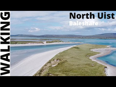
A walk round, Baleshare - North Uist - Scotland

This was our first walk, whilst on staycation in North Uist. This is a figure of 8 walk round the island of Baleshare. You can look at ...

Helping out a sheep caught up in wire.

We were out walking in South Baleshare, when we came across a sheep, caught in wire. Not one for walking by, I helped the wee ...

Nearby Amenities

Located within 500m of 57.553011,-7.3539704
Passing Place
Lat/Long: 57.5569014/-7.3572918
Passing Place
Lat/Long: 57.5557435/-7.3484985
Passing Place
Lat/Long: 57.5560654/-7.3509547
Passing Place
Lat/Long: 57.5564722/-7.3540579
Barrier: cattle_grid
Lat/Long: 57.5565194/-7.3554364
Power: pole
Lat/Long: 57.5559566/-7.3564923
Power: pole
Lat/Long: 57.5556846/-7.3579353
Power: pole
Lat/Long: 57.5556213/-7.357313
Power: pole
Lat/Long: 57.5557479/-7.3586246
Power: pole
Lat/Long: 57.5560602/-7.3600784
Power: pole
Lat/Long: 57.5554961/-7.3559236
Power: pole
Lat/Long: 57.5553882/-7.3547703
Power: pole
Lat/Long: 57.5552572/-7.3532521
Power: pole
Lat/Long: 57.5551464/-7.3519674
Power: pole
Lat/Long: 57.555014/-7.3505217
Power: pole
Lat/Long: 57.5549148/-7.3494676
Power: pole
Lat/Long: 57.554873/-7.3468309
Power: pole
Lat/Long: 57.5547723/-7.3483169
Power: pole
Lat/Long: 57.5492478/-7.3509869
Power: pole
Lat/Long: 57.5498551/-7.351011
Power: pole
Lat/Long: 57.5501574/-7.3502466
Power: pole
Lat/Long: 57.550438/-7.3495841
Power: pole
Lat/Long: 57.5506438/-7.3491066
Power: pole
Lat/Long: 57.5493932/-7.352497
Power: pole
Lat/Long: 57.5496479/-7.3516494
Power: pole
Lat/Long: 57.5491082/-7.3533123
Power: pole
Lat/Long: 57.5488448/-7.3541546
Power: pole
Lat/Long: 57.548652/-7.3547366
The data included in this document is from www.openstreetmap.org. The data is made available under ODbL.

Have you been to An Crois-eilean?

Leave your review of An Crois-eilean below (or comments, questions and feedback).