Alt

Island in Inverness-shire

Scotland

Alt

Sloc nan Each
Sloc nan Each Credit: Alpin Stewart

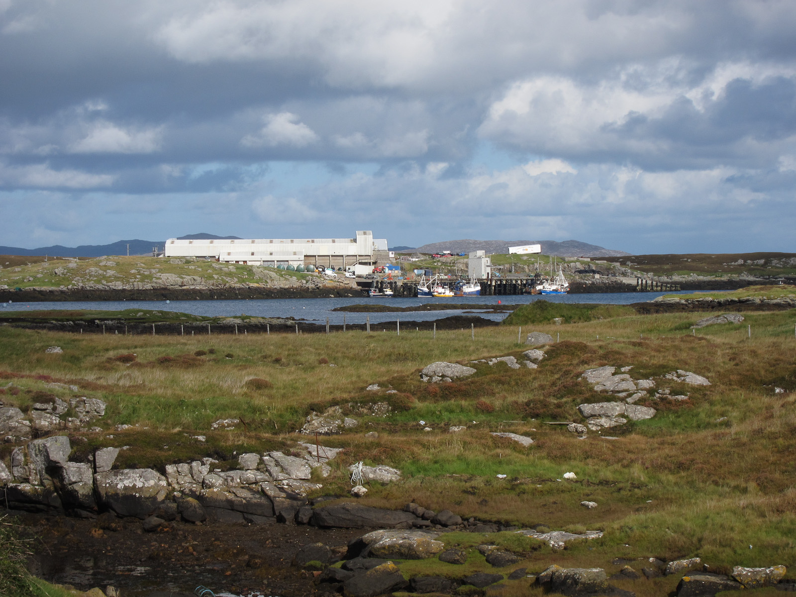
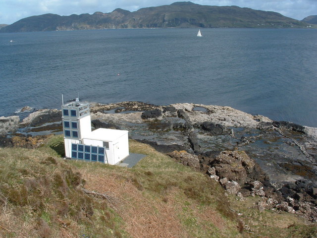
Alt is a small island located off the west coast of Scotland in Inverness-shire. The island, which covers an area of approximately 2 square kilometers, is situated in the Inner Hebrides, surrounded by the Atlantic Ocean. Alt is characterized by its rugged landscape, with steep cliffs and rocky shores, offering breathtaking views of the surrounding sea and neighboring islands.

Alt is home to a diverse range of wildlife, including various seabirds such as puffins, guillemots, and razorbills. The island's coastal waters are also known for their rich marine life, with seals, dolphins, and occasional sightings of whales in the area. These natural features make Alt an attractive destination for nature enthusiasts and bird watchers.

Despite its small size, Alt has a long and fascinating history. The island has evidence of human presence dating back to the Neolithic period, and it is believed to have been inhabited continuously since then. Ruins of ancient settlements, standing stones, and burial mounds can still be found on the island, providing insights into its ancient past.

Today, Alt remains mostly uninhabited, with only a few seasonal residents. The island offers a tranquil and secluded escape from the hustle and bustle of modern life. Visitors can enjoy hiking along the rugged coastline, exploring the rich wildlife, or simply unwinding in the serene natural surroundings. With its stunning scenery and rich history, Alt truly offers a unique and captivating experience for those seeking a remote island getaway.

If you have any feedback on the listing, please let us know in the comments section below.

Alt Images

Images are sourced within 2km of 56.975613/-7.4177602 or Grid Reference NF7000. Thanks to Geograph Open Source API. All images are credited.

Sloc nan Each
Sloc nan Each
The A888 towards Earsairidh
Beach at Earsairidh
Beach at Earsairidh
Coastal rocks A view at low tide of the coastal rock platform by Earsairidh.
Coastal rocks
A view at low tide of the coastal rock platform by Earsairidh.
Skerries off Earsairidh The rocky east coast of Barra.
Skerries off Earsairidh
The rocky east coast of Barra.
Sandy beach on Orasaigh There are four Orasaighs around Barra, it being the Gaelic for small tidal island. The fishing waste on the beach is unfortunately common, though it will do less harm on the beach than on the seabed.
Sandy beach on Orasaigh
There are four Orasaighs around Barra, it being the Gaelic for small tidal island. The fishing waste on the beach is unfortunately common, though it will do less harm on the beach than on the seabed.
Earsairidh, Barraigh
Orasaigh, near Earsairidh
Earsary: postbox № HS9 6 This small postbox stands in a passing place on the A888 - it is emptied at 8:45am on weekdays and at 6:45am on Saturdays.
Earsary: postbox № HS9 6
This small postbox stands in a passing place on the A888 - it is emptied at 8:45am on weekdays and at 6:45am on Saturdays.
Rough sea at Earsairidh A view across Sloc nan Each to Eilean nan Gamhna, and to Bruairnis.
Rough sea at Earsairidh
A view across Sloc nan Each to Eilean nan Gamhna, and to Bruairnis.
Houses at Earsary/Earsairidh The nearer one is on Google Street view imagery dated 2009, the other one is not.
Houses at Earsary/Earsairidh
The nearer one is on Google Street view imagery dated 2009, the other one is not.
Remains of fence on Orosay Looking NE to Mainland Barra.  Taken whilst waiting for the tide to turn to give clearance to kayak through the shallow channel.
Remains of fence on Orosay
Looking NE to Mainland Barra. Taken whilst waiting for the tide to turn to give clearance to kayak through the shallow channel.
Leinis Small grassy peninsula on the east coast of Barra.
Leinis
Small grassy peninsula on the east coast of Barra.
Orasaigh Small island off the east coast of Barra.
Orasaigh
Small island off the east coast of Barra.
Inlet and road at Earsary Barra
Cottage at Earsairidh This apparently isolated cottage on a rocky shore makes an almost classic Hebridean view.
Cottage at Earsairidh
This apparently isolated cottage on a rocky shore makes an almost classic Hebridean view.
Orasaigh This little island is one of a surprisingly large number with the same name, or variants of it.
Orasaigh
This little island is one of a surprisingly large number with the same name, or variants of it.
Leinis Looking south across the rocky shore of the Leinis peninsula.
Leinis
Looking south across the rocky shore of the Leinis peninsula.
Show me another place!

Alt is located at Grid Ref: NF7000 (Lat: 56.975613, Lng: -7.4177602)

Unitary Authority: Na h-Eileanan an Iar

Police Authority: Highlands and Islands

What 3 Words

///melon.motoring.showed. Near CastleBay, Na h-Eileanan Siar

Nearby Locations

Alt Earsairidh

Related Wikis

Bogach

Bogach (Scottish Gaelic: A' Bhogach) is a village on the island of Barra in the Outer Hebrides, Scotland. Bogach is also within the parish of Barra, and...

Brevig, Barra

Brevig (Scottish Gaelic: Brèibhig) is a village on the island of Barra, in the Outer Hebrides, Scotland. The settlement is situated on the A888, which...

Barra

Barra (; Scottish Gaelic: Barraigh [ˈparˠaj] or Eilean Bharraigh [ˈelan ˈvarˠaj] ; Scots: Barra) is an island in the Outer Hebrides, Scotland, and the...

Heaval

Heaval is the highest hill on the Outer Hebridean island of Barra, Scotland. The highest point is 383 metres high above sea level and it is located 1.5...

Northbay

Northbay (Scottish Gaelic: Am Bàgh a Tuath) is a township and community in the north of Barra in the Outer Hebrides, off the west coast of Scotland. Northbay...

Ardveenish

Ardveenish (Scottish Gaelic: Àird Mhèanais) is a village on Barra in the Western Isles, Scotland. Ardveenish is also within the parish of Barra. ��2�...

Fuiay

Fuiay (Scottish Gaelic: Fùidheigh) is an island in Scotland. It is one of ten islands in the Sound of Barra, a Site of Community Importance for conservation...

Ardmore, Barra

Ardmhor (Scottish Gaelic: Aird Mhòr) is a small village in the north east of the Isle of Barra in the Outer Hebrides, Scotland. In 2002 a small ferry port...

Related Videos

Touring the Outer Hebrides, Isles of Barra and Vatersay - Part 1

This video is filmed in 4K and is part of a series touring the beautiful Outer Hebrides, Scotland in our little white motorhome. In Part ...

OUR SIMPLE LIFE ON A TINY SCOTTISH ISLAND | long sandy beaches, an abandoned village & lots of cows

Today I'd love to share with you a glimpse into our life on a tiny Scottish Island in the Outer Hebrides. Last Autumn we spent an ...

Isle of Barra | Outer Hebrides Road Trip

Welcome to the first video in our Outer Hebrides Road Trip series and to our first stop, the beautiful Isle of Barra! We arrived on ...

Scotland's Outer Hebrides | Barra, Vatersay & Mingulay (film + guide)

BARRA TRAVEL GUIDE https://www.goingthewholehogg.com/best-things-to-do-on-barra-and-vatersay ➤ BECOME OUR ...

Nearby Amenities

Located within 500m of 56.975613,-7.4177602
Passing Place
Lat/Long: 56.9760559/-7.4216878
Passing Place
Lat/Long: 56.9766525/-7.4206422
Passing Place
Lat/Long: 56.9769929/-7.4194036
Passing Place
Lat/Long: 56.9794665/-7.4170121
Bus Stop
Earsary
Bus: yes
Naptan AtcoCode: 6010731638
Naptan Bearing: N
Naptan CommonName: Earsary
Naptan Indicator: Village
Naptan Landmark: Village
Naptan NaptanCode: 94723246
Naptan Street: Village
Naptan Verified: no
Public Transport: platform
Source: naptan_import
Lat/Long: 56.9734219/-7.4229605
Bus Stop
Rhulios
Naptan AtcoCode: 6010731887
Naptan Bearing: N
Naptan CommonName: Rhulios
Naptan Indicator: Village
Naptan Landmark: Village
Naptan NaptanCode: 94724364
Naptan Street: Village
Naptan Verified: no
Source: naptan_import
Lat/Long: 56.9776538/-7.4184277
Passing Place
Lat/Long: 56.9728875/-7.4232599
Passing Place
Lat/Long: 56.9798692/-7.4162904
Passing Place
Lat/Long: 56.978443/-7.4175341
Passing Place
Lat/Long: 56.9736288/-7.422836
Leisure: slipway
Lat/Long: 56.9753014/-7.4206928
Turning Circle
Lat/Long: 56.9760834/-7.4209672
Power: pole
Lat/Long: 56.9794337/-7.4190089
Power: pole
Lat/Long: 56.9785874/-7.420122
Power: pole
Lat/Long: 56.9781255/-7.4206156
Power: pole
Lat/Long: 56.9774093/-7.4213854
Power: pole
Lat/Long: 56.9769627/-7.4218802
Power: pole
Lat/Long: 56.9764899/-7.4223992
Power: pole
Lat/Long: 56.9760952/-7.4228083
Power: pole
Lat/Long: 56.9753482/-7.4236357
Power: pole
Lat/Long: 56.9747255/-7.4239576
Power: pole
Lat/Long: 56.9741568/-7.4242473
Power: pole
Lat/Long: 56.973727/-7.4244511
Passing Place
Lat/Long: 56.9774977/-7.4186213
Passing Place
Lat/Long: 56.9747905/-7.4226822
Power: pole
Lat/Long: 56.9742385/-7.4206358
Power: pole
Lat/Long: 56.9747184/-7.4209834
Power: pole
Lat/Long: 56.9749906/-7.421138
Power: pole
Lat/Long: 56.9753395/-7.4213997
Power: pole
Lat/Long: 56.9757891/-7.421091
Power: pole
Lat/Long: 56.9740621/-7.4217722
Power: pole
Lat/Long: 56.9737697/-7.4234882
Power: pole
Lat/Long: 56.9743321/-7.4231942
Power: pole
Lat/Long: 56.974736/-7.4229197
Power: pole
Lat/Long: 56.9734207/-7.4237516
Power: pole
Lat/Long: 56.9729088/-7.4239992
Power: pole
Lat/Long: 56.9726771/-7.423663
Power: pole
Lat/Long: 56.9738991/-7.4227287
Power: pole
Lat/Long: 56.9739865/-7.4233749
The data included in this document is from www.openstreetmap.org. The data is made available under ODbL.

Have you been to Alt?

Leave your review of Alt below (or comments, questions and feedback).